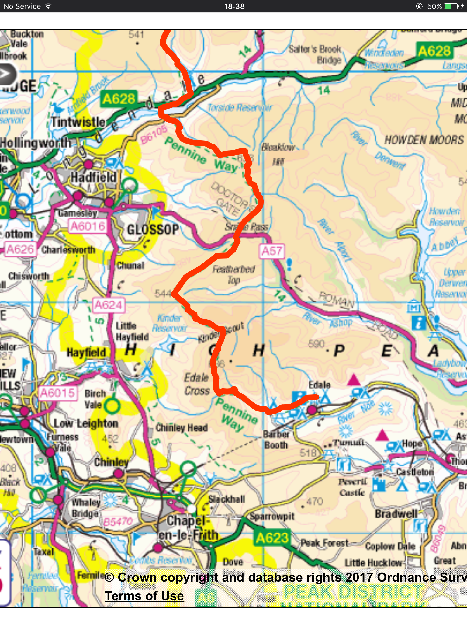
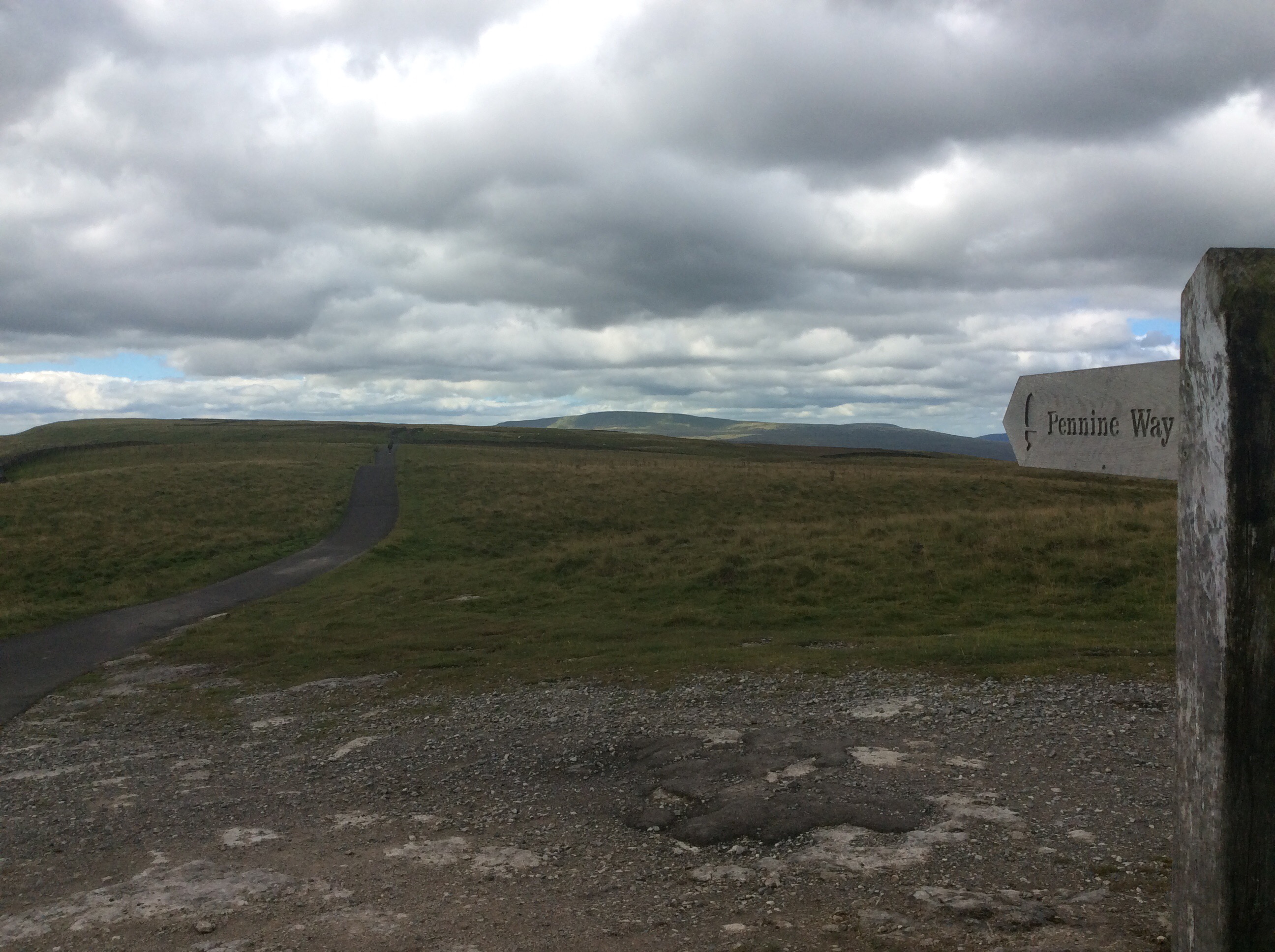
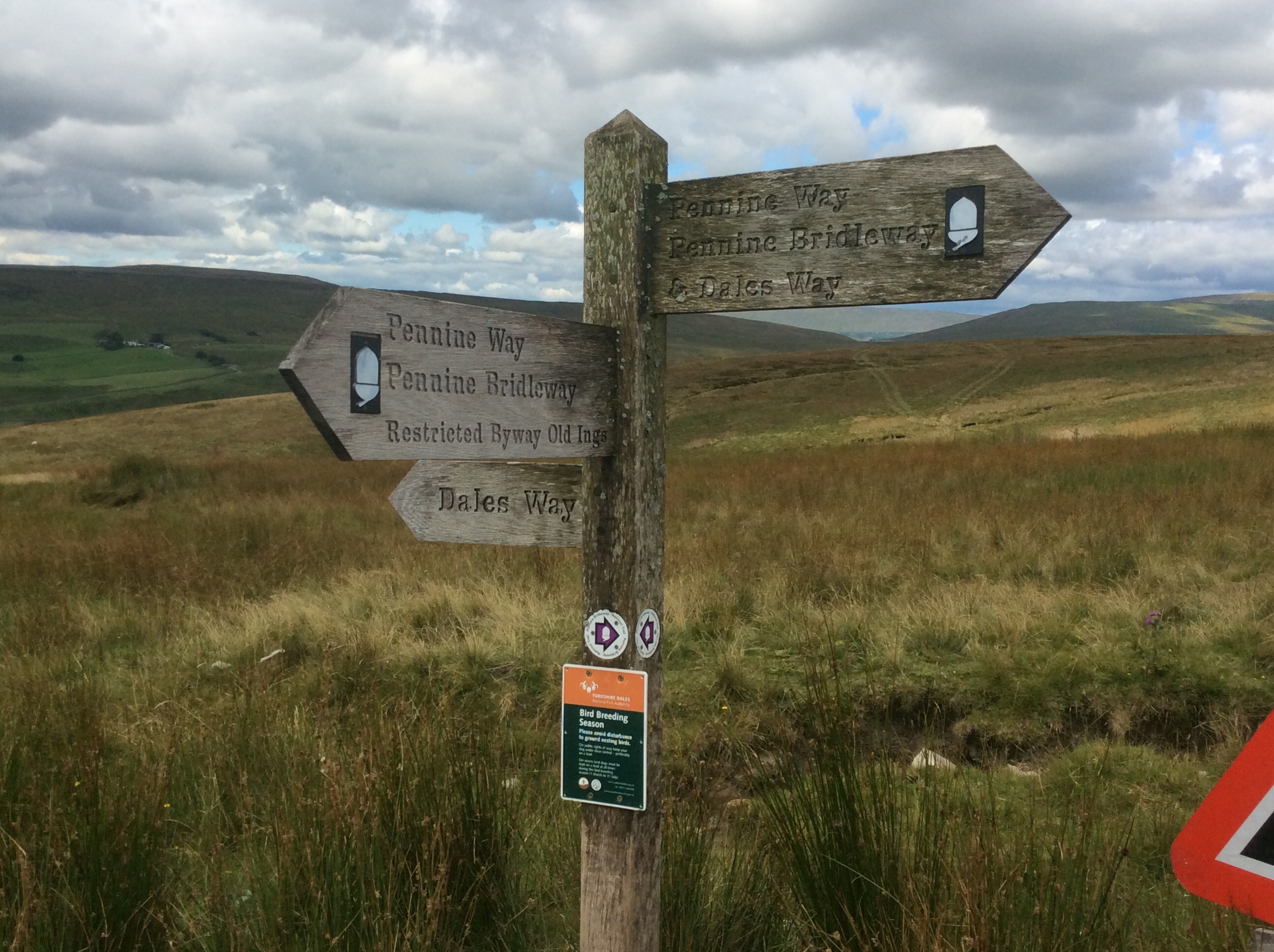
Crowden to Edale – Bleaklow and Kinder Scout – Home
The campsite was miles from anywhere so it was an early night. However the manager used to be a chef so I got Chicken Jalfrezi for dinner for a fiver (good unall) and two sausage and egg bread cakes for breakfast for four quid. Brilliant.
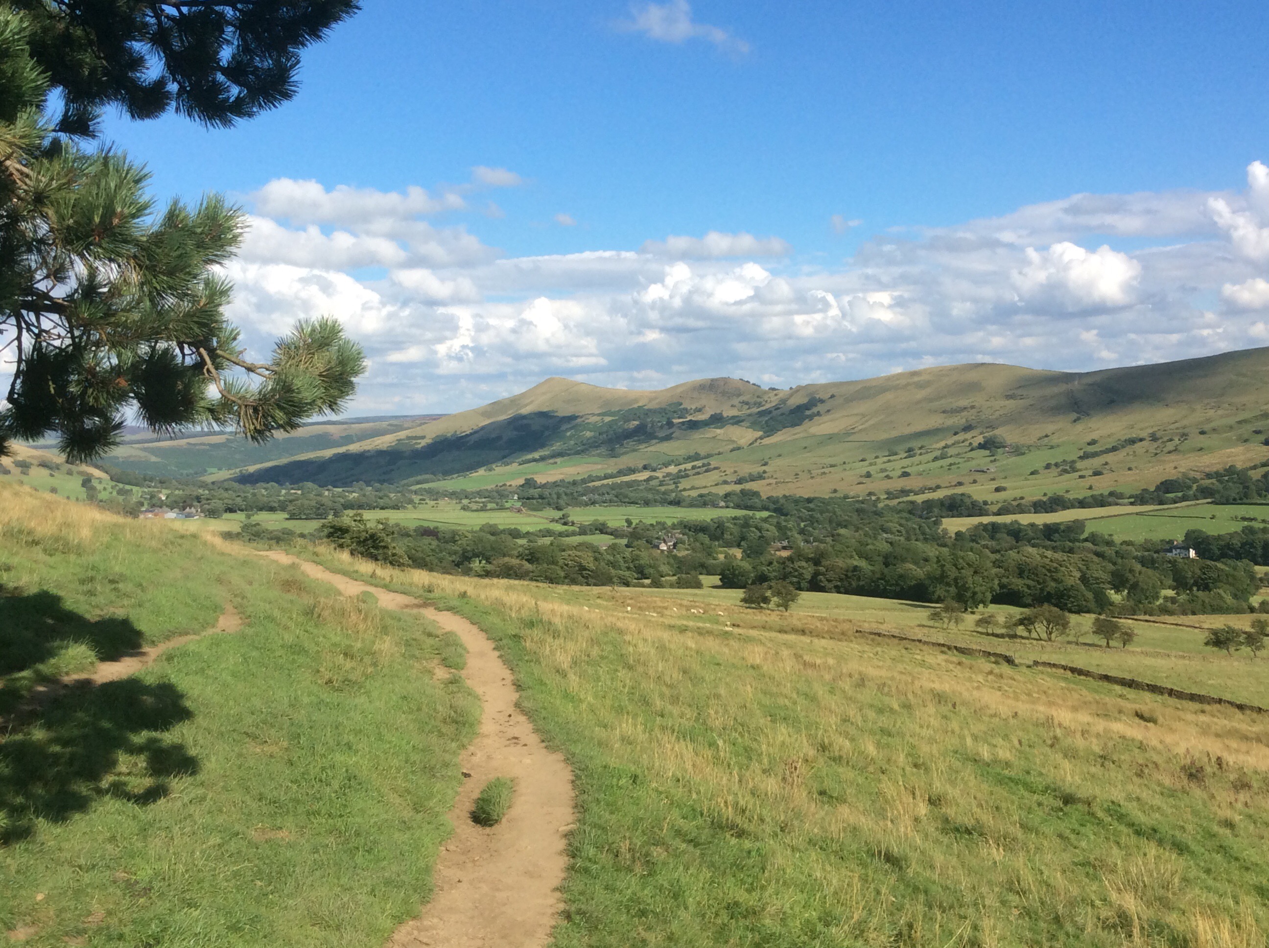
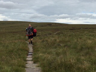
Today’s walk was to be a tough 2,600 foot climb over Bleaklow and Kinder covering 16 miles. I needed an early start and got away at 8.30, breakfasted and packed.
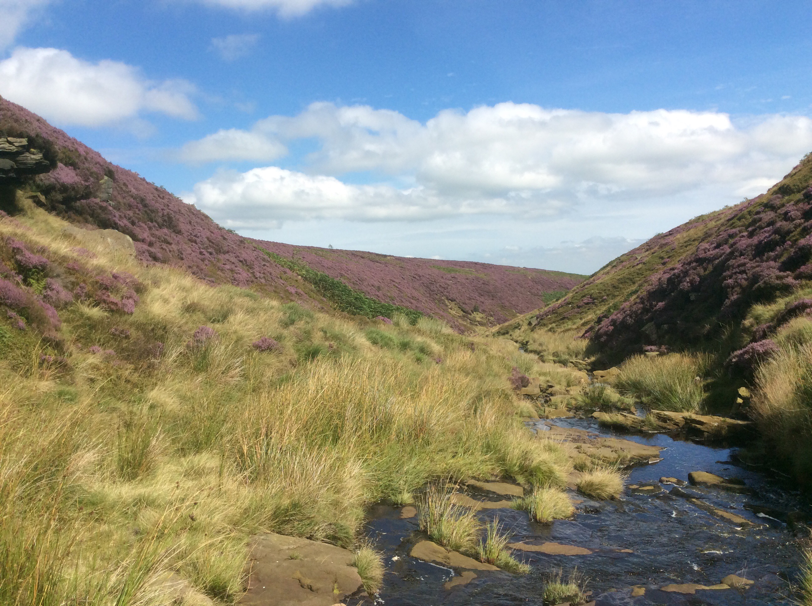
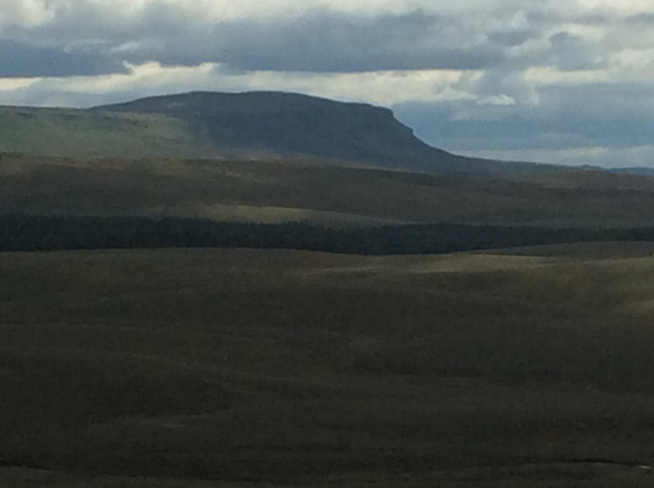
The tent was dry and there was a cool breeze, a welcome addition for a steep climb out of the valley. Looking back across the reservoir to Crowden the moors, and Black Hill in the background, were great.
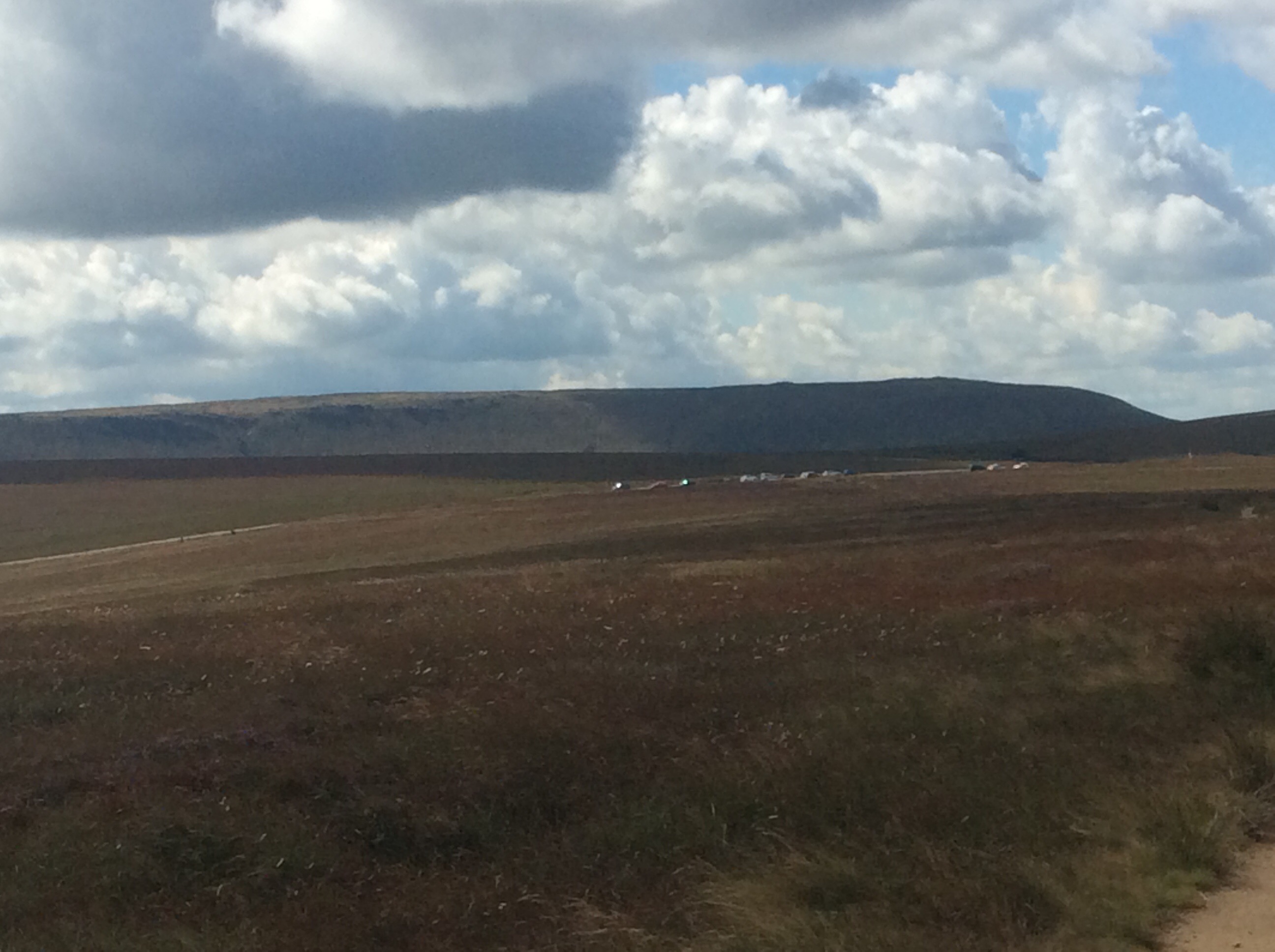
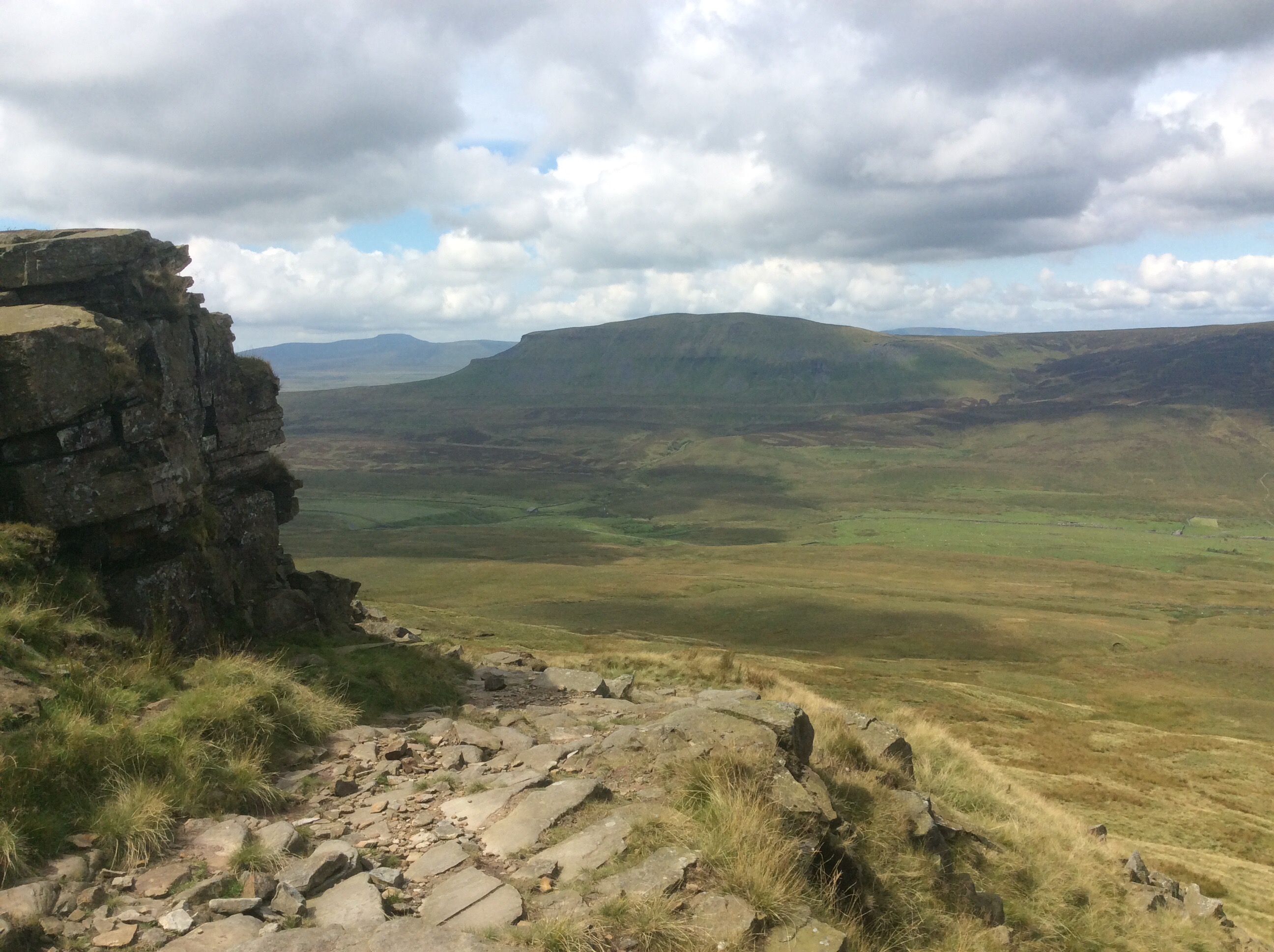
The track was extremely steep for the first 400 feet climb and the rucksack dug into my shoulders, but I felt ok. Slow, deliberate steps and as I’d lost a few kilos from my fat belly and was much fitter than when I started it wasn’t too hard. And going up Bleaklow, one of the legendary High Peak places when I was young, was coming home. I can’t help but think of the poor buggers in planes that crashed into Bleaklow and Kinder when I’m walking these tops. There are over 100 crash sites up here. Incredible loss of life during and shortly after WWII. Poor kids. Thirteen young American lads in a Superfortress lost in fog. A Halifax bomber killing five kids, and amazingly two survived. Lumps of undercarriage and engine parts can still be seen.
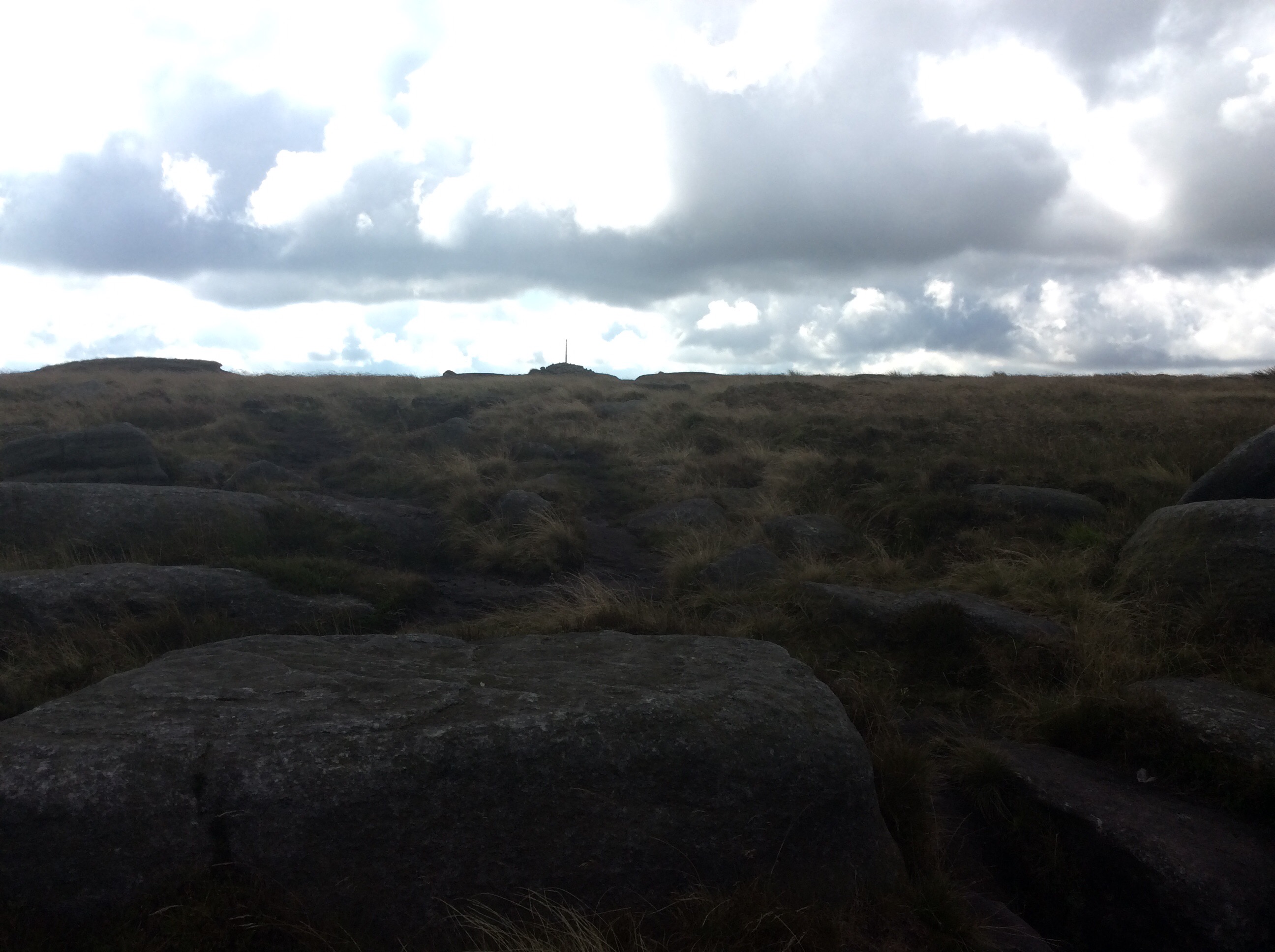
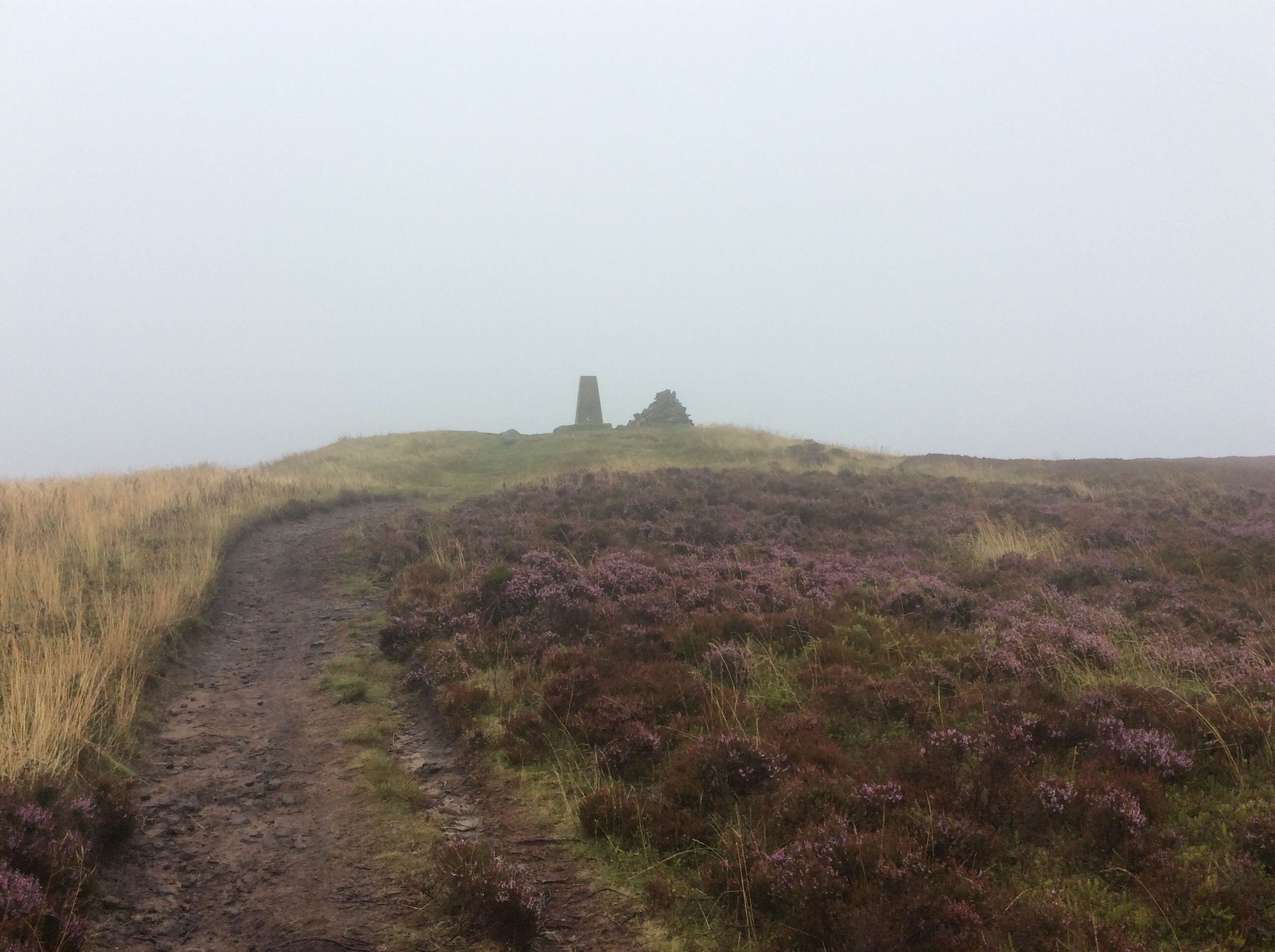
Bleaklow is a flat peak, with a nominal summit of a cairn with a wooden stake sticking out of it. Wild and windy.
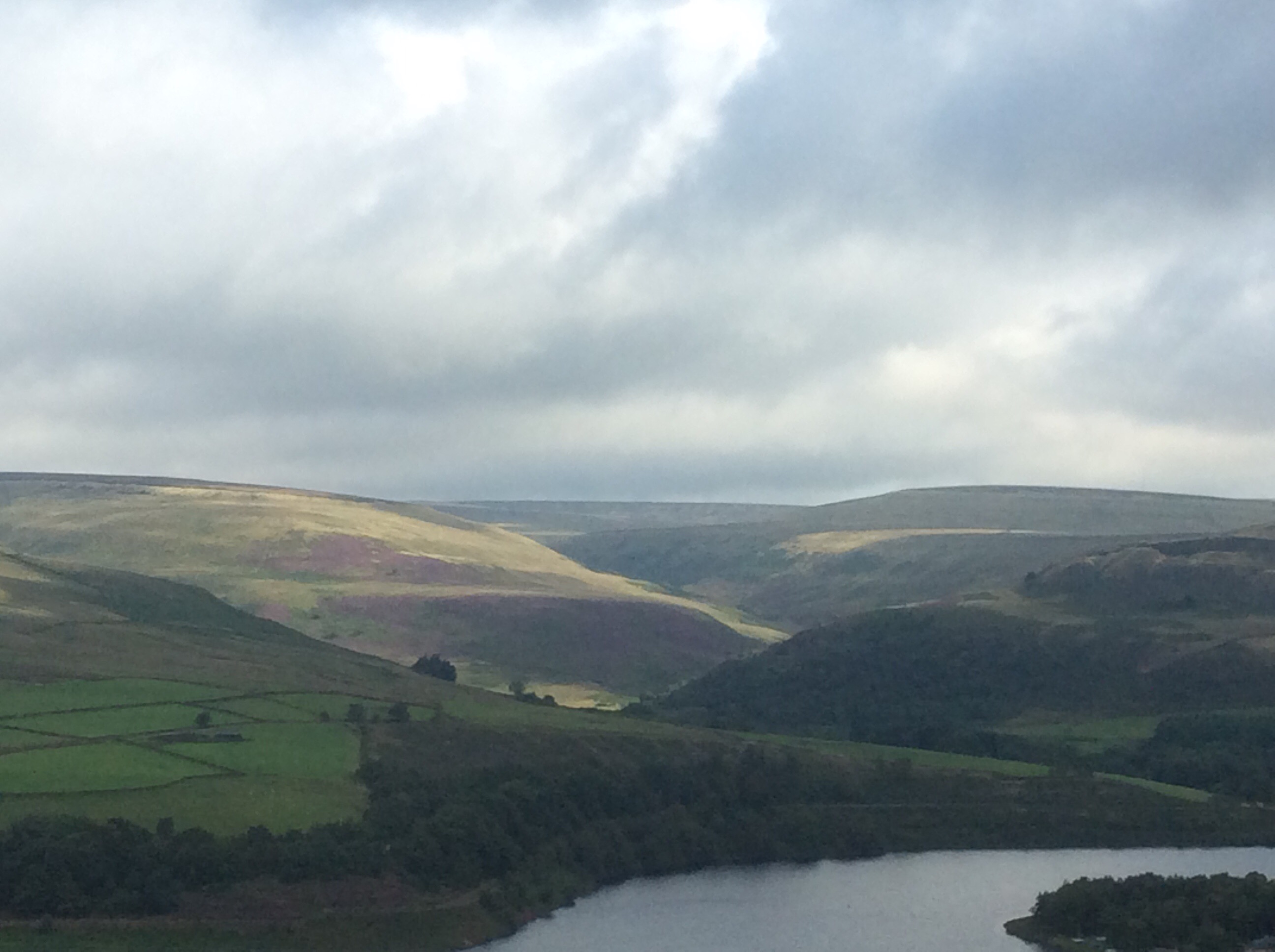
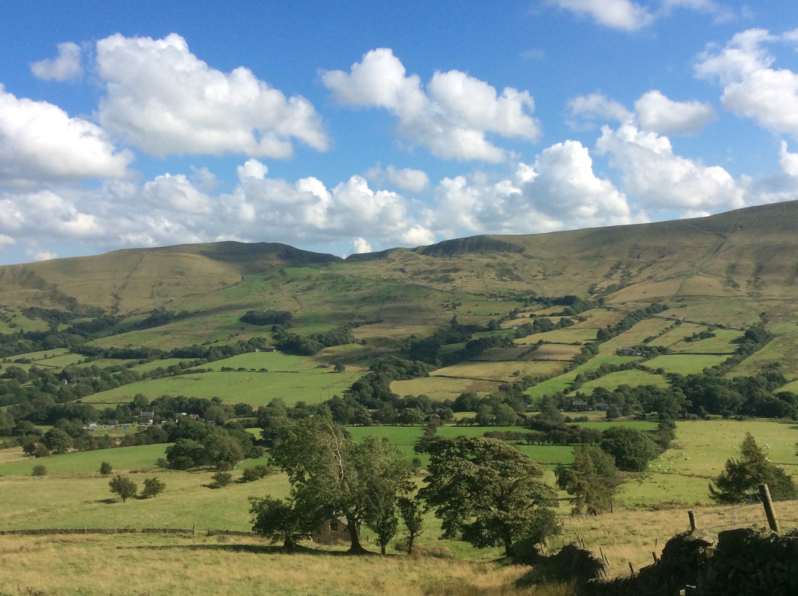
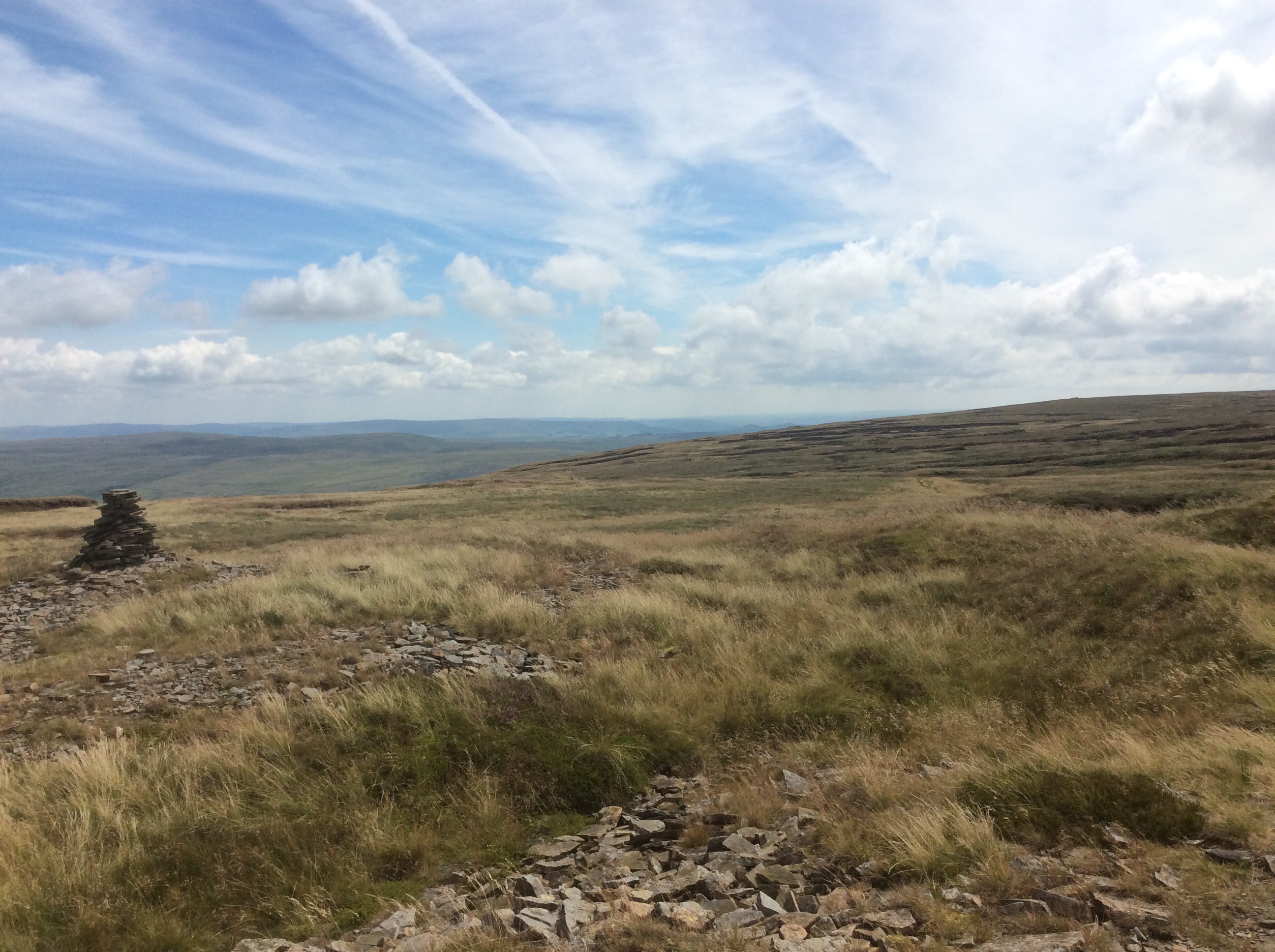
Over the far side the PW runs down a winding brook which cuts through four metres of peat bogs. All this was forested until Stone Age man cut down the trees and the vegetation started to rot and create peat. The sun came out to welcome me back.
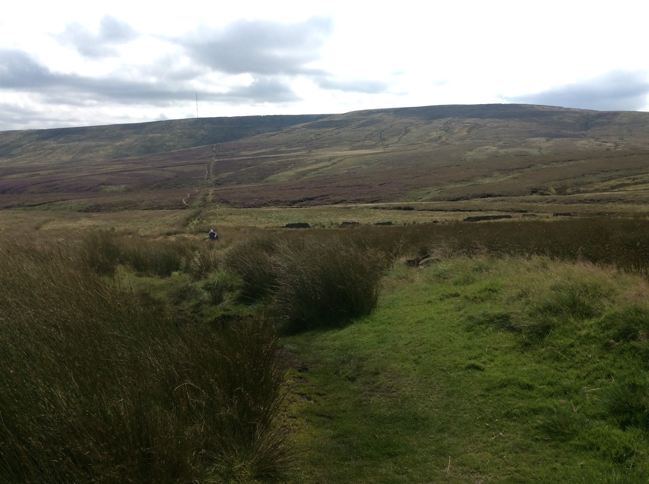
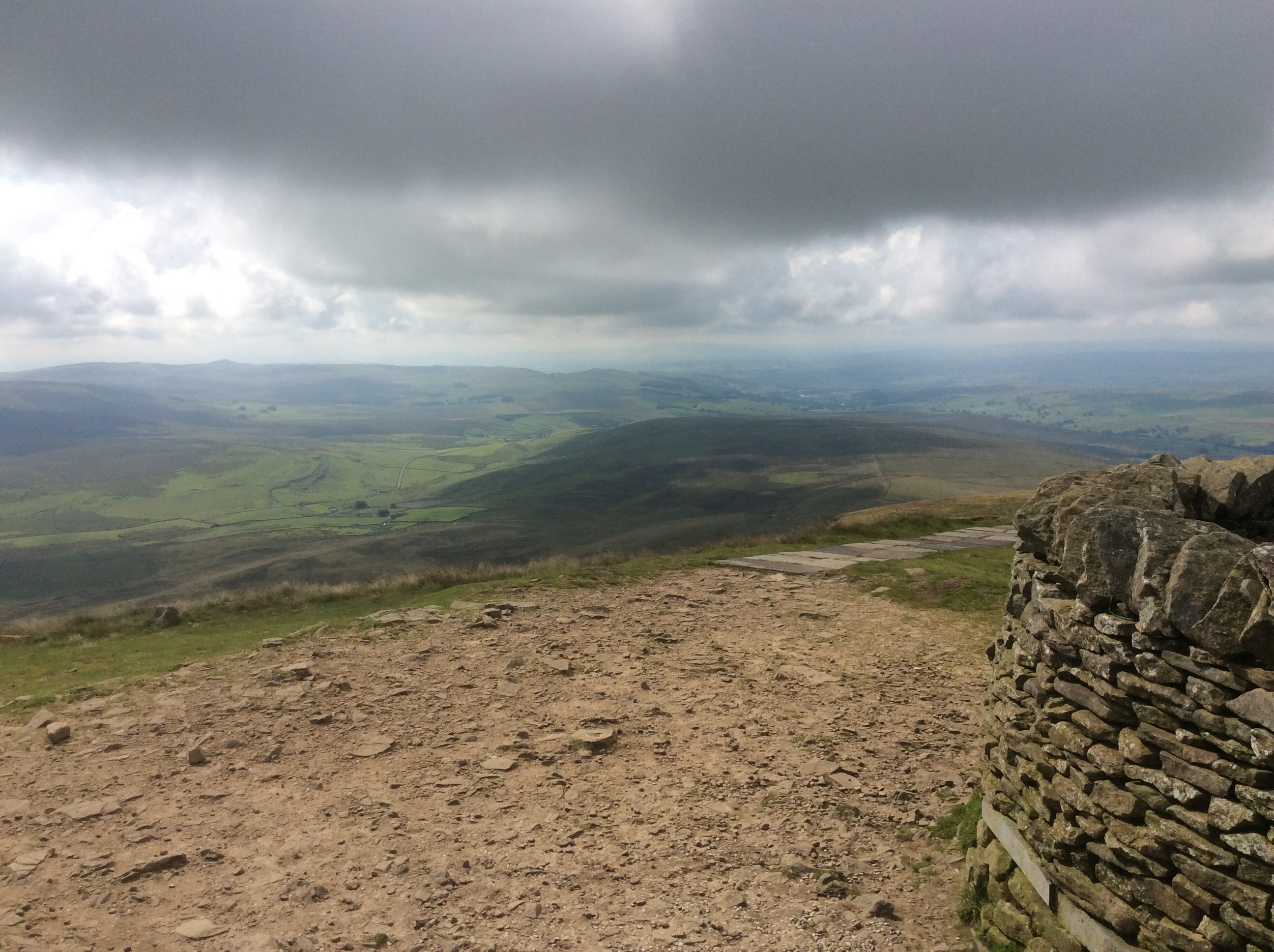
And Kinder smiled in the distance, beyond the cars parked at the top of the Snake Pass. It all looks so innocuous in the sun. But this place can be deadly. Lest we forget.
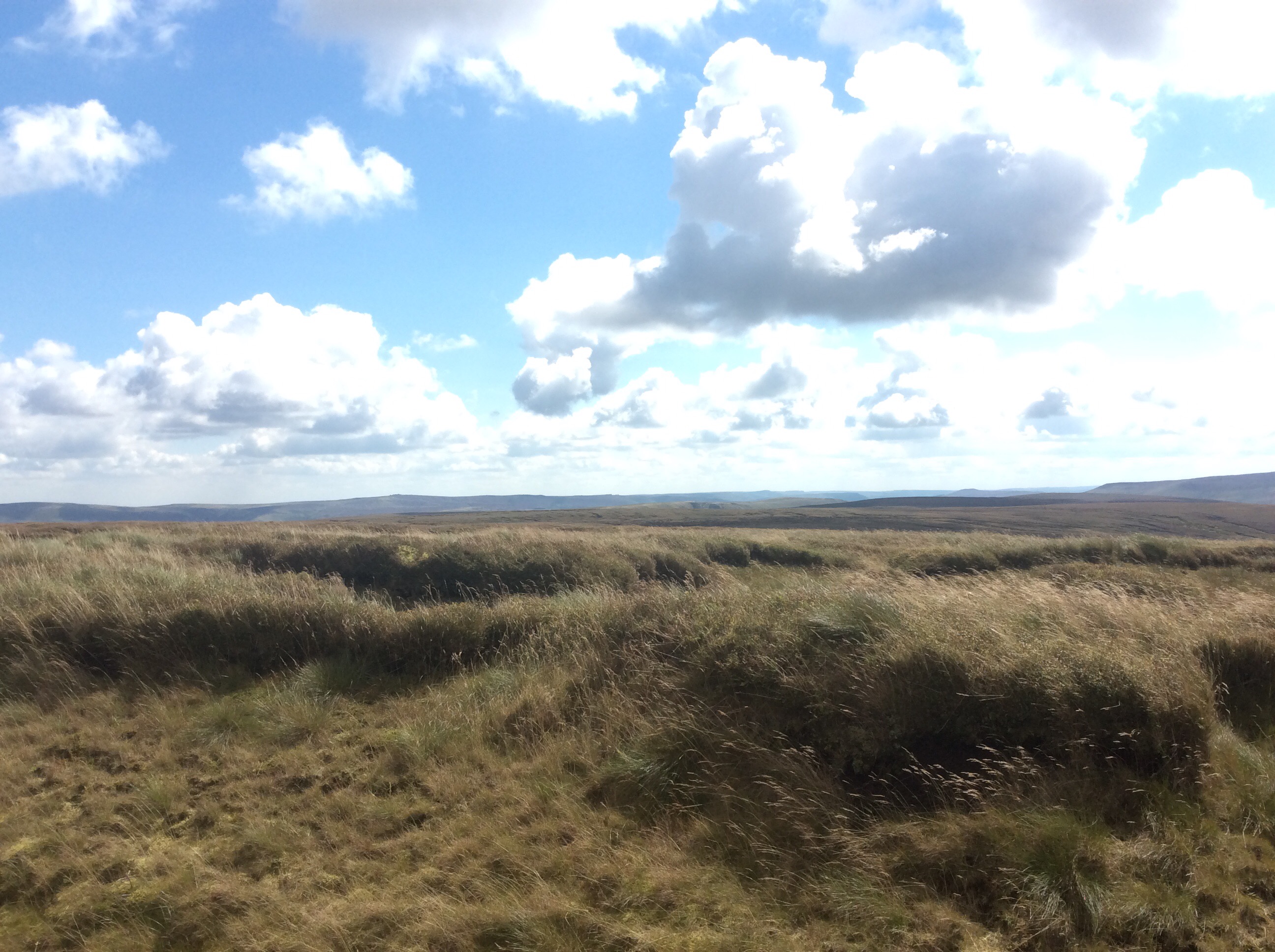
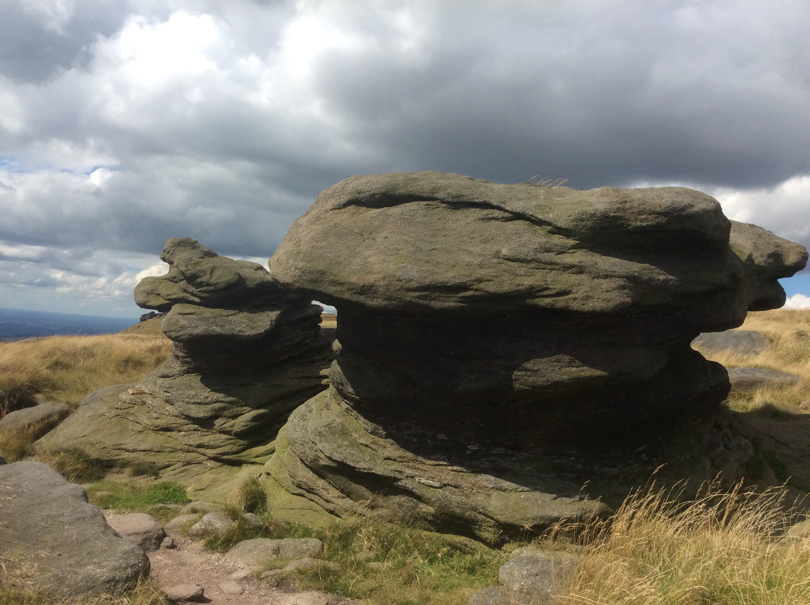
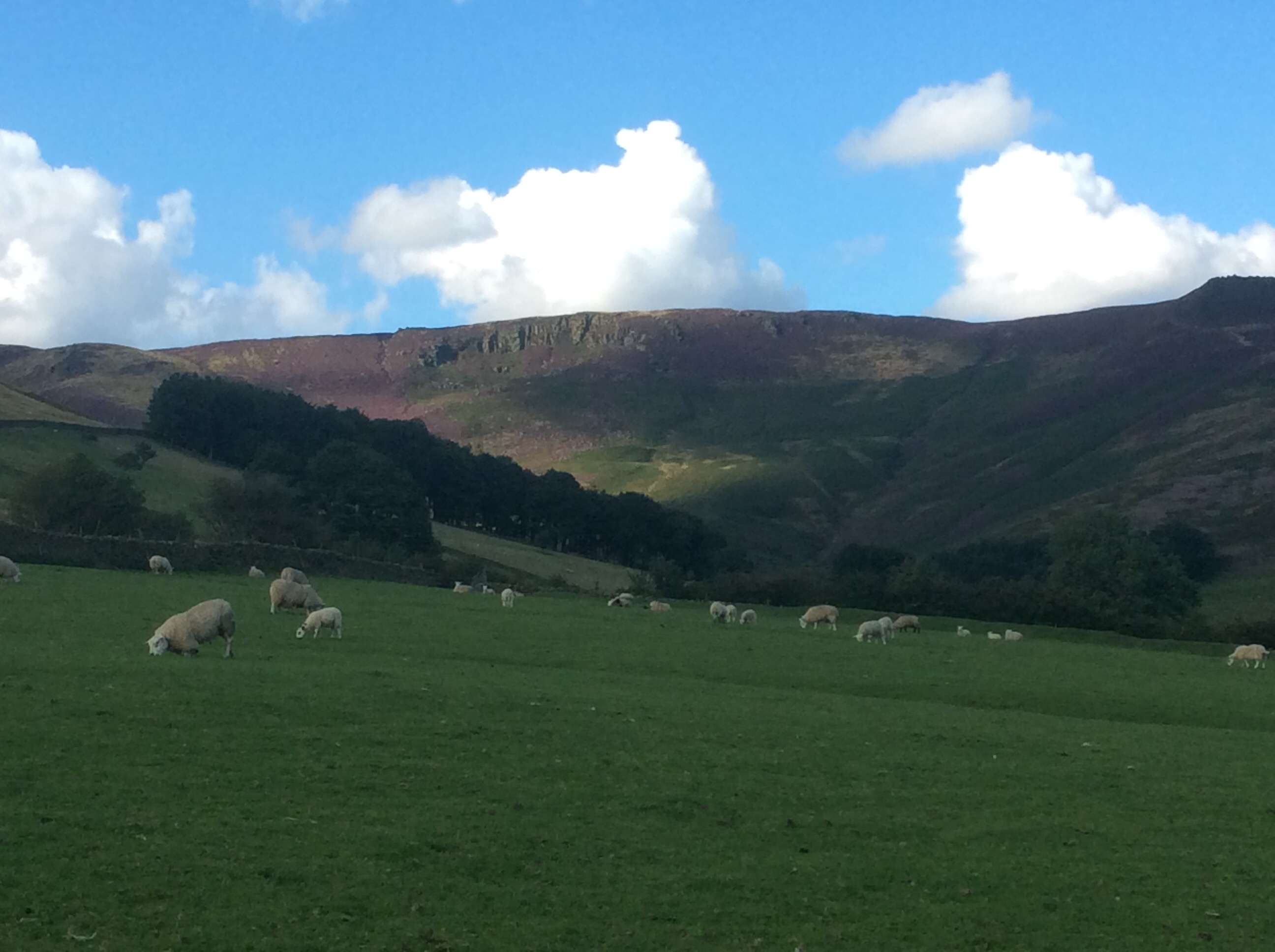
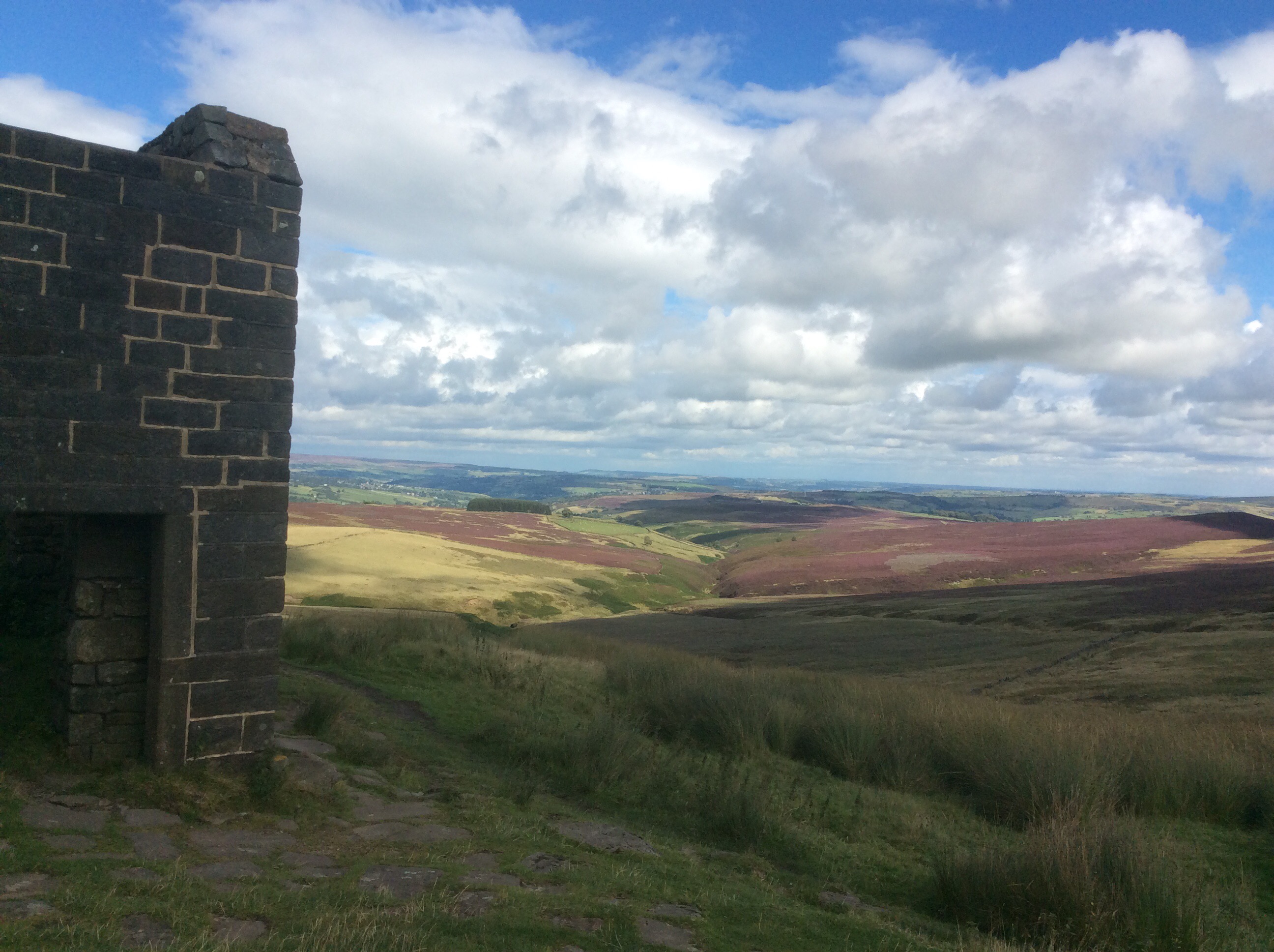
By early afternoon I was climbing up a Kinder with its trademark rock formations. Showers were scooting across the sky, and I was lucky to just catch a few spots of rain at the edges.
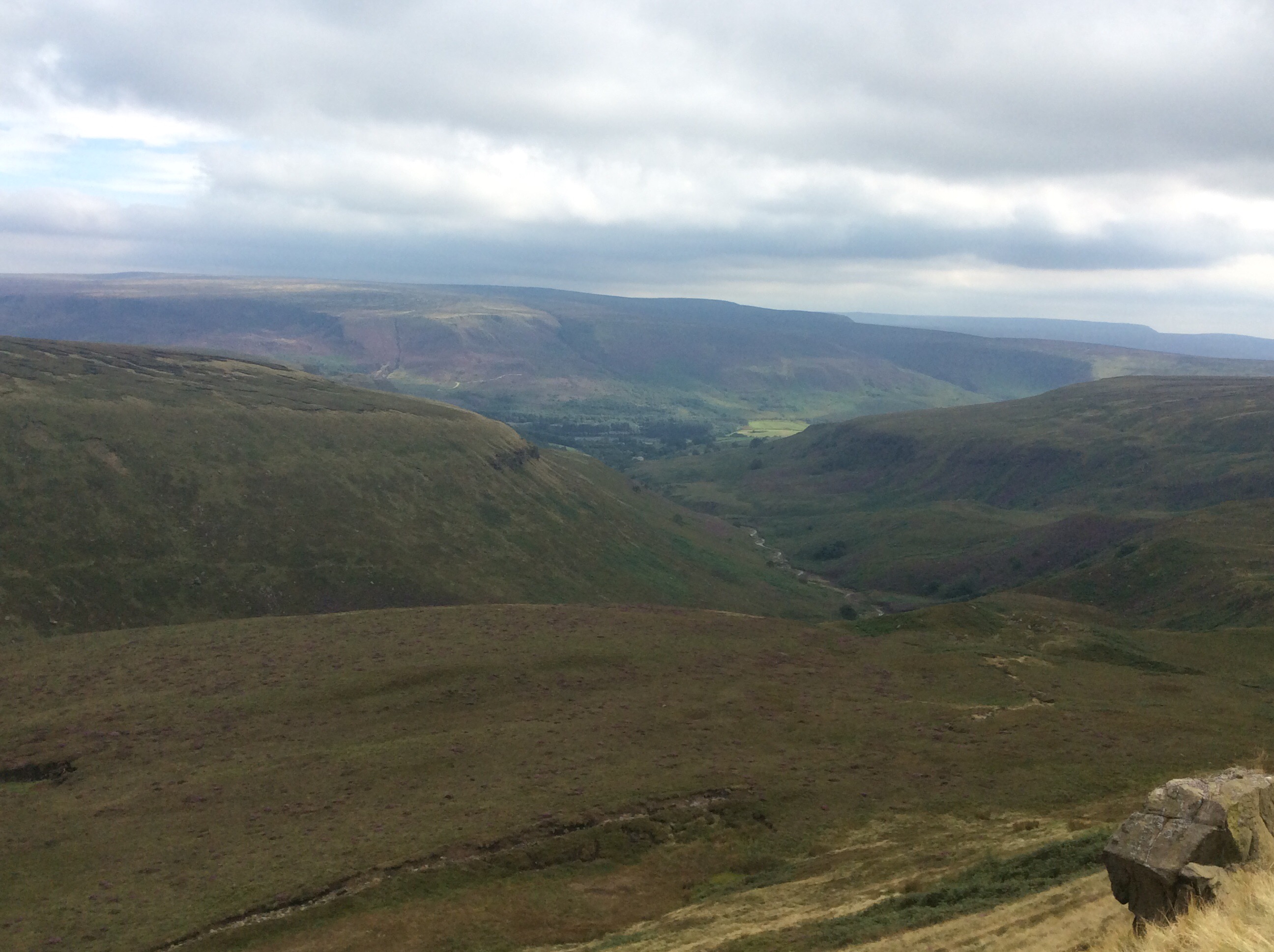
At last, after early three weeks, the first views of the Edale valley.
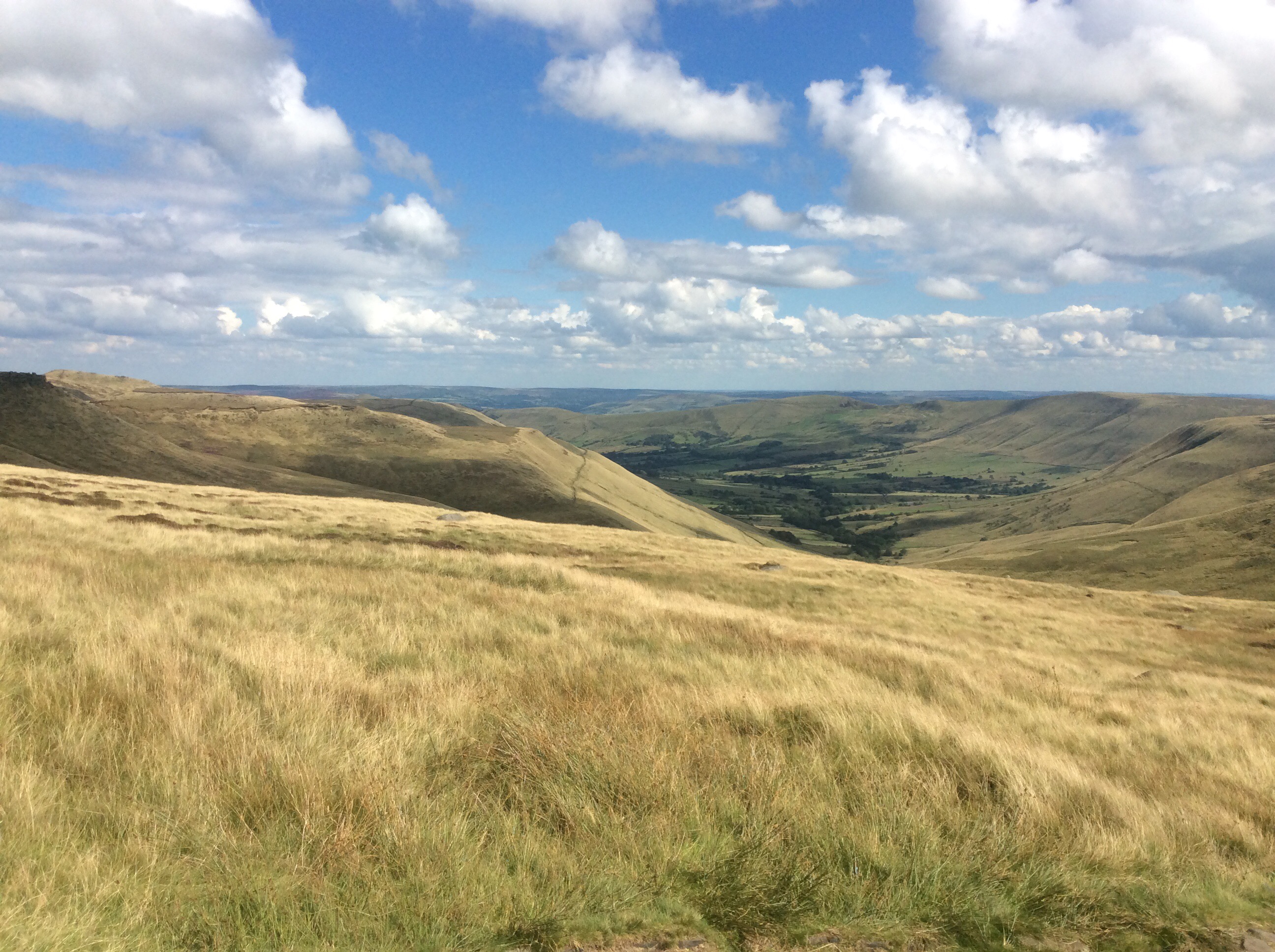
The Way drops steeply down Jacob’s Ladder and gives views back up to the ridge around the Kinder Scout plateau. God I love this country. It’s part of my fabric. My mum’s ashes are a few miles away in the Peak District and she’ll be happy to rest there. She deserves it, after living with that arsehole for so long.
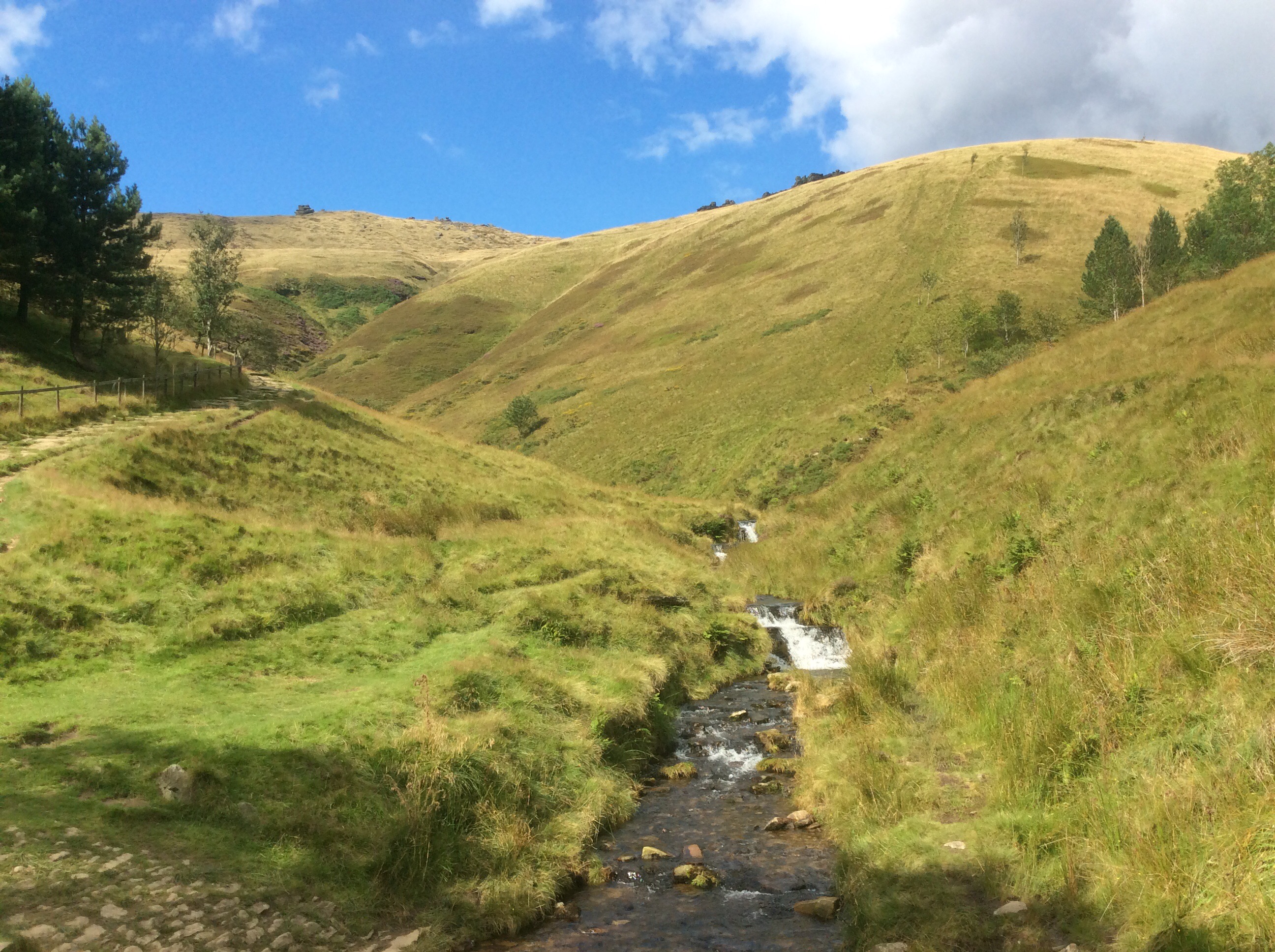
From dramatic moorland to domestic vale, the last mile or two are enchanting.
It’s over. The Pennine Way has taken me closer to my end goal, completing the long trail from the northern tip of the British Mainland to the southern tip of the European Mainland. 278 miles in 20 days walking.
Thanks for following me. X
Marsden to Crowden – perfect penultimate perambulation – 2nd blog today.
I got up late as it had been raining and I wanted to let the tent dry whilst having a cold tin of beans for breakfast. Heinz – money no object. I took down the tent, filled my water bottles and set off in the breezy but mostly sunny day.
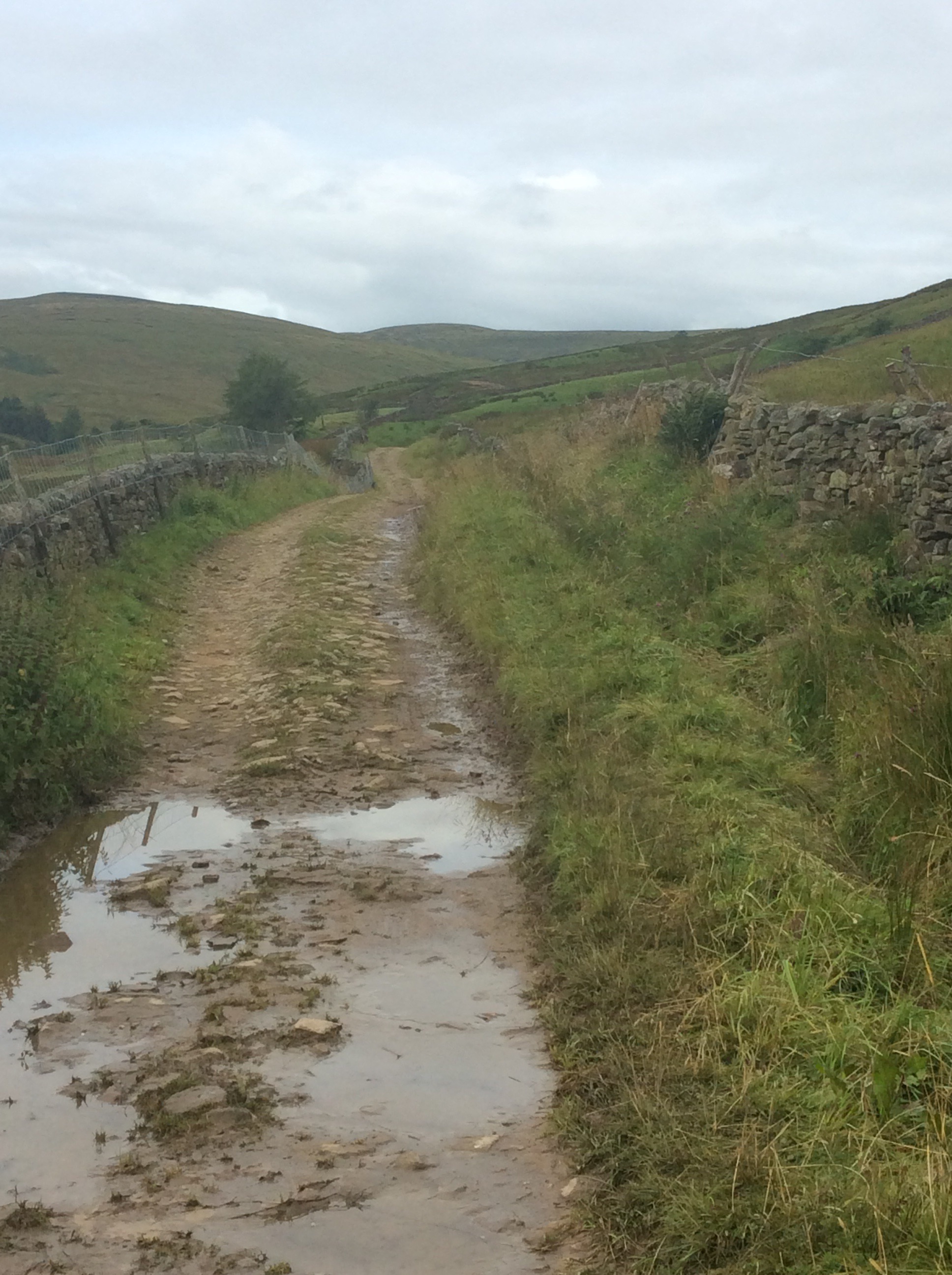
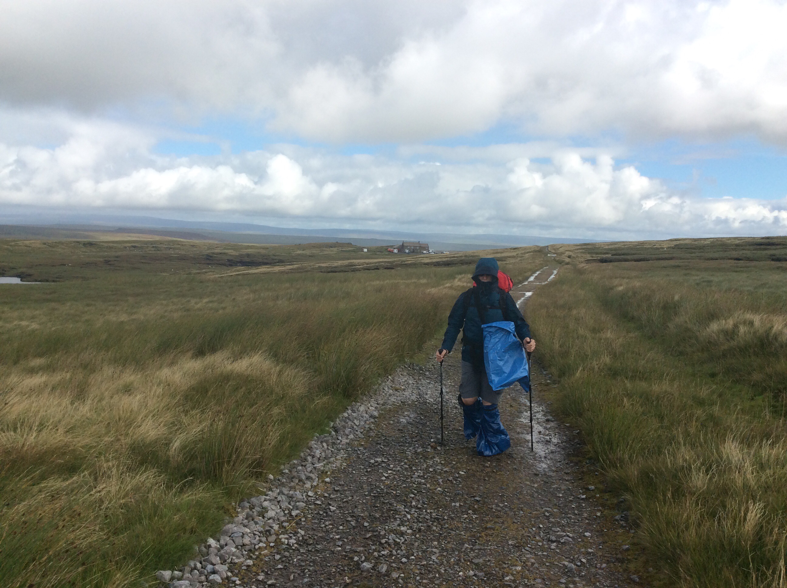
The day was made for walking. No, walking was made for days like this. No, days were made for walking like this. No, walking days were……. Shut the front door Smithy lad. On the boggiest parts of the moors the stone floors from old cotton and wool mills have been helicoptered up and form a solid base for a path. It means that erosion from footfall is less and that you can make reasonable speed. But I wasn’t reacting well to the rucksack. I’d forgotten how heavy it was. Wasterd.
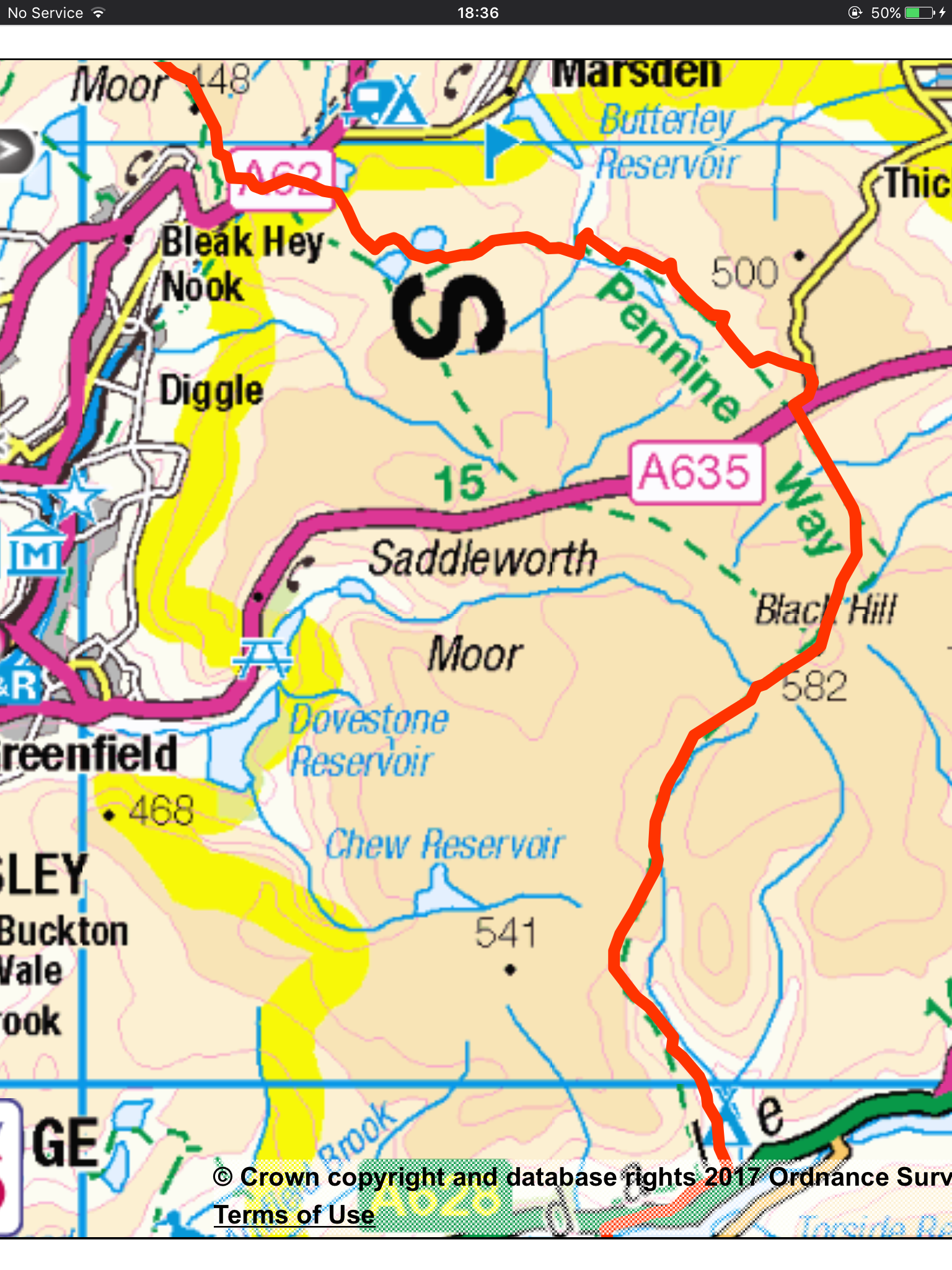
The route rambles over moorland for a few miles, then up Black Hill and finally over the top and down to a campsite in Crowden.
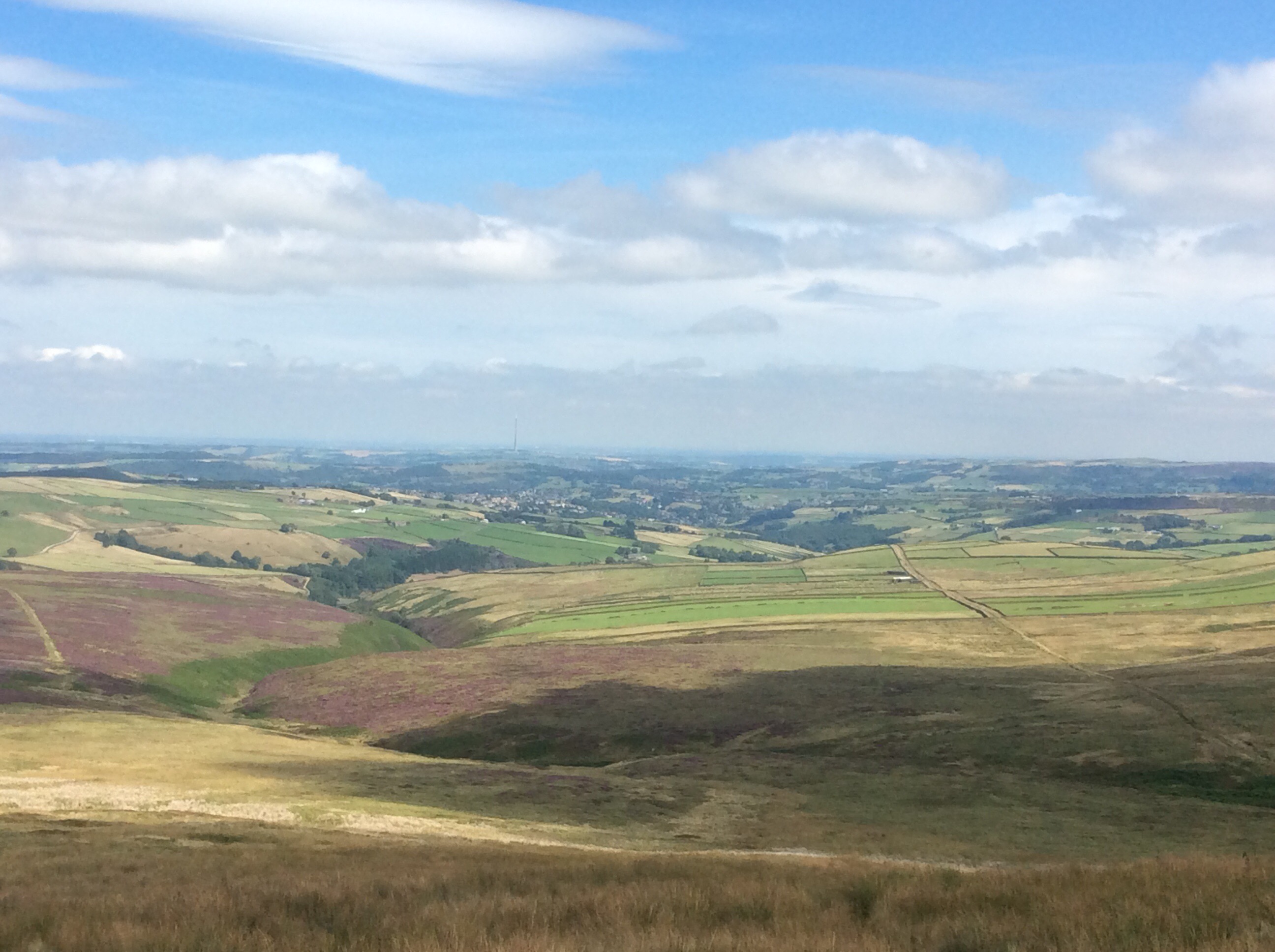
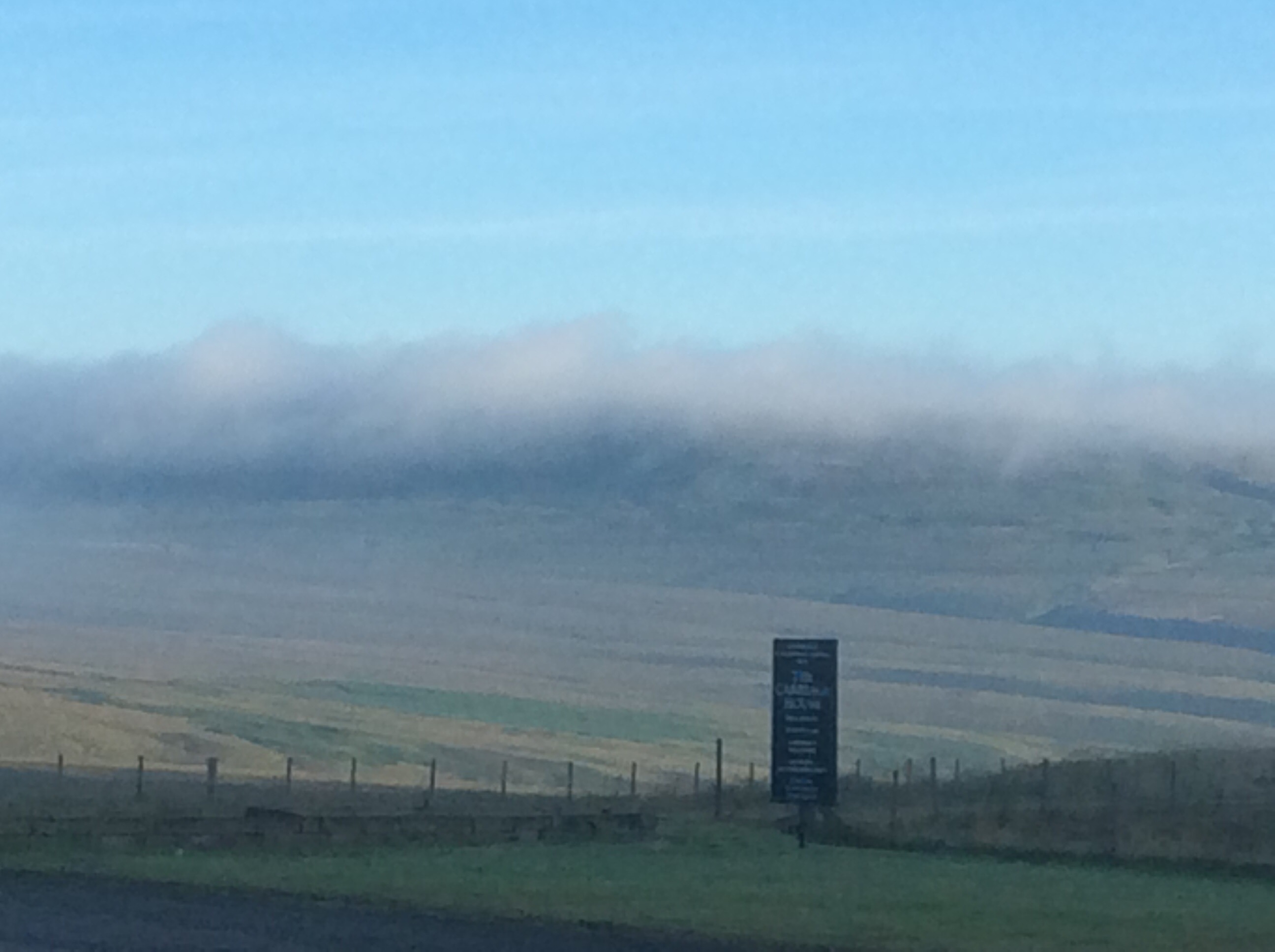
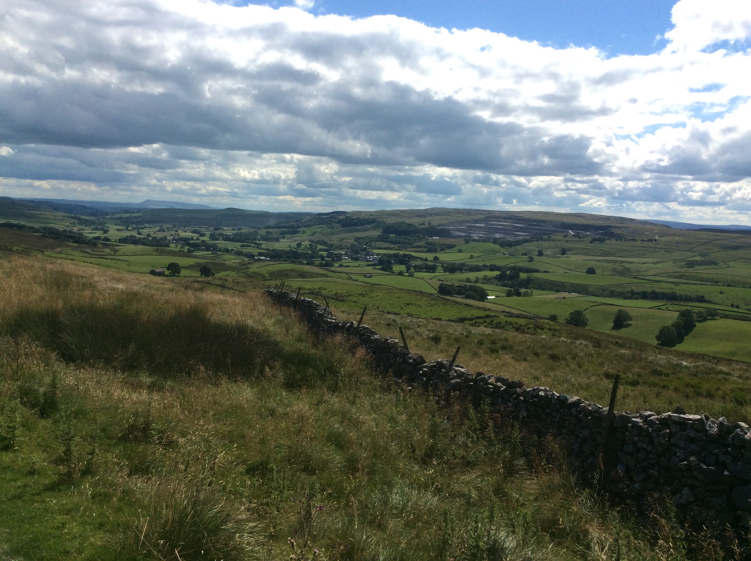
The views eastwards into Yorkshire outshone westward Lancashire by a long chalk. Useless Lancky gets. This view sees the TV transmitter at Emley Moor in the distance.
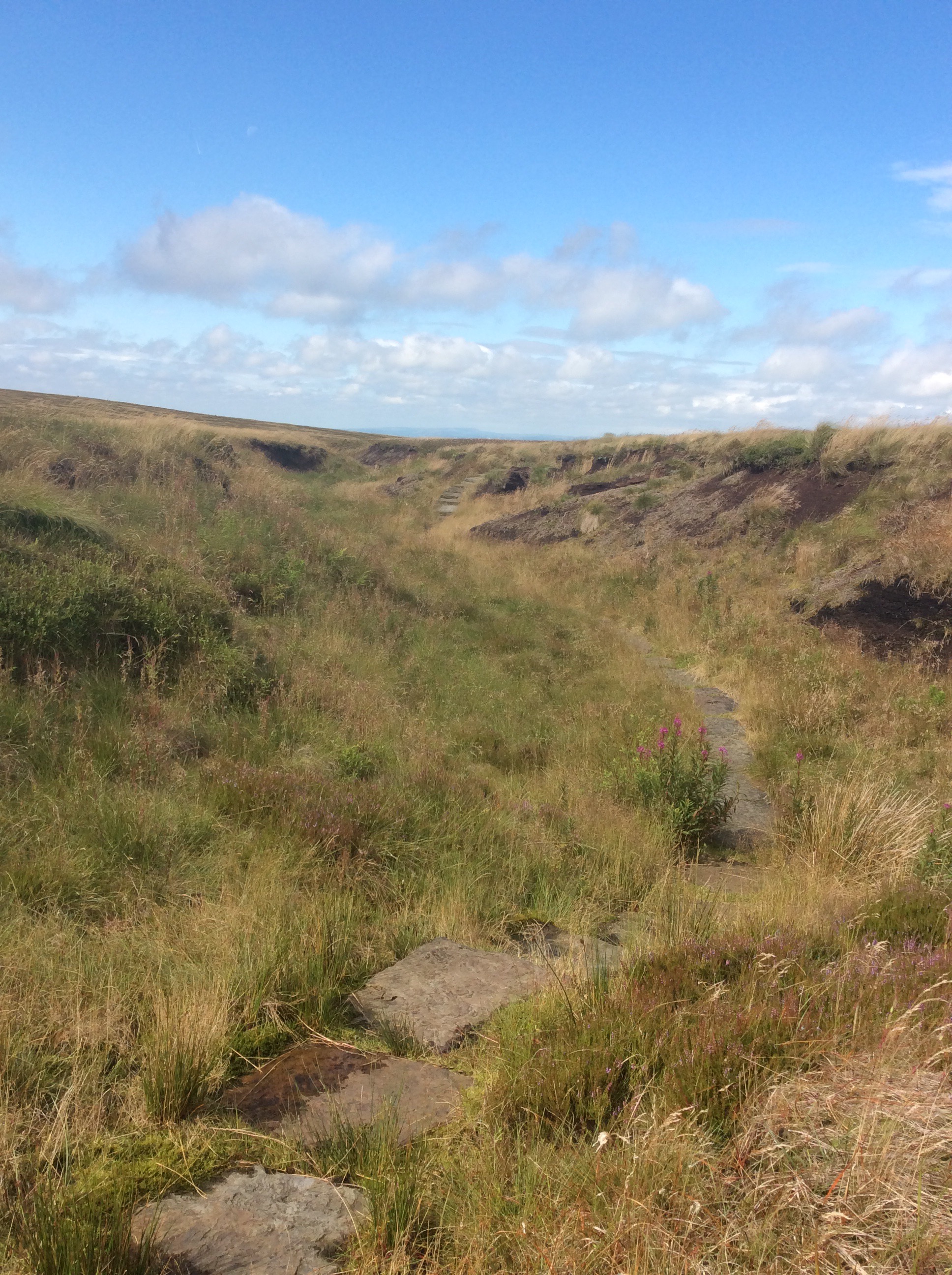
Onward and downward to a small stream spilling down the Moorside, with the purple heather in abundance in its late summer finery. It stoned me to my soul. Stoned me just like going home, and it stoned me.
Upward and onward to Black Hill. Only 11 miles today but not a pushover. Certainly not a pushover with the rucksack. Has Che put lead weights in here for a laugh? This was one of the few times Pennine Wayfarers passed me in the last week. It really seems to be less popular.
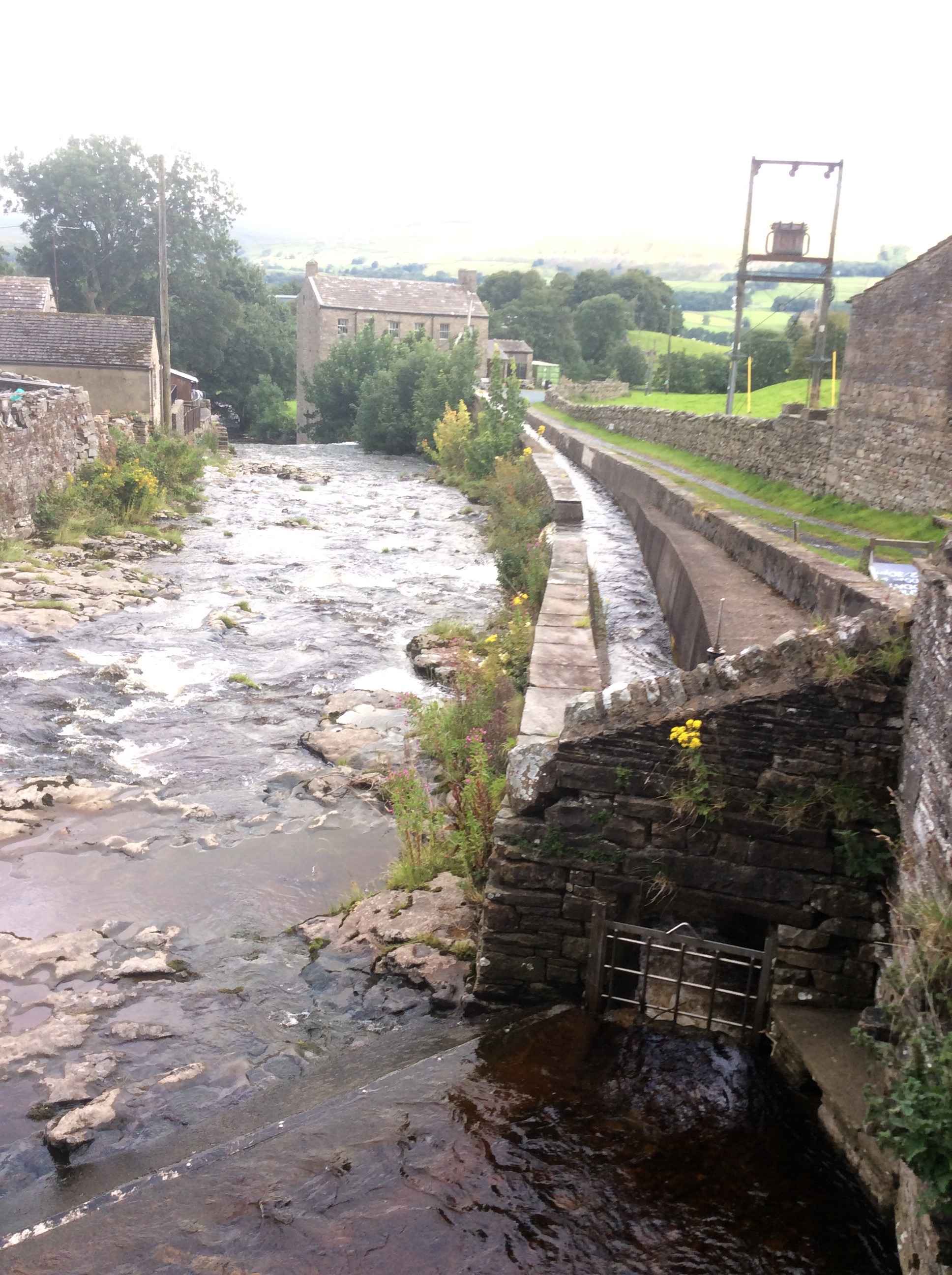
And down to Crowden.
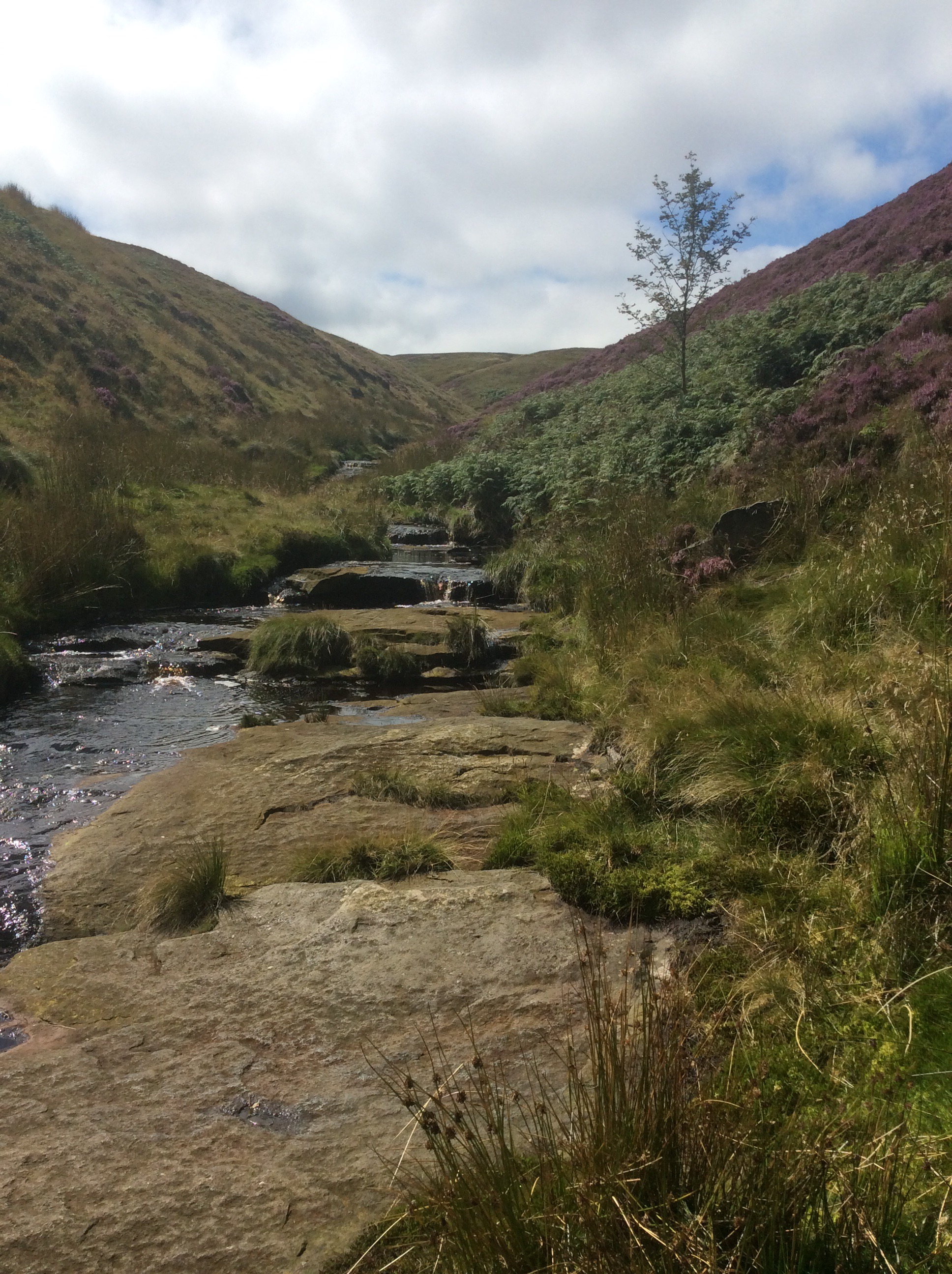
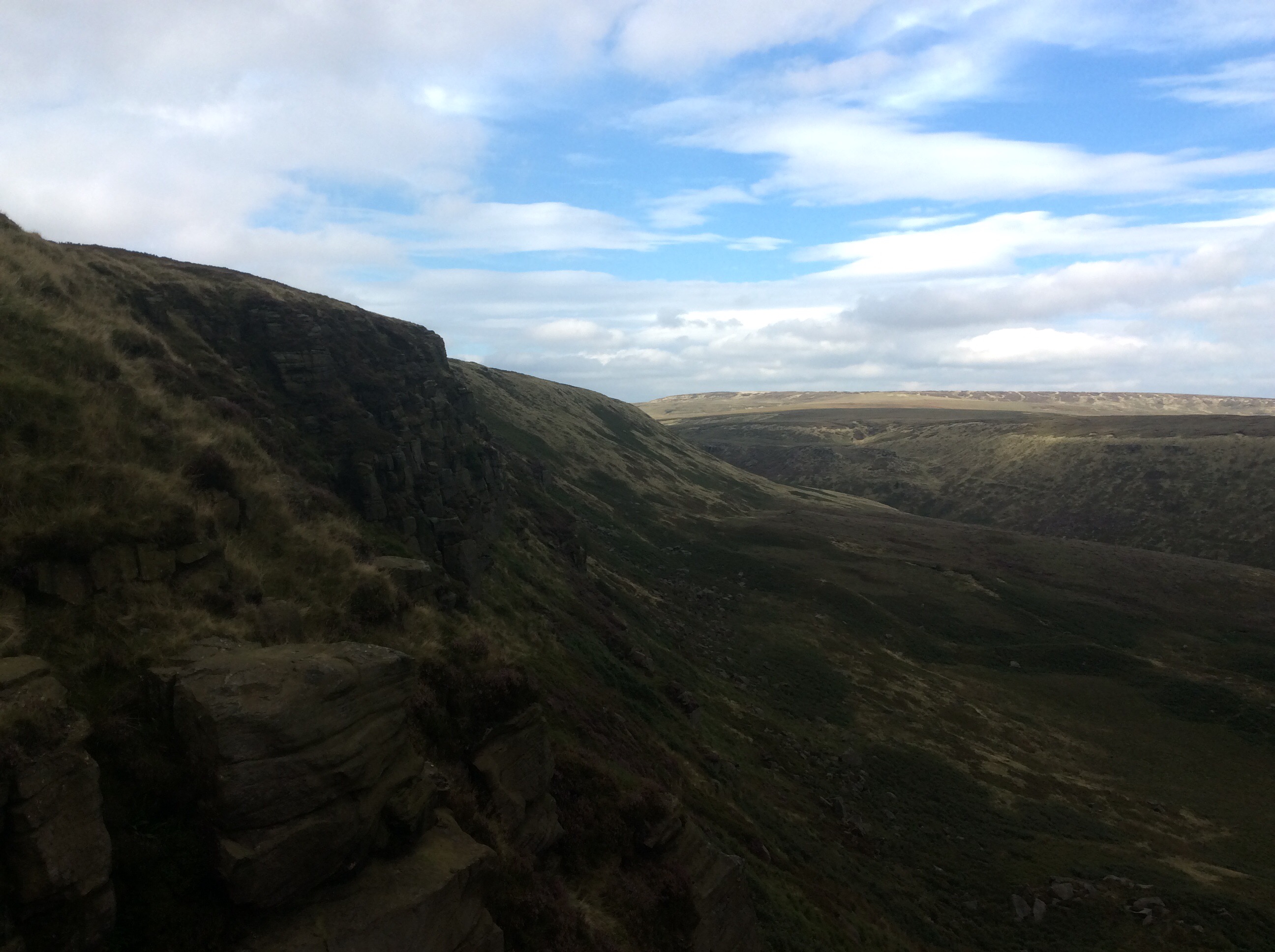
The Way skims precariously along the sheer edge of a ridge, the most vertiginous part of the whole walk.
Down to the campsite in the valley below. I find myself singing old songs that my grandmother, mother and (surprisingly) my father sang when I was young. Trekking takes me back to a simpler time, before school and before my family became dysfunctional. But when I was 8 years old my mother was petrified by the Cuban missile crisis and told me and my 4 year old sister of the potential end of the world through nuclear war. We never said nuclear war. It was atom bombs in those days. I lay awake and cringed at every plane passing overhead, thinking it was a Russian coming to Atom Bomb me, and less significantly Norton RAF aerodrome nearby. If something horrible is happening then tell your kids that it’s ok. And they’ll be happy in bed, like this.
Night night.
Colden to Marsden – business end of the season
A good night sleep in Che’s tent whilst her and the dog slept in her converted British Gas van.
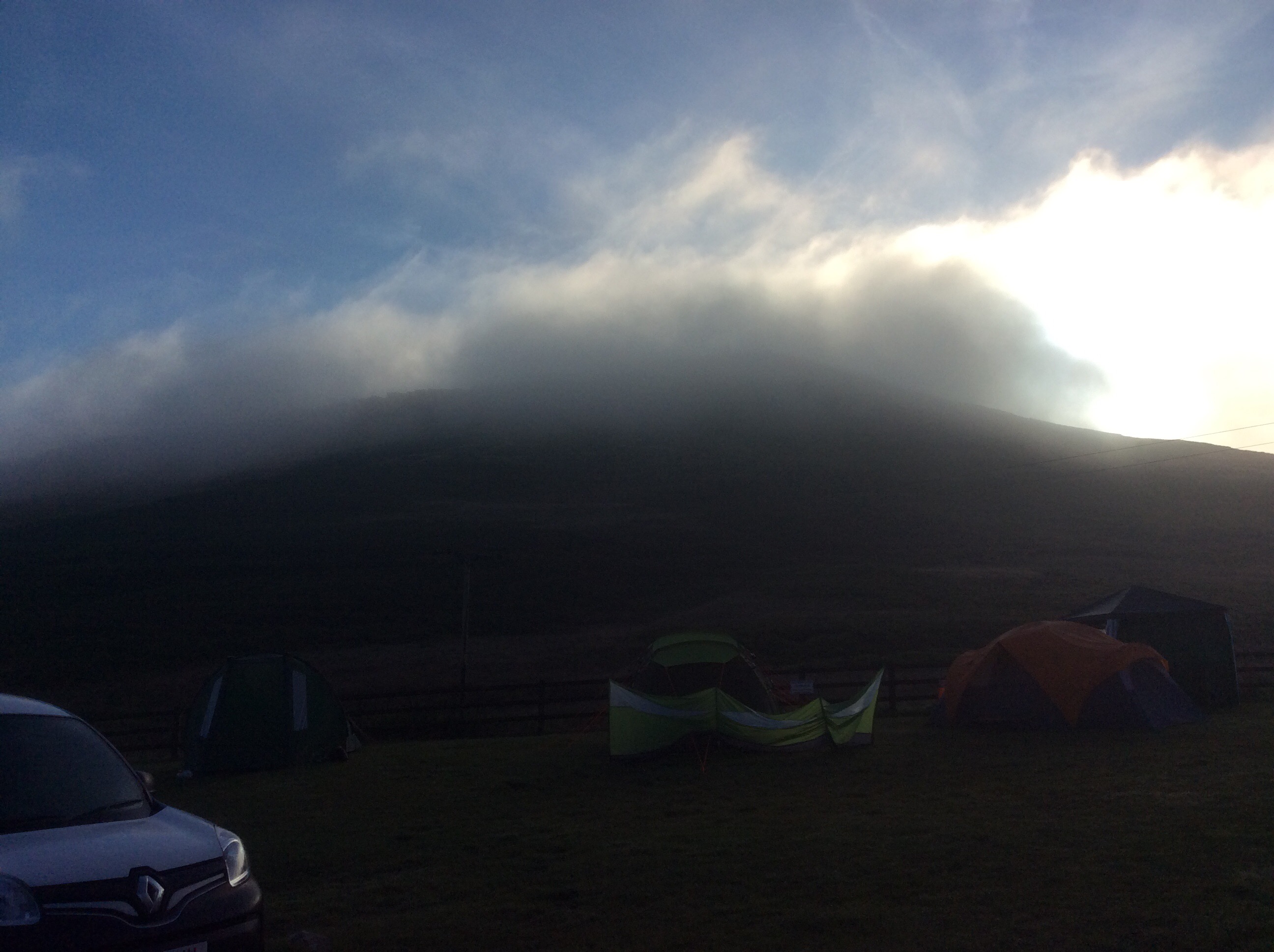
The hills looked good in the morning mist.
 She took me back to Colden, via breakfast at the Shay Cafe in Halifax. 18 miles today walking back to the campsite, then I’ll pick up my rucksack for the first time in a few days on tomorrow’s walk.
Che dropped me off and I was on my way on a sunny day. She left her teeth out and wig off but she still looked ok.

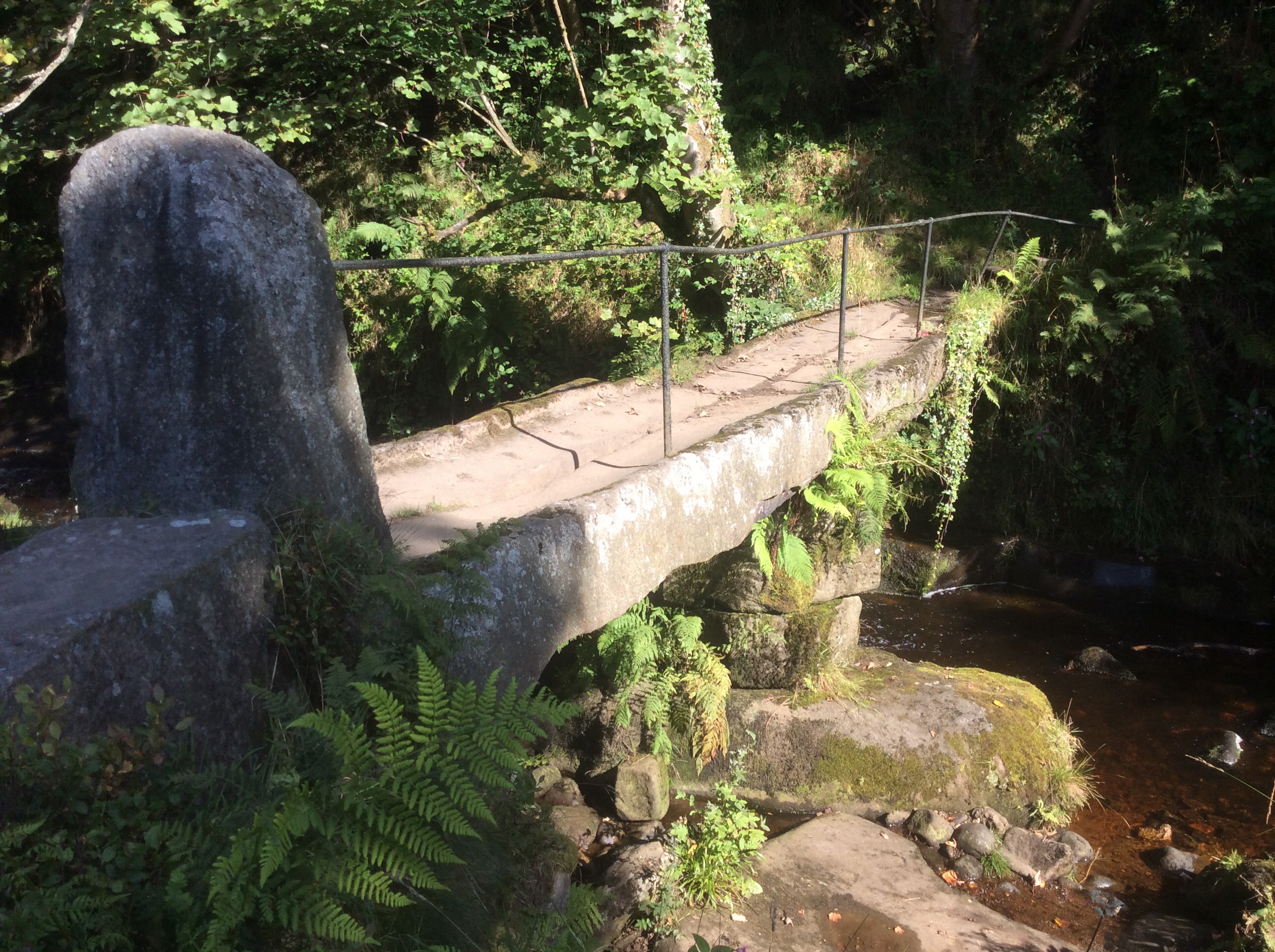
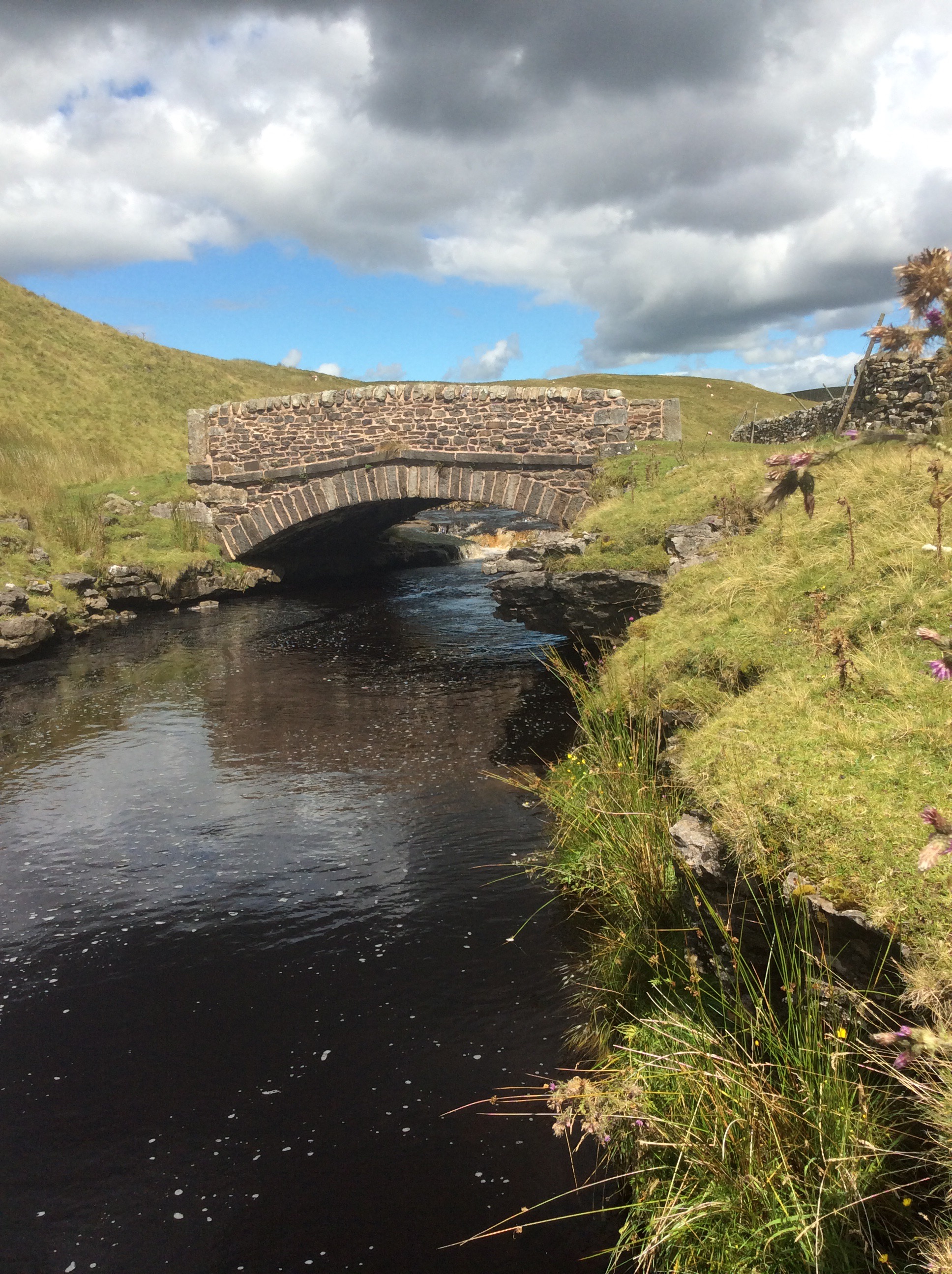
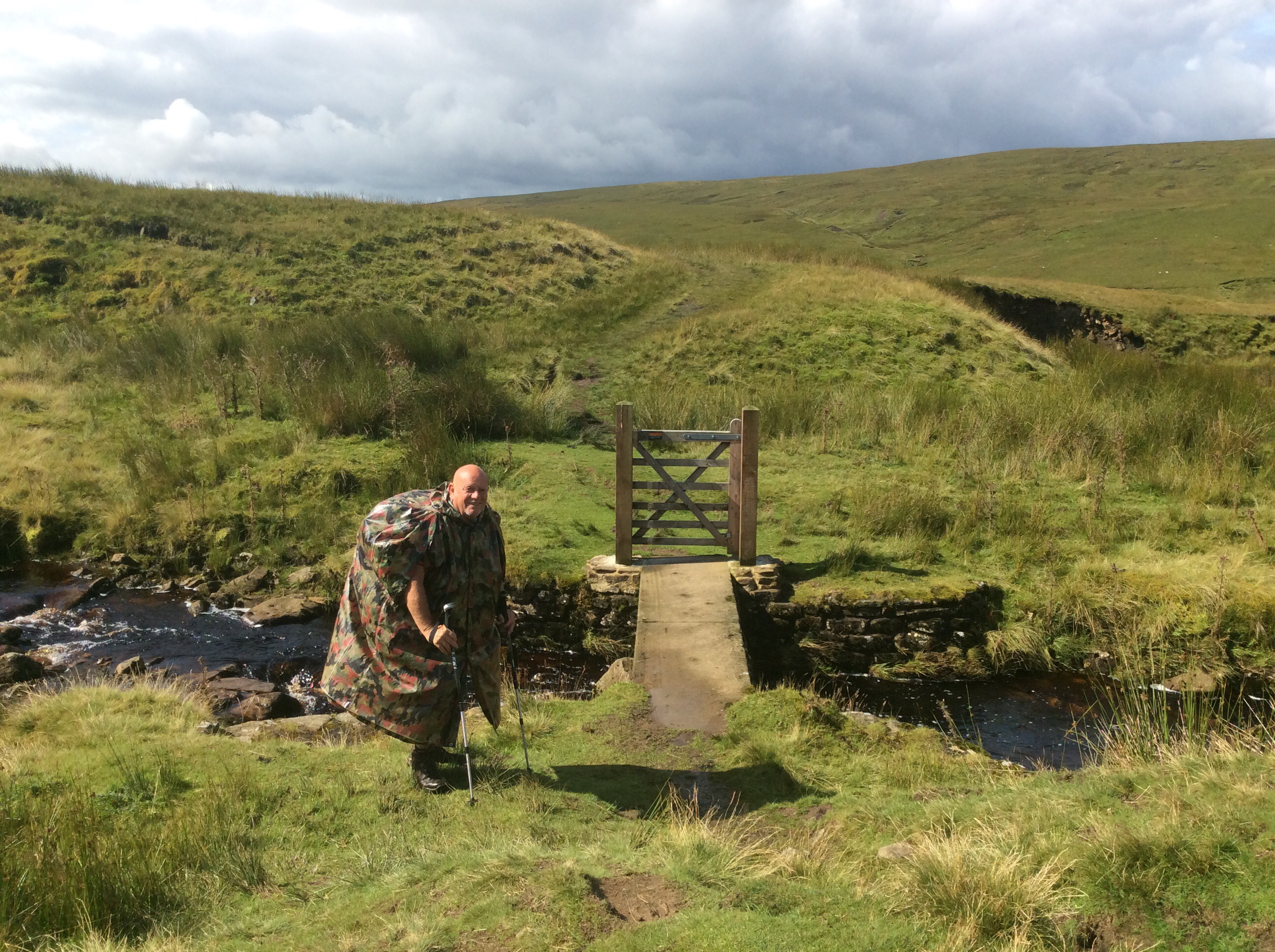
Dropping down to the first stream was an ancient bridge of which I have not seen the like before. A long stone slab. It must weigh a few tons.
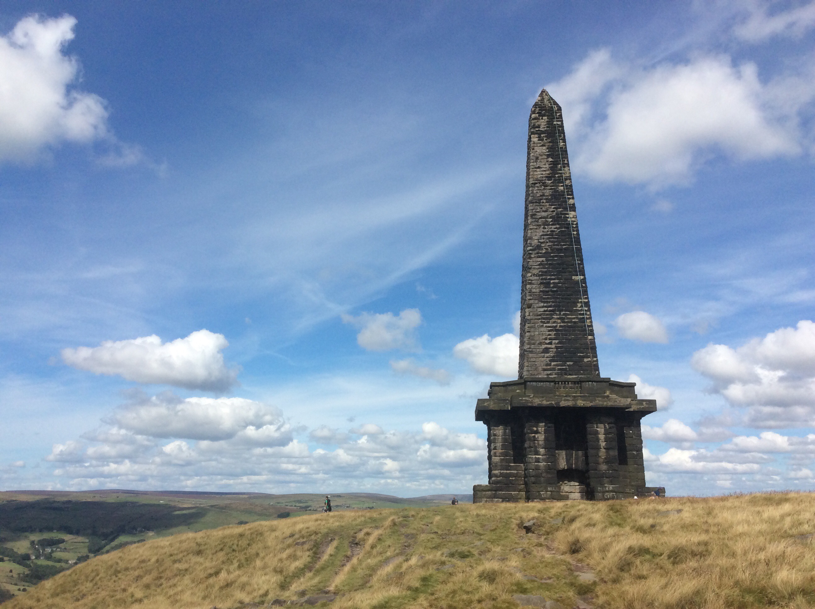
Over the next hill the Way dropped down into the Calder valley and the monument of Stoodley Pike pierced the horizon. Celebrating for eternity the victory over Napoleon, although it fell down once and had to be rebuilt. And building was suspended after he escaped from Elba,until he met his Waterloo at … well Waterloo actually. 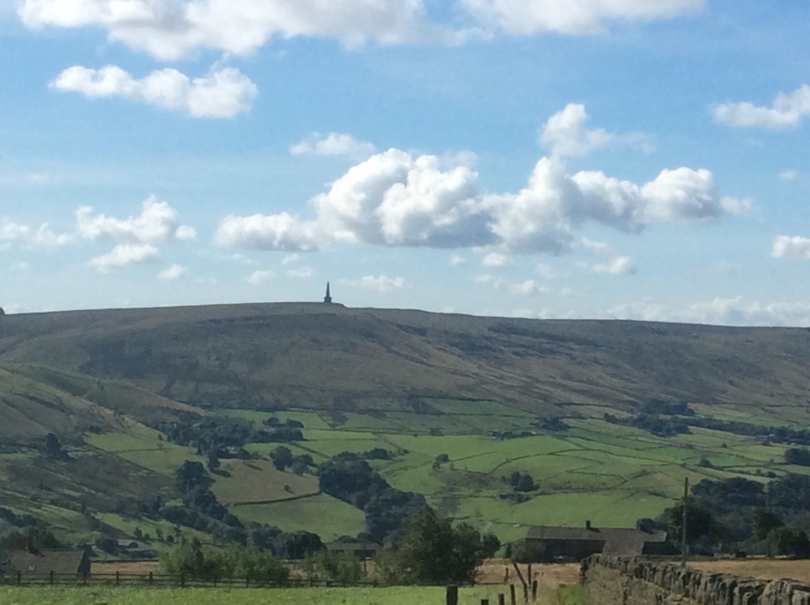
Physically I feel pretty good but my feet, right foot in particular, hurt real bad on occasions, mostly late afternoon.
Today all was ok for a good while. Climbing up towards Stoodley Pike the view northwestwards over Todmorden was bootiful. So let’s talk turkey. It was booootiful.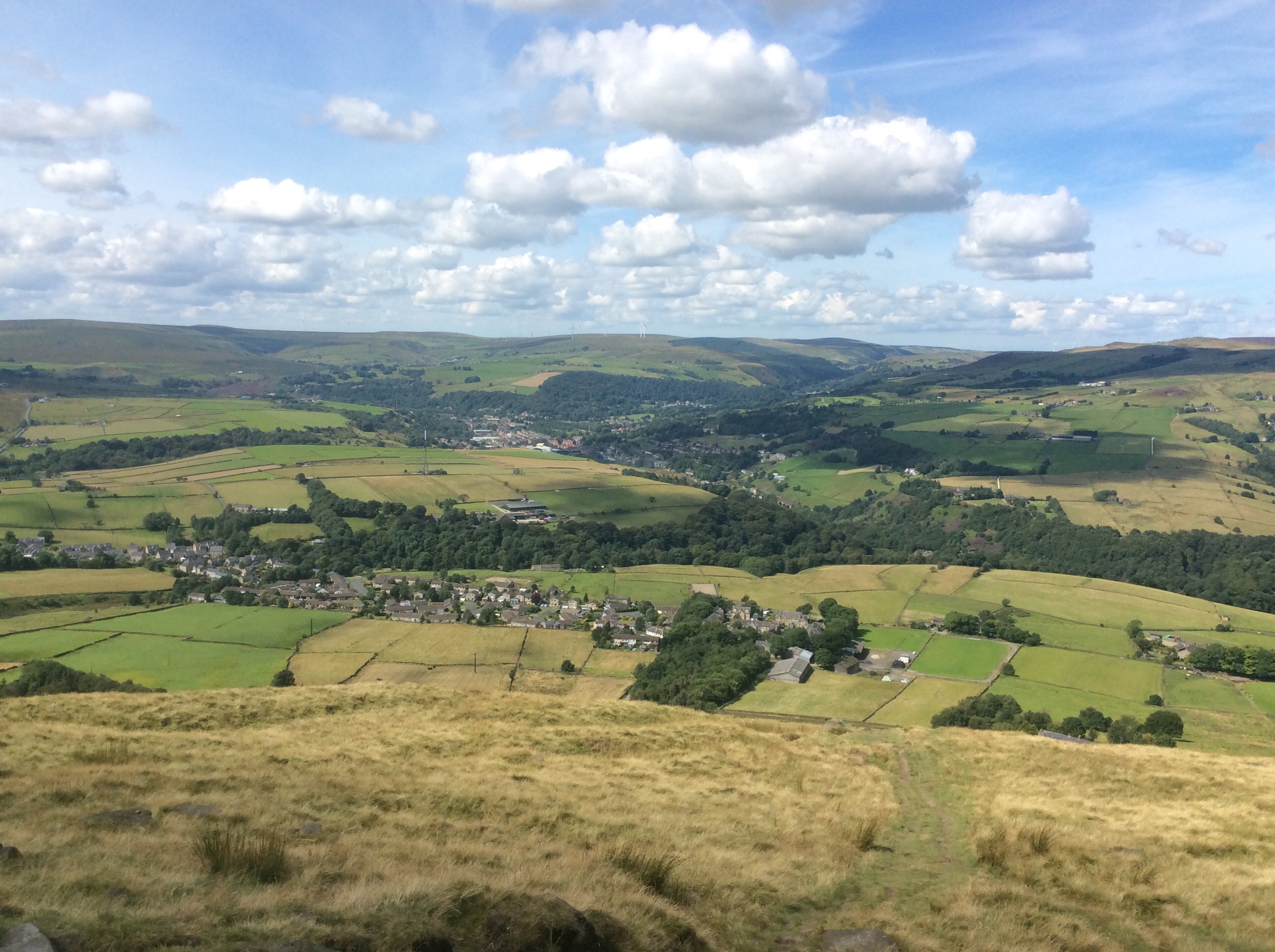
The monument was impressive and hang gliders flitted over it like birds of prey coasting the thermals.
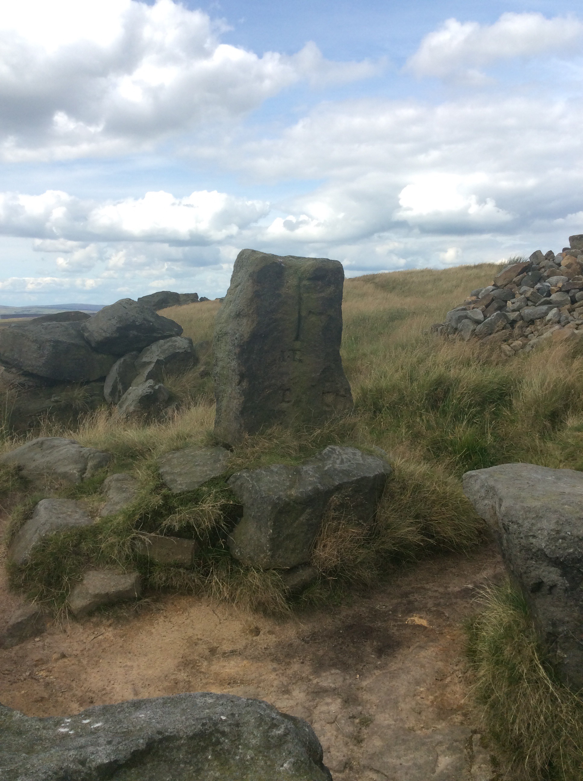
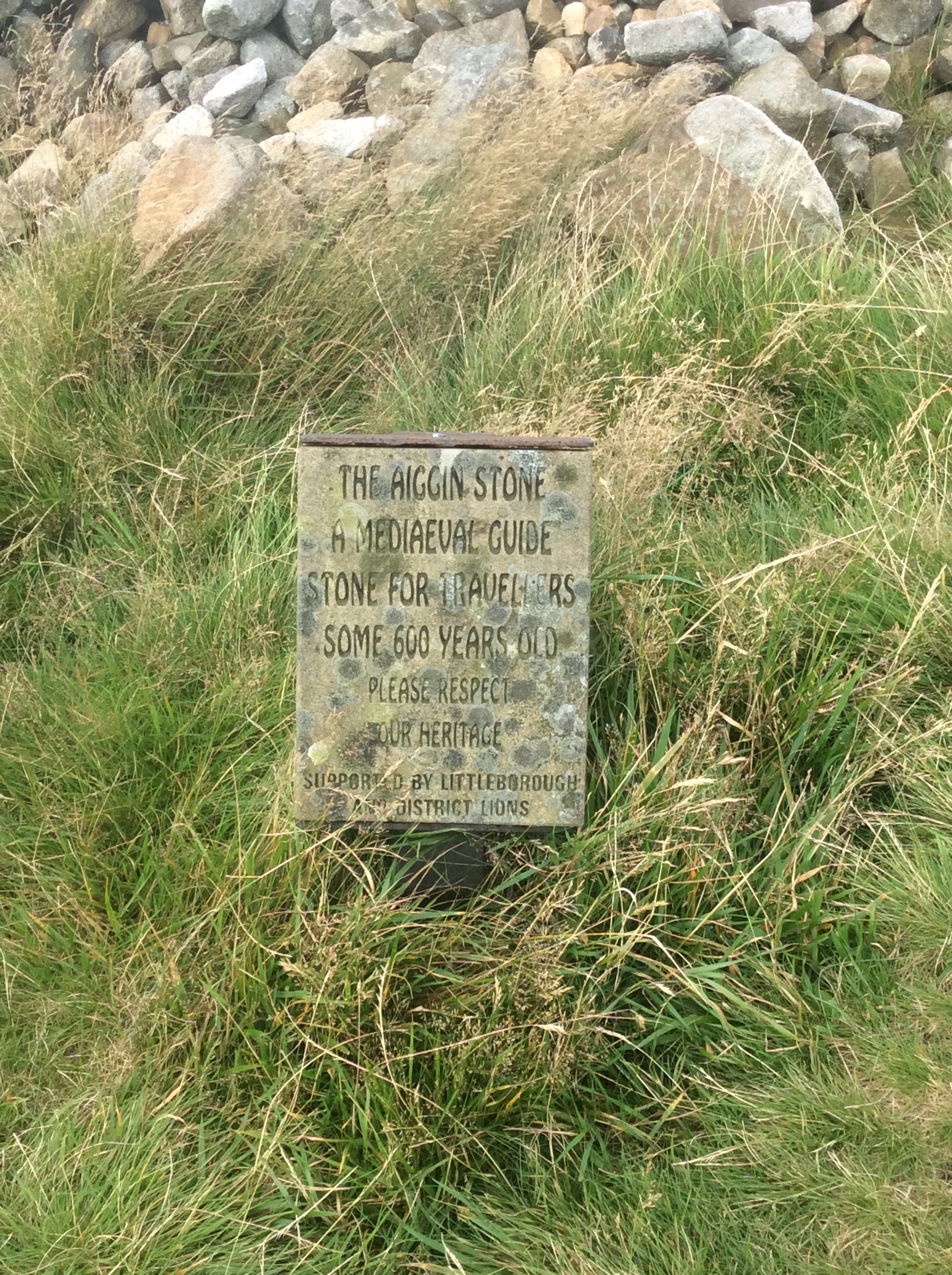
Here the Way turns southward and follows a ridge looking west towards Manchester, Liverpool and the Irish Sea, sadly out of range in the haze. At one point it cuts uphill eastwards along an old packhorse track with a 600 year old waymark stone marking the way. Well, course it does. If it was a skidmark stone it would mark the skid. It does what it says on the tin. Marks the way.
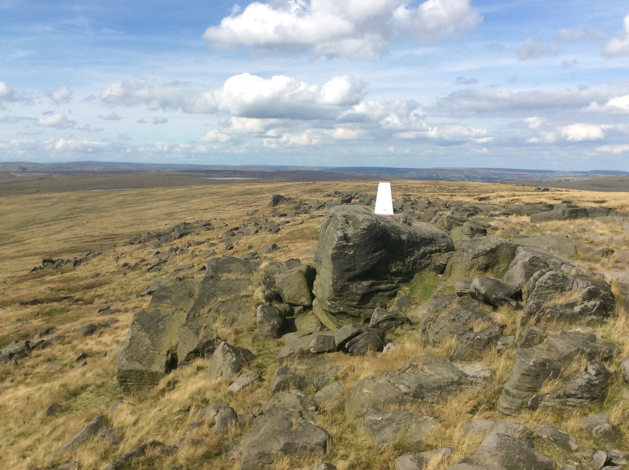
The Way rises up Blackstone edge, with it’s vantage over the northwest of England and, in the eye-screwing distance, north Wales. God bless Great Britain.
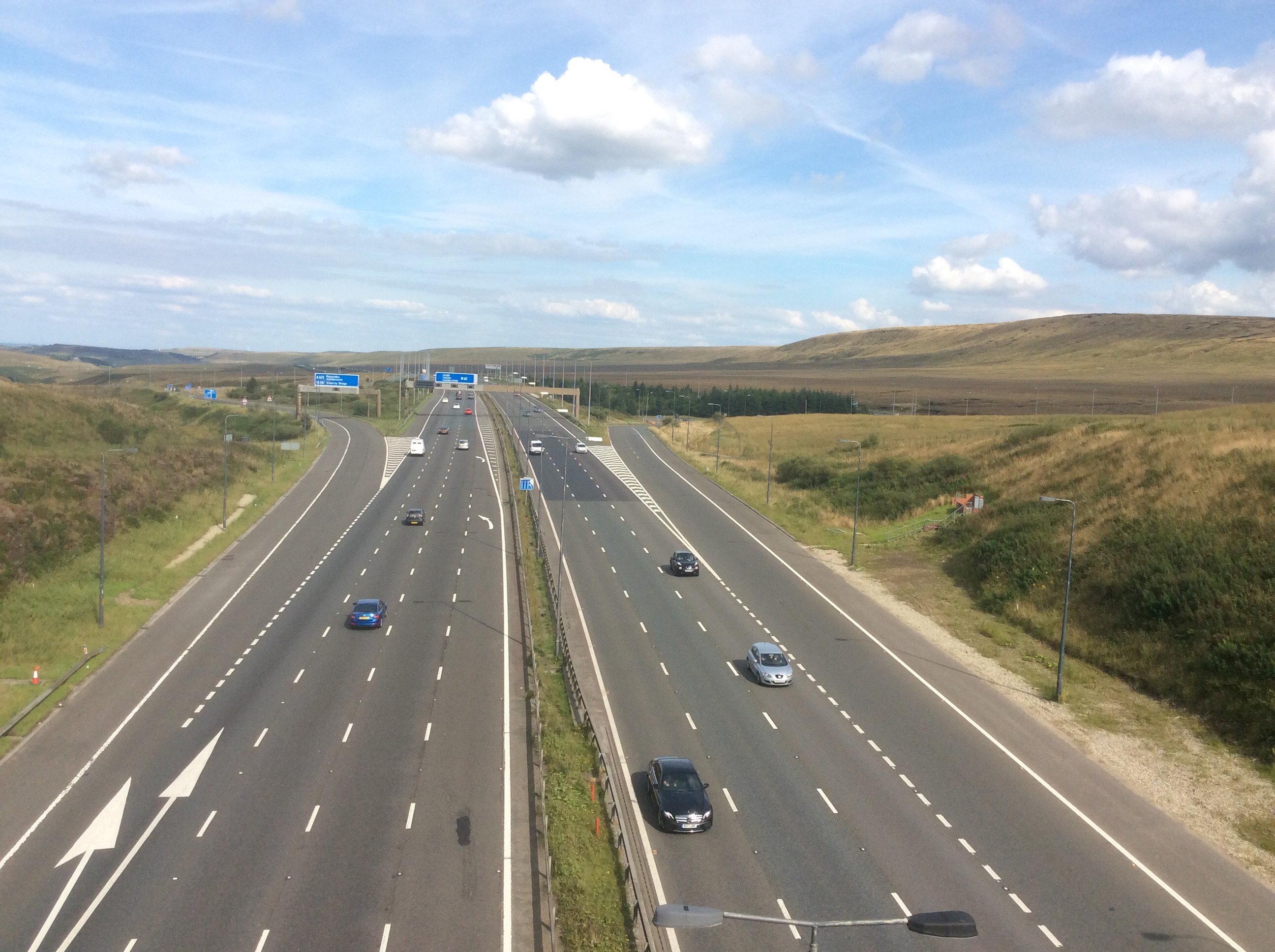
Then the route crosses the main east to west motorway, the M62, incongruous in this moorland. At least the PW gets its own footbridge.
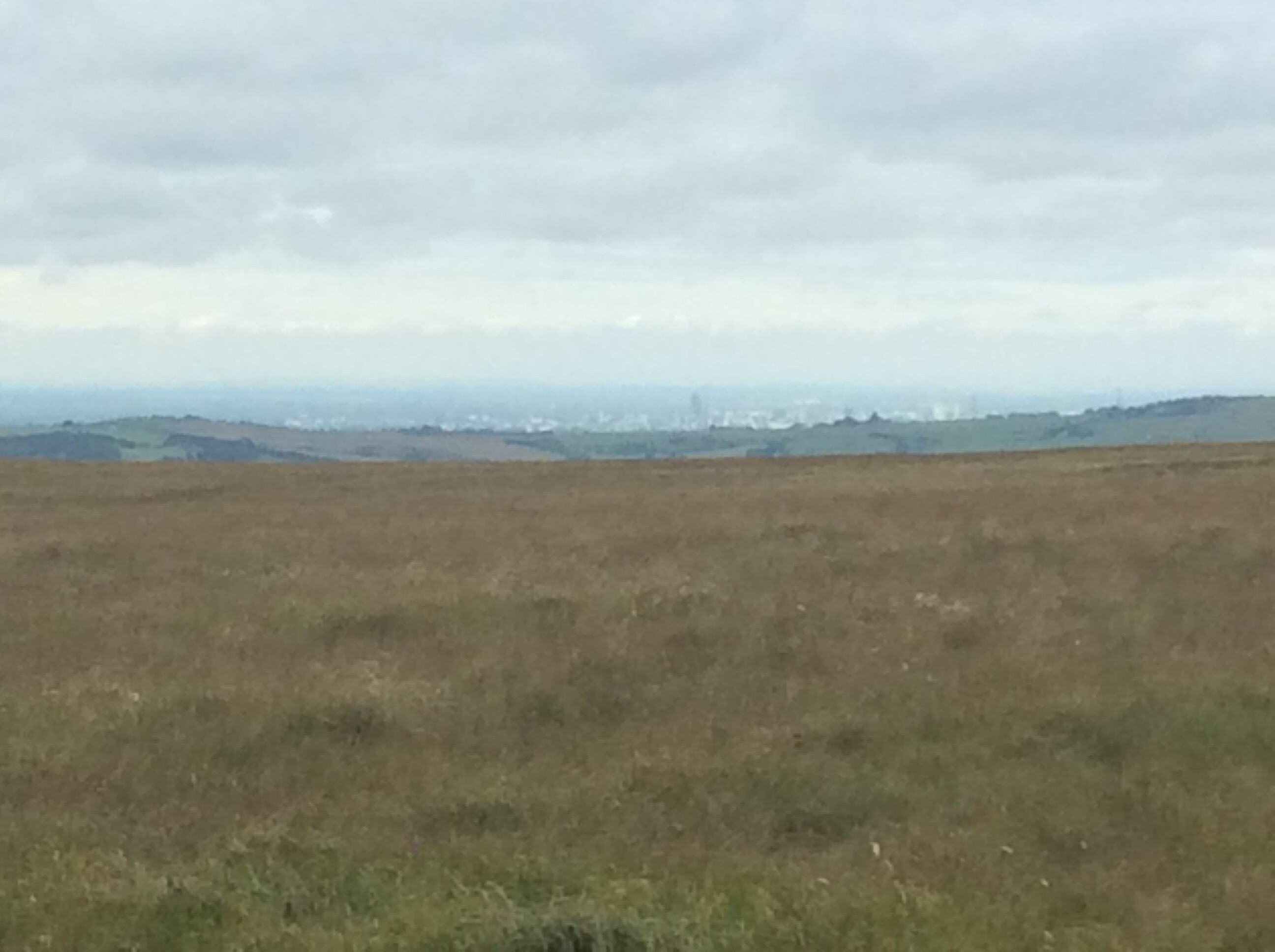
And on to Saddleworth Moor, forever haunted by the buried bodies of the children murdered by Myra Hindley and Ian Brady, may they both burn eternally with a red hot poker stuck up their jacksies. Sub-human. And on a day like today the sun must lighten the pain of those lying beneath its peat and heather. Some warmth penetrating the gloom. Manchester down in the distance, congratulating itself on its status as the cradle of civilisation. Pat yourselves on the back boys and girls and then peep over the hills with envy at the beauty of Sheffield and the new music outstripping your dried up Stone Oasis.
Eventually (again) my campsite arrived at my feet and an early night in the tent that Che built.
Night night.
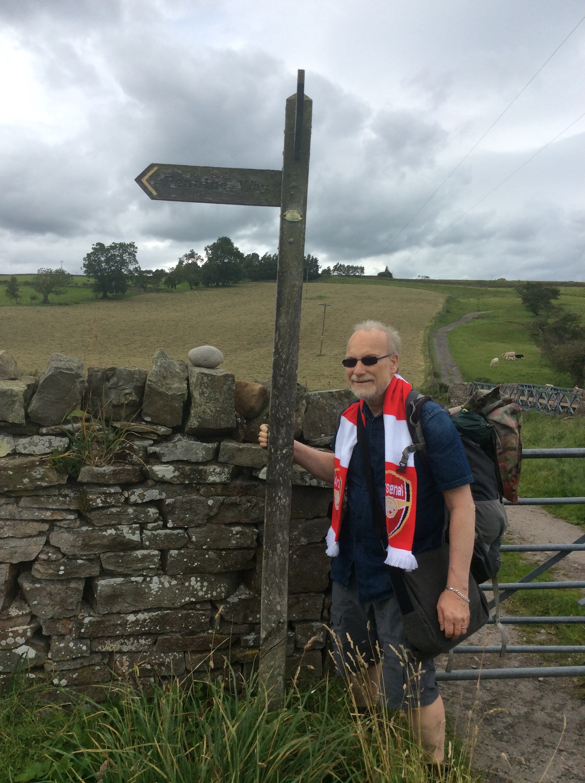
Lothersdale to Colden – an unexpected pleasure
We got up early to get some bacon butties in Hebden Bridge and to drive on to where I left off in Lothersdale. The route today was through Bronte Country with wind-blasted moors and stark hillsides. Meandering 16 miles up hill and down dale to the rendezvous point, the New Delight Inn, Colden where we had spent last night camping in the back field. Debs – oh bugger it, everybody calls her Che – Che was dropping me off, coming back to Colden to derig my tent and push on to Marsden to put her own tent up, for me to sleep in. It’s big and comfortable. Marsden is one day ahead of where I’ll finish today but I’ll stay there for two nights. Means I don’t have to carry my rucksack for a day when Che’s gone. But she’ll take her tent with her and put my little one (tent) up. 
Bacon butty mission accomplished we, me, Che and her dog Flo, walked together up the hill out of Lothersdale in the wind and the rain, and the backstreets and the backstreets.
Looking back Lothersdale looked lovely, even in the rain.

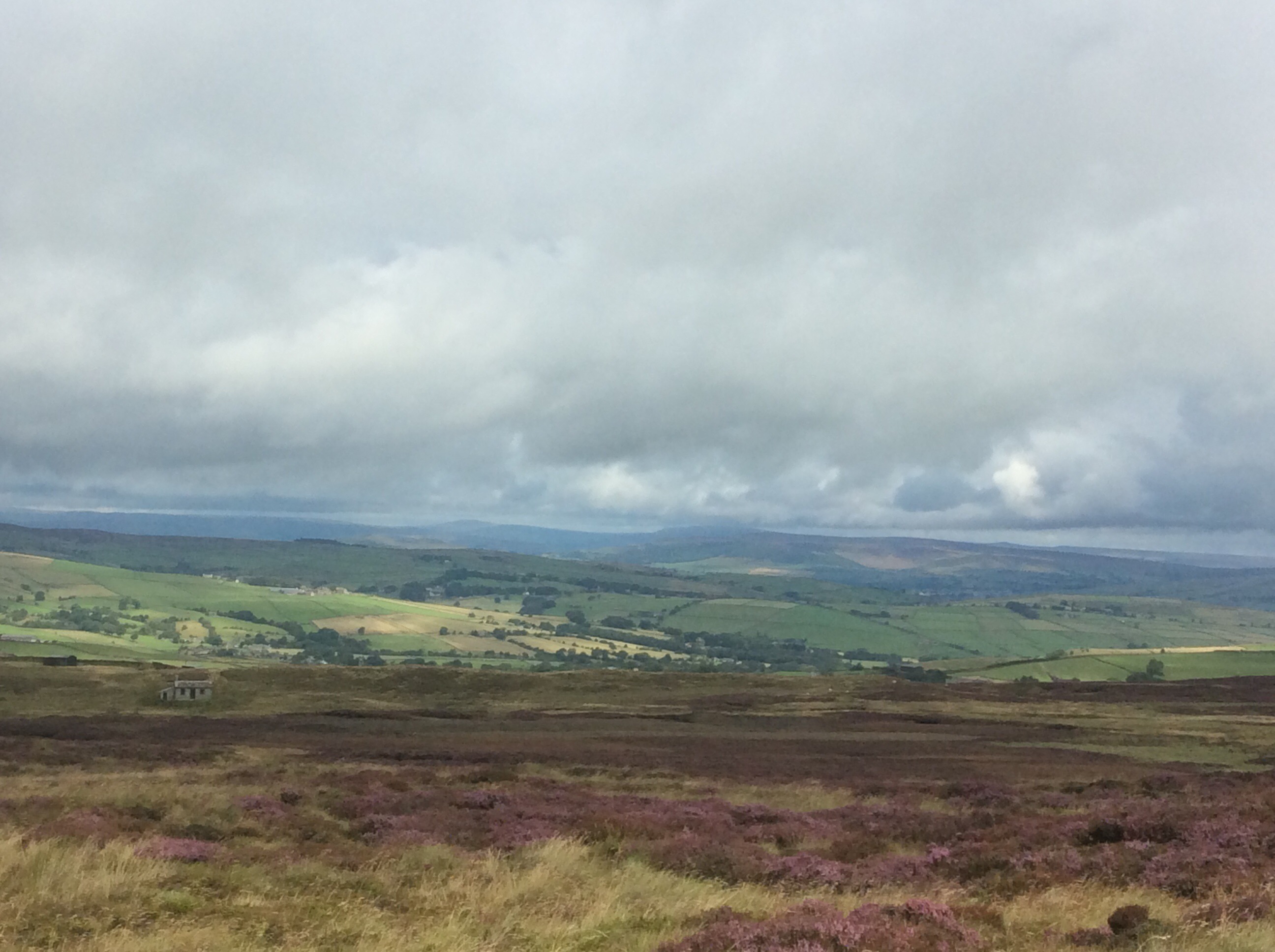
The route cut over the moors to Ponsden and the weather started clearing up a bit.
On the top the views were brilliant, with the purple heather playing a starring role.
The moors give you wet boots, peak bog sinking in to your socks, rain and wind. They also give you an enormous sense of spiritual freedom. Expecting a punchline? There int one. I felt it.
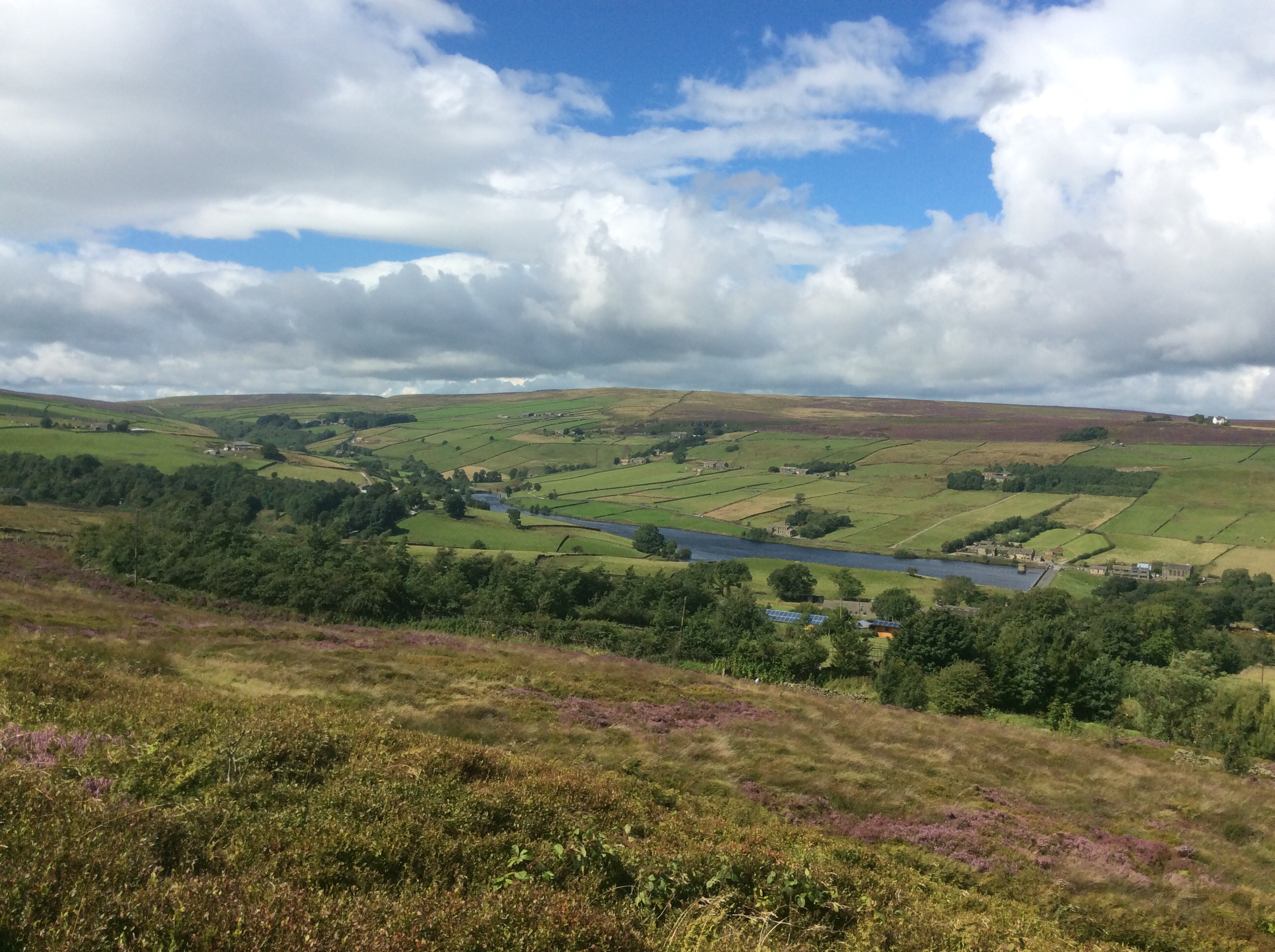
Che and Flo had gone back to shift the stuff early on so I was alone mostly today, as usual, and I enjoyed it. Beautiful views, no rucksack and only moderate foot pain. I passed and looked back at Ponden reservoir.
I was also really taken with this little view up a valley but the photo doesn’t quite do justice to the pleasure it gave me. The purple heather topping the variety of colours.
Now I was really into Bronte country and the footpath signs included directions in Chinese!
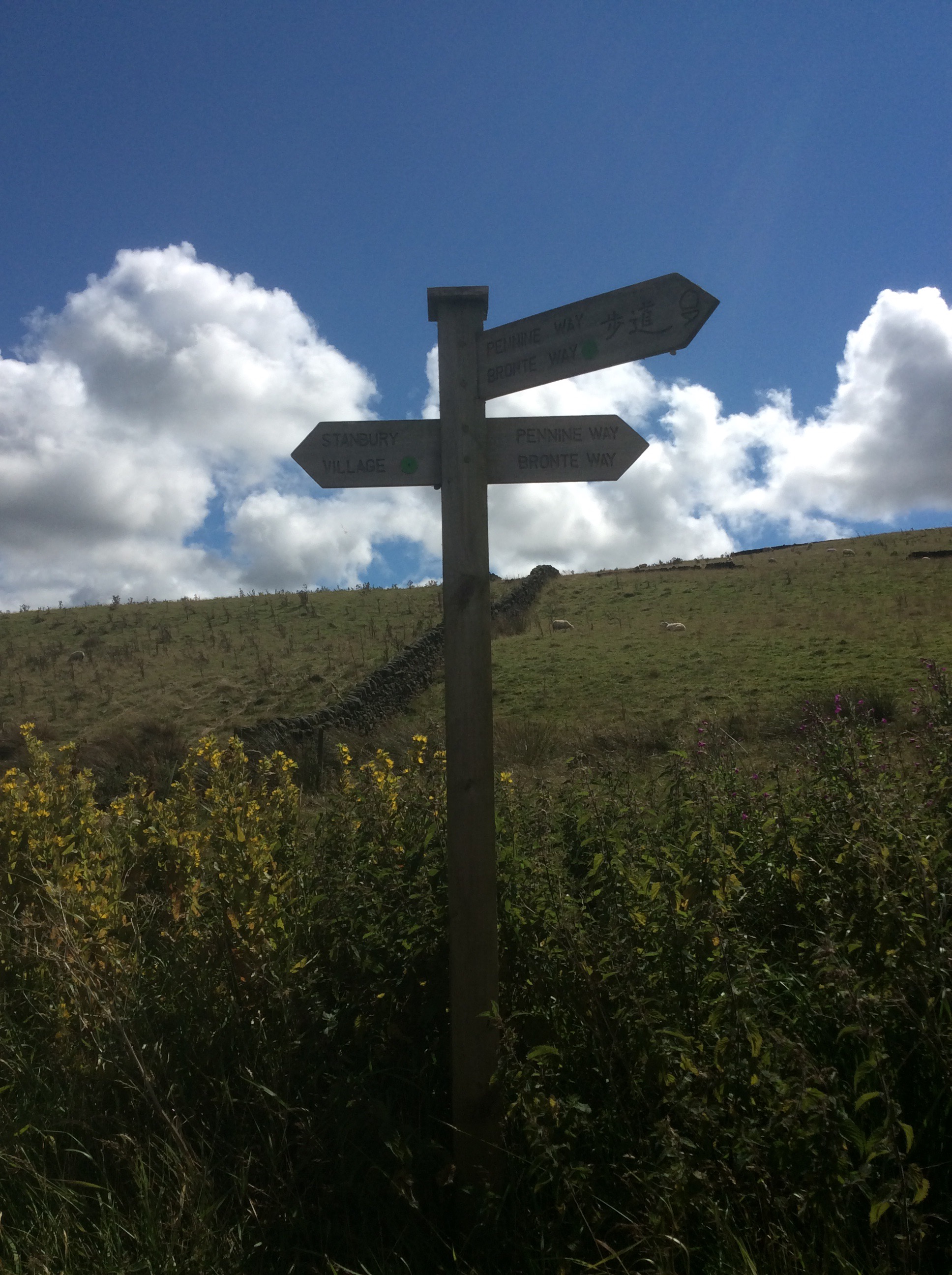
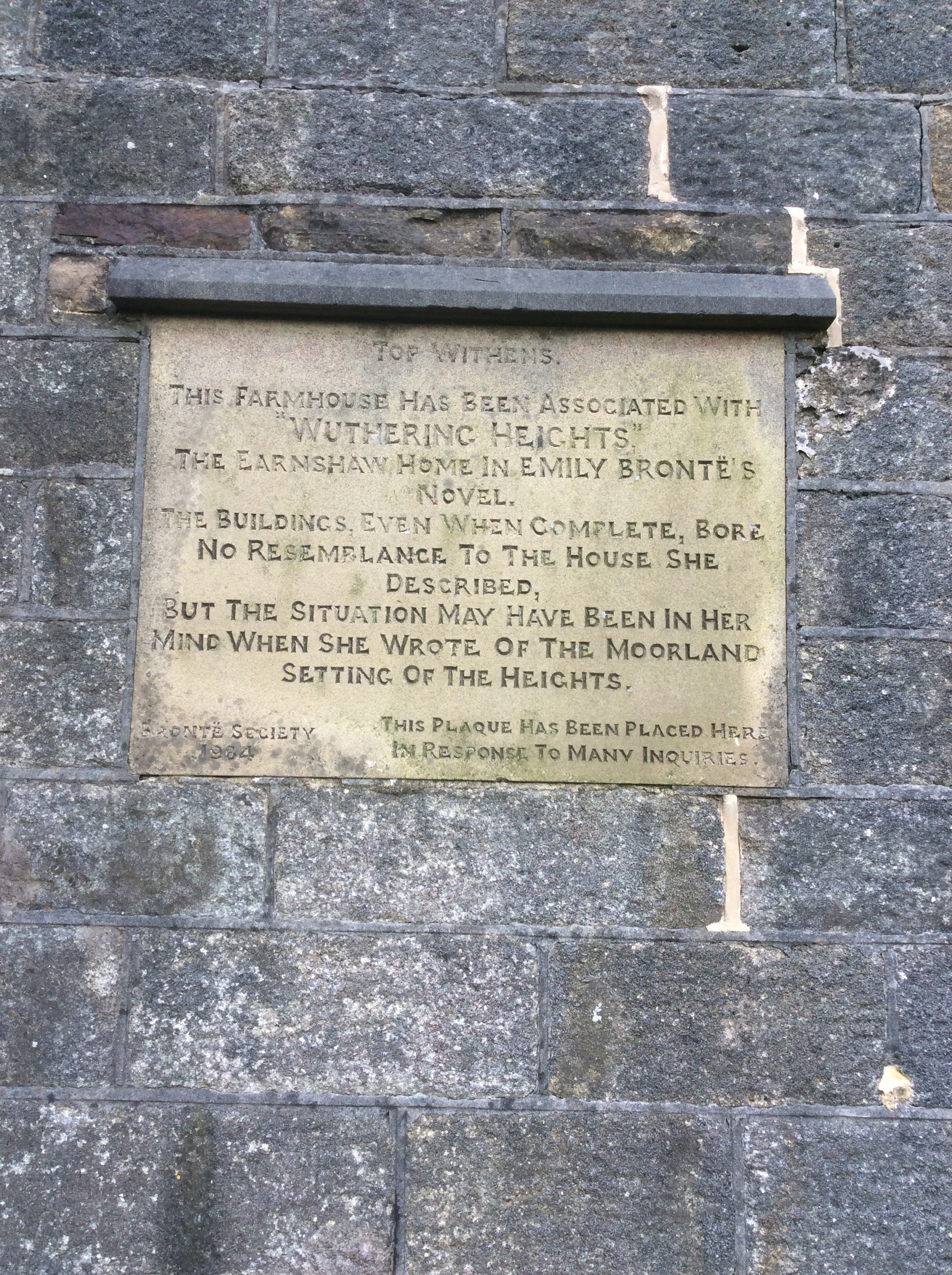
Directly on the Pennine Way is the shell of Top Withens. Clearly significant in Bronte history.
Onwards, upwards and over the Way runs alongside reservoirs high in the Pennines feeding down drinking water to Halifax, Bradford and Leeds.
I made it to the New Delight Inn at 6pm, bang on rendezvous timing, and we shot over to the tent at Marsden. Che was cooking lamb chops on couscous for us and when it was on we nipped next door to the The Carriage House pub, where the campsite was based. A couple of drinks took us long enough for Flo to get wrongly accused of biting a member of staff. Much to Che’s denial. The owner of the pub came to complain about it. I asked her if she wanted us to execute the dog but she and my sister both thought that was an unhelpful comment. I nearly peed myself. I thought it was brilliantly funny.
We got an early night after an excellent meal. Cheers Che.
Night night.
Malham to Lothersdale – Wet and Dry
I slept really well but woke up a little achey from previous days’ efforts. The route today is a 14 mile yomp, without a rucksack. Should be ok. Debs is taking down the tent after I push off and taking it to Colden near Hebden Bridge. I’ll meet her in the Hare and Hounds in Lothersdale at 6pm and we’re going to have fish and chips tonight. Get in!
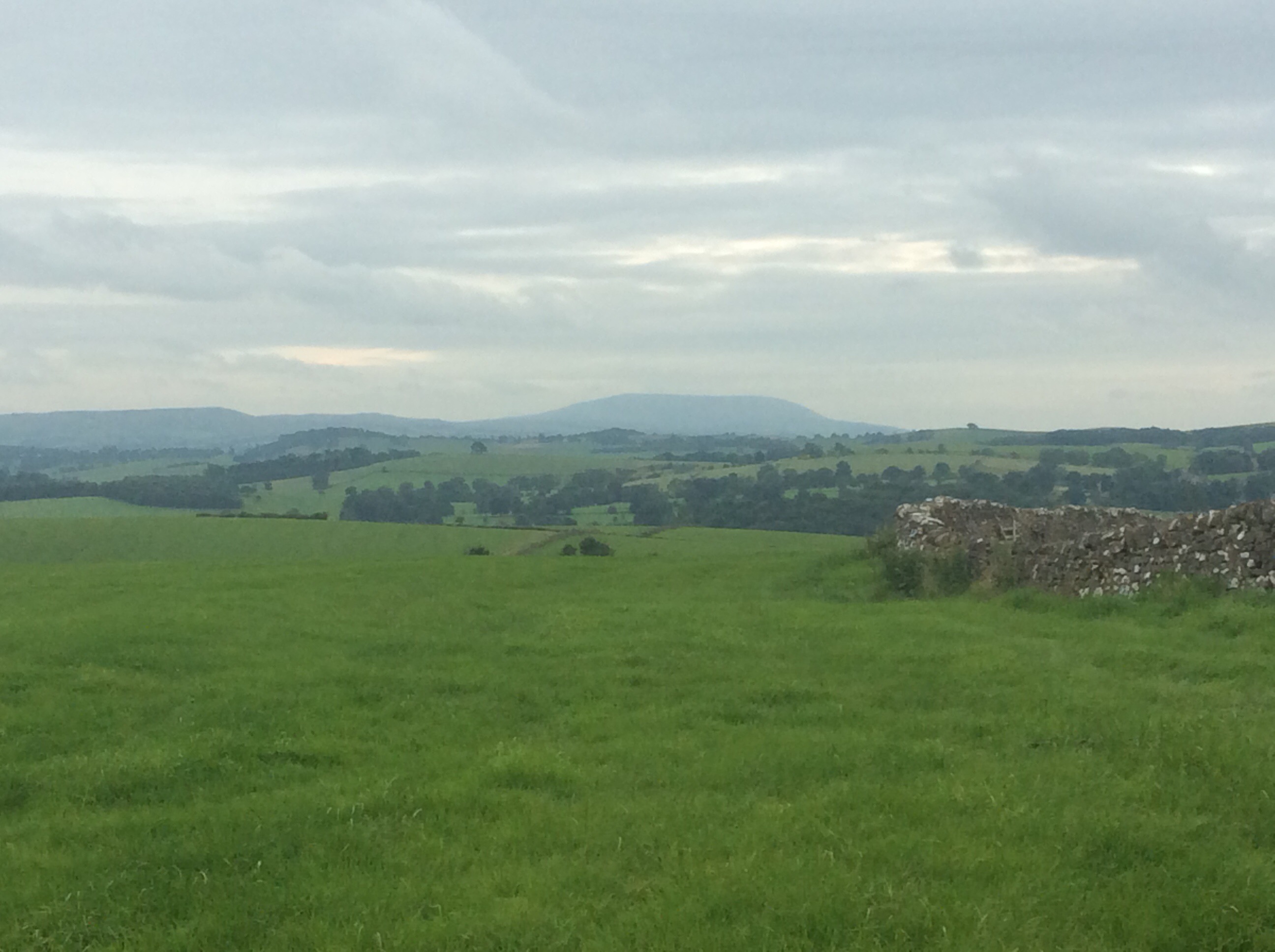
Before setting off we drove down to Gargave and had an English breakfast at a Beefeater type pub and stocked up on fat and protein. The views were less spectacular today. Rolling grassy hills.
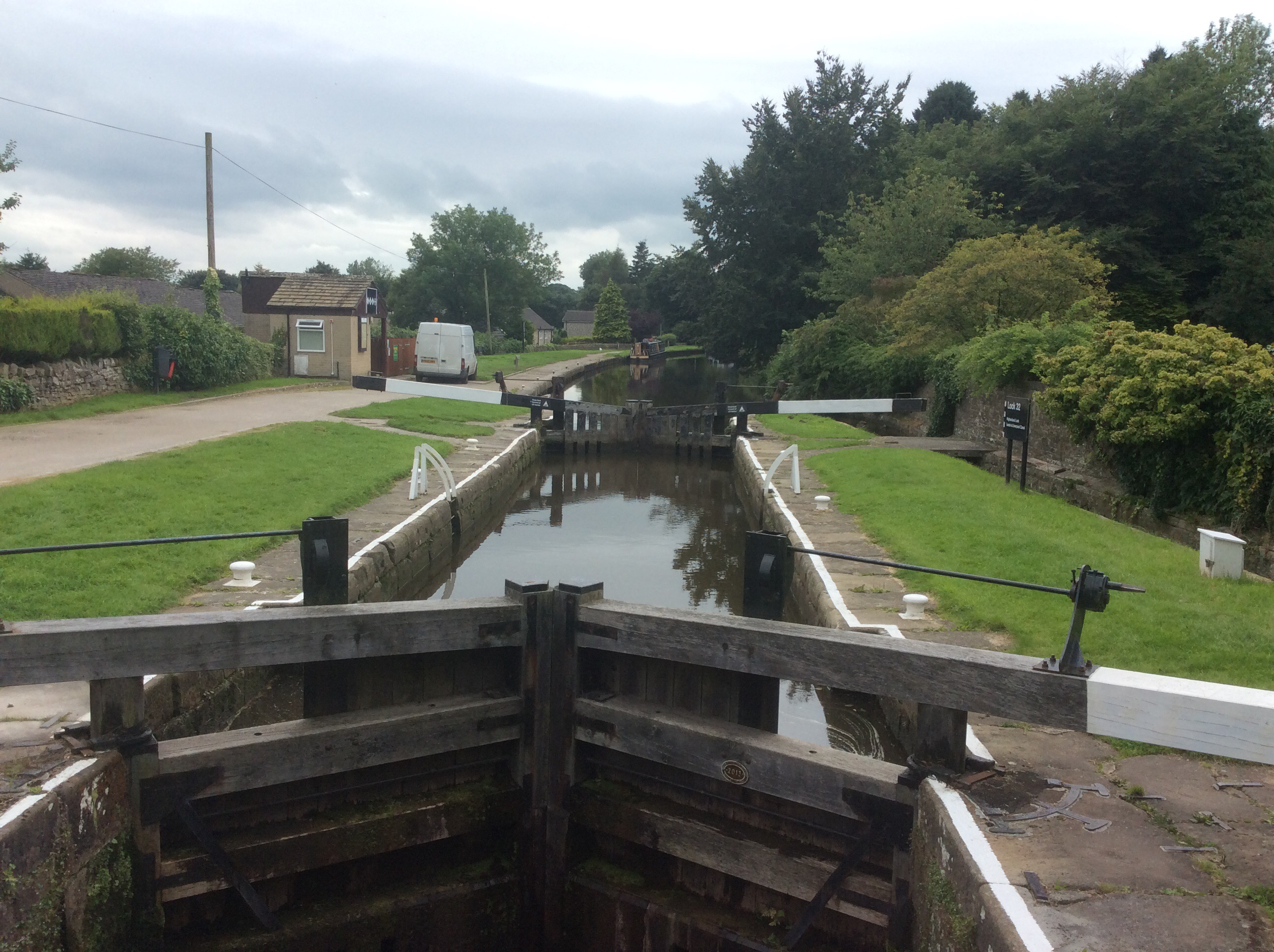
I was so pleased not to be carrying a rucksack. Gargrave came sooner than I expected and the Leeds Liverpool canal cuts through it. With more locks carrying canal barges uphill than you can shake a stick at.
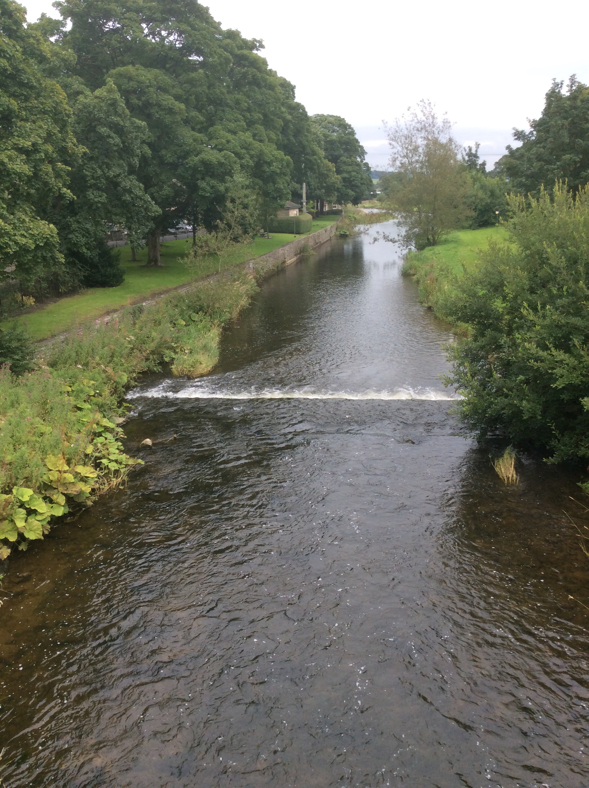
And further down by the village green the River Aire pitches down towards Keighley, Bradford and Leeds city centre.
Out the other side of Gargrave and over the hills I came on the canal again with more traffic evident this time.
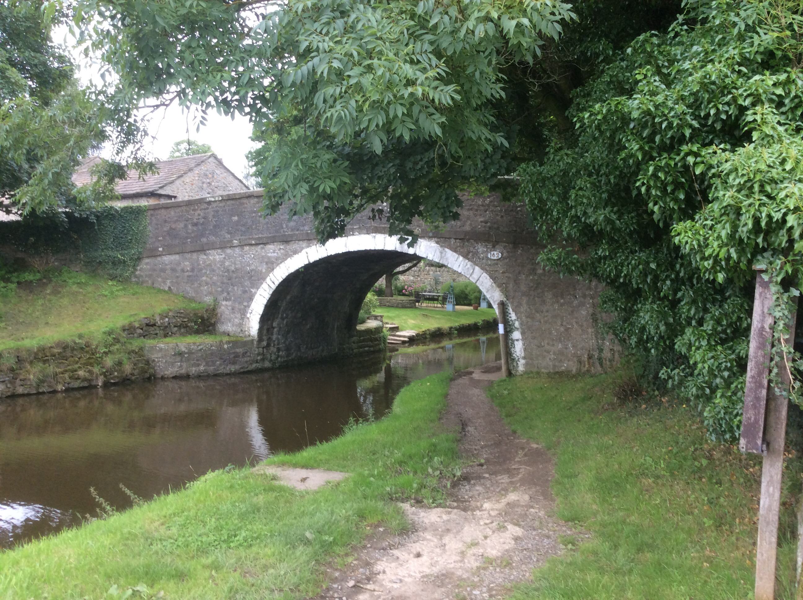
And cute canal bridges.
Before dropping down to Lothersdale the Way climbs up to Pinhaw Beacon at 1300 feet, which is nothing by PW standards but, in later afternoon in later life in the rain and strong winds that had returned, it was tough today. The Way signage going southwards was awful and I thought I was lost at one stage. A motorbike rider came out of his farmhouse and was just getting on his bike when I caught his eye. He told me that the Pennine Way went over the moorland away from his farm and I should go back. I said the path I was on was ok and I’d follow it along to a road. He asked if I’d seen his sign warning people away from his house and I admitted that I hadn’t. When he rode off I noticed a bright light in his loft, shining through a small hole under the eaves. You crafty little cannabis cultivator you. And it turned out that I was on the Pennine Way after all. I made it up to the summit of Pinhaw in really grim weather.
Dropping down over the back I made it to Lothersdale by 5pm, looking forward to defrosting in front of a fire with a pint in the Hare and Hounds.
It was shut for renovation and nowhere else in the village provided shelter. I waited for an hour under a tree for cover from the rain.
Deb came just before 6pm and we went down into Hebden Bridge for fish and chips and a mug of tea. Finishing off with a couple of pints in the New Delight Inn which we were camping next to.
A good day all in all. But very tired now.
Night night.
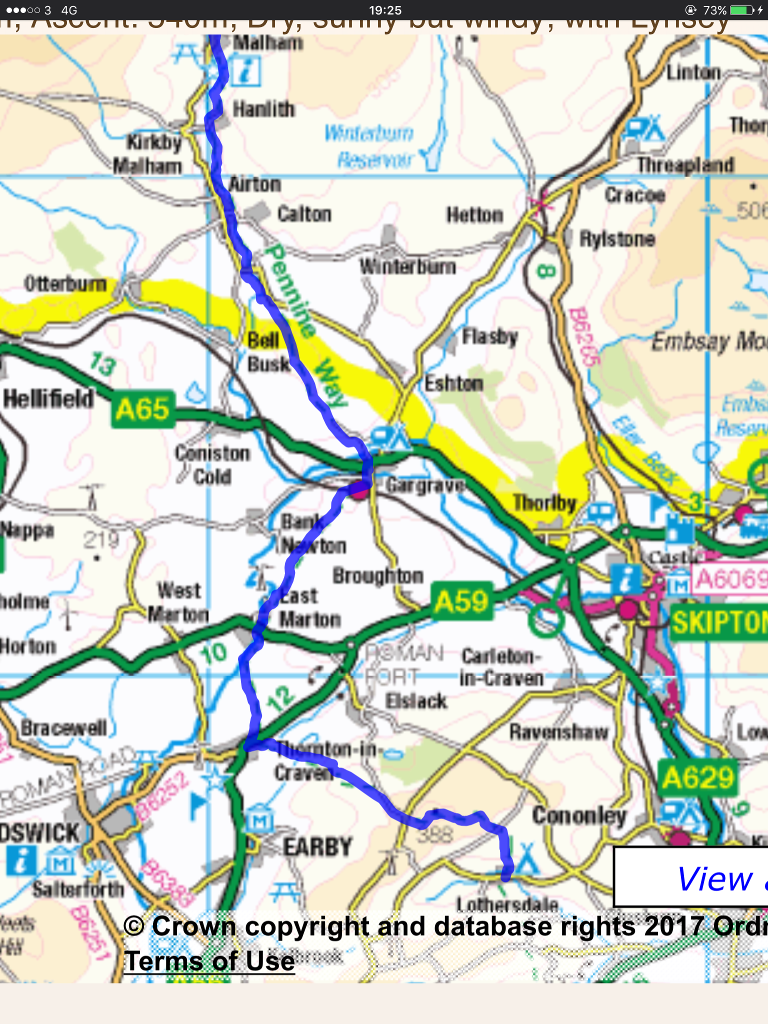
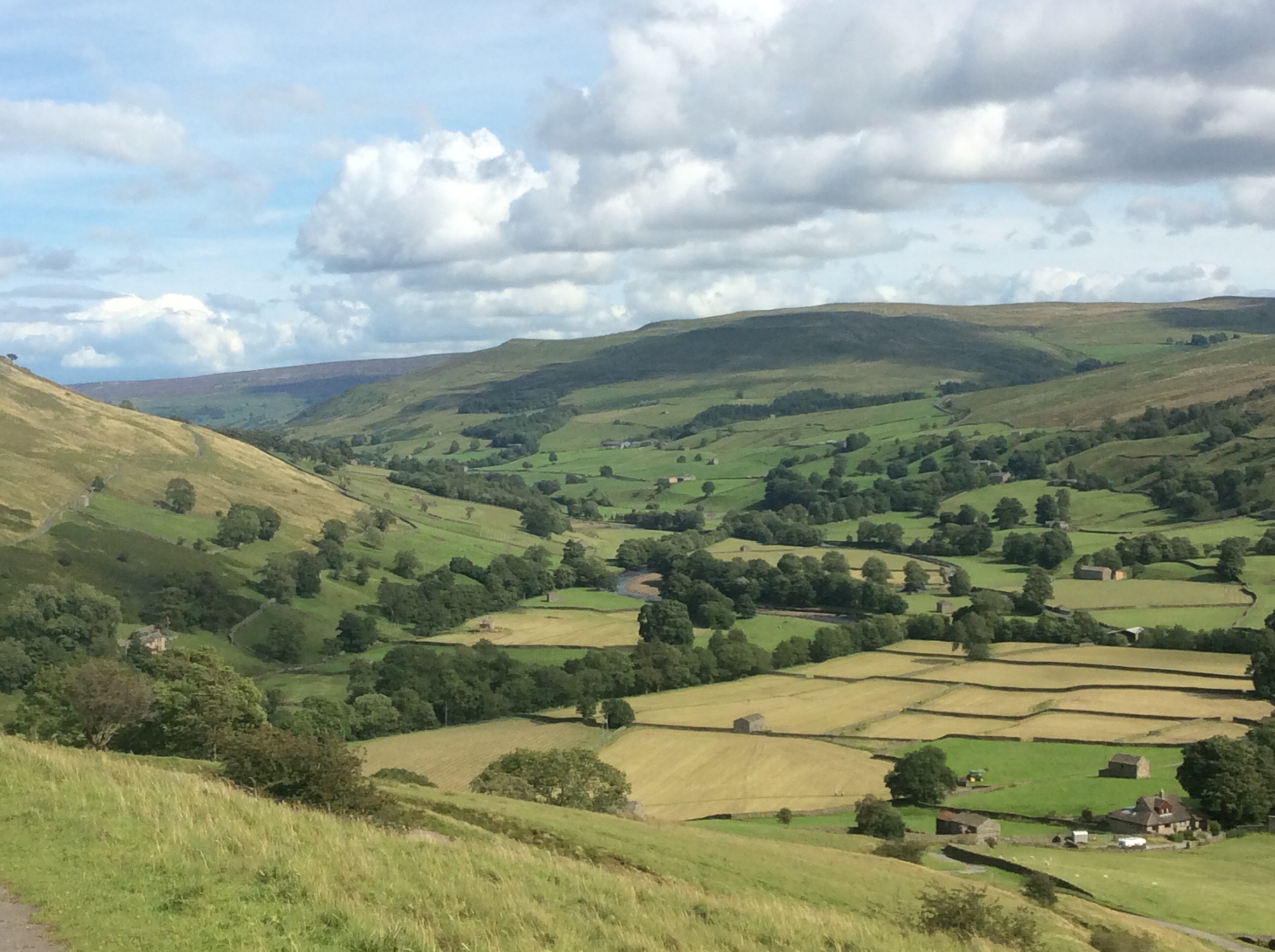
Horton to Malham – Getting Closer to Edale
The route today is fifteen miles, climbing up Pen y Ghent and dropping down to climb up Fountains Fell and on to Malham to meet my sister Debs at a campsite.
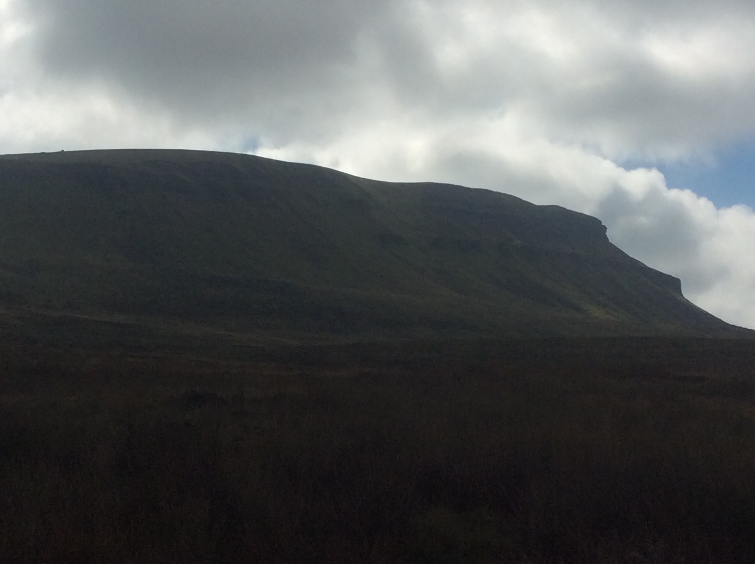
Pen y Ghent stands over Horton in Ribblesdale like a sleeping giant.
It’s a dog of a climb up and there were plenty of people trying it. Perfect for a family who want to be challenged, first part of the Yorkshire Three Peaks and the summit is crossed by the Pennine Way. The view from the top is great.
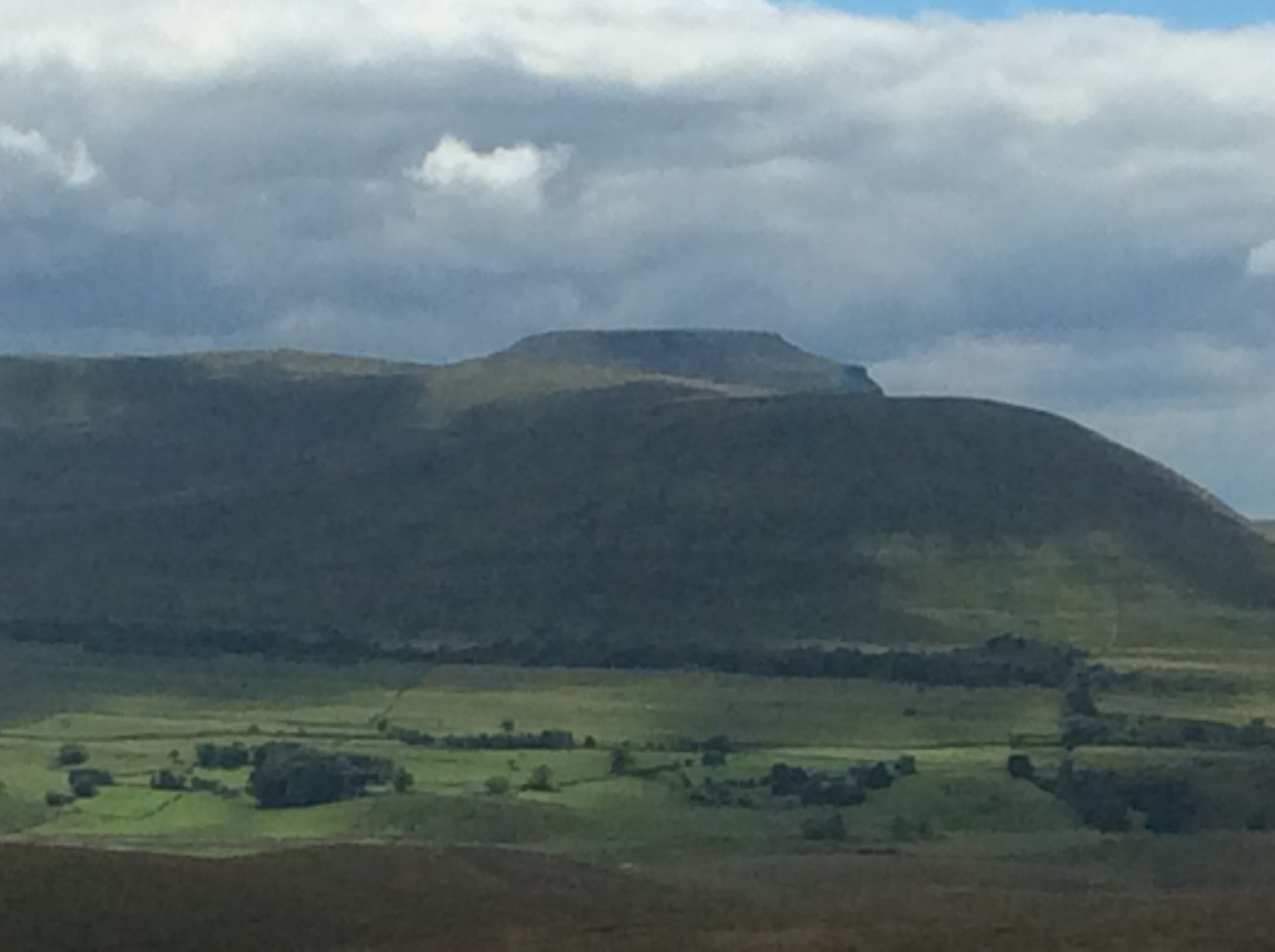
The south side drops steeply down and the Way traverses a couple of miles of moorland before pitching up the side of Fountains Fell. From this angle you can see Pen y Ghent and, to the left in the far distance, Ingleborough.
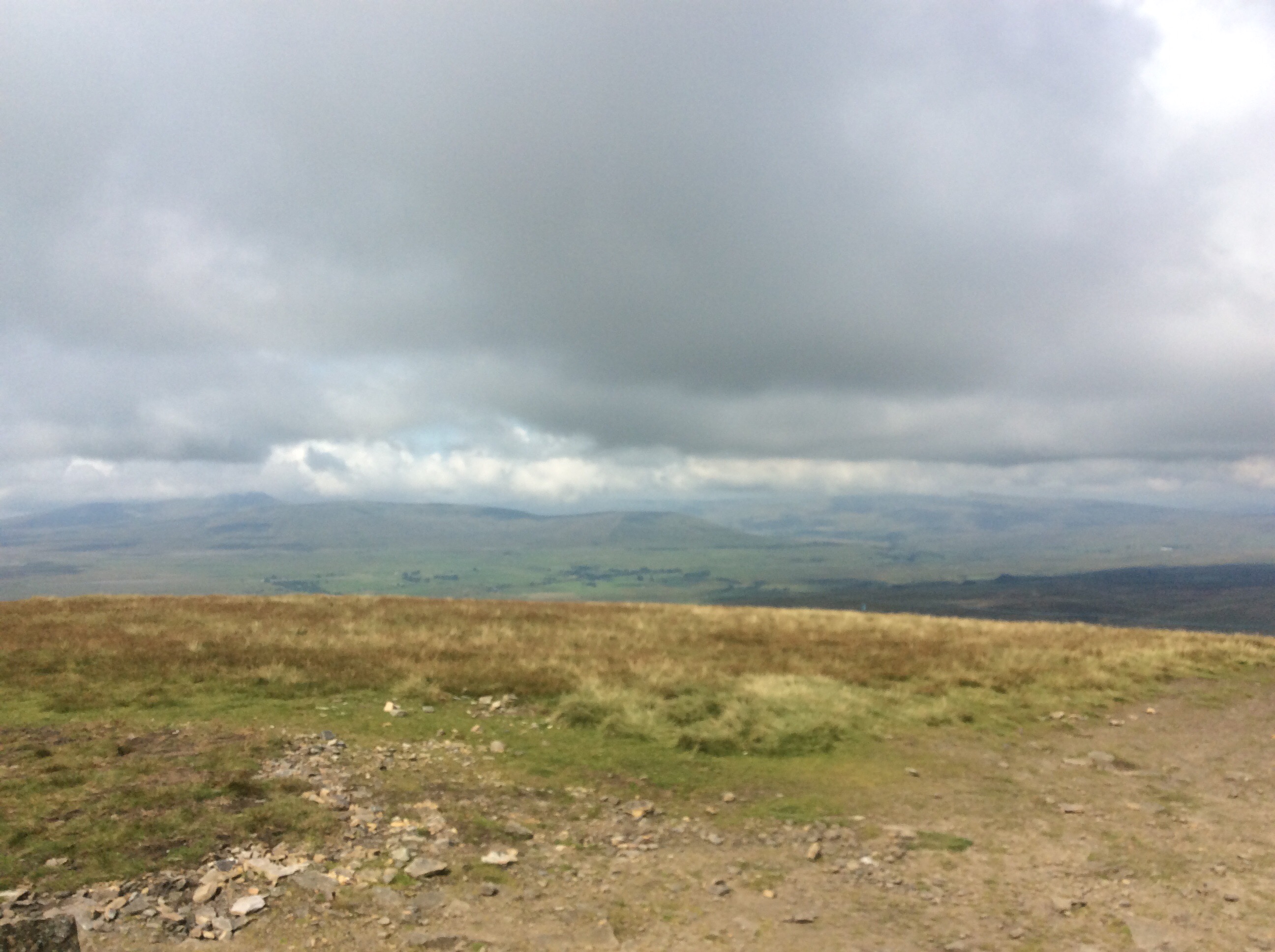
A good day for walking. Bright and breezy. Heading southeast the view goes over towards the far distant North Yorkshire Moors beyond York, just to the right of centre on the far horizon.
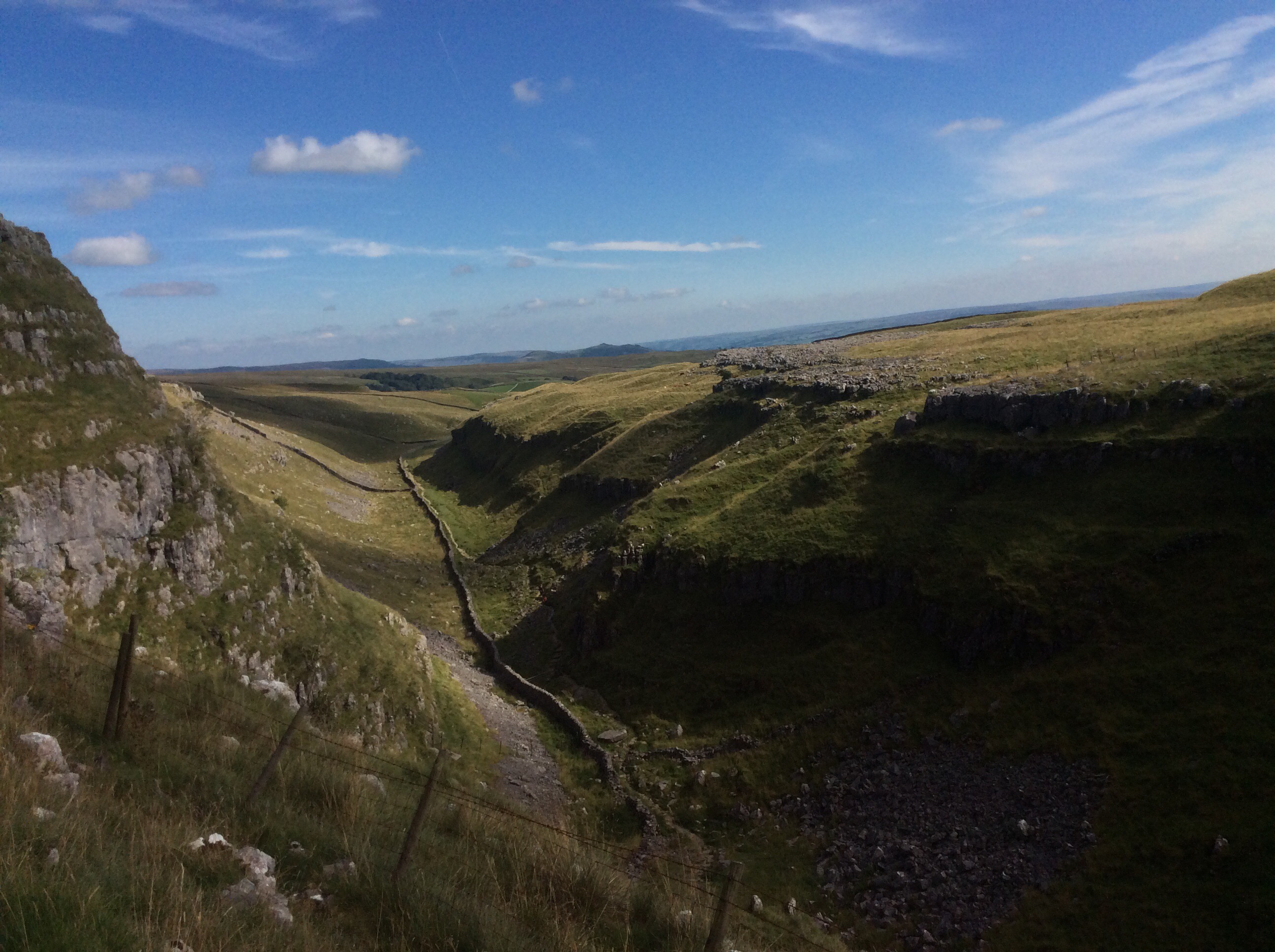
Dropping down over the back of Fountains Fell the track runs five miles to Malham Tarn, an oasis in the dry limestone valleys.
The Way curves 180 degrees round the Tarn, giving lovely perspectives.
And then drops down a dry valley towards Malham Cove.
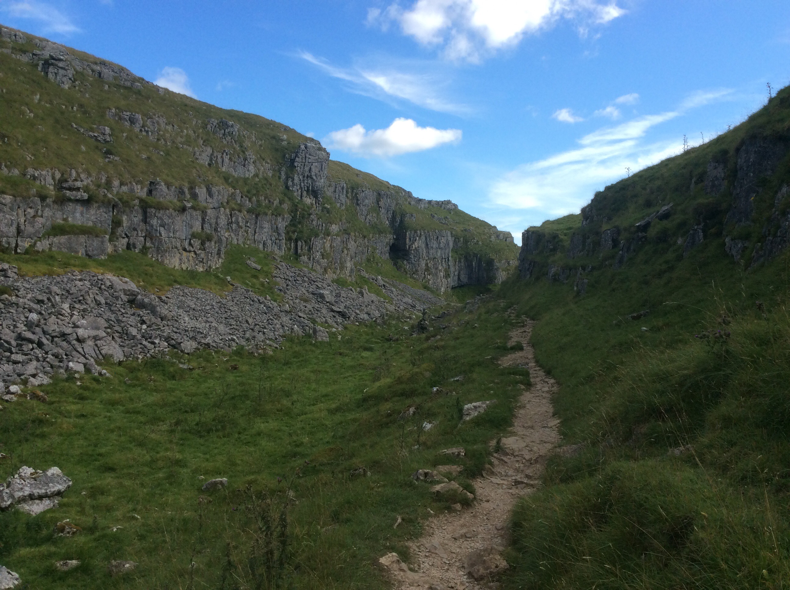
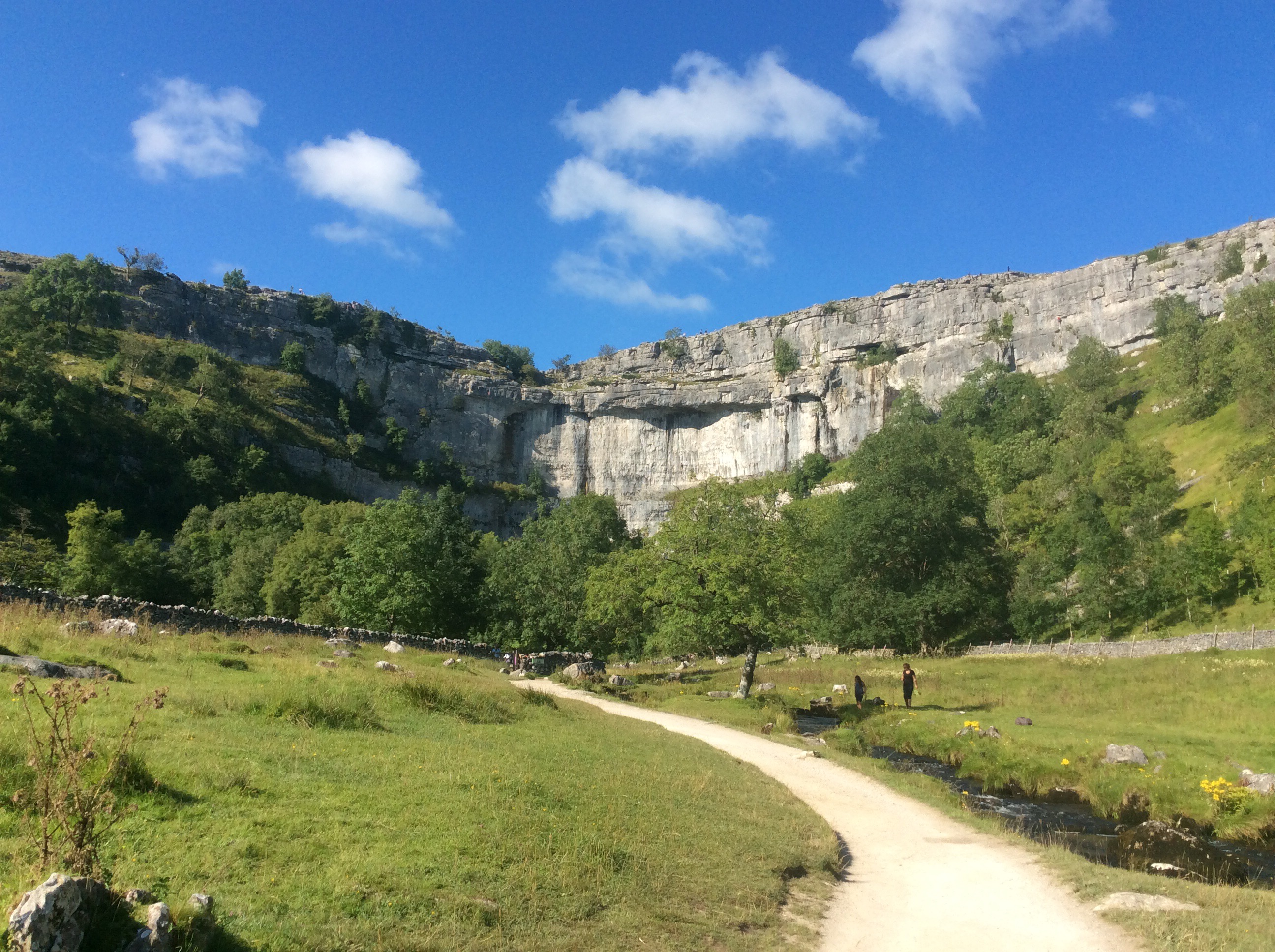
Eventually leading out onto the top of Malham Cove, an amazing crescent shaped cliff over which a stream fell for the first time in living memory during heavy rains earlier this year.

It looks good from below too.
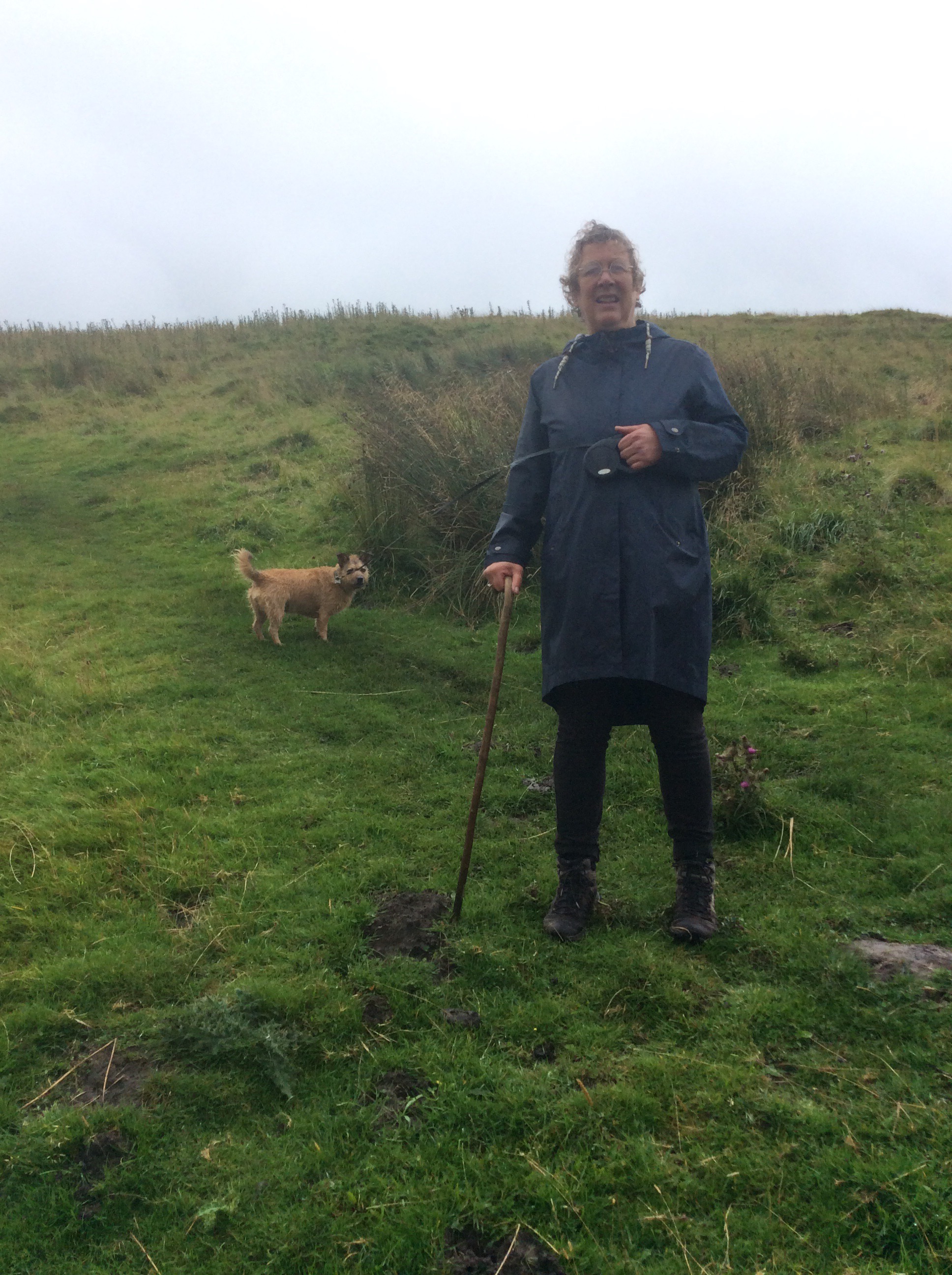
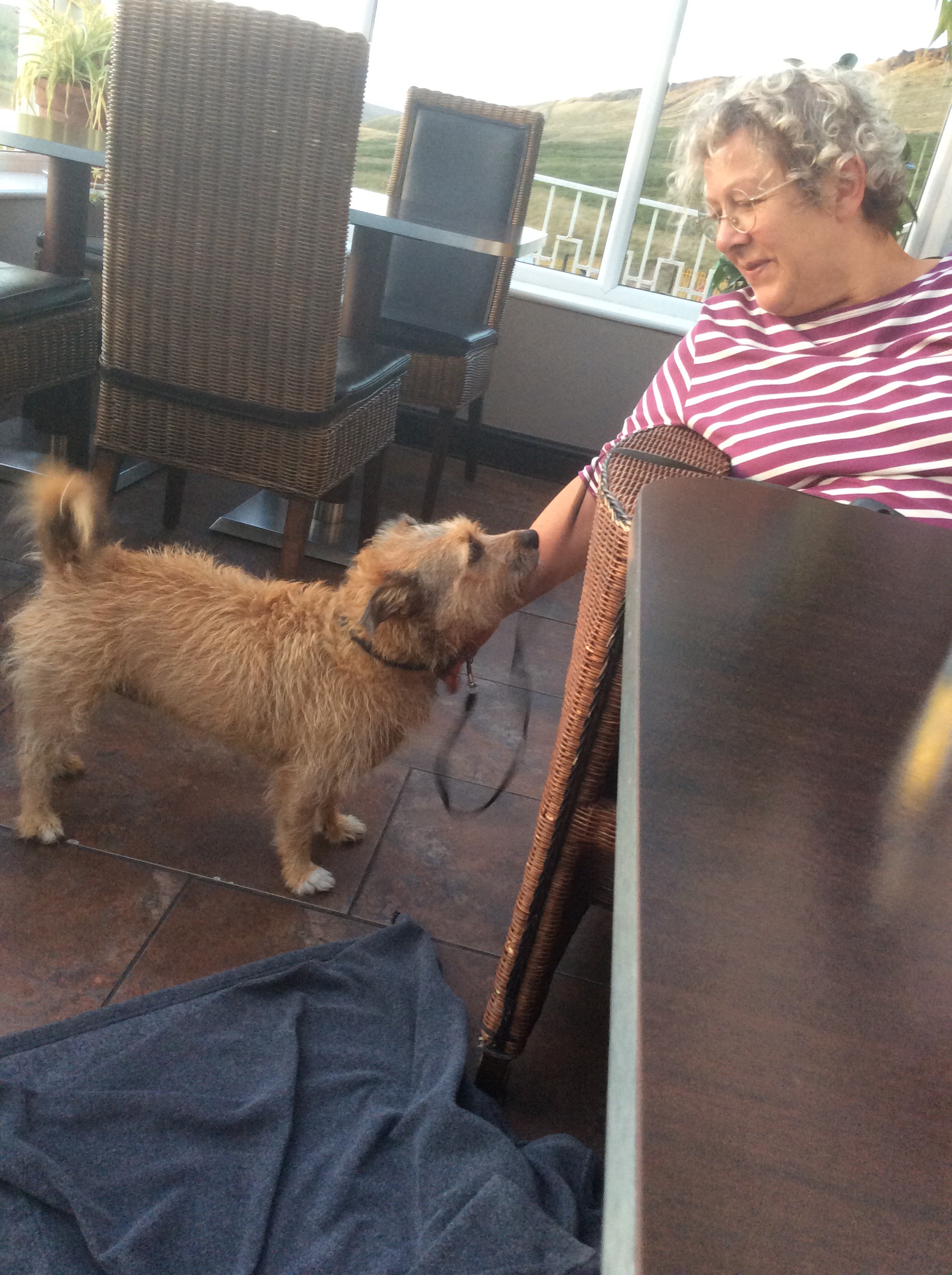
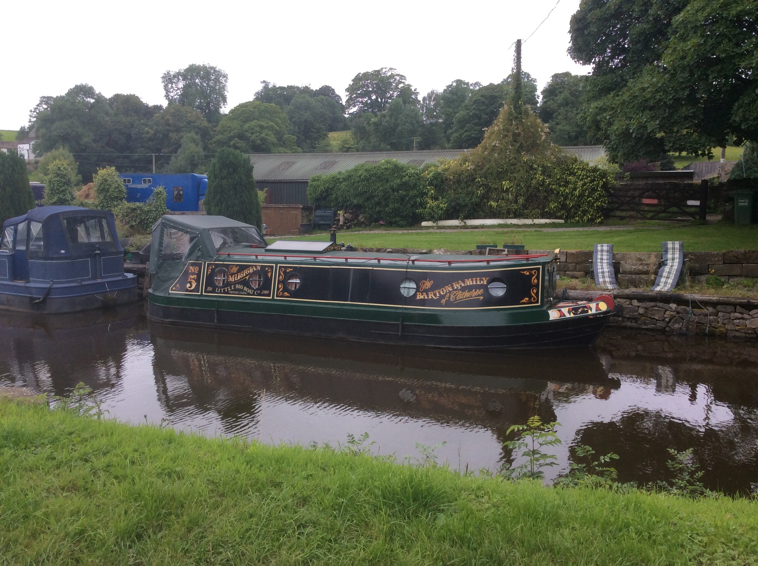
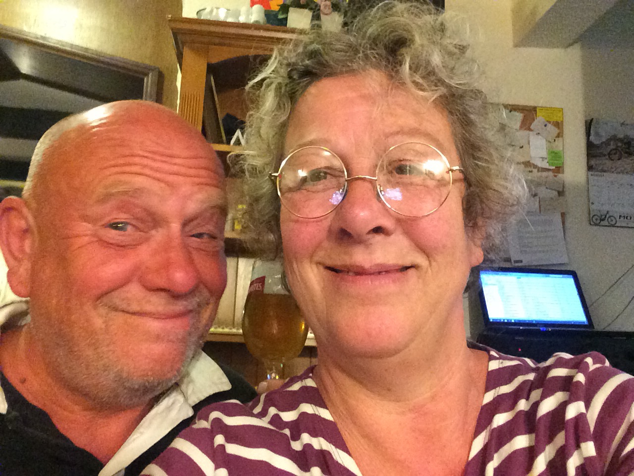
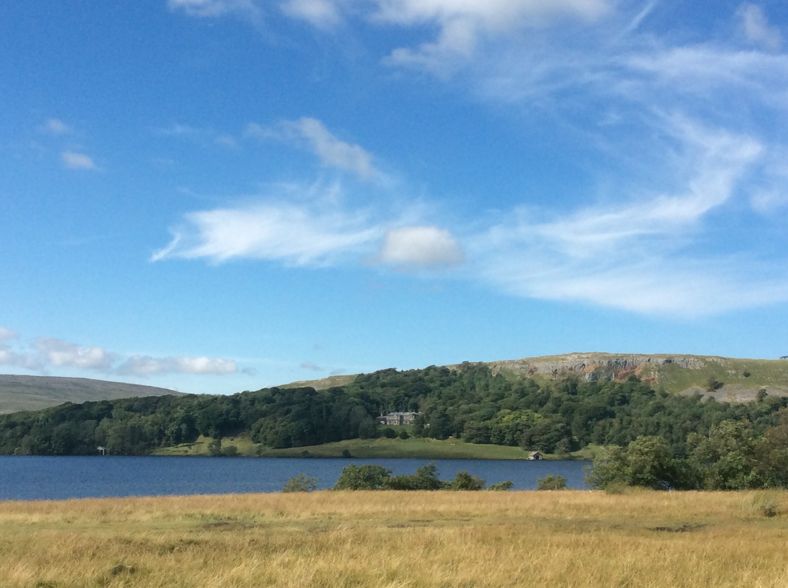
Debs had just put up the tent when I arrived in Malham village. She was up here with her dog. This is Debs (not the dog – haha).
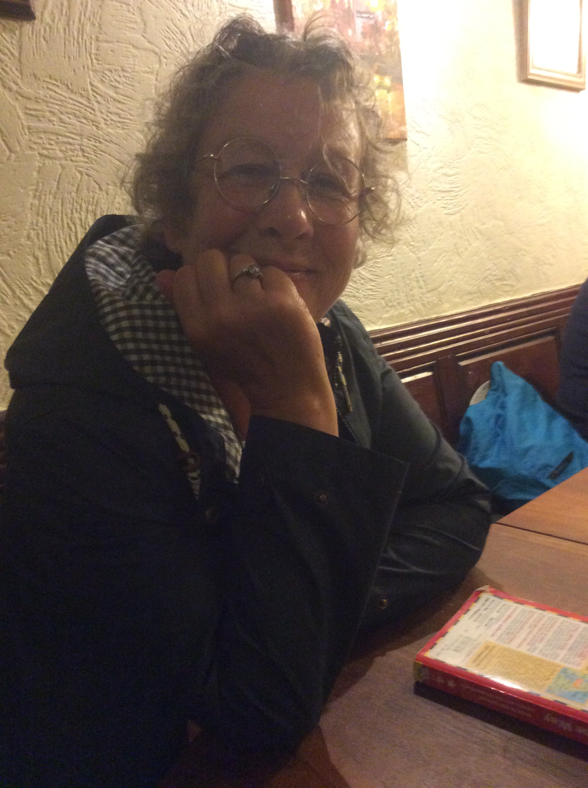
We nipped down to the local for a couple of beers and went back to the tent for barbecued steak, salad and potatoes. A bottle of wine and Deb and her dog retired to her sleep-in van and I got to bed in the tent. A big tent, with a mattress and a blanket over my sleeping bag. Heavenly.
Night night.
Chip Off; the Old Blockhead – Hawes to Horton
Me mate went this morning.

Only kidding. It was really like this.
The Bull’s Head Hotel B&B was great. The landlady said straight away that she’d give Chip a lift to the station 11 miles away. In the end her husband did and he got him to the train on time. Pull out the stopper, let’s have a whopper.
See you soon matey Chip, pal, warrior. Pushes himself to the limit. Been fighting a shitty little thing inside him for 5 years and dunt give up. Even pretends he’s an Arsenal fan for laughs. Daft get.
Breakfast was good and I hit the road at 9.30am. A lighter pack as I’d dropped a fair amount of gear at home, clothes and stuff. It was nearly 14 miles today from the Bull’s Head to my intended campsite in Horton in Ribblesdale.
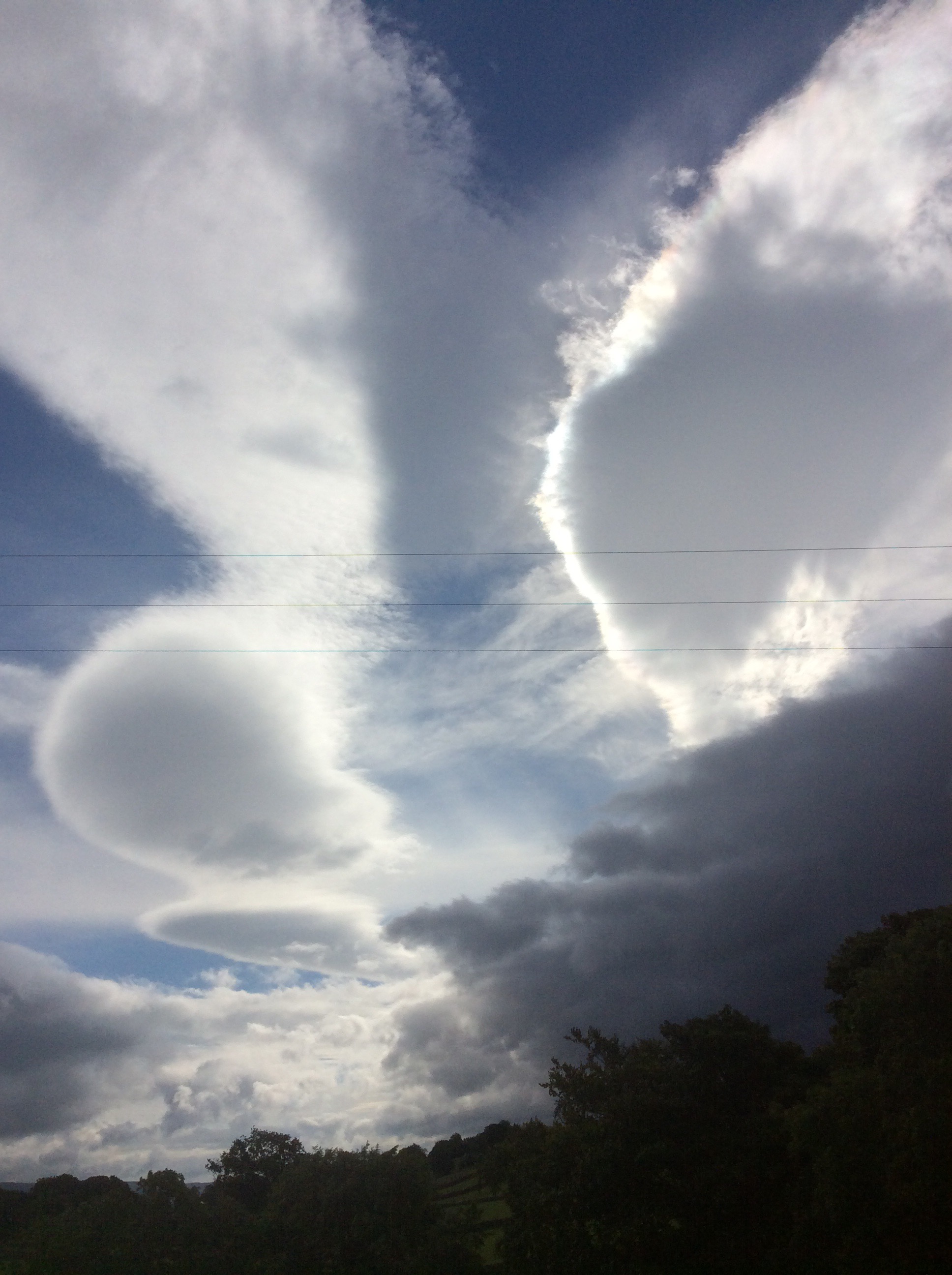
The morning light and clouds produced some great shapes and light in the sky.
I made good time up hill and the first village was Gayle with an old bridge and timber mill, being fed from the river.
And looking upstream the river was lovely.

Higher up the Way I could look back over the village of Hawes and the clearing sky being driven towards me on a northerly wind. Wensleydale. I love your cheese.

Up, up and away and a first view of Whernside to the right and the stately pile that is Ingleborough to the left. Two of the 3 Peaks.

I was heading towards another watershed on this journey. Up to the highest point of the day and the Pennine Way turned westwards and was paved, which was most unusual. In the photograph below, any rain falling to the right of the path would run down to the River Ure and make its way eastwards to the Ouse and eventual exit into the North Sea. Any rain falling to the left of the path trickles down to join the River Ribble and exits westwards into the Irish Sea and onwards to the Atlantic Ocean.
I might put a bottle in the river with a message and my mate Will Lovell in the USA might find it, unless that stupid idiot Kim I Feel ill nukes America first. Likely to, the way that stupid idiot Donald Trump is tub thumping. They ought to have a love child. Can you imagine the haircut?

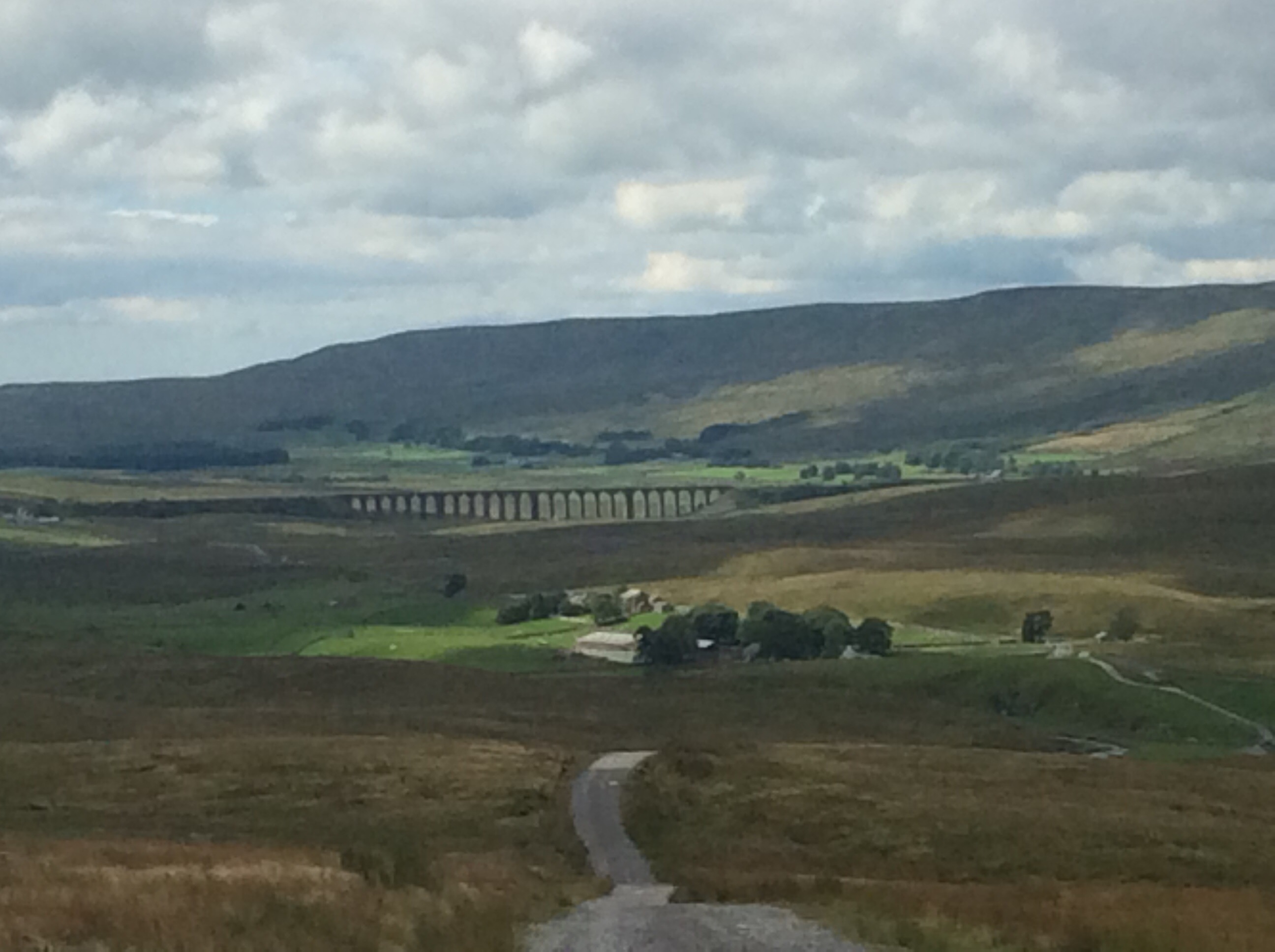
On and over the hill down into Ribblesdale the views were beautiful. Ingleborough.
The Ribblehead viaduct.
Pen y Ghent.
From South Yorkshire we don’t generally believe in the existence of a God who created everything and needs to be worshipped. However, if there is such a chap, or chapess so as not to be sexist (because the creator of the universe would take a keen interest in political correctness), he would have created Yorkshire for his own country.
It was another slog, but this time in decent weather, and it was a pleasure. I had a reyt smile on my fizzog. And where there’s a will there’s a way.
Having dropped down off the tops the walk was fairly domestic to Horton. Up and down small hills and a few bridges and pot holes.
Lovely country.
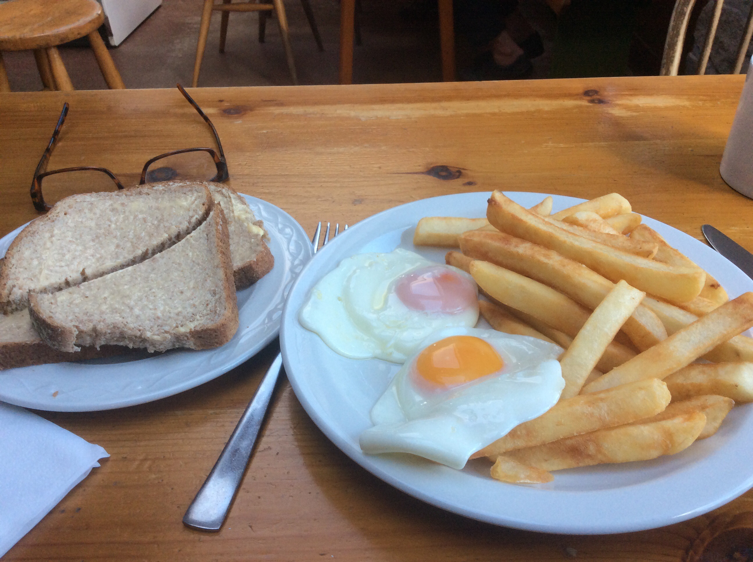
Horton was familiar, I bought a sandwich for breakfast tomorrow and a cup of tea and egg and chips for today. Fantastic.
I pitched my tent in the village campsite, where squaddies in training and touring couples were in equal portion. Five quid. And I spoke to the old lad collecting the cash and he gave me a pint bottle of the local pale ale. God’s country.
Night night.
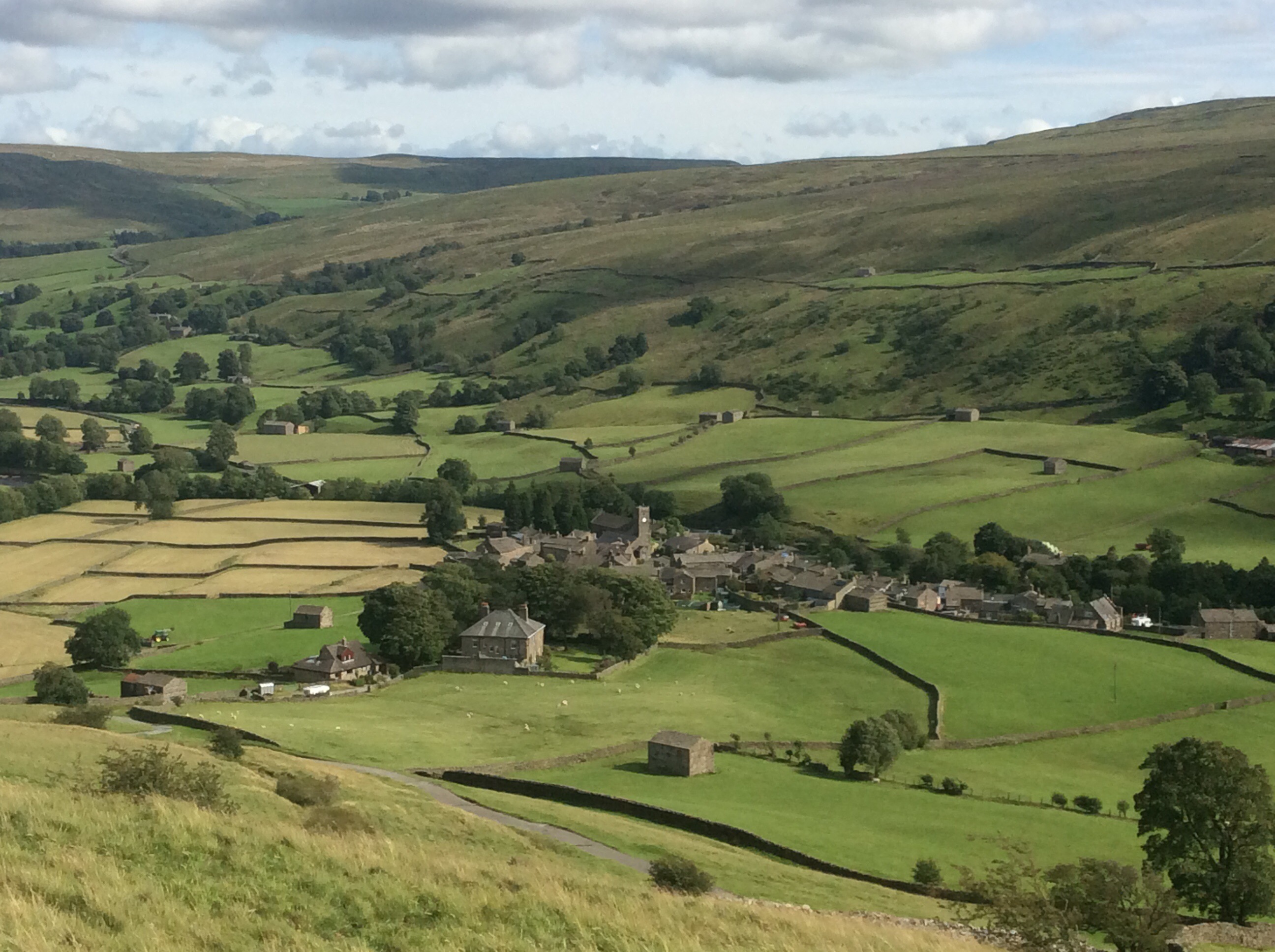
Only one ‘F’ in Fletcher – my old Muker (to Hawes)
The morning was cool at Usha Gap Campsite and we’d both had a night’s sleep broken by the cold temperature. The midges were out again and we packed the tents away as fast as we could. We both got bit bad. We’d bought sandwiches, the previous afternoon, for breakfast and tinned fish for lunch.
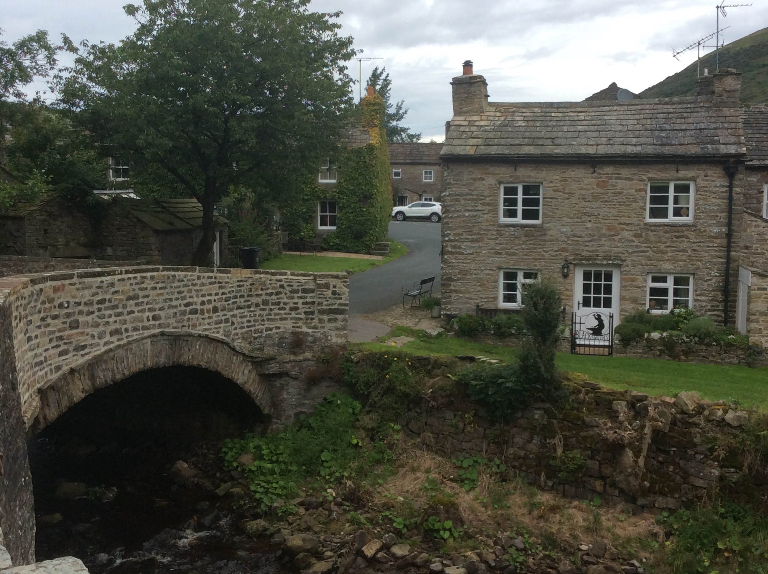
It was nearly 10 miles to Hawes from the site and the first half mile, to Thwaite, was easy road walking. A quaint bridge and Blacksmith’s cottage welcomed us there.
It was an 8.30am start so we were ahead of the game. However the road rose before us and we started to lag behind it. But looking back was Swaledale, cradled between hills.
The wind was a harsh northeasterly and cold as a cabbage. I didn’t know cabbage was cold. No it isn’t but ice wouldn’t be alliteration you cretinous creature.
We were aiming for the top of Great Shunner Fell as first base but it kept drifting further and further away in the cabbage-like wind.
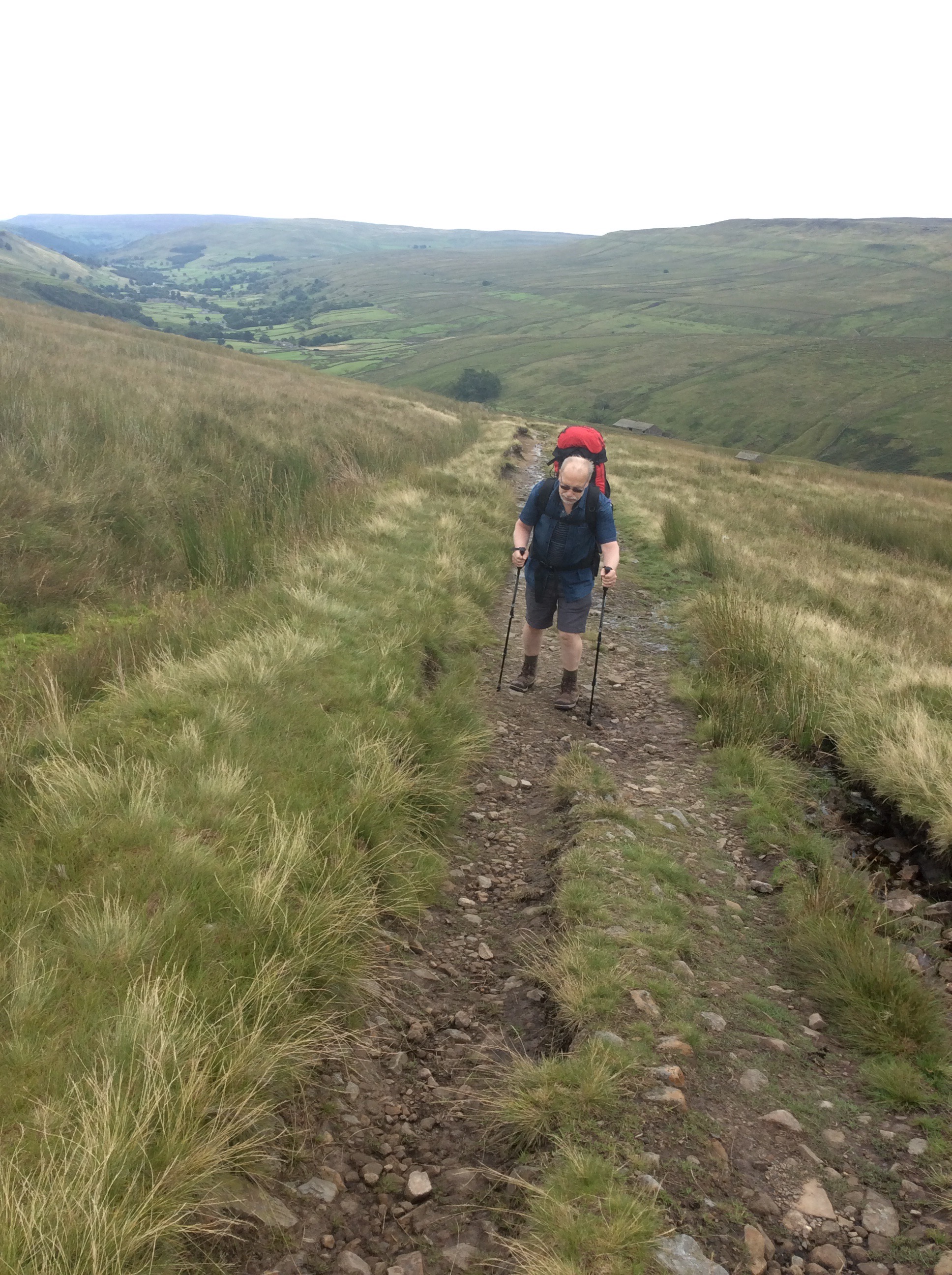
Dear old Chip was struggling under the weight of his rucksack and I took what I could but his shoulders were very painful. For a brief period I carried both of them but he’s so stubborn he wouldn’t let me do it for more than a hundred yards. Good job because it was knackering!
At long last we got to the top, and the wind was cruel and it started to rain. A 360 degree view from the third highest peak in Yorkshire and we were too cold and our fingers too numb to take photos. In August.
We managed to strip down a bit more of Chip’s load and transfer it to my rucksack and get our wet weather gear on for the walk down to Hardraw and on to Hawes. On automatic zombie pilot we made it to Hardraw, eight miles after setting out eight hours before. The Green Dragon Inn beckoned with an open fire and we slowly re-humanised. Fair play to Fletch he kept going, slow as an action replay but determined as a British bulldog.
After an hour we finished the last mile to Hawes. The weather was such that camping would be a mess for Chip’s last night before going back home. A full day journey with wet tent and wet clothes would be a bummer. So we got a B&B twin room for thirty quid each, ate well and got an early night. I beat him at pool as well. Always pick on the weak.
Night night.
No Effin Tan Hill Inn (to Muker)
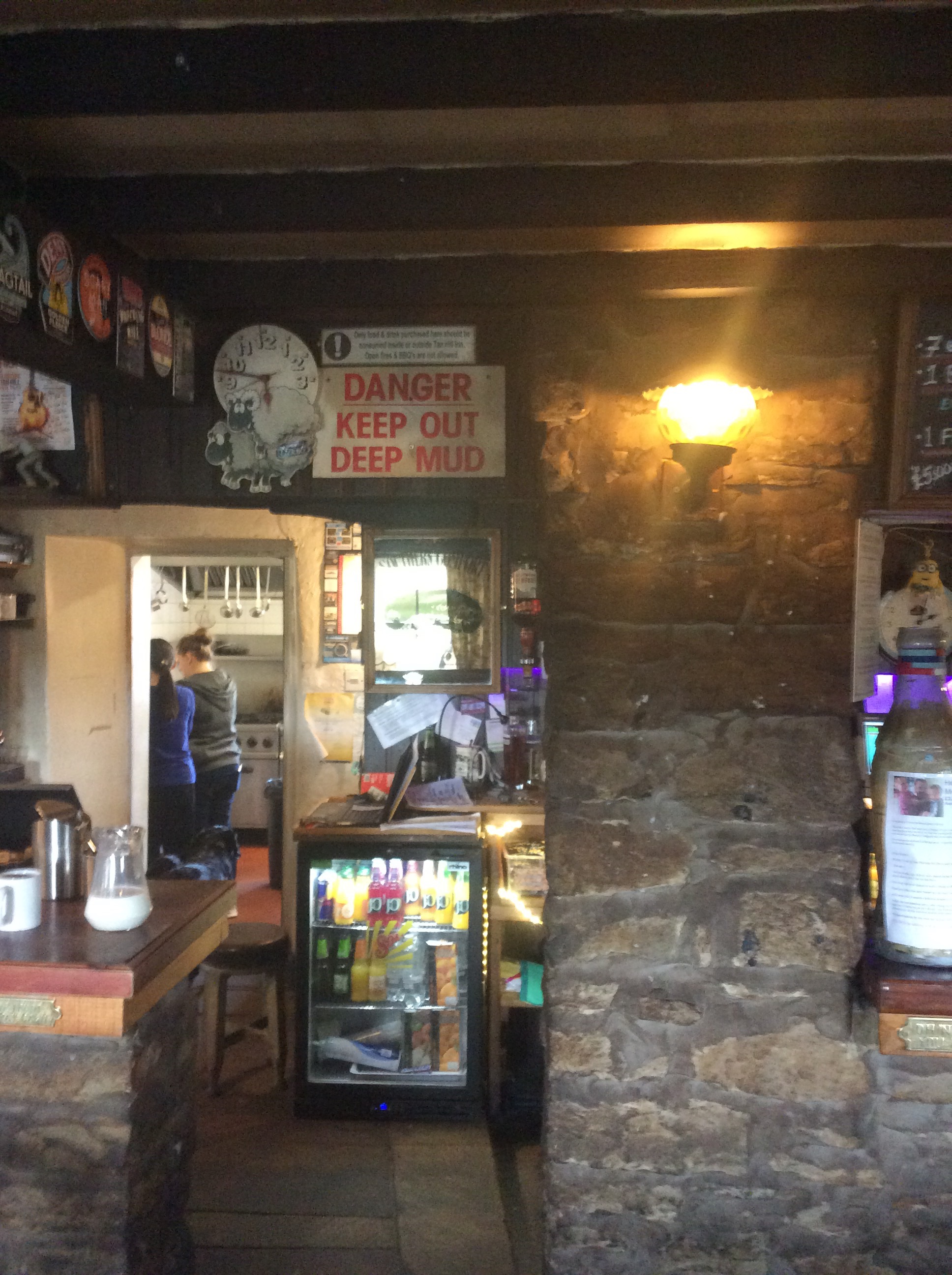
When we turned up waterlogged and muddied at the Inn last night and asked if they had a room, it was over an hour before the woman locked behind the computer could confirm it. The queue was deep at the bar and only one woman was serving. Five others were hovering behind the bar doing nothing, and unsure if that was right. It was the most disorganised outfit ever. The highest pub in the U.K. and the lowest level of customer service. Chip went to pay with his card and the woman said she hoped there wasn’t an ‘f’ in his name or post code as the ‘f’ key didn’t work. She seemed terrified of Fletcher and reduced him to Letcher. Dirty old get. Anyway a good night sleep was had by all.
The sign above the bar summed up the previous day.
The weather was looking iffy in the morning and after being ignored for half an hour we got a decent breakfast. Then we were off.
Quickly Chip slipped into his new waterproof outfit as we hit mud again. He says he’s going to patent the footwear!
And I developed a bad Richard the third impersonation.
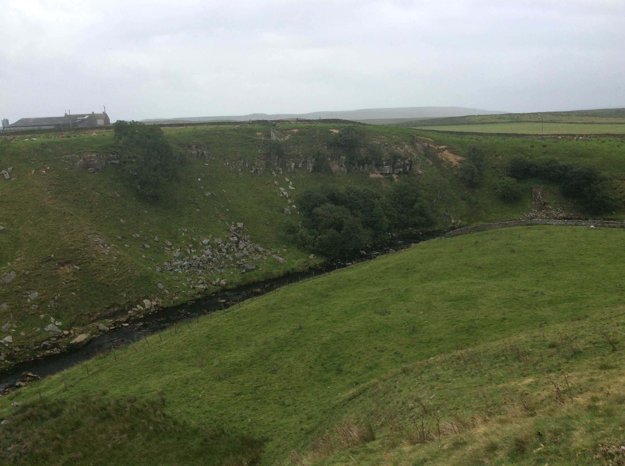
Today’s journey was to be a modest, but ultimately testing, 8 miles to Usha Gap Campsite near Muker. We were initially aiming for Hawes, which was a 16 mile hike, but that’s too much for Chip and I don’t want to do it. We’re carrying a lot of stuff and there’s no need to push ourselves to the limit. However the weather improved and the rain stopped. The first leg was 4 miles to Keld, down the side of the valley from Tan Hill.

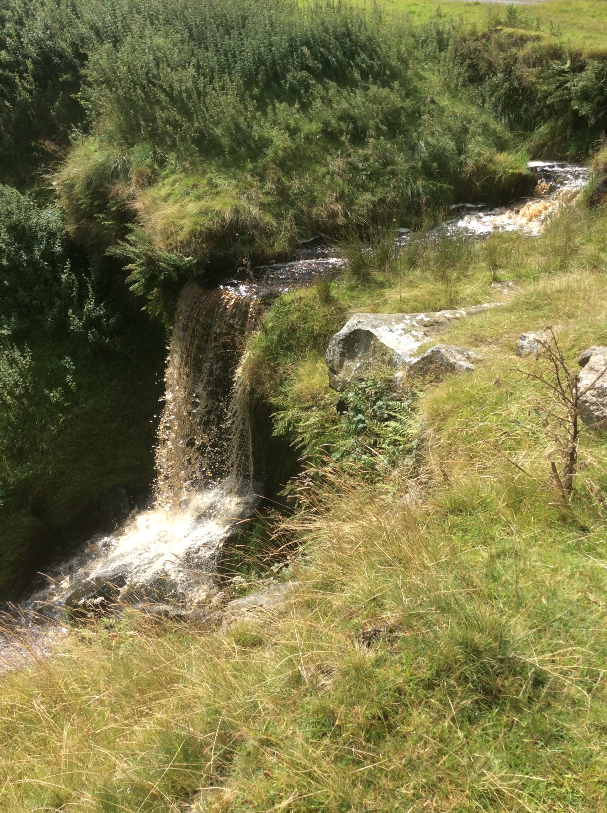
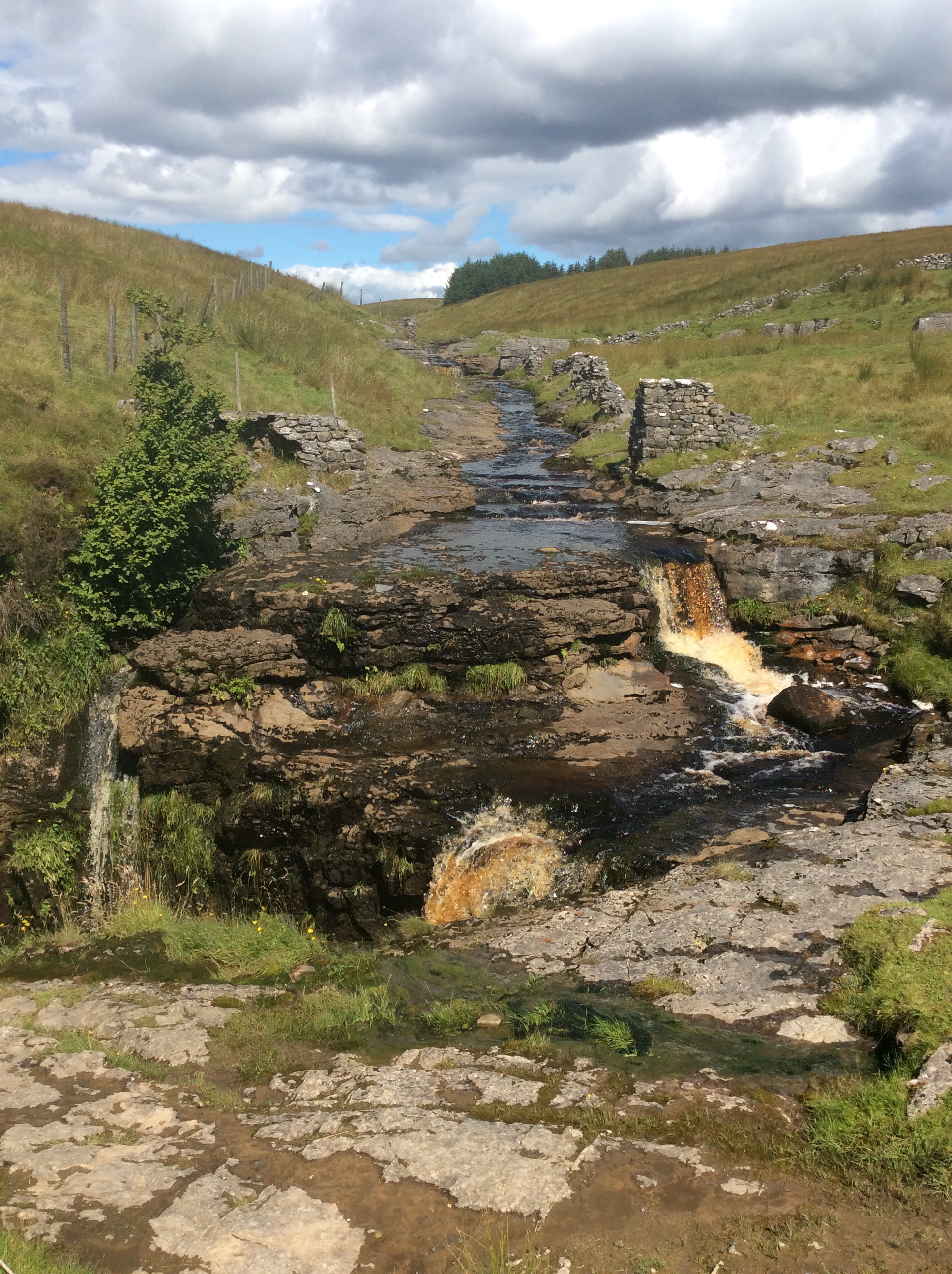
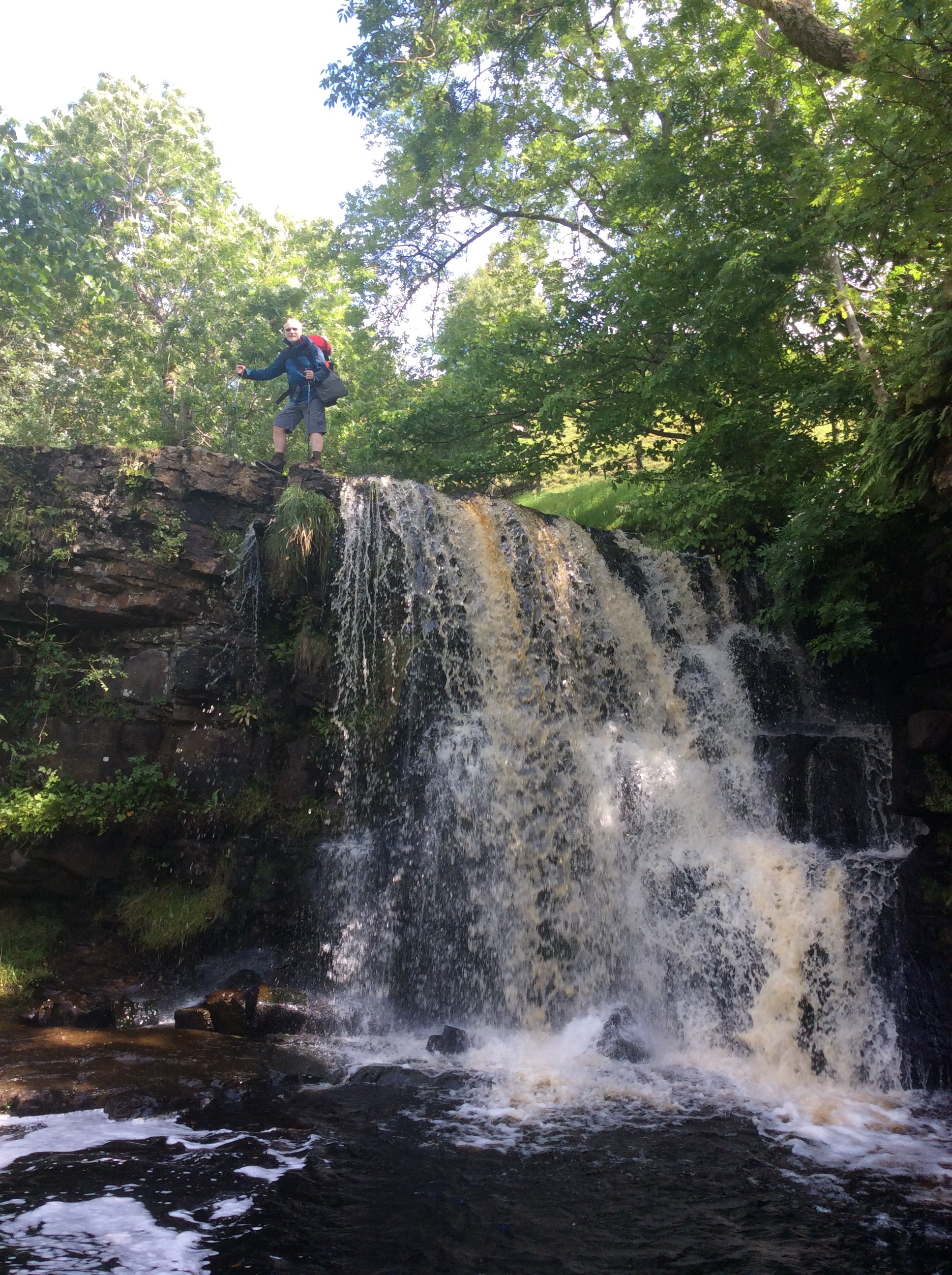
Just before Keld is a delightful cascade, which is a pleasant interlude after featureless moorland.
We had coffee and snacks in Keld and set off refreshed on the route to Muker, the River Swale snaking in the valley below. With streams running down from the tops and cutting deep valleys on the far side.
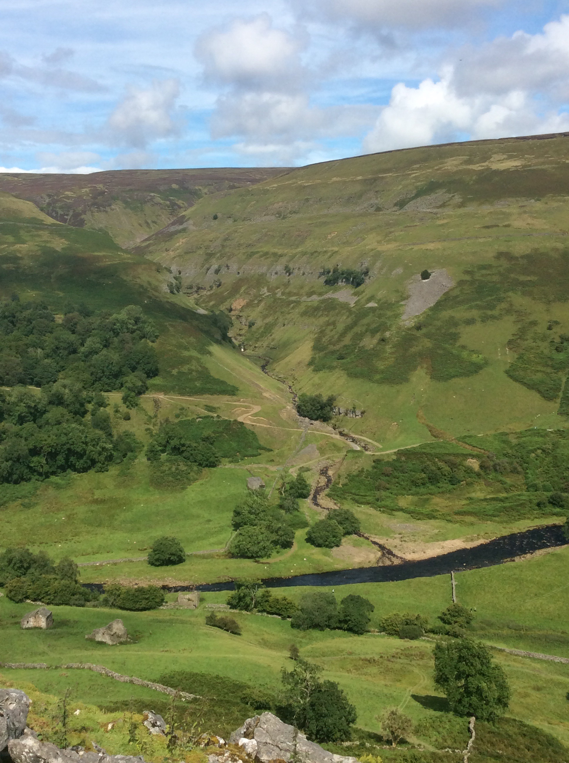
Eventually the river turned left into Swaledale proper and the views were great.
Chip was feeling the strain. An old, knackered wasterd. Not a pretty sight. But he kept going like a Trojan.

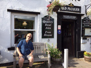
We dropped down the hillside to Muker, a mile off the Way, nestling in the valley.
And we refreshed ourselves at the Farmers’ Arms, appropriately selling an Old Peculier. Won’t get much for him!
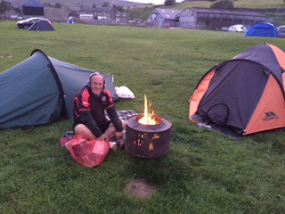
Up to the campsite, pitched the tents, back to the Farmers for dinner. Great food.
Then an early retreat to our tents and a bonfire outside, invaded by armies of midges. A little corner of Scotland in north England, land of the swarming midge, and Chip’s legs look like he’s got chicken pox. Poxy old get.
Sleep time. A long day. But a great one.
Night night.
Back to Bowes and Ribbons of Rain – third blog today
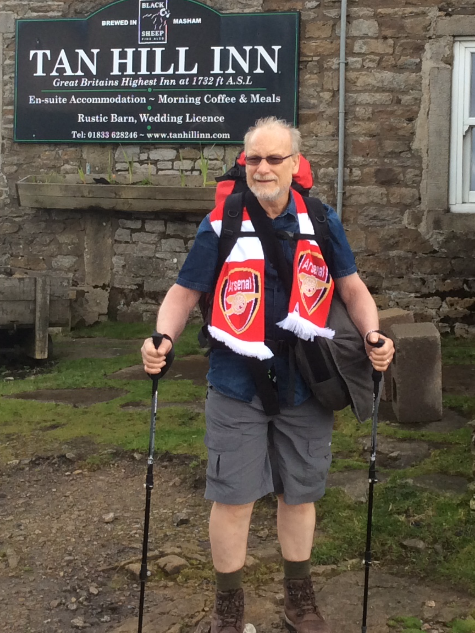
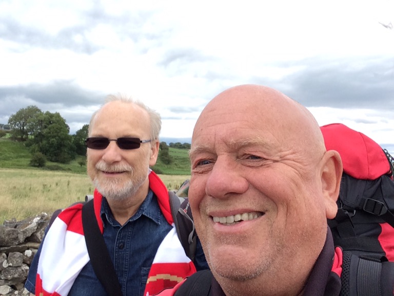
Blades won, nice early weekend with my old lass, great meal of slow oven stewed Ox cheek. Then I set off from Leeds at 9.40am to Darlington again. My old mate Chip was joining me for three days walking and camping. I met him there and we had a breakfast at Weatherspoons before getting the bus to Barnard Castle and a taxi the four miles to Bowes, where I left off on Thursday. Our spirits were high and despite the wind the weather was dry.
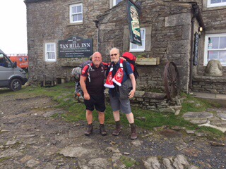
The Pennine Way splits, with one leg taking in Bowes before rejoining the main path. The Bowes Loop rises uphill southward to link in with the main path en route to Tan Hill. Our afternoon stretch would take us 11 miles to the Tan Hill Inn, where we would pitch our tents this evening. It’s a pleasant walk and we linked up in good time with the main path.
As we climbed higher the wind picked up. The Tan Hill Inn is the highest pub in the British Isles, at over 1700 feet, so weather is an issue there. But the views are good going up.
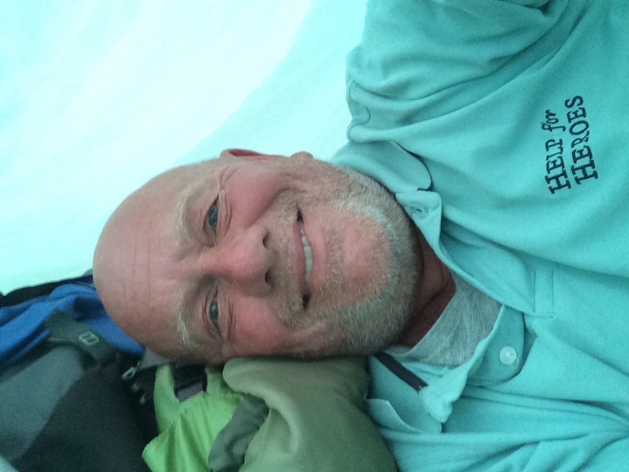
Chip was doing well, despite his long period of sickness, although he is a determined old get anyway. And then the wind picked up, and it turned cold, and the rain started slowly at first and ended in a downpour. The path began to get boggy, and then became very boggy, and finally became almost impassable. Chip kept going. Not reyt fast but still going.
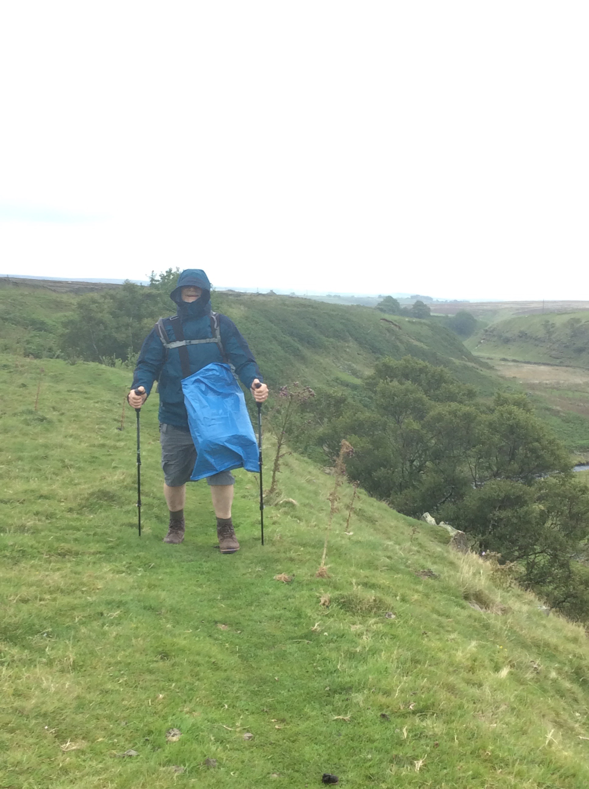
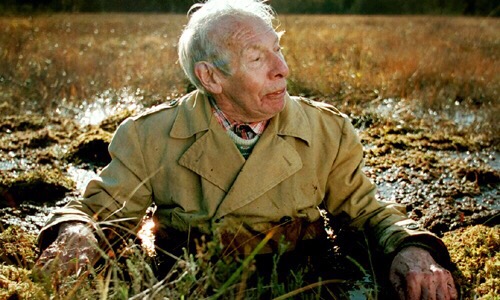
We decided to cut across for the last few hundred yards from a massive liquid bog area to a road that had appeared to our left. Getting there Chip slipped into a boggy ditch and pitched backwards with the rucksack on his back. He was stuck and I didn’t get a picture. Bugger! But if I had done it would be like this.
I helped him up. After nearly six hours walking we made it to the Inn. The weather conditions were such that we couldn’t pitch a tent. No way at all. So we got a room and had a few beers and a meal and dried our soaking boots and gear on a radiator.
Tired out, early night, sleep tight.
Night night.
