I Have Made A Very Big Decision – Thanks Lou (Second blog today)
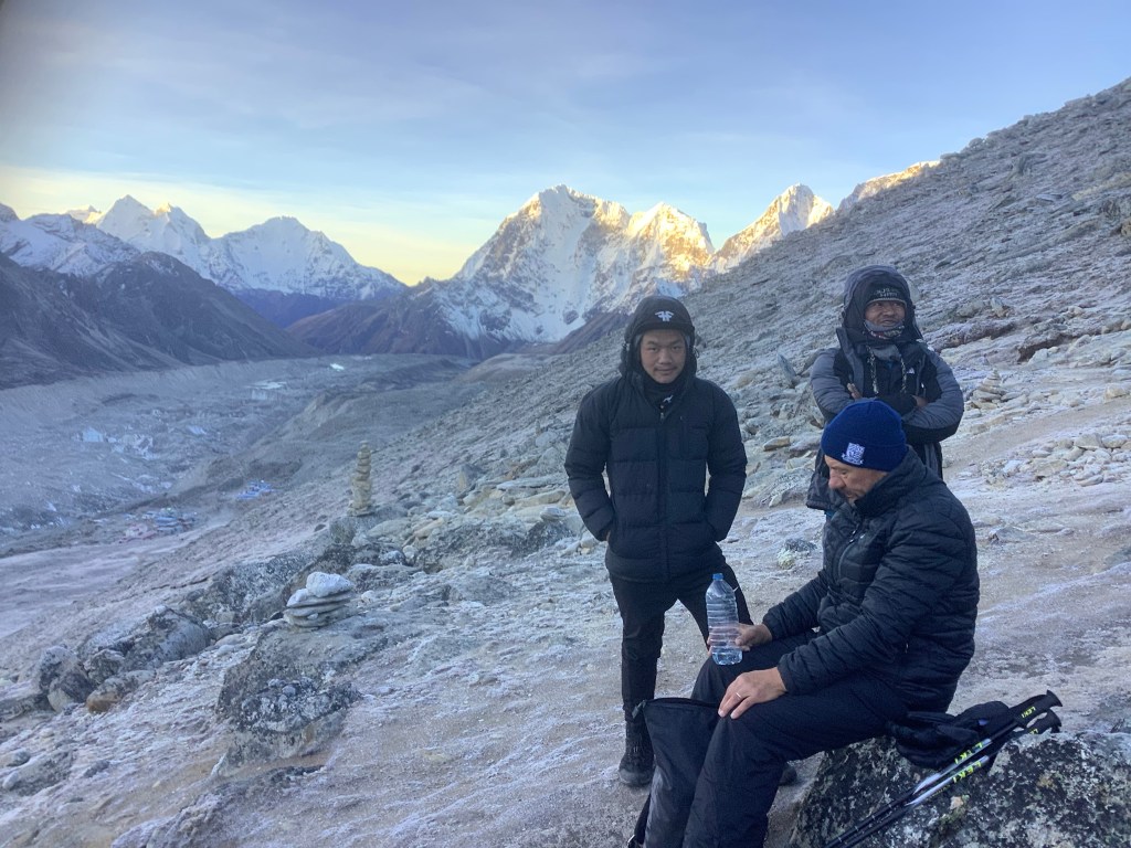
We gathered for breakfast in the tea house when we made it down from Kala Patthar.
The previous night Nawaraj, the boss of our tour guide company, had rung to advise us that groups were pulling out of Annapurna and Manaslu treks as the weather was turning adversely. We were his only group in the Everest area and he was ringing to advise us of the situation.
We had checked the weather for our route, particularly the high pass Cho La, and it was for more snow in a couple of days for a couple of days. We knew this pass was problematic, with ice and snow issues close to the summit, but this was greater difficulty than could be expected at this time of the year. We don’t have crampons, which are spikes strapped to the bottom of your boots to stop slipping on snow and ice.
We also knew that other people were pulling out. The bloke that bruised his buttocks (always reminds me of Fforest) had run up to us the previous night in a panic. He was following the three high passes route and knew that we were too. He said he had hired a helicopter to take him to Kathmandu to get him out. He said that if we went up we wouldn’t get down. His guide was equally concerning, saying that both Cho La, and the last pass Renjo La, were going to be dangerous.
We decided over breakfast that it would be too risky for a small, non-mountaineering group to try to continue the original route in view of the weather forecast. After discussion we came up with a cracking alternative. To follow in the footsteps of Hillary and Tenzing. To trek from Gorakshep via Pheriche to Pangboche tonight, where we stayed on the way up. Then to continue down past Lukla, through the lower jungle, eventually to climb Pikey Peak at over 13,000 feet, with amazing views of the entire Himalayan high range, and then continue to Jiri, where Nir lives.
This is a brand new and very challenging continuation of our adventure. Bye Everest!
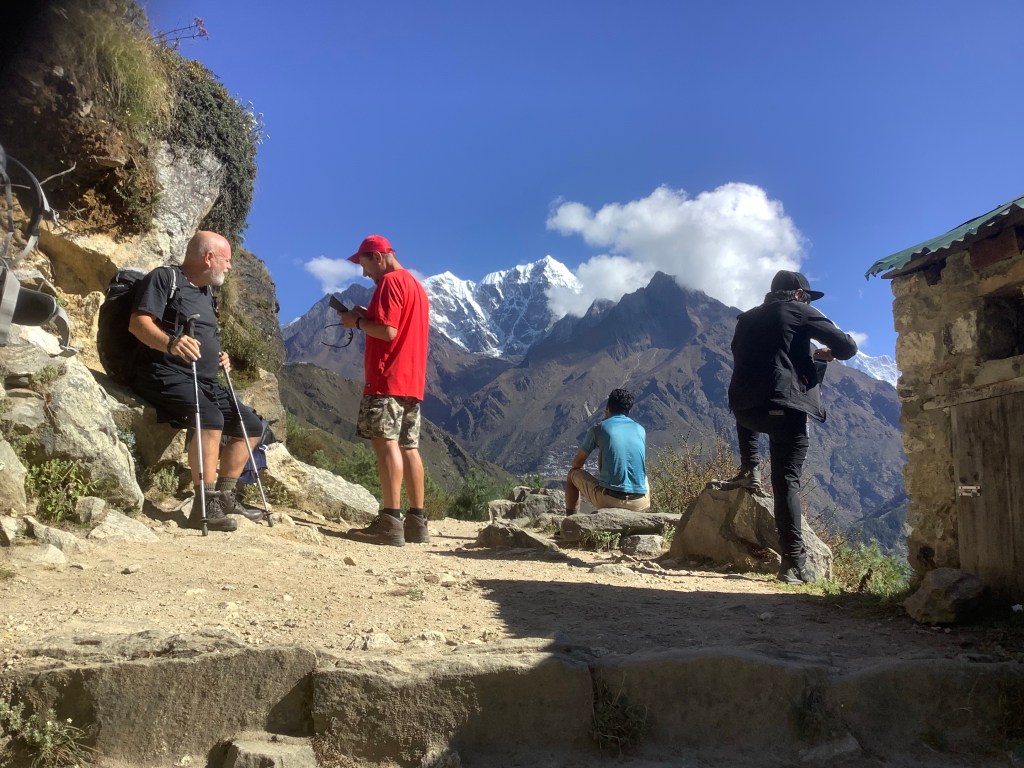
Back down via Lobuche the route looked rough from the perspective of up going down.
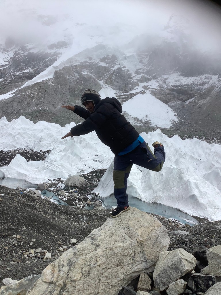
And what a classy picture show we had as a farewell to this area.
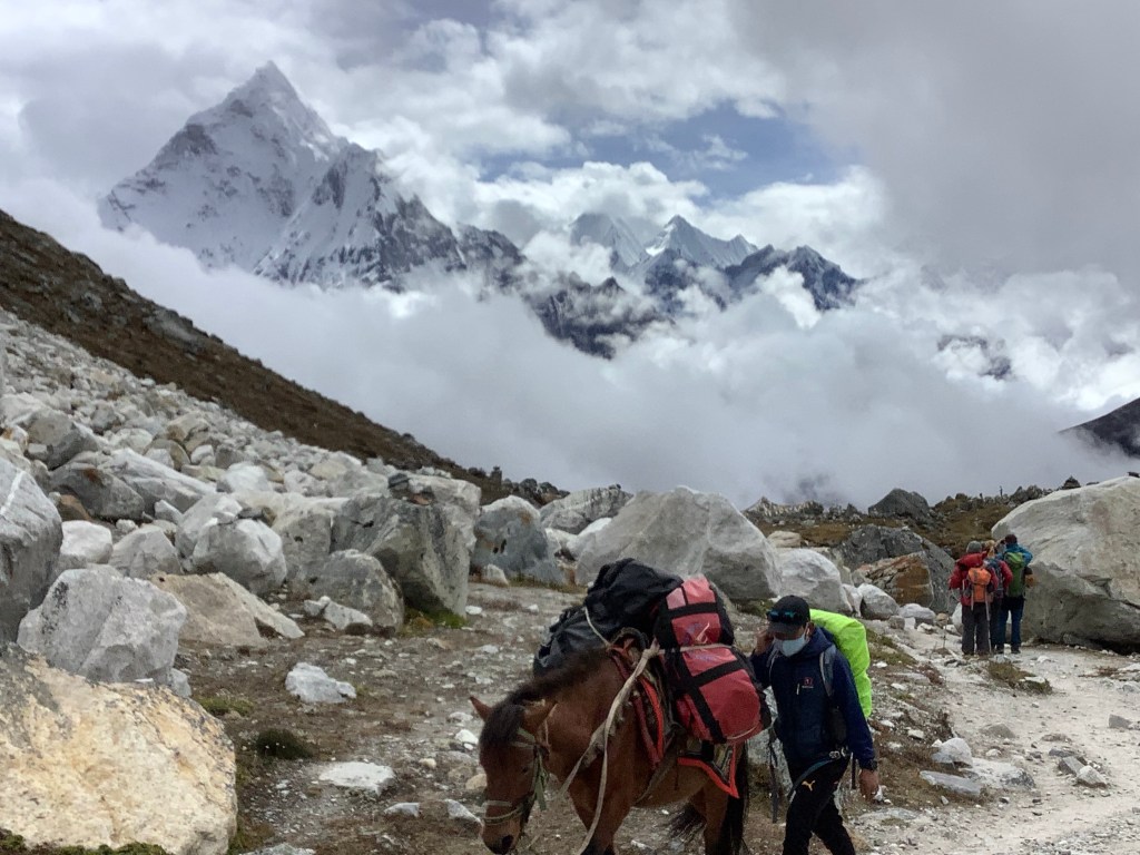
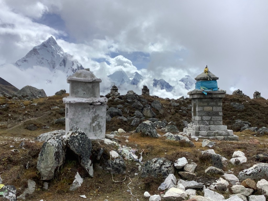
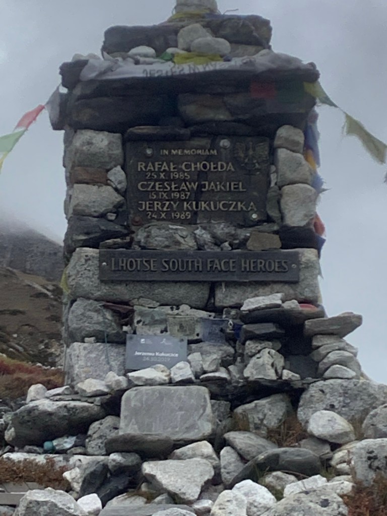
Down towards the end of the valley leading down from Everest Base Camp, were memorials for many climbers who have died in this range. A moving tribute to their courage and commitment.
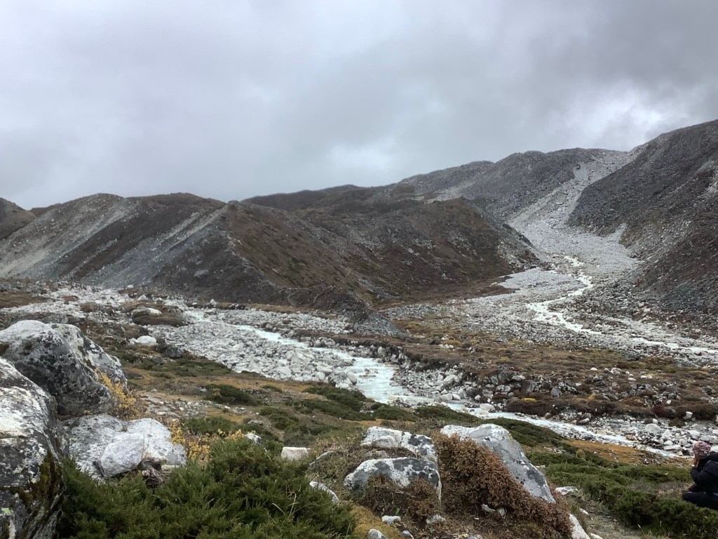
We made it down to Thukla for lunch and then struck off southeastwards down the river valley that Everest was melting into. We were setting a good pace and, looking back, we were saying goodbye to the highest of mountains in the range.
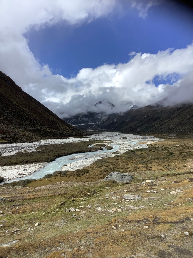
Two hours later our river ran into the valley that we followed up from Pangboche to Dingboche, as the weather was turning worse.
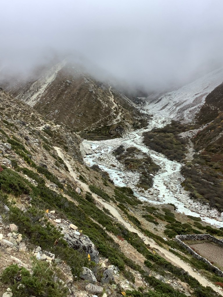
This is a domesticated stretch of valley, with the main enterprise being the drying out of Yak turds for sale as firedung. Effective it is too.

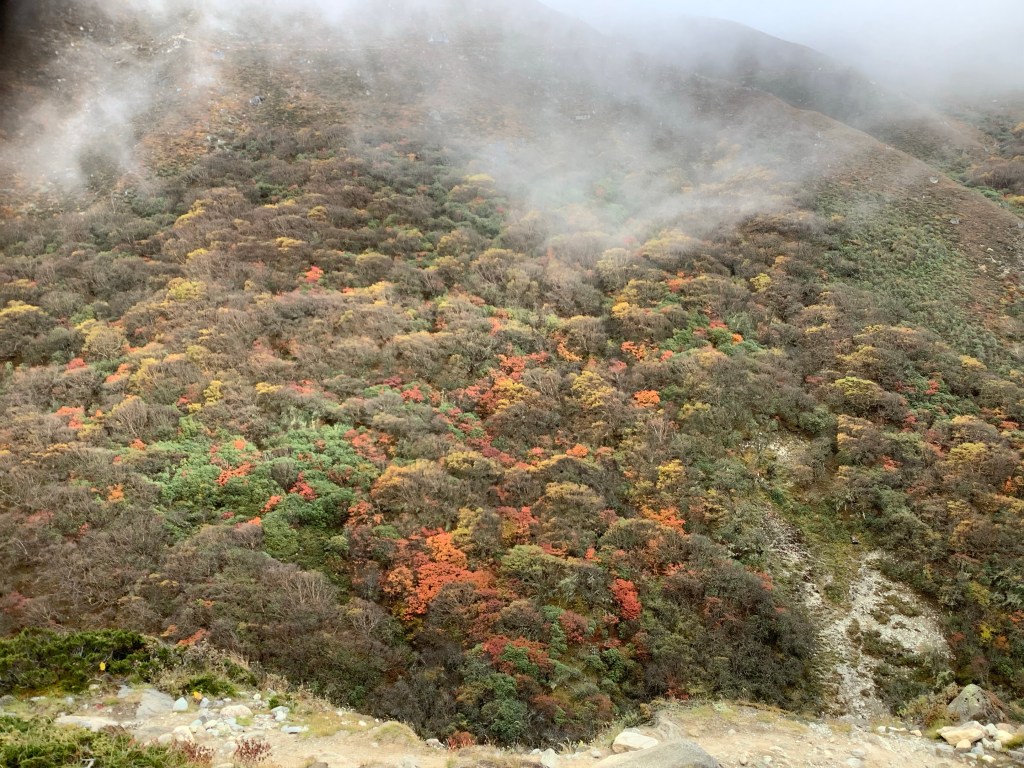
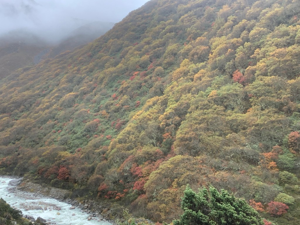
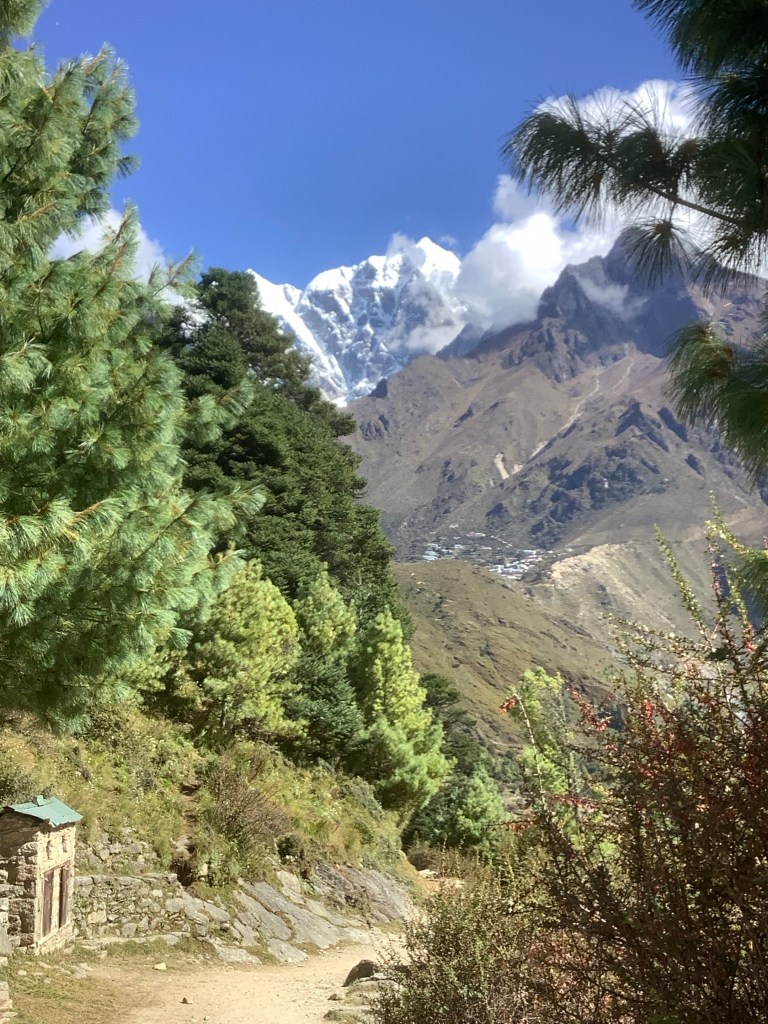
And the woods were ever so slightly more autumnal than a week ago.
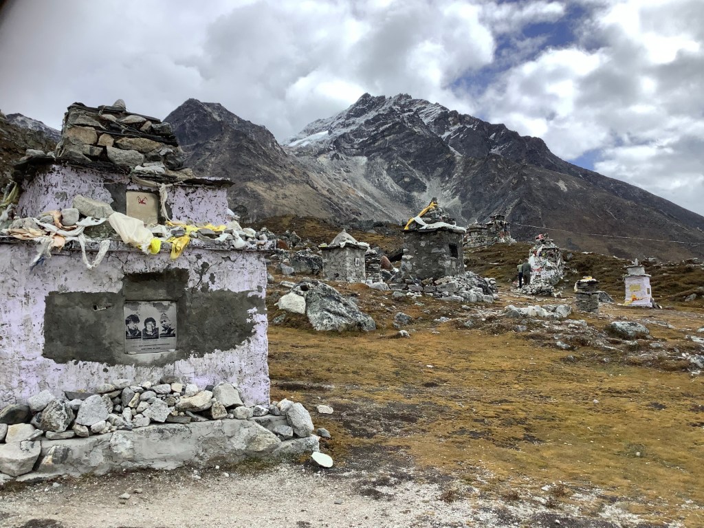
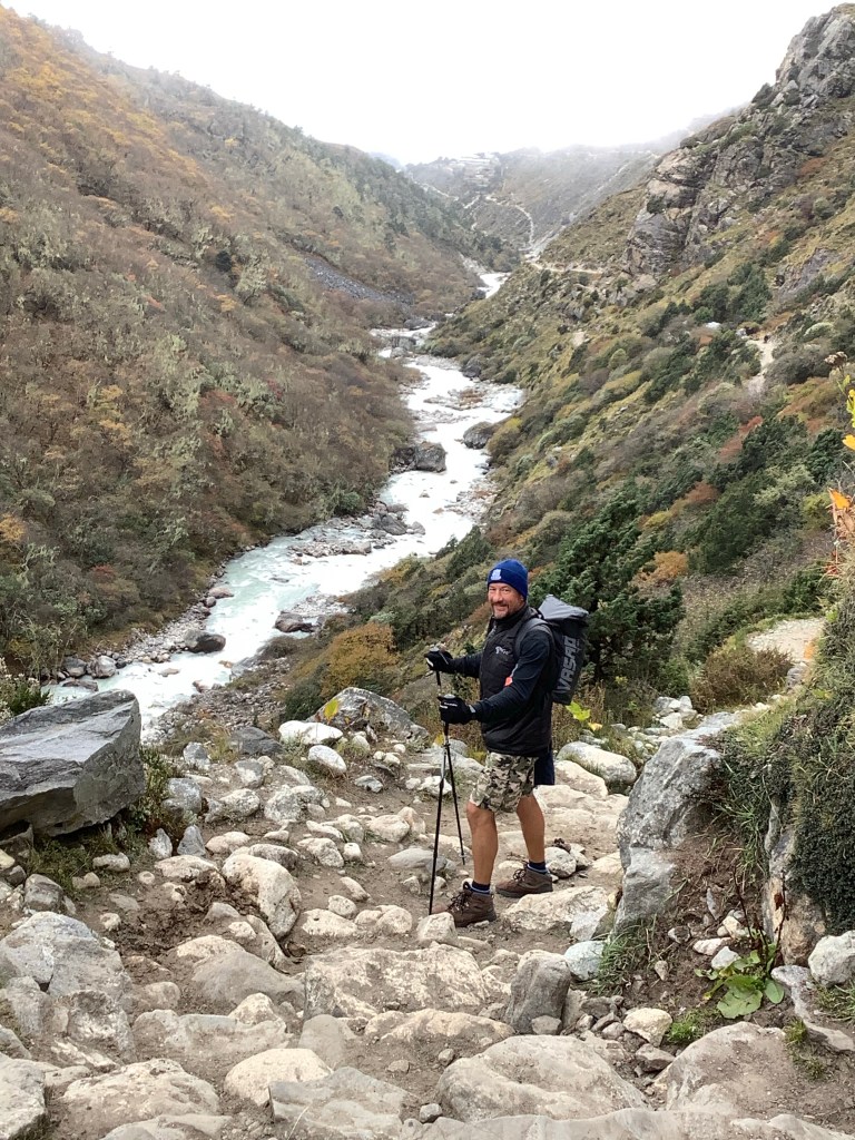
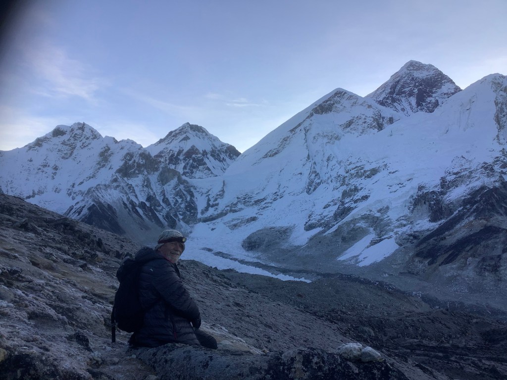
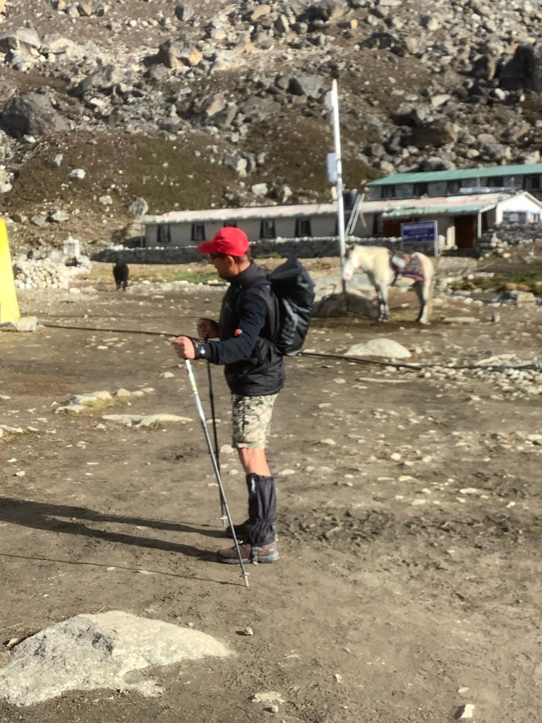
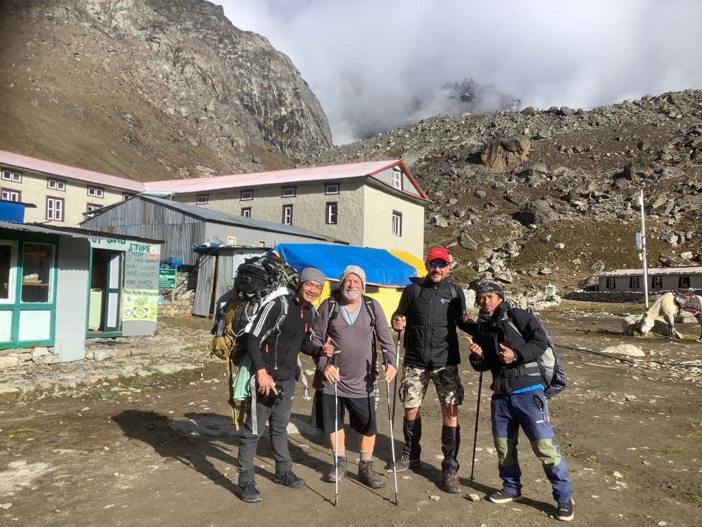
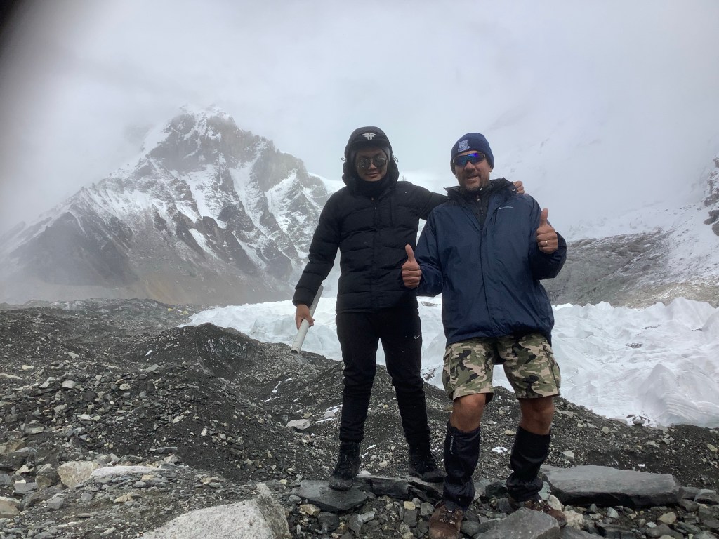
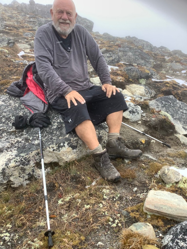
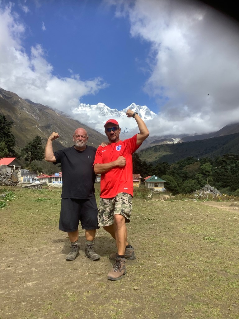
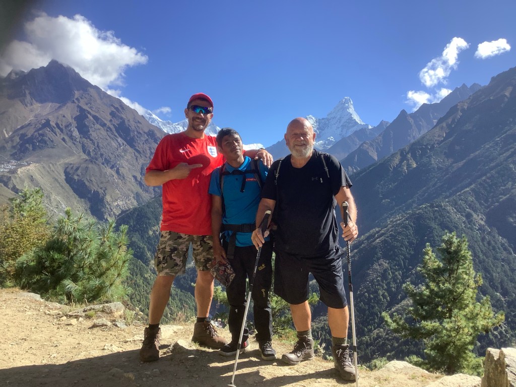
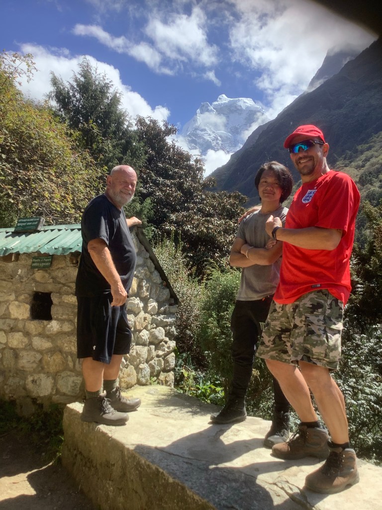
Finally we arrived back in Pangboche, lurking just over Senor Kilby’s right shoulder. A big decision taken today, and a big challenge ahead of us.
Night night.
The View From Kala Patthar
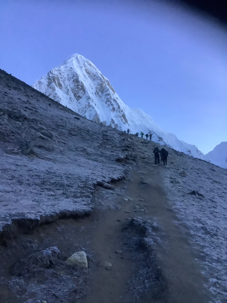
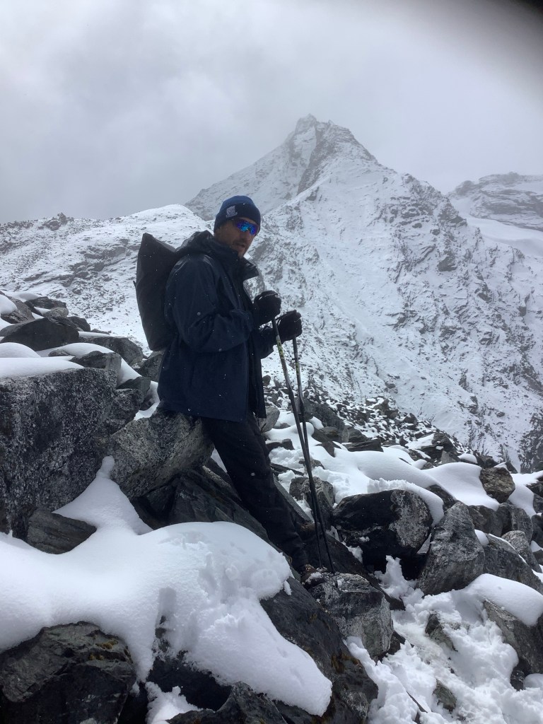
It was a very cold night and neither David nor myself could sleep. In the end I think we managed a couple of hours. In addition to the cold we are both struggling with this prolonged exposure to altitude which leaves you breathless in the night. At 4.30 am we had a knock on the door. ‘David, Papa, get ready, we are going to climb Kala Patthar, come look’. I opened the door, followed Nir down the corridor and out into the freezing night. The mountains were clearly visible and the Milky Way hung majestically above us. Behind the tea house Kala Patthar loomed over us at 18,500 feet.
‘Get ready Papa we are going up there’ said Nir pointing to the summit. The spirits had once again parted the clouds for us, and on this occasion had lifted them completely. We had to climb however badly we felt. Many trekkers see only the inside of clouds for the entire trip and we realised how lucky we have been.
It was bitter, to the extent that I put my trousers on!

As we climbed, the light grew around us and the big boys were showing off in the silvery dawn.


If you rest, do it under Everest.
It was very clear to us that this was a never to be repeated opportunity. You feel like you are gifted to see one of the most amazing sights in the world. The problem was that David, particularly, and to a lesser extent myself, were suffering from the altitude. Dav looked ill.
From this angle he looked a bit like Hitler just before he topped himself. Resigned, defeated, withdrawn, unwell, wearing a Southend United hat. Ha – little known fact. Hitler was a Shrimper. He led several charges against Colchester fans before the war. Caught them in a pincer movement with Bert Trotter and his three sons from Leigh on Sea coming in from the North Bank and Hitler, who was originally from Shoeburyness, coming at them from across the pitch. Even then he was a nasty piece of work.
And then………KAPOW! David was revived.
I told him there’d be side effects if he took those local painkillers.

We got up to 18,100 feet and couldn’t climb further. It hurt me, it was completely debilitating for David as he slipped towards altitude sickness and after last night we needed to breakfast and pow wow again. Back down to Gorak Shep.

See you later. X
Everest Base Camp – What a Great Day!
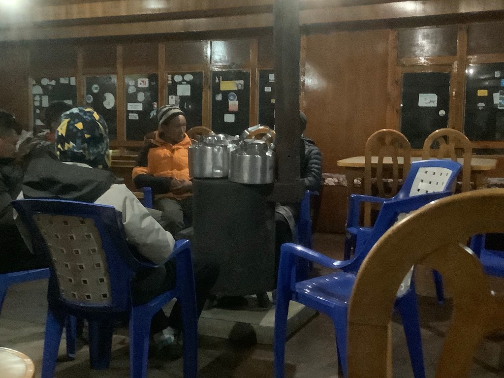
We had a meeting with Nir last night after we had warmed up, drunk ginger, lemon and honey tea and had a meal. The tea house was ok and we had a toilet and a hand basin in the room, but no water to wash in or work the flush. Another ‘pour a bucket of water down from this tank to flush the bog’.
We were reassured that yesterday was a one-off and that irrespective of the weather the rest of the trek is ok. This morning we set off up the valley from Lobuche towards Gorak Shep, the last village before Everest.
This is a photo of David, a donkey and a yak. Can you identify each one accurately. Ps. The yak isn’t wearing gaiters.
The weather started off ok and the team were in a good mood this morning. The darkness, defeat and defecation of yesterday dissipated in the diaspora.
Diaspora?
Well I couldn’t think of further alliteration that would keep the meaning and the rhythm going so I sacrificed meaning.
How about dissipated in the dawning of a new day?
Okay mate I’ll try it out on my homies. Are you ok with defecation?
Yes. You did it and it was significant to the way the day panned out. Pardon the pun.
Great, thanks, here goes.
The weather started off ok and the team were in a good mood this morning. The darkness, defeat and defecation of yesterday dissipated in the dawning of a new day.
Feels good mate. Thank you.
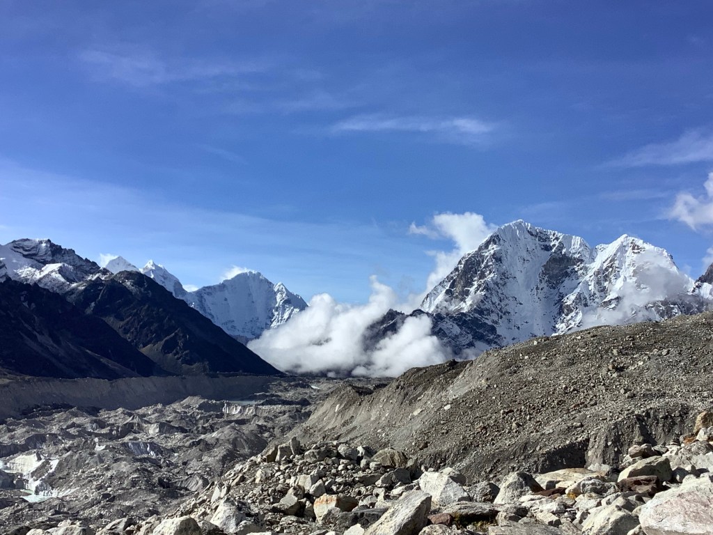
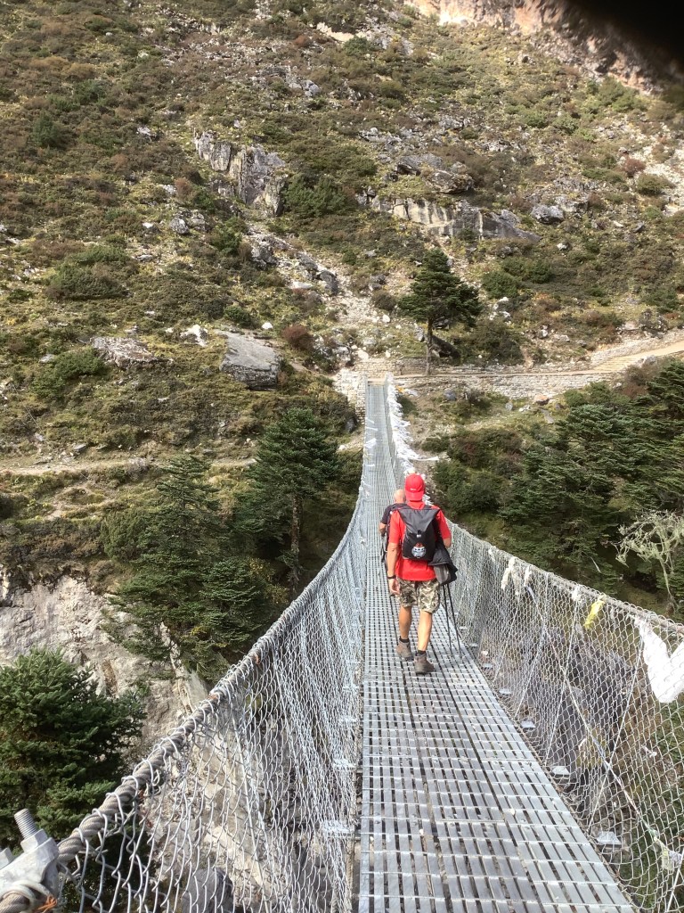
The route to Gorak Shep is along another side moraine and across a subsidiary glacier. Lots of rocks and boulders to balance on with the regular crashing of landslides and falling ice tumbling into the pools of water created by global warming. But nicer views and sentiments along the way.
Amar on the near horizon.
Killer and Nir Himalayan grooving.
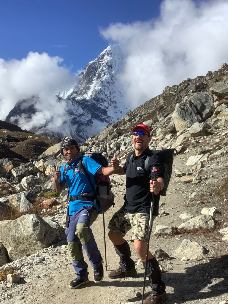
And me I’m just on the street, heading for a different joint. Thanks Bob.

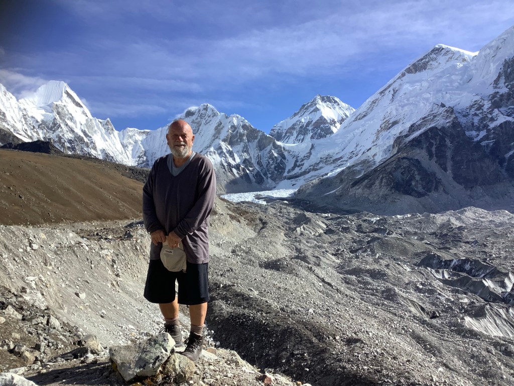
We reached Gorak Shep in time for an early lunch and to dump our stuff before our ramble up to Everest Base Camp.

And continuing upwards the snow set in for the long fall, which in the end we had to brave. Jesus it was cold. And the glacier is a difficult place to be. Don’t slip down these crevasses or you’re not coming out.
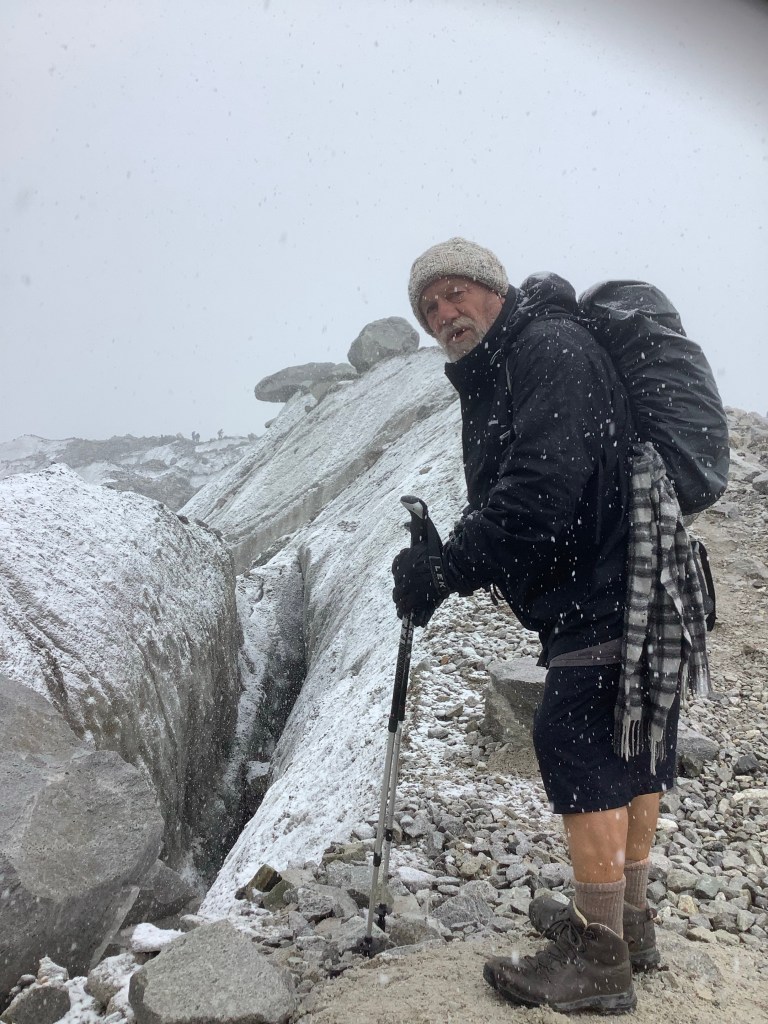
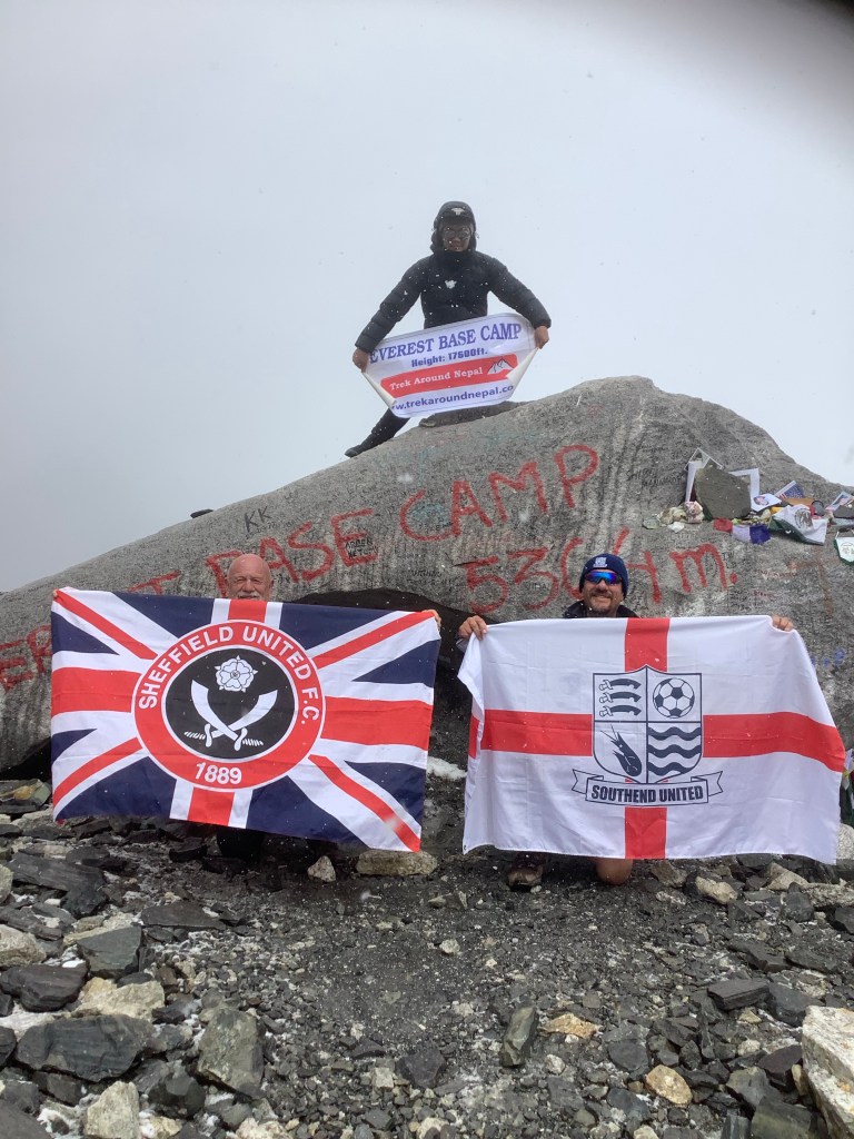
Eventually the snow eased and we finally made it to Base Camp. It was hard, due to the weather shifting from cold to frickin freezin, and due to the lack of oxygen. But it did not contain the risk of Kongma La. I’m taking the liberty of failing to provide explanation and only posting photos of one of the most iconic locations in the entire world. And we are in it.


It was a great day and we retired to our tea house in Gorak Shep, which had the most basic hygiene facilities – one unflushable bog per 20 people and no running water. Happy days.
What I said about that Indiana Jones risky bollocks; I was a bit hasty.
Night night.
From Chhukung to Lobuche – We Got Through It (2nd Blog today)
Today was the first of the three high passes and we expected, at a similar height to Chhukung Ri yesterday, that the conditions crossing Kongma La pass would be similar. We were quickly disabused.
Setting off at 6am with a whiff of sun about, and sufficient gaps in the clouds to spot the peaks, we were confident and prepared.

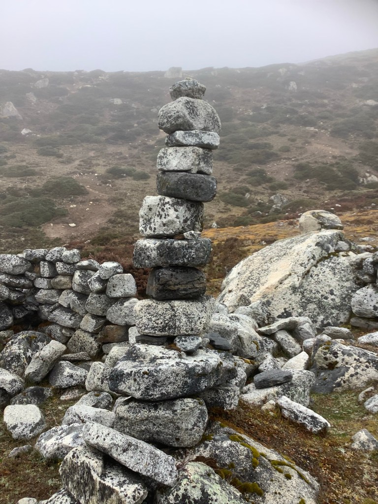
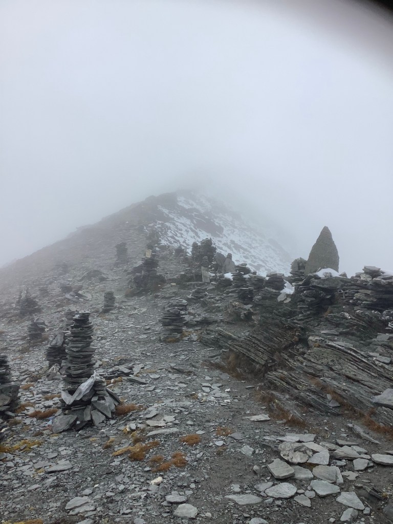
The path immediately struck uphill. There were fewer groups walking this way, compared to the lower routes to Everest, although we knew that this would be the case. On higher routes cairns lead the way.
The promise of sun didn’t last as the mountain became steeper and our path wound along and up steep sides cut deep by melting ice. Cut deep by melting ice is it? Hark at ee!
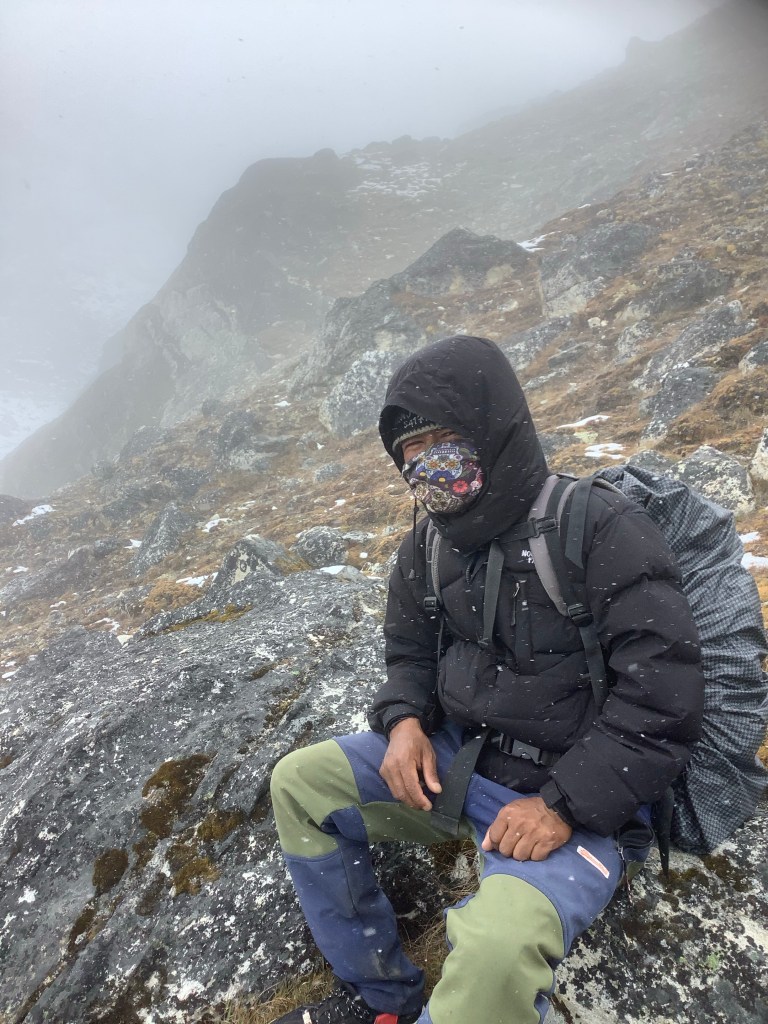
The cloud drew in further. And as it started to snow I realised I needed to get covered up!
Nir was leading by costume example.
Before I could get my gear on I started to get awful stomach cramps and my legs and lungs got a bit wobbly. Nipping behind a boulder I evacuated the runs again. Luckily David had his Imodium handy so I dropped two straight away.
Then the climbing got really tough as we hit a three or four hundred foot stone wall, and the path got steeper and steeper. The snow got heavier and then eased and a drop of sun sneaked through. Only to be obliterated by snow again.
David was drawing on his reserves and climbing well but I felt ill and lagged behind. It took hours to scale to the next level, which featured a few small lakes, culminating at a larger lake surrounded by another wall of rock. Nir pointed out the top of the pass and I couldn’t imagine a way up. Horror of horrors there had been considerable snowfall the previous night.
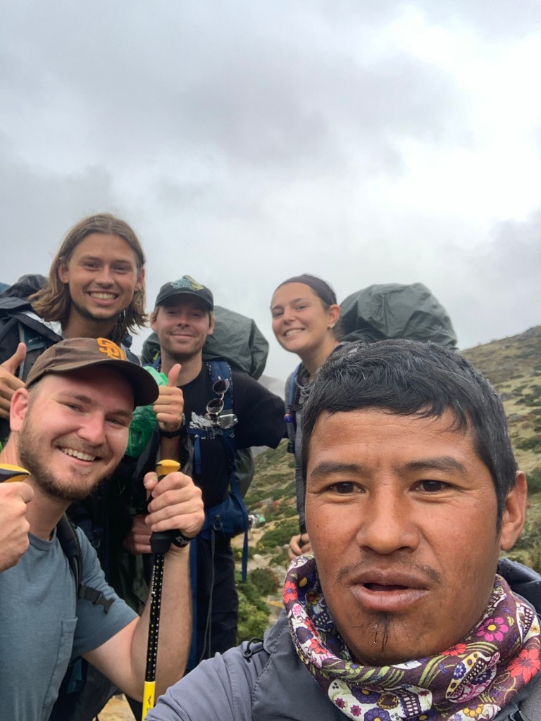
David and Amar led, with Nir following behind me. There was snow and pack ice along the narrow ledge that we followed, without ropes or crampons. One slip and it was game over. David’s video sums it up as I’m appearing up the track behind him.
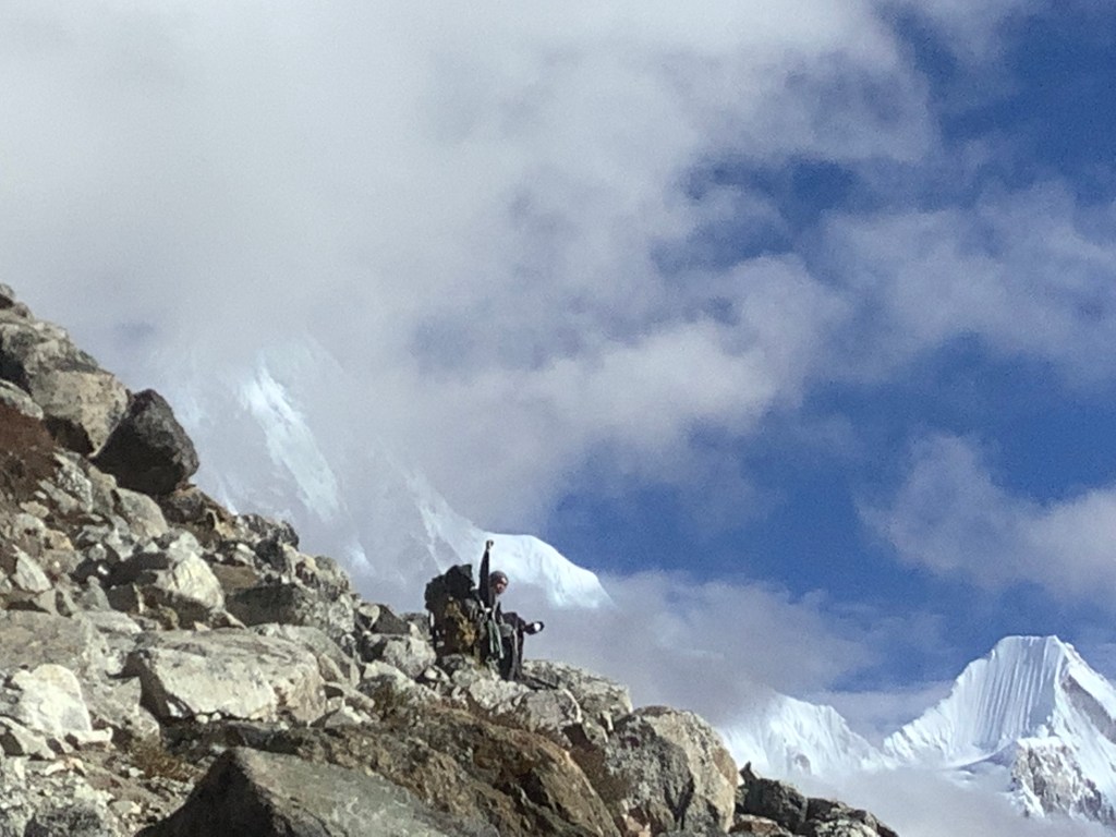
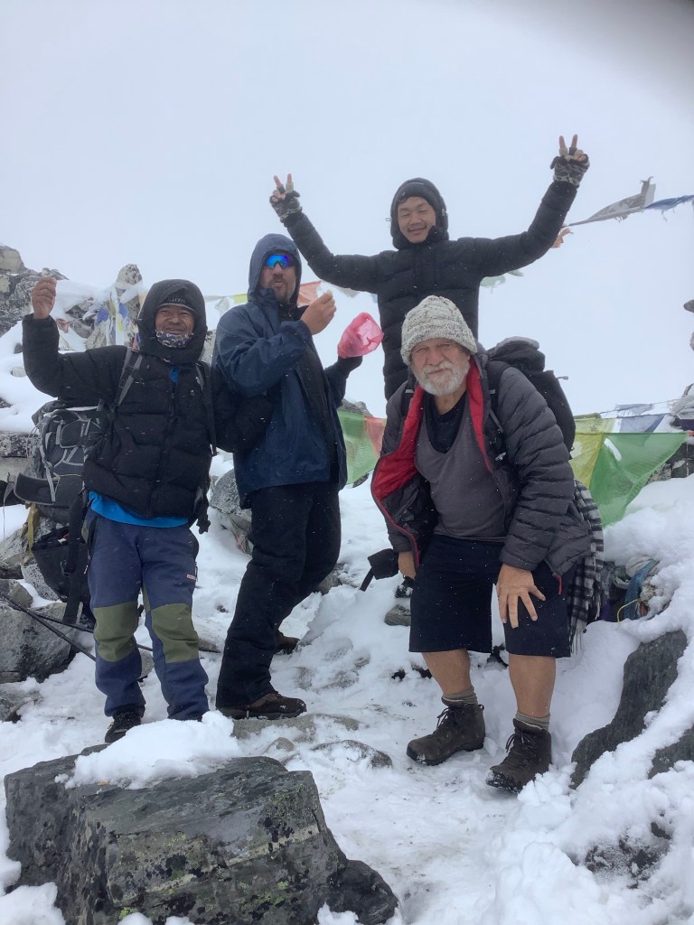
We eventually dragged ourselves up to the top of the pass, at 18160 feet altitude, with fresh snow and ice, with 50% of the oxygen in the air compared to sea level, with no climbing equipment and completely knackered. A member of another group took this for us. I think you can say that this is relief on our faces. But it was short lived. We had to go down.
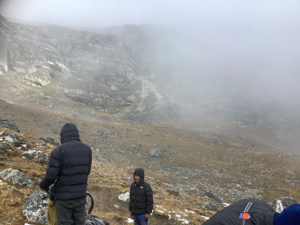
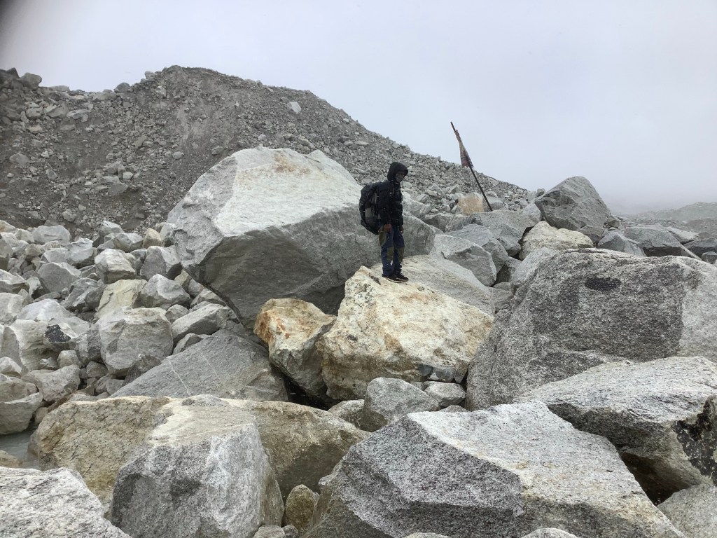
On the Lobuche side of the pass the mountainside was steep and covered in boulders. The boulders were in turn covered in snow and the route of the path was obliterated.
The first people up before us had guessed at the path and had packed down a narrow route which had resulted in snow turning to ice again. At times this disappeared and we had to guess where the gap was between boulders covered in snow and where a foot might slip through and twist an ankle. At other times the narrow path was so slippery that it was completely daunting. The drop would be bone breaking.
I couldn’t even reach for my iPad to take photos as we needed to grip our poles hard. These were truly the Boulders of Broken Bones. And they extended ahead of us for hours.
We were buggered. We couldn’t go back down the Lord of the Rings narrow ledge, we couldn’t get a helicopter to pick us up, we had to go on. And at the bottom was a glacier between ourselves and Lobuche which we had to cross.

It took us hours to gingerly tread our path down the mountain. It was exhausting and extremely concerning. There were about four groups snaking down and despite most of us slipping it is a miracle that only one bloke tumbled and damaged himself. A bruised buttock. David slipped onto his wrist and was hurt but uninjured. At last we were down, but then had to climb up the side moraine of rocks, sand and soil, which contained the glacier.
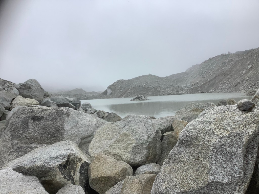
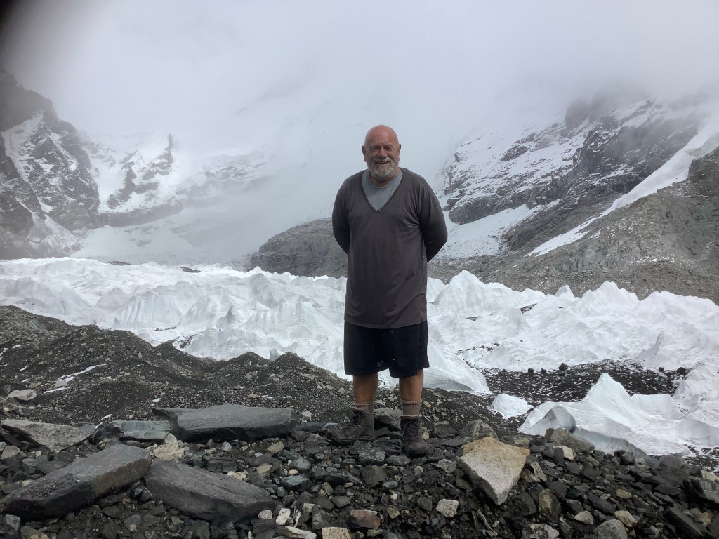
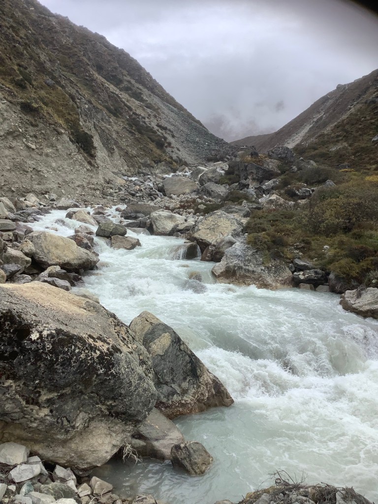
This is the Khumbu Glacier running from the foot of Everest down across our path. It is melting and is covered in large boulders like this, as well as smaller scree. It’s difficult to see the ice and there are many small lakes connected by a subterranean river, which you can hear through the gaps in the Boulders of Death! We had to cross the river from boulder to boulder without slipping.
By the time we arrived in Lobuche we were mentally and physically exhausted. It had taken 9 hours. This was not going to happen again. I felt that I was too old, too unfit and too tired for this kind of Indiana Jones risky bollocks and David was of an equally firm and similar mind. We needed a cards on the table pow wow when we had rehumanised and clarified how we felt.
Night night.
Dingboche to Chhukung – and climbing Chhukung Ri
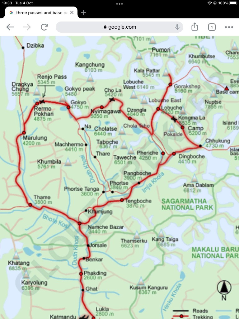
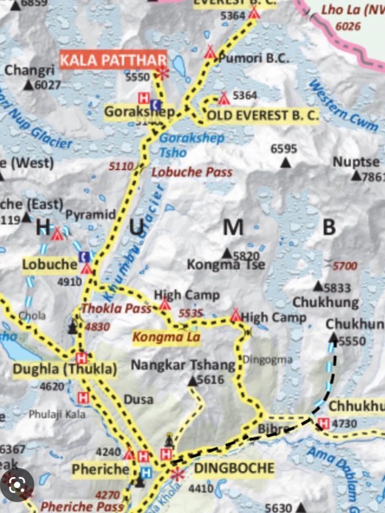
Today was a relatively easy trek up to Chhukung in the morning, climbing up to 15,500 feet. The route is shown towards the bottom of the map.
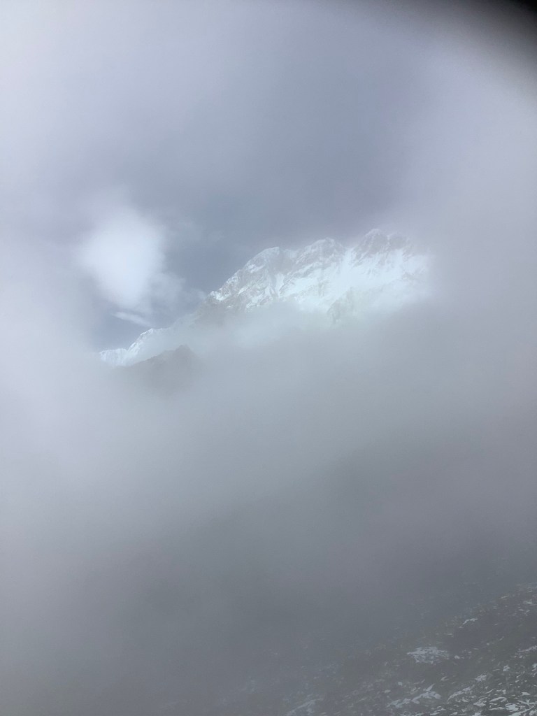
As we set off there were tantalising glimpses of the mountains surrounding us through the clouds.
We got a good pace going and we’re soon able to look back at Dingboche down below the cloud level.

And with a sad reminder that those who are brave enough to climb the peaks, around which we only trek, frequently pay the ultimate price. God bless lads. And lasses.
We are well into glacier country now and vegetation is becoming sparse.
Chhukung ahead and when we made it to the tea house we left our stuff in the room. After an early lunch, the four of us (the Fellowship of the Trek) set off for Chukhung Ri, the peak on the map marked at 5550 metres.

Sadly we became enveloped in cloud, like being inside a ping pong ball.

It was a steep hard slog with every step forward tearing at your lungs. We were down to 50% of the normal level of oxygen in the air and it hurts. Then the ridge appeared with cairns erected by climbers over the years. We had made it to well over 18,000 feet. The highest place on earth either David or myself had stood. The summit was brooding above us, surrounded by steep slate that was unacceptably slippery in the rain. We accepted our ascent of the ridge as an overriding success.
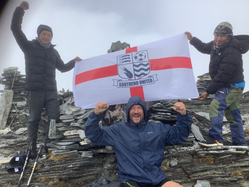
Flags come out, as did indiscernible tattoos.
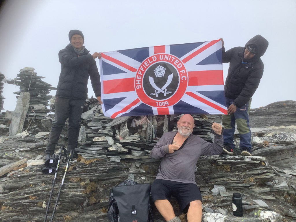
Both Uniteds united.

Then an amazing moment of grace and spiritual uplifting occurred. The clouds momentarily parted above us and the massive peaks towering over us shone through. I heard David say, ‘we’re looking at angels.’ It was exactly like that. I burst into tears and he patted me on the back and comforted me. Something beyond the mountains is here.
After a long drag down we made it to the tea house. Uplifted, exhausted and happy.
Night night.
Rest Day in Dingboche
Today was a rest day to assist acclimatisation to the altitude. We’re staying at 14,500 feet and this morning we climbed through rain up to 15,750 feet, well into the snow line.
We had hoped to climb further but the route became covered in snow and further climbing would have been dangerous. We were in cloud for most of the climb up and back and did not take photos. Sorry.
Tomorrow we’re off again, hopefully to reach Chukhung, leave our gear at the tea house and climb 17,400 feet up Chukhung Ri. Chukhung is one of the highest villages in the world.
The weather forecast is adverse for our route.
Good job we are hard as nails!
Night night.
Pangboche to Dinboche – In the Rain
I had a poor sleep due to my lungs being uncomfortable and I had a bad case of the runs last night and this morning. I’ve taken some Imodium donated by Senor Kilby (I’ve no idea why I call him that) and it seems to have settled down so it might have been a flash in the pan! Sorry about the pun but it wasn’t pleasant so I won’t poo poo it.
The cloud was low but the temperature was ok and we set off in shorts and quickly took off waterproof jackets to walk in the light rain in t shirts. After an hour looking down the valley we could make out Pangboche.

Our guide Nir has been courting four Americans as potential future punters and he has exclusive use of my iPad when he’s carrying it.
The year is moving on and Autumn is beginning to paint its colours on the trees. Although we are coming close to the tree line, beyond which only the occasional stunted hardy pine is seen. And without tree cover the ground is prone to landslides and erosion.
After two and a half hours we arived here in Dingboche, at 14,500 feet and even thinner air. We’re on a rest day tomorrow so we’re using it to get acclimatised to a higher altitude by climbing a local hill and coming down again. It works.
Bala has stayed in Namche Bazar as he is getting better pay on construction there so Amar is our only porter. He is carrying quite a load but he can carry a lot more apparently. I tried the load. Chuffing hell!
I’ll leave it to the expert.
Night night.
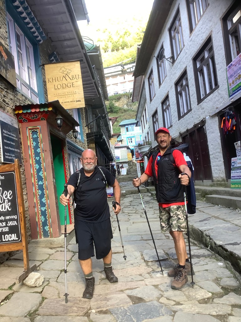
Namche Bazar to Pangboche – a Grueller
It was an early start this morning and we were heading for Pangboche, a further couple of hours walking than we originally anticipated. The weather was on our side again.
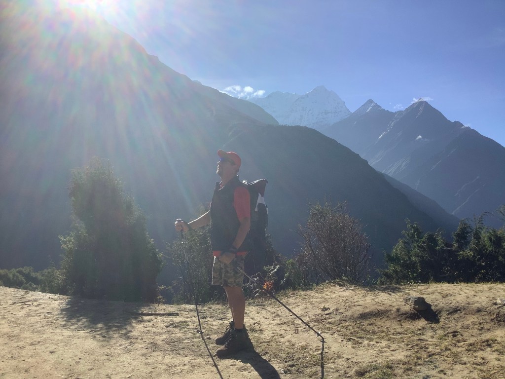
The views were just as exciting as the day before. This is the Killer gazing at them with awe and amazement. Or maybe he’s just remembered that he forgot to put his gaiters on.
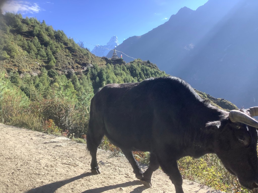
This photo sums up this beautiful country. A Yak wandering down the track, a Buddhist shrine behind it and a 25,000 foot peak behind that.
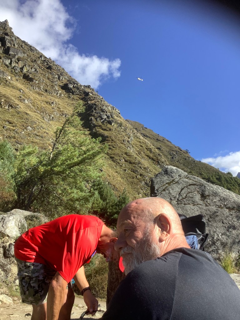
We take regular stops to rest a bit and drink water. Hydration is essential to stave off altitude sickness and we’re working our way up to 5 litres a day at the higher levels. We hopefully won’t need an emergency evacuation by that chopper over our heads.
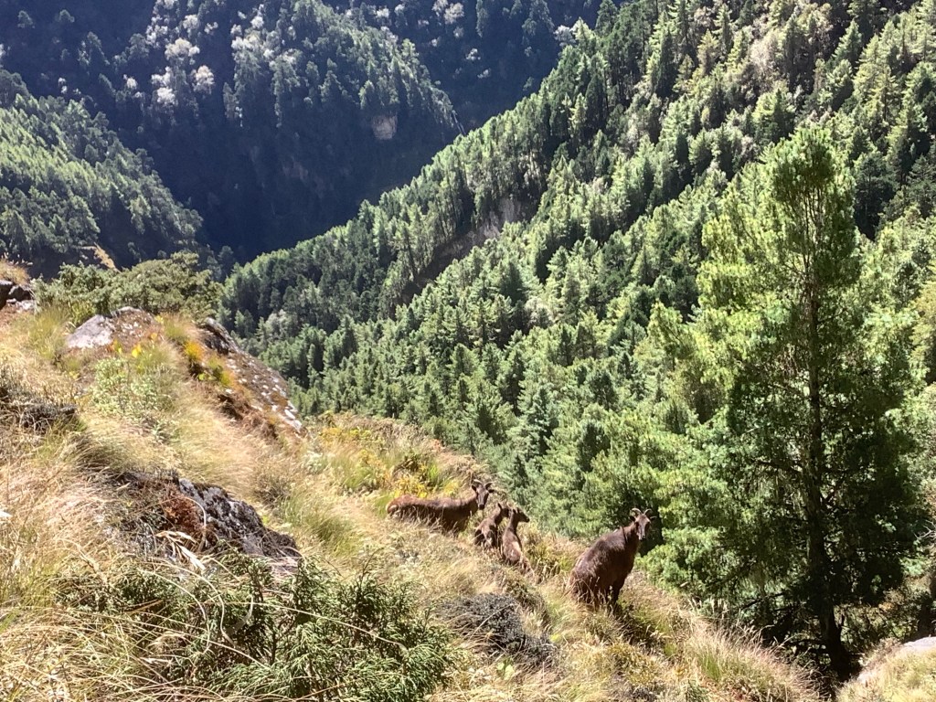
We are in the Sagarmatha National Park and these wild goats are protected here, as are the Red Panda and the Snow Leopard.
Even rarer, however, is the Senor Kilby. There is only one left here and it was recently caught on film. It does exist despite all the cynicism. The abominable Englishman ladies and gentlemen.
The path goes down as well as up even if you’re going up. And we are going up. Over 1500 feet altitude increase today.
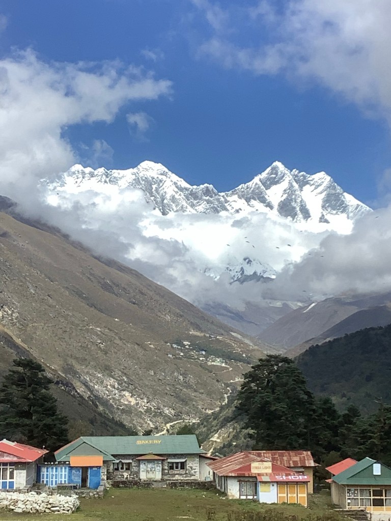
Eventually we reach the river and a tea house providing lunch. Then immediately after we have the longest climb of the day up to the village of Tengboche. This hurt, the only way to do it is slowly. And on a welcome break the peak of Kang Taiga, at 22,000 feet, poked through the cloud and said hello to our fellowship.
Climbing over the ridge leading to Tengboche we were astonished by the sight of Nuptse, Everest and Lhotse up the valley, now much closer.
Tengboche Buddhist Monastery is famous in the region and is amazing.
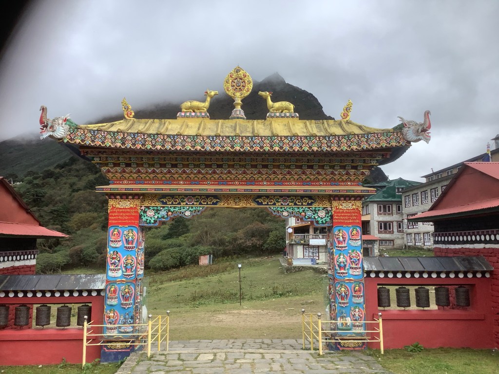
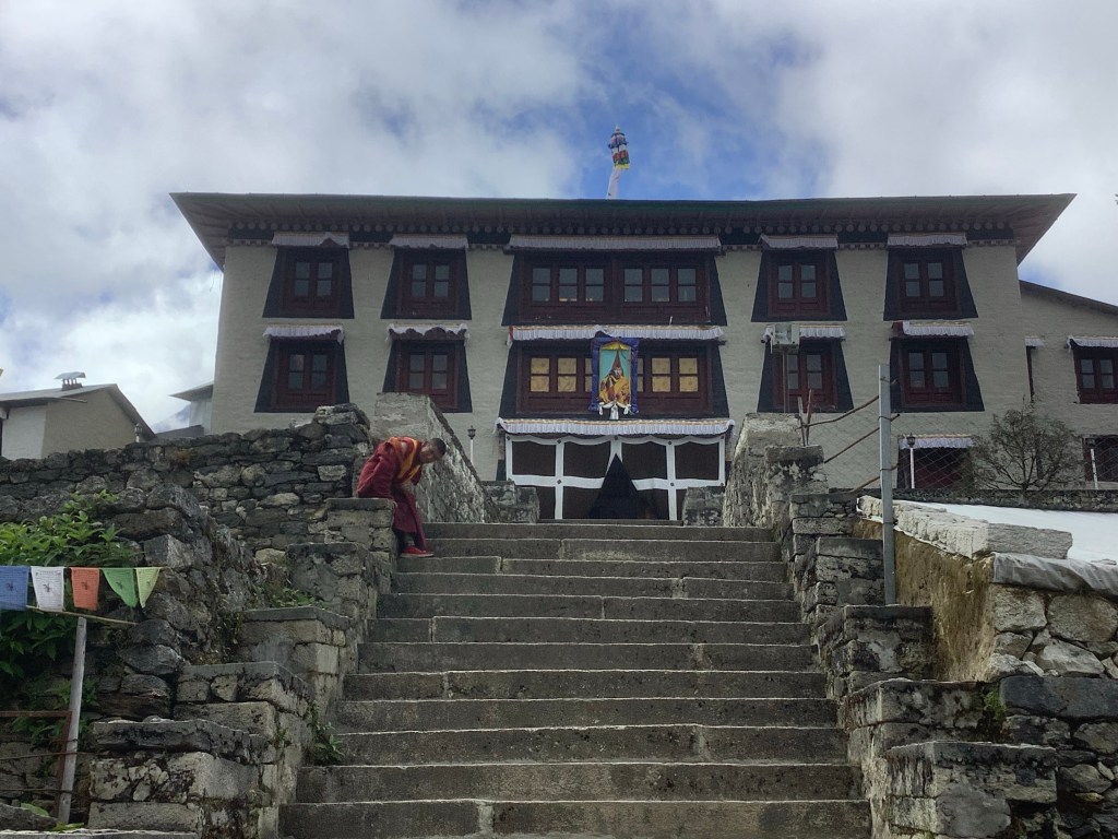
We were not allowed to take photographs inside but we were allowed to enter in shorts, with boots respectfully discarded. The decoration and the size of the golden statue of Buddha were incredible. Like entering another world. In another time, in another place – thanks Van.
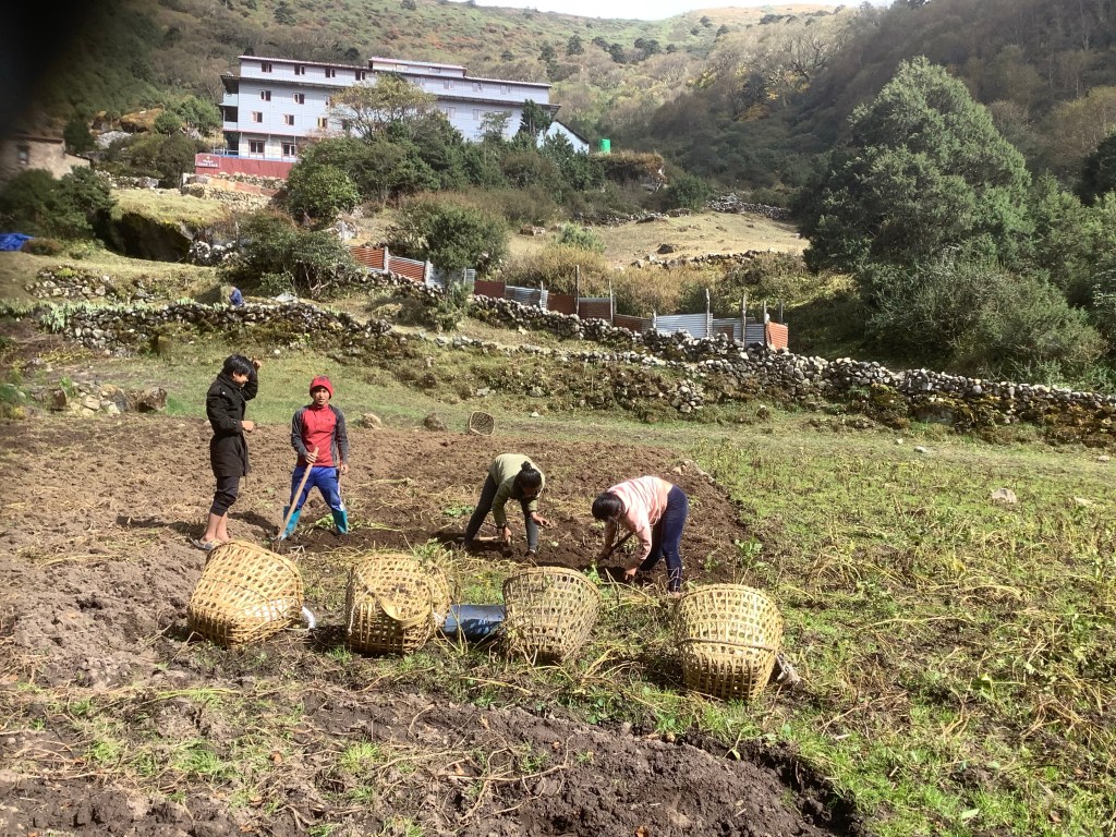
We set off again for Pangboche, back down to the river and up the hillside for an hour to finish the day. Passing wood pixies.

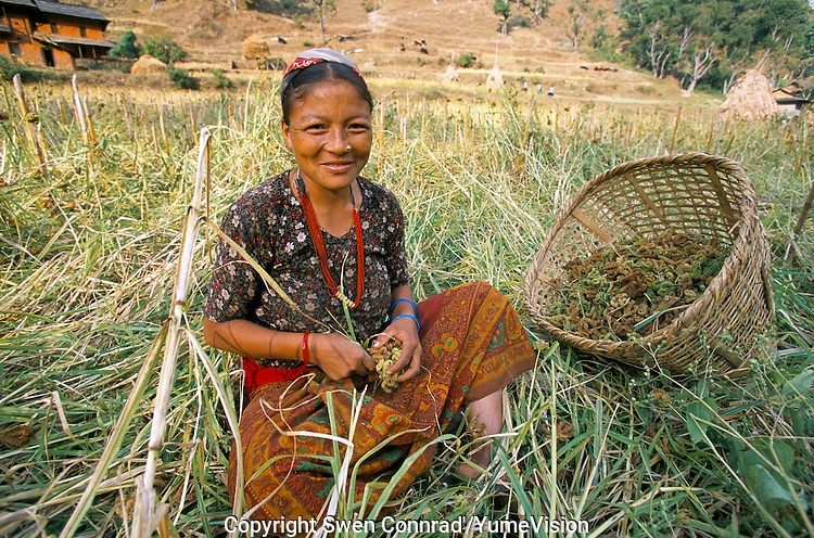
And youngsters harvesting potatoes.
Crossing the river we huffed and puffed up to Pangboche and a frustrating evening squeezing blogs out of an intermittent and underpowered Wi-Fi.
Night night.
Just a Video of us landing at Lukla
And some other poor buggers taking off.
Nir demonstrates a traditional Nepali dance – identifying Everest for us! 4th blog today
Had to include this as David had just been talking about how the Himalayas have a spiritual value and Nir did this in reply!
