Normal Service Will Be Resumed Shortly
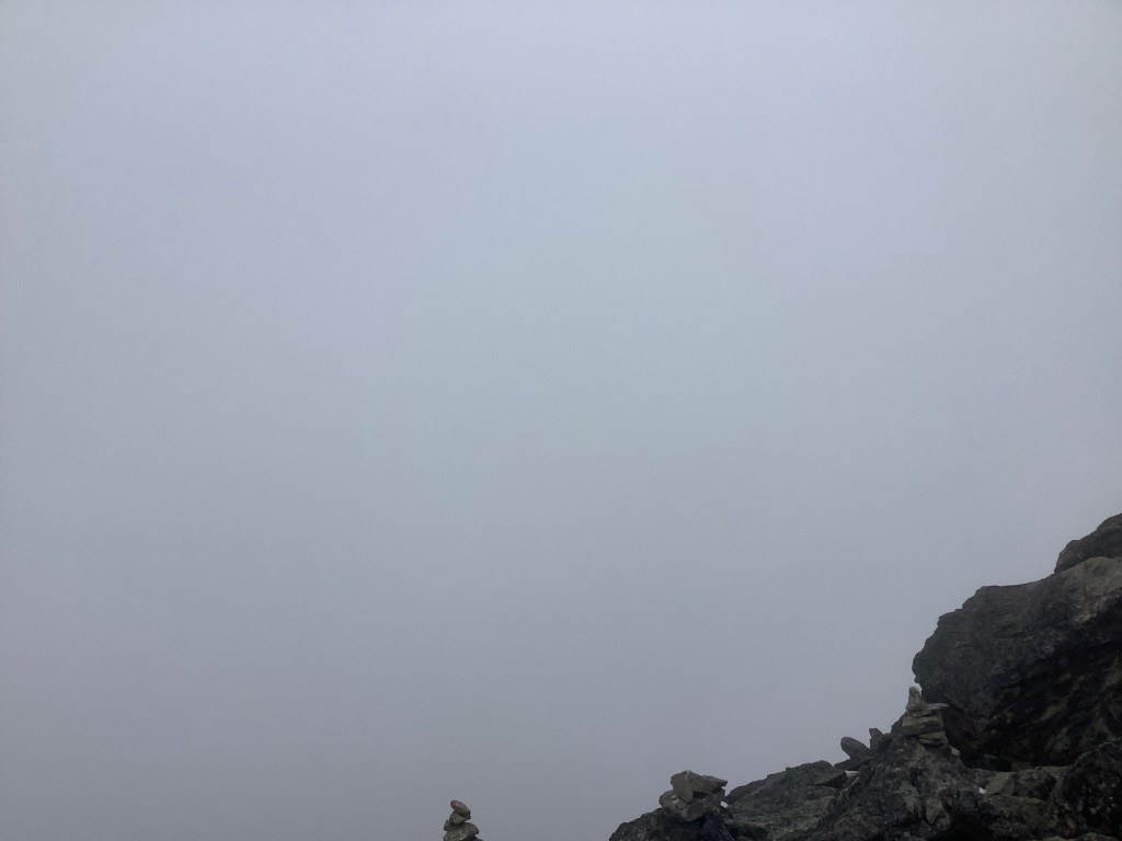
Sorry. We’re stuck in a smallish village and are only getting Wi-Fi for a few minutes each day. I’ll blog again when we’re out of here. It’s a bit messy, massive rainfall, many massive avalanches and were on the road to nowhere. Thanks David.
Night night.
Resting in Dingboche – I’m Busy Doing Nothing
Thanks Bing. I got up earlier than I anticipated. Your long awaited loaf in bed rarely contains the essential element of sleep. If you wake up around 5.30 am often enough then it’s going to stick. It did.
Rather than do something useful I chose to go to the common room, get plugged into the Wi-Fi and work on my overdue blogs. Breakfast intervened, then lunch, then dinner.
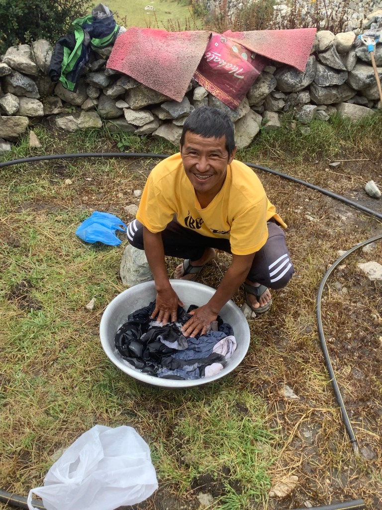
However I didn’t completely spend my time blogging, as noble a pursuit as it may be. I went round with Nir to wash mine and Danny’s clobber. We had a laugh with the lass who was there ahead of us. Such pleasant folk.
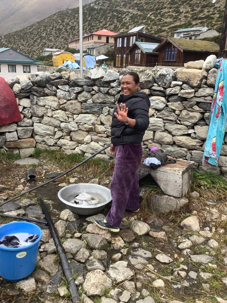
Nir was a much more athletic clothes washer than I was. Water, soap, podging, rinsing. And repeat. And repeat. Interspersed with harsh brushing on a smooth rocky surface.
Then we hung it up as the clouds broke for a while.
Then back to blogging.
Because I’m so precise in my use of language it takes me a long time to blog. Oooh! Precise in your use of language are you? Turd!
See what I did there? I built an anticipation of clever and targeted wordmongery. Then I let it down with a drop. A warm and steaming drop in this environment.
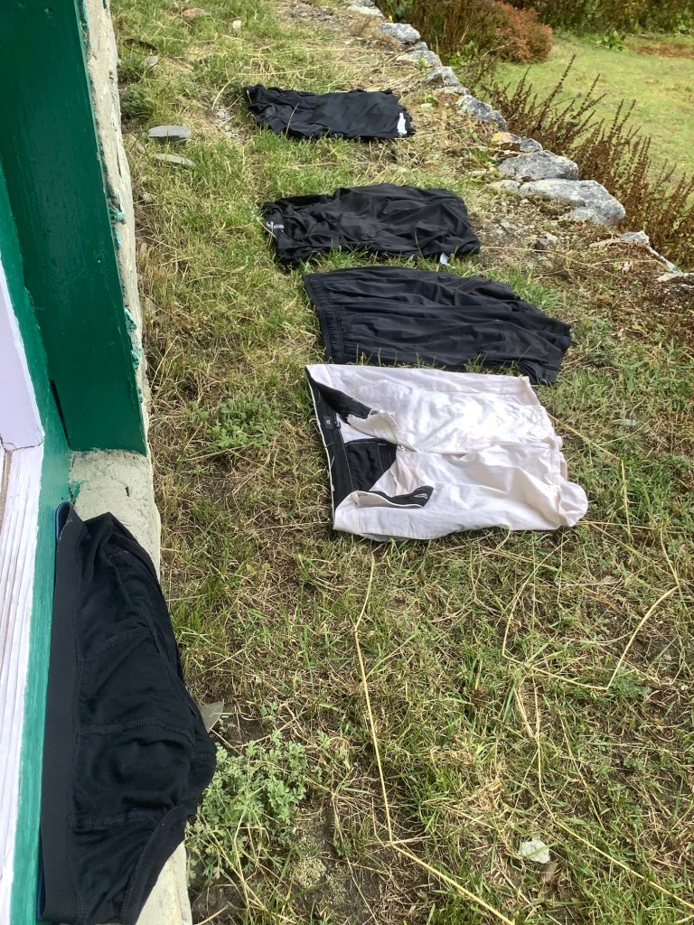
We laid out the wet clothes on a south facing bank and hoped for the best. On the same bank was my power pack and Dan’s solar powered charger. It worked a treat.
Then I had a shower.
You can imagine how Emmeline Pankhurst felt in 1918 with the Representation of the People Act, which effectively brought about Universal Suffrage that she had been fighting so long to achieve. That’s how I felt when, after all these days, I got a dribble of warm water dropping on my back and a small block of soap in and out of my lower and upper crevices. The relief was tangible.
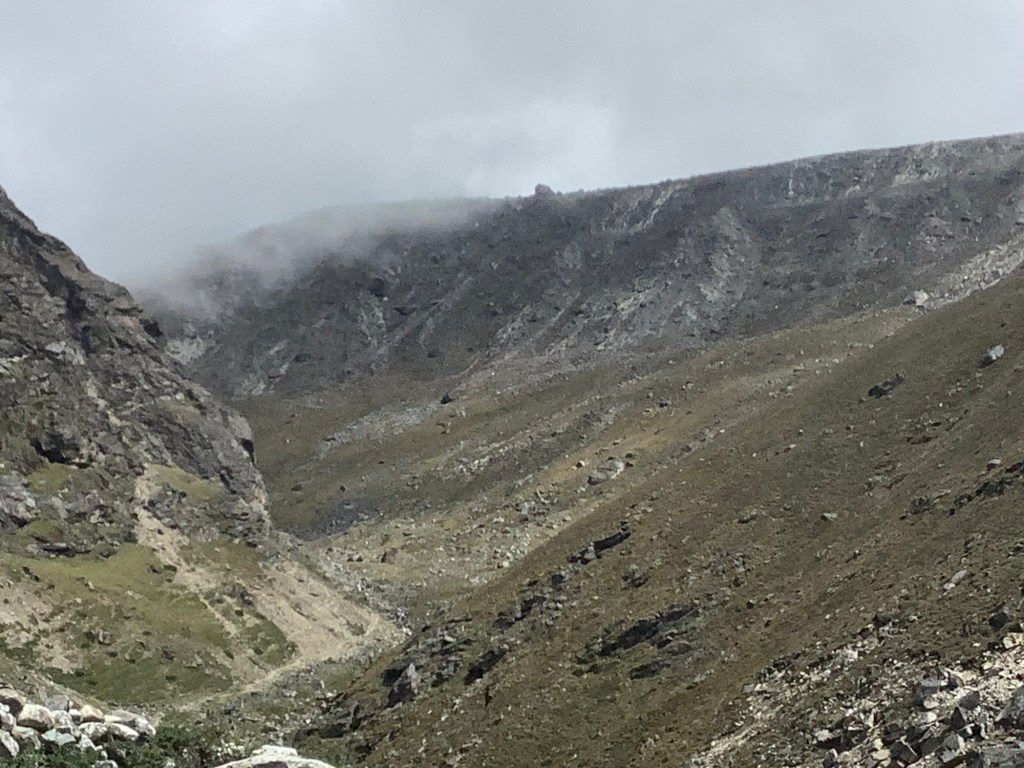
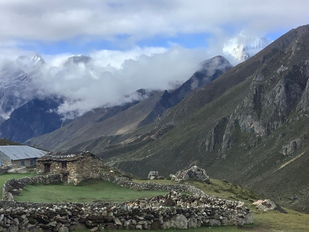
This is a view further up the valley from our place. It looks like South Yorkshire in the sixties with coal tips and smoke from the steelworks. It isn’t anything like that but it resonates in me.

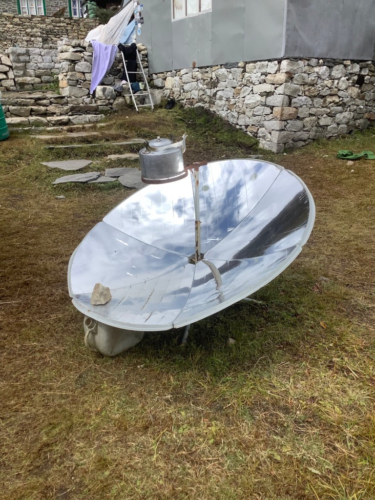
Back to the guest house garden, it doesn’t even take full sunlight to boil this solar powered kettle.
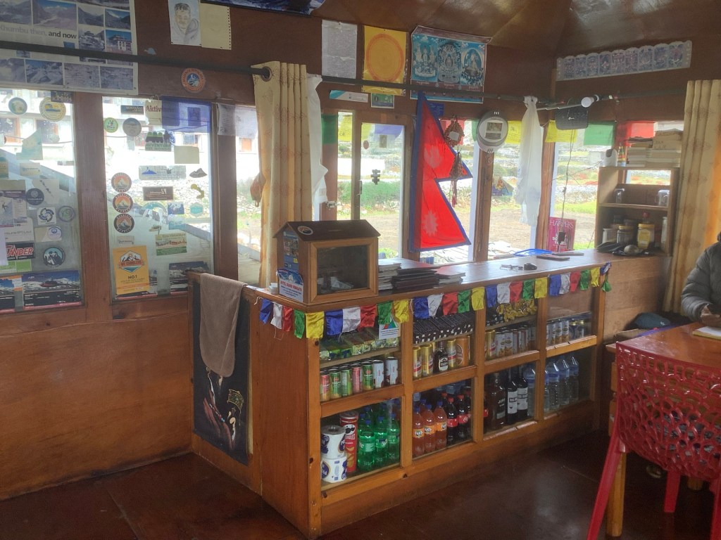
Getting towards evening meal the attractions of the common room tuck shop were tempting me towards the pleasure of San Miguel.
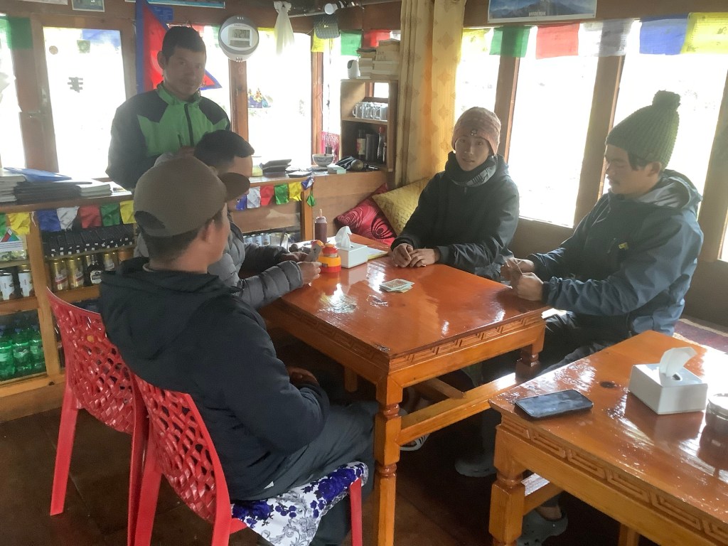
And the trekkers started playing cards. A couple of hours of eating, drinking and blogging and my day was done.
Night night.
Lobuche to Dingboche – Descending (into madness)
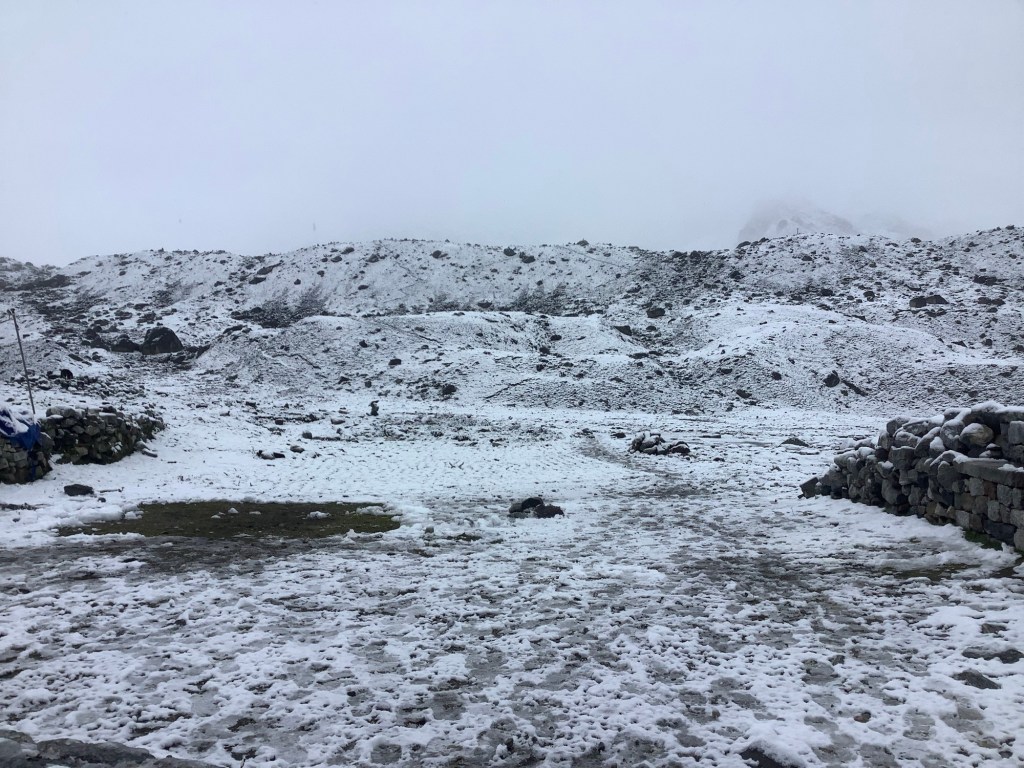
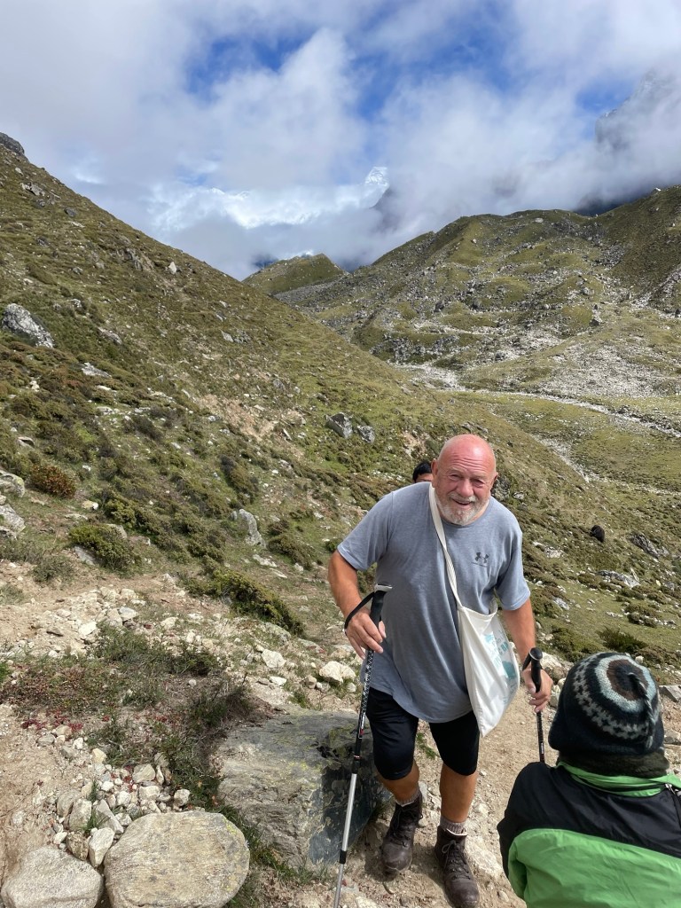
It was a late collection for Dan and Bikram by the mountaineering guide. He arrived at 10.30 am. There had been some snow overnight and the air was cold.
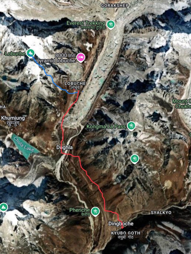
They were Carrying on up the Lobuche East. Oooer missus! (Blue route) And we were dropping down to Dingboche, a crossroads village up the Khyber. Sorry. Khumbu. (Red route)
Bye bye boys. Stay safe.
The weather wasn’t great, but it wasn’t terrible. Just keep dry. You’ll be alright if there’s no wet involved.
Oh God no. We’re not going down this tortuous, tedious, but all too often trodden Soft Southern Bedwetter routine again are we?
Yep!
Boys, keep safe and, unlike anyone south of Milton Keynes, don’t wet the bed and you’ll be ok.
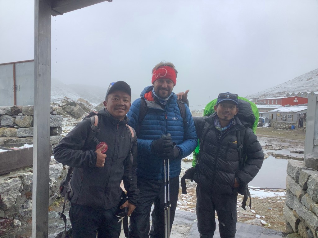
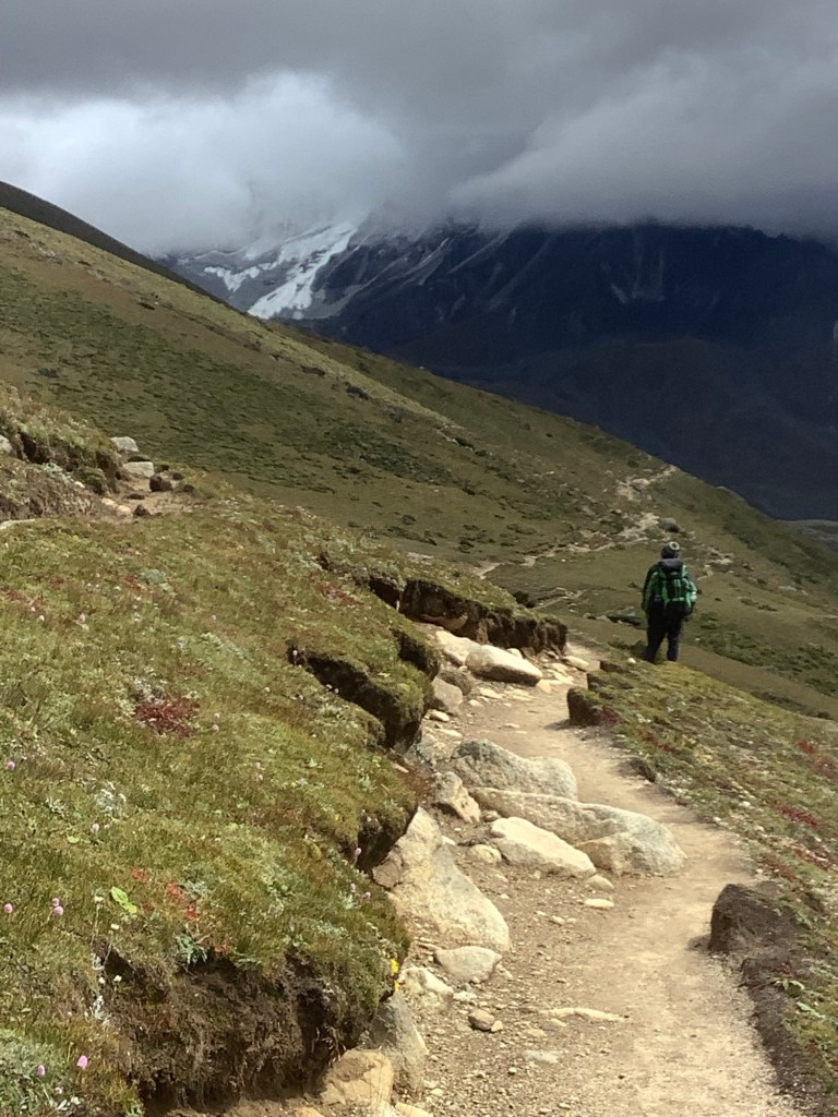
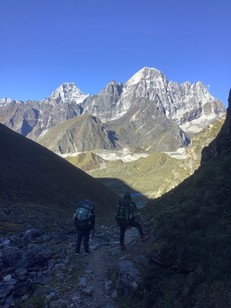
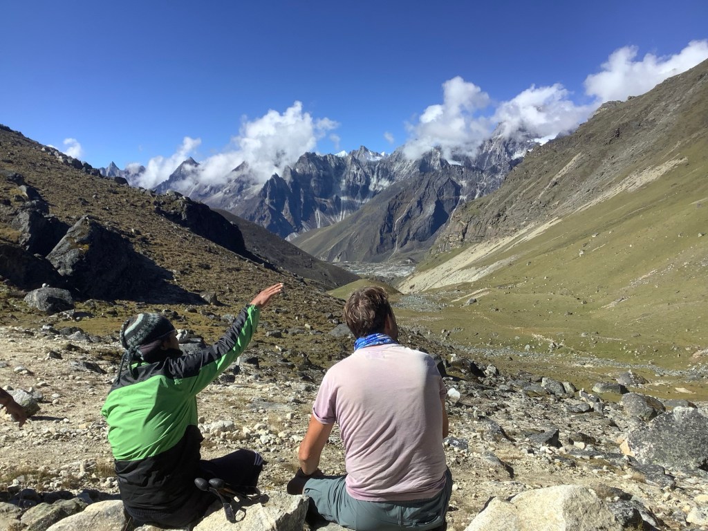
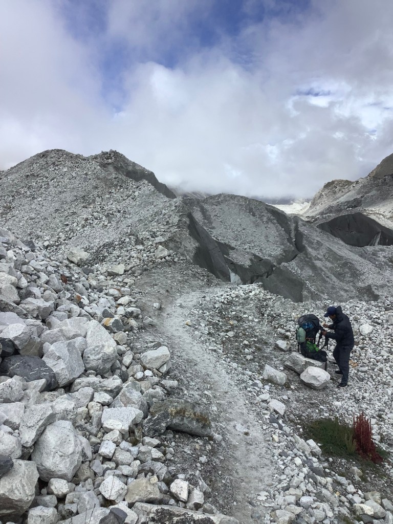
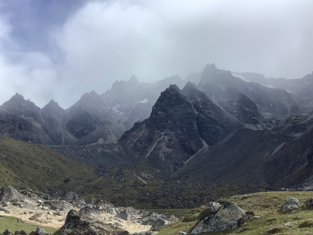
Amit, Nir and I dropped down the glacier as we were aiming initially for Dughla, where the track splits. There’s one route along the mountainside to Dingboche, and another down the mountain to Pheriche. We were going along and not down.
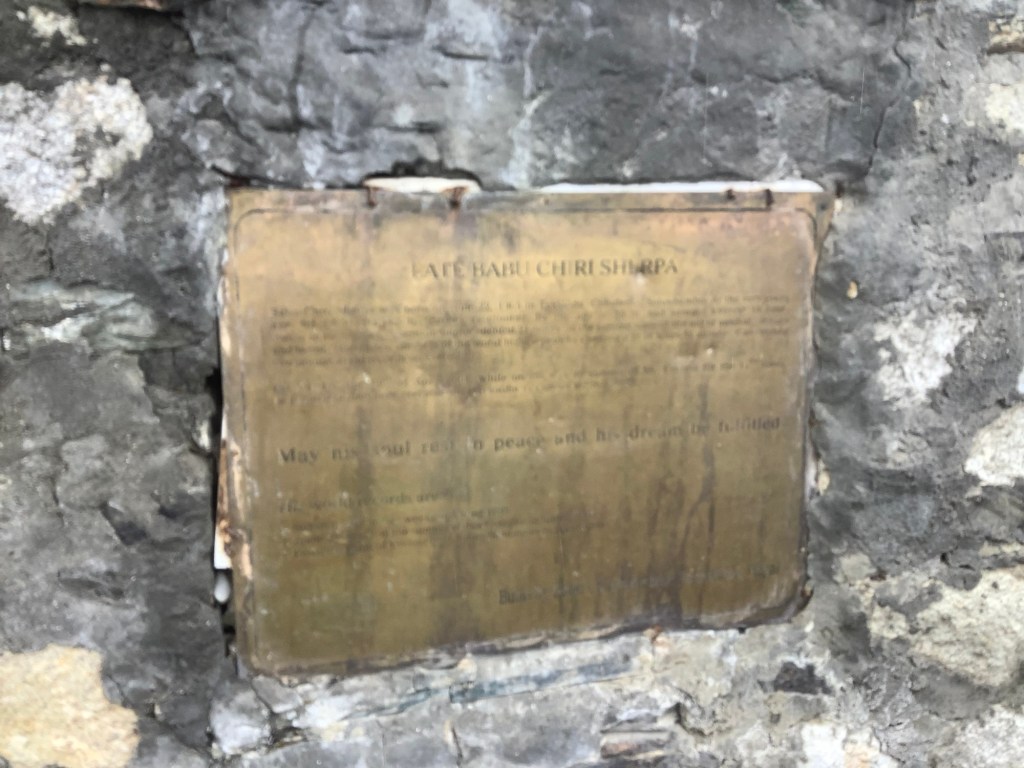
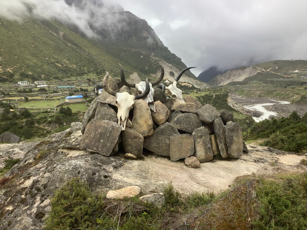
Before we arrived in Dughla we came upon memorials to those who have died climbing Everest. The cloud emphasised the sombreness of this display.
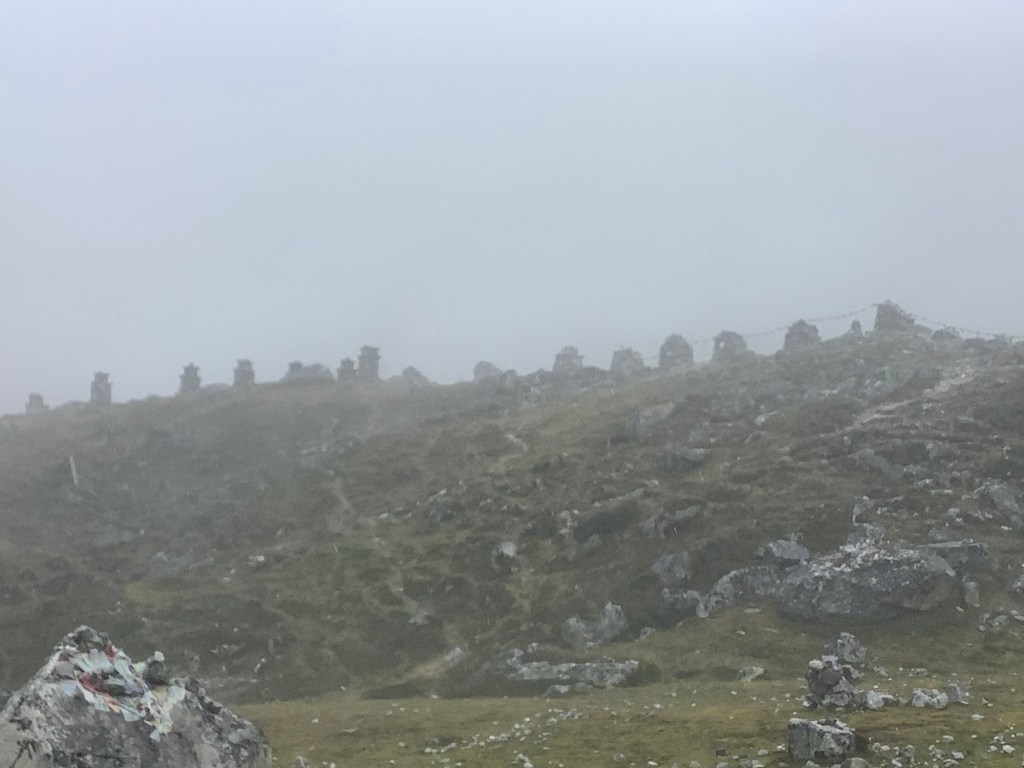
The individual memorials make me sad.
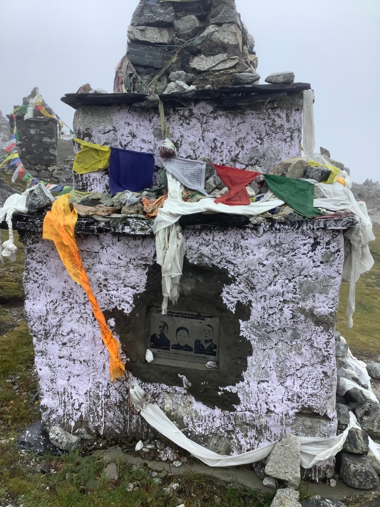
The ones for Sherpas make me weep.
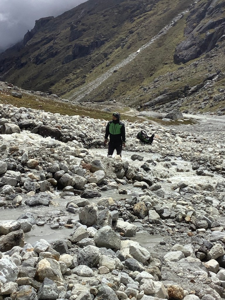
We had lunch in Dughla and just beyond there the Khumbu glacier run-off tumbles down the valley.
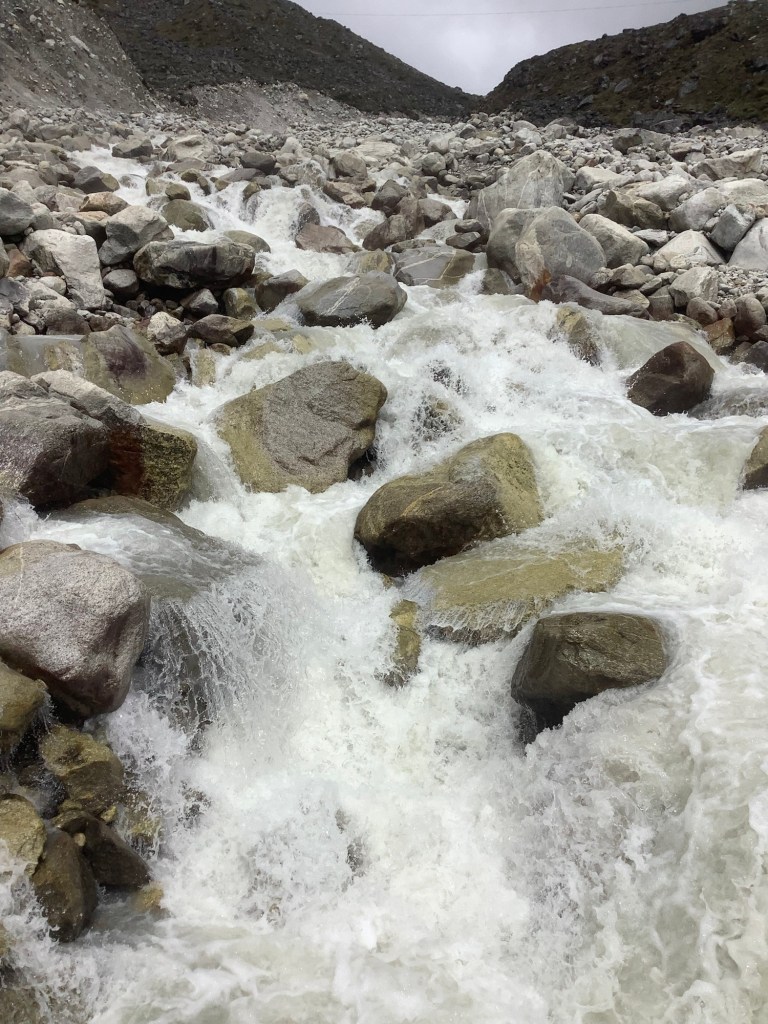
We needed a decent bridge to get across it and there is one a bit higher up. Beyond the bridge the two paths are clearly visible. We’re taking the higher of the two.
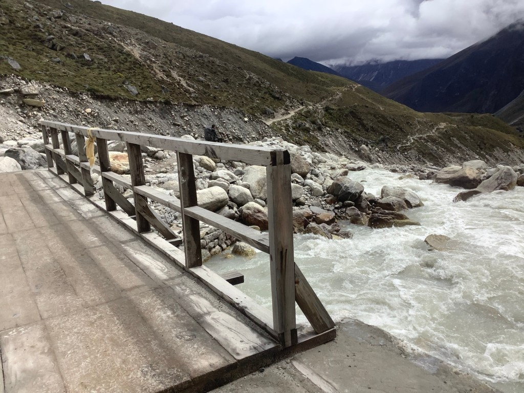
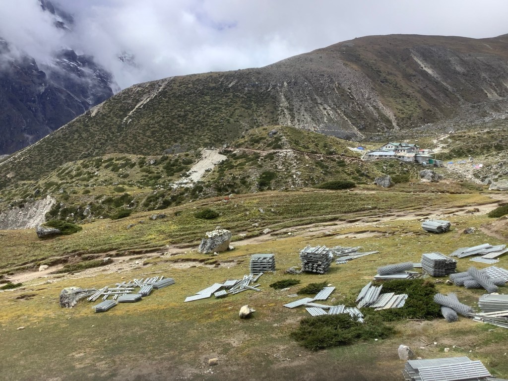
Once across, and looking back to Dughla, the government is building a long swing bridge across the valley, lower down, and some of the materials are there. It will be completed in six months.
The temperature had increased to around 5c and the wind wasn’t uncomfortable. We made a good pace.
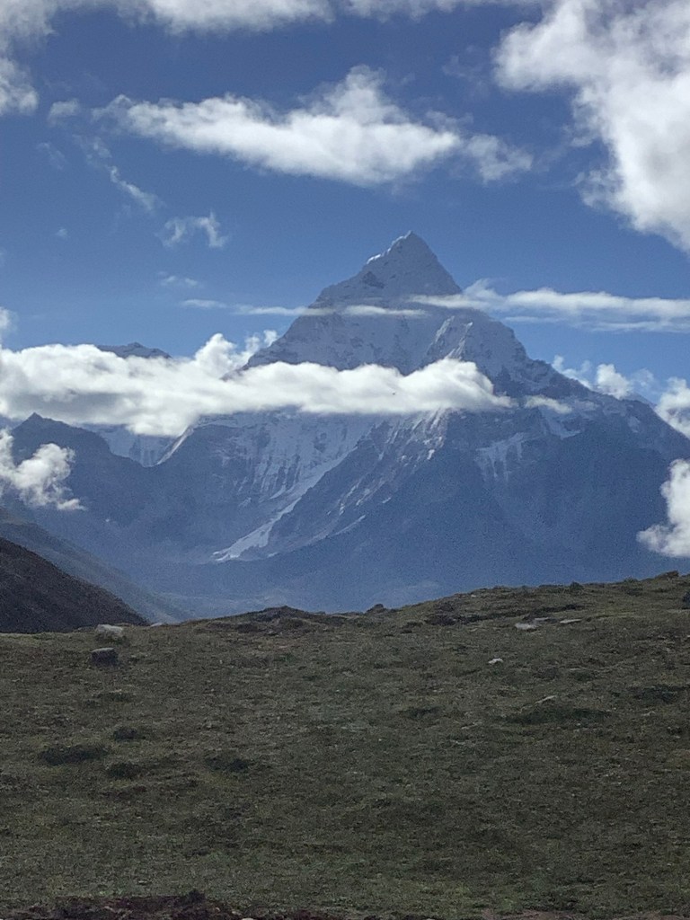
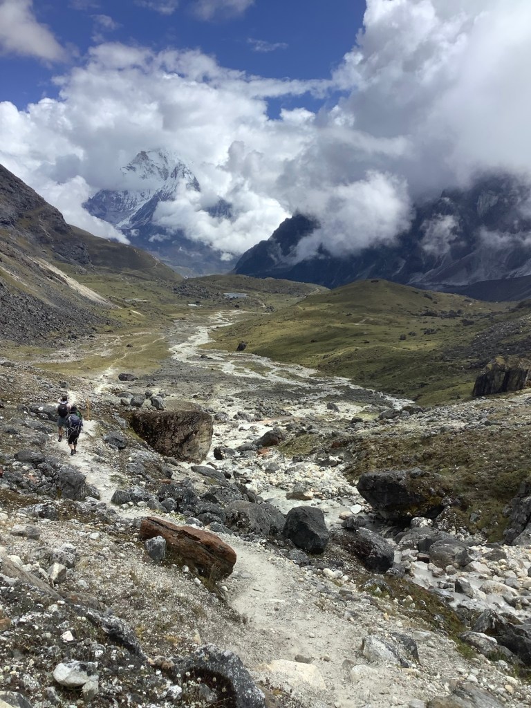
Looking down the valley, to the left of the last shot, was a fabulous combination of blue sky, high peak, troublesome white cloud, glacier, boulder strewn river bed and green mountainside. I really, really love this photo. War and peace in Nepal.
I felt great. Walking alone but with my buddies there.
Down the valley to my right rested the village of Pheriche, with its great farming terraces tucked under the valley wall. We may be traversing the mountain but we’re slowly heading down now. Danny is fighting against it temporarily and spectacularly, climbing a proper peak and a proper pass before succumbing to the gravitational pull of Kathmandu.
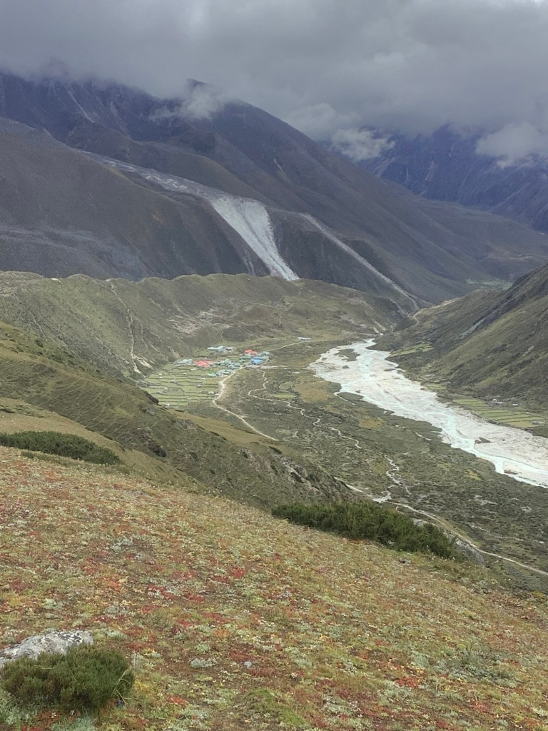
We reached the end of the mountainside and dropped over the ridge behind Pheriche, down to Dingboche.
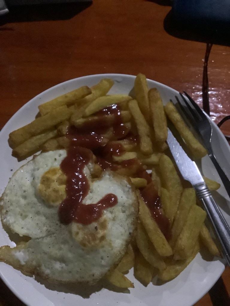
We checked in to our guest house and loafed for a couple of hours before supper. Then, joy of joys, I whacked down these two fried eggs with chippy chips (thinking of you mate) and a great ketchup. Beat that!
Tomorrow Amit goes back to Lobuche to meet Bikram and Danny Boy.
Nir and me, myself, I will have a rest day. The first real rest day of the entire trip.
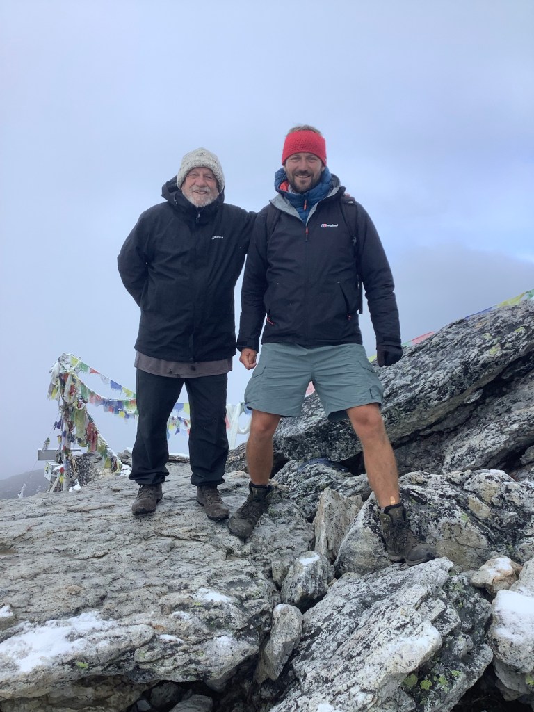
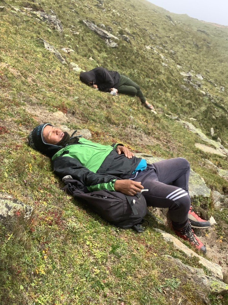
At various points of this trip people have come up to me and said ‘congratulations’. I soon realised that what they meant was ‘how unusual it is to see such an old bastard as you on this trek who hasn’t dropped dead yet’.
I am the oldest person on this circuit. I haven’t seen anyone close, and that astonishes me. It’s doable, but more than that it’s incredible. What is wrong with the elderly? Not that that includes me. No, course not! Late middle aged?
When it first happened it was a young, female, Nepalese guide who was leading a group up the hill to Namche. I overtook em and she said, ‘how old are you and can I have a photograph?’
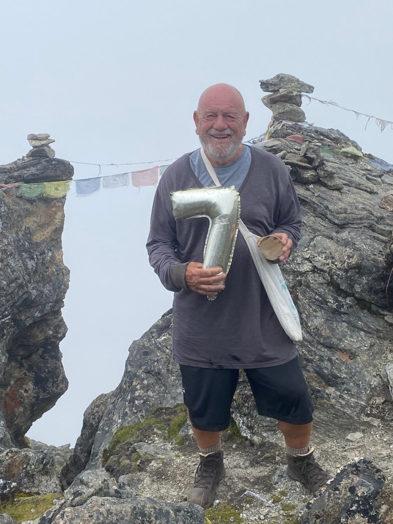
I obviously thought that she could see a touch of the George Clooney in the grey hairs poking out of my nostrils. I said, with a bit of a swagger, ‘I’m 70, why do you ask, and of course you can take a photo?’
She answered, ‘I want to persuade my grandmother to do a trek.’
She spotted the watery disappointment developing in my eyes and asked why I was crying.
So I smiled and said, ‘when a lovely flame dies, smoke gets in your eyes.’ Thank you Noel.
Night night.
Kala Patthar, Base Camp, Lobuche – Easy
We got up at 4.30am, feeling jaded and uncomfortable. It had been peeing it down heavily throughout the night and with corrugated iron roofs these places make a racket in the rain. Brahms’ third racket. Thanks John.
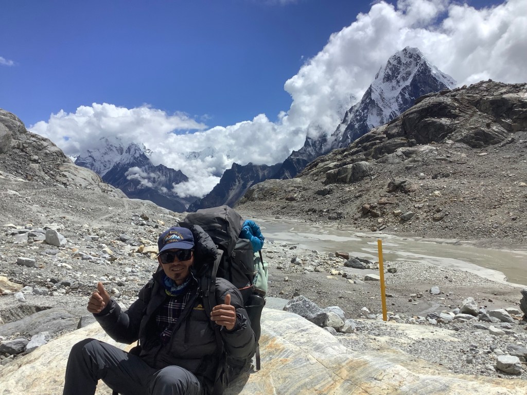
We are aiming to climb Kala Patthar, at around 18,300 feet the highest point I have ever climbed. Returning back to Gorak Shep we will trek up to Everest Base Camp and back before moving back down to Lobuche.
I must admit I had second thoughts at the prospect of a four hour climb up Kala Patthar in the dark, rain and cold. For the only time this trip I’d put on long trousers. I was disappointed that I’d let Dan down, as he was wearing his trademark tennis shorts.
The weather was not going to improve so we pushed off in the dark at 4.45, torches strapped to our noggins. Dan moved ahead and we overtook a large group of South Koreans. Although we are a few weeks away from peak season there were one or two groups at various heights in the dark in front of us. Visible by their head torches, weaving backwards and forwards along the footpath hairpins.
The cloud cleared slightly at the top as Dan got there, and it became light enough to take photos westwards, away from Everest, which was still well hidden.

We joined Dan shortly after, the last boulder strewn 20 yards taking a lot longer than it should have, as we huffed and puffed. We had made it. We were less than 2kms from the China border. Wonder if we could get sweet and sour chicken delivered?
We hung around in the half light, until the South Koreans caught up and swamped us at the summit, and it was apparent that we would not get a clear view of Everest. On the way down the helicopter landing point and memorial near the bottom were barely visible, as the cloud had intensified.
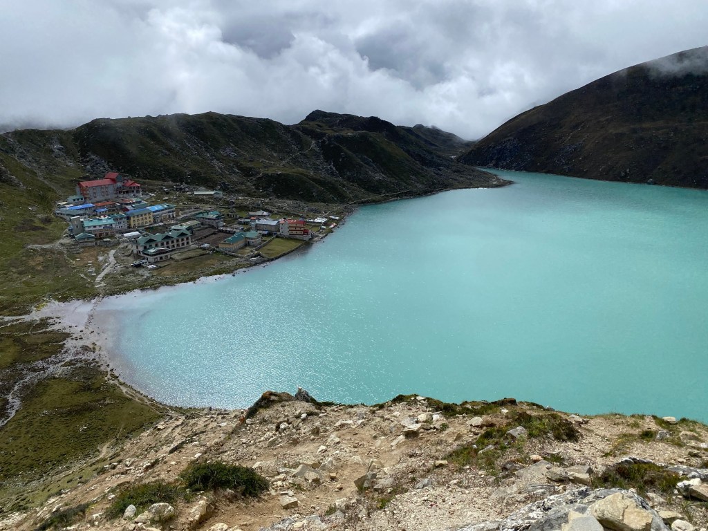
Looking down over the last ledge, Gorak Shep and its frozen lake were clearer.
Holing up in the guest house all that we could do was have breakfast and defrost. We packed our kit and left it in the rooms to collect it later. Then set off uphill again along the Khumbu glacier towards Everest old base camp. I’d put my shorts on and it was much warmer at around freezing point. There were a few groups, including around a dozen youngsters from Israel, but not as many as I had expected.
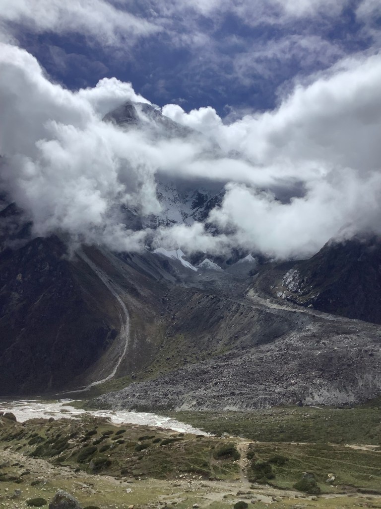
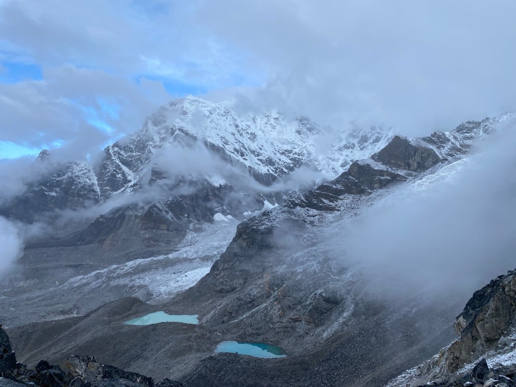
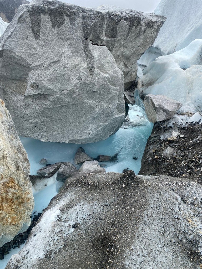
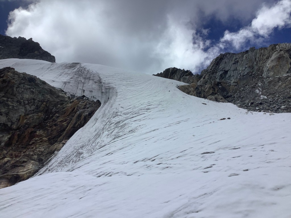
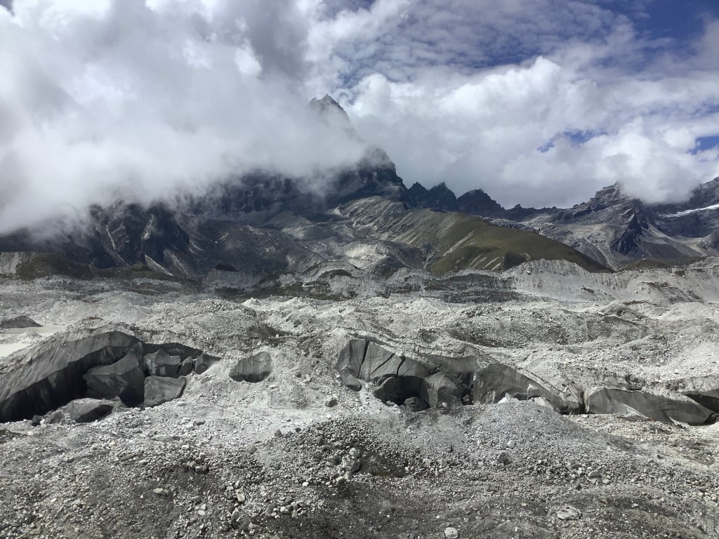
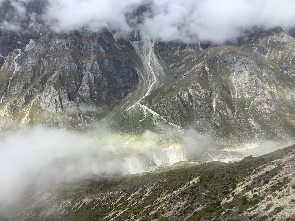
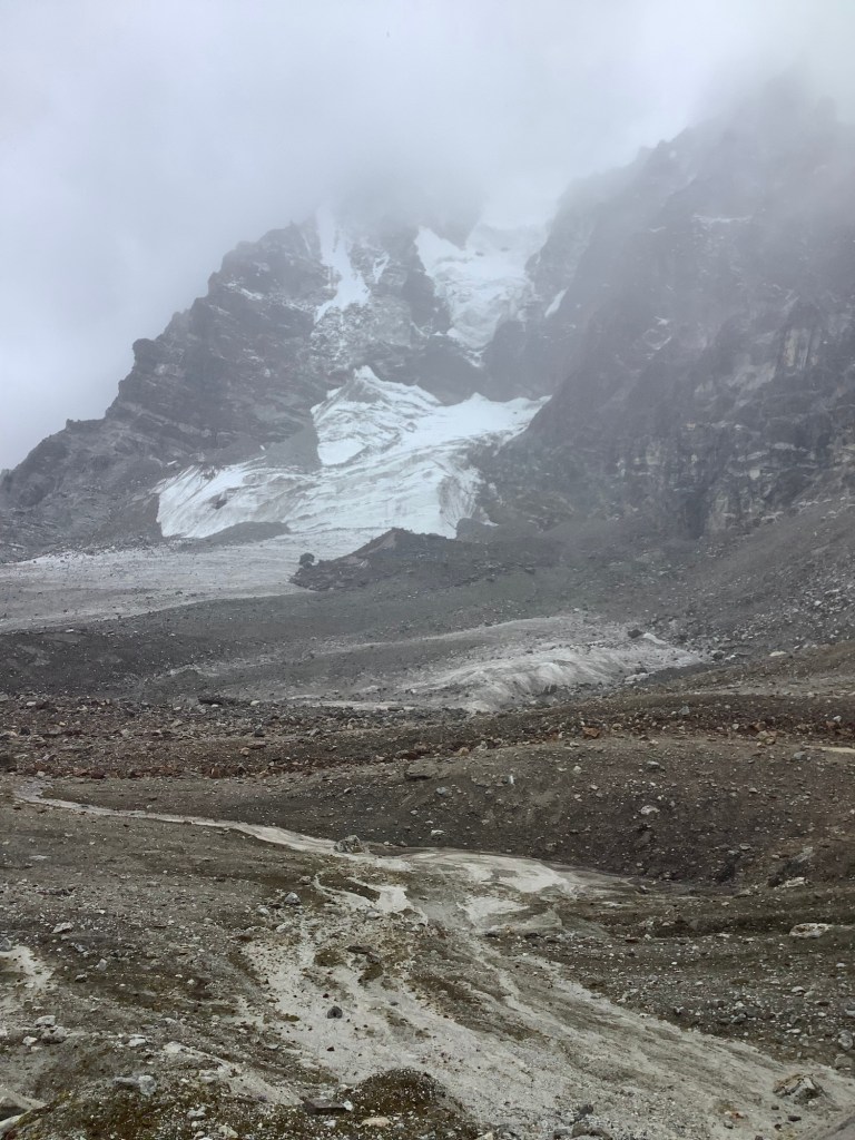
The glacier was what we had come to expect. With a huge wall of snow hanging over it halfway up Nuptse opposite us.
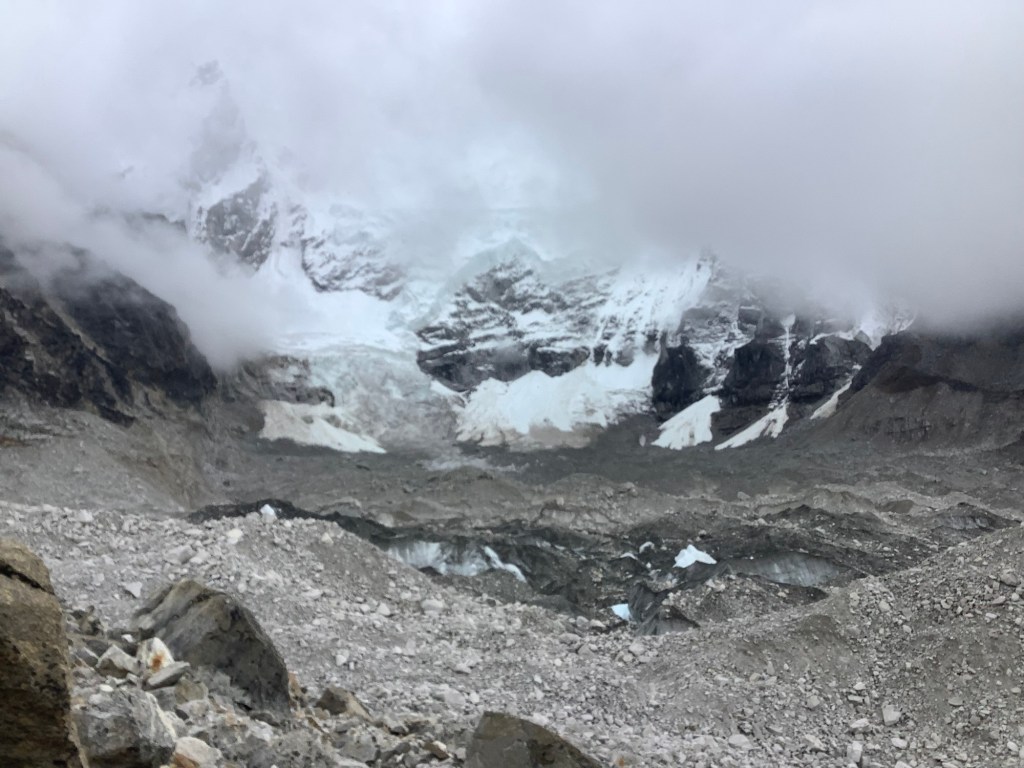
But this spectacular avalanche was way beyond our expectations! Dan had spotted some snow slippage starting and caught the main event on camera.
An avalanche hit Base Camp in 2015, killing 24 people. Triggered by an earthquake at the busiest time of the year for climbers hoping to summit Everest; April.
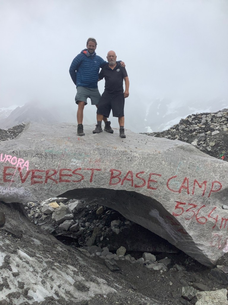
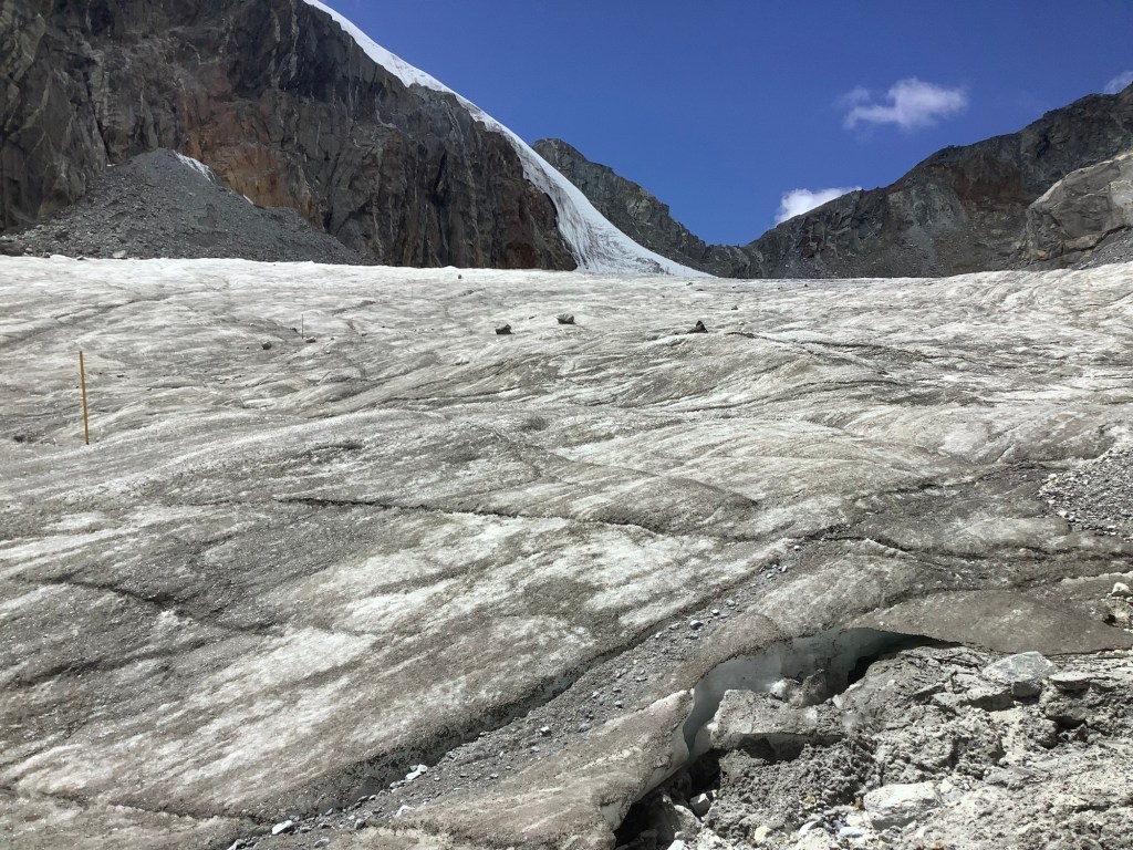
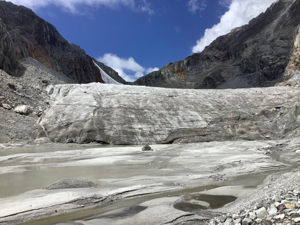
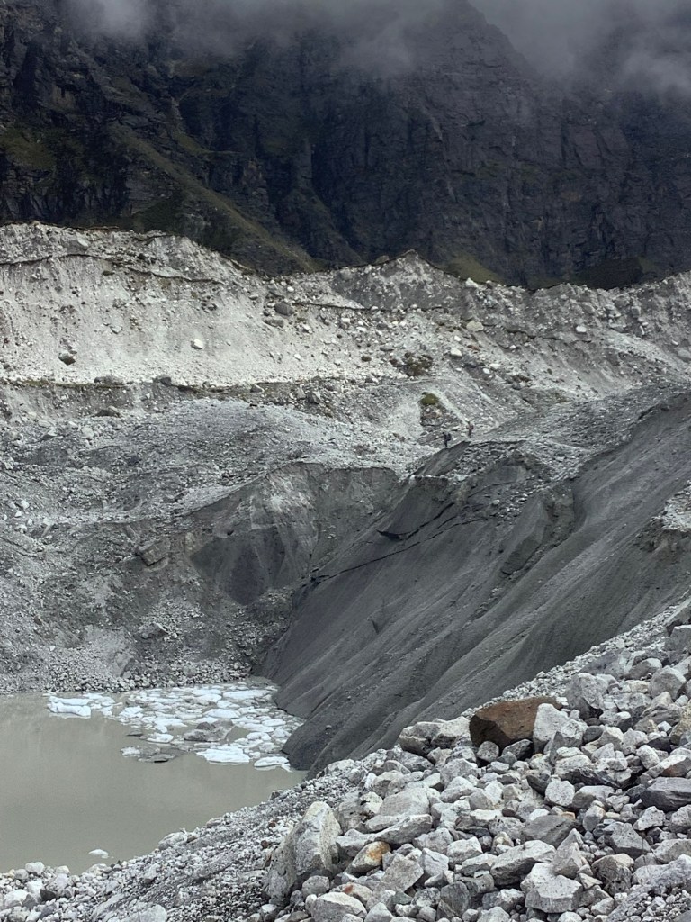
We made it comfortably up to Old Base Camp, despite our exertion up Kala Patthar this morning. The old place is noticeably closer to a deepening and widening crater filled with icy water. There is talk of not allowing people to it, due to the danger of collapse, although this is a particularly safe walk if you don’t arse about. Which means it’s dangerous for a twit like me. This is such a tourist money-spinner that I can’t see them scrubbing it.
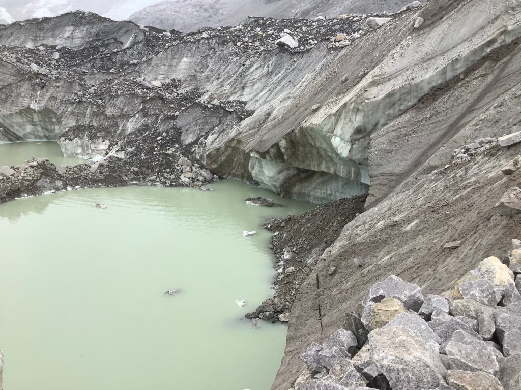
Popular with folk like us.
Best just to get an American heavy duty helicopter and shift the rock a bit. Nobody will notice.
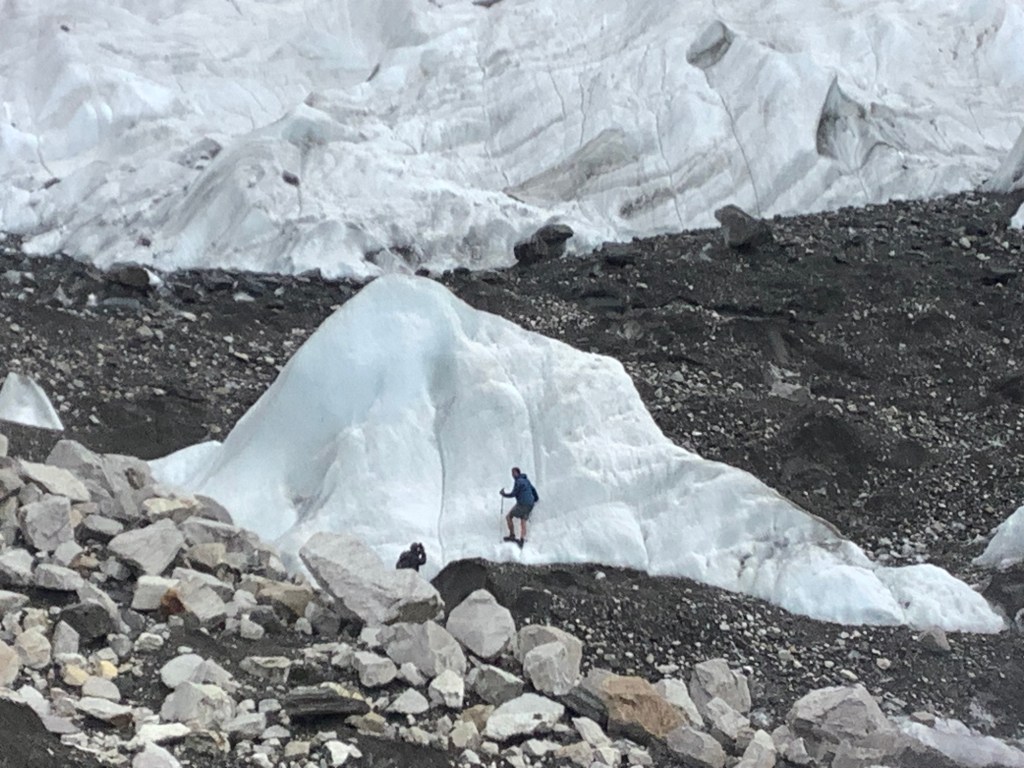
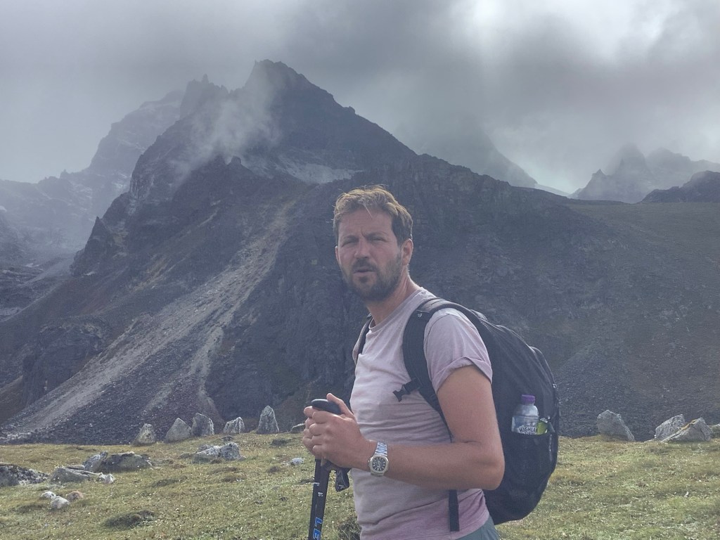
Dan wanted to waltz about on the glacier so I followed him some of the way
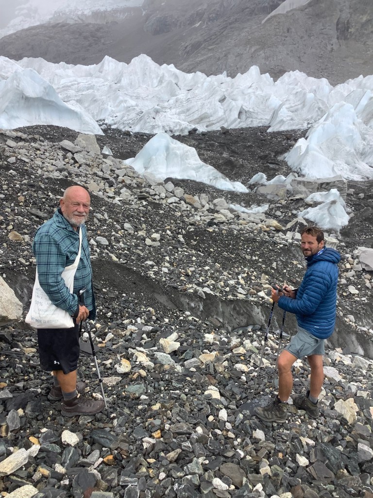
I’d promised our lass that I wouldn’t chuff about and risk my safety, which we all know is half the fun. And anyway I was a bit tired. So Dan wandered off with Bikram.
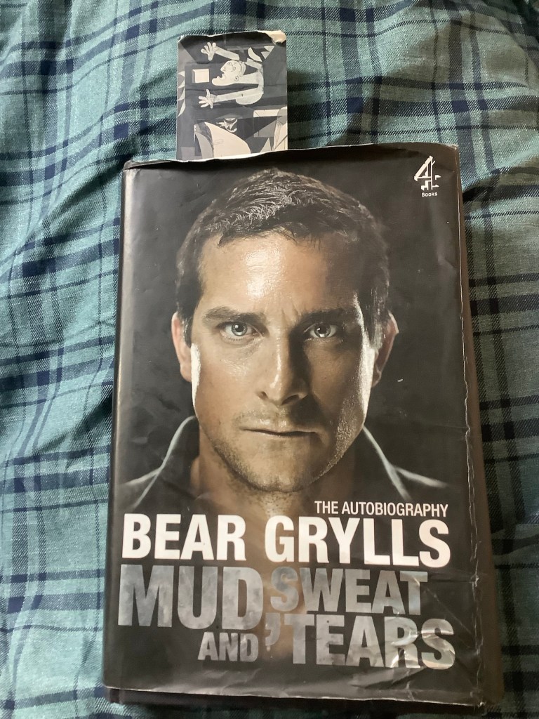
Funnily enough I’m just reading a Bear Grylls autobiography and he fell down a crevasse not far from here, only being saved from death by a relatively flimsy rope. I’m not sure what I think about Bear. In fairness he’s done some good stuff and had a very exciting life. Just a bit clean, if you know what I mean. However I love the girl who gave me the bookmark. One of my favourite paintings.
Heading back towards Gorak Shep Nir said that this was a local ambulance. When we’d left EBC we noticed an American kid looking ill. We’d spoken to his dad yesterday further down the valley and he must have organised an emergency call.
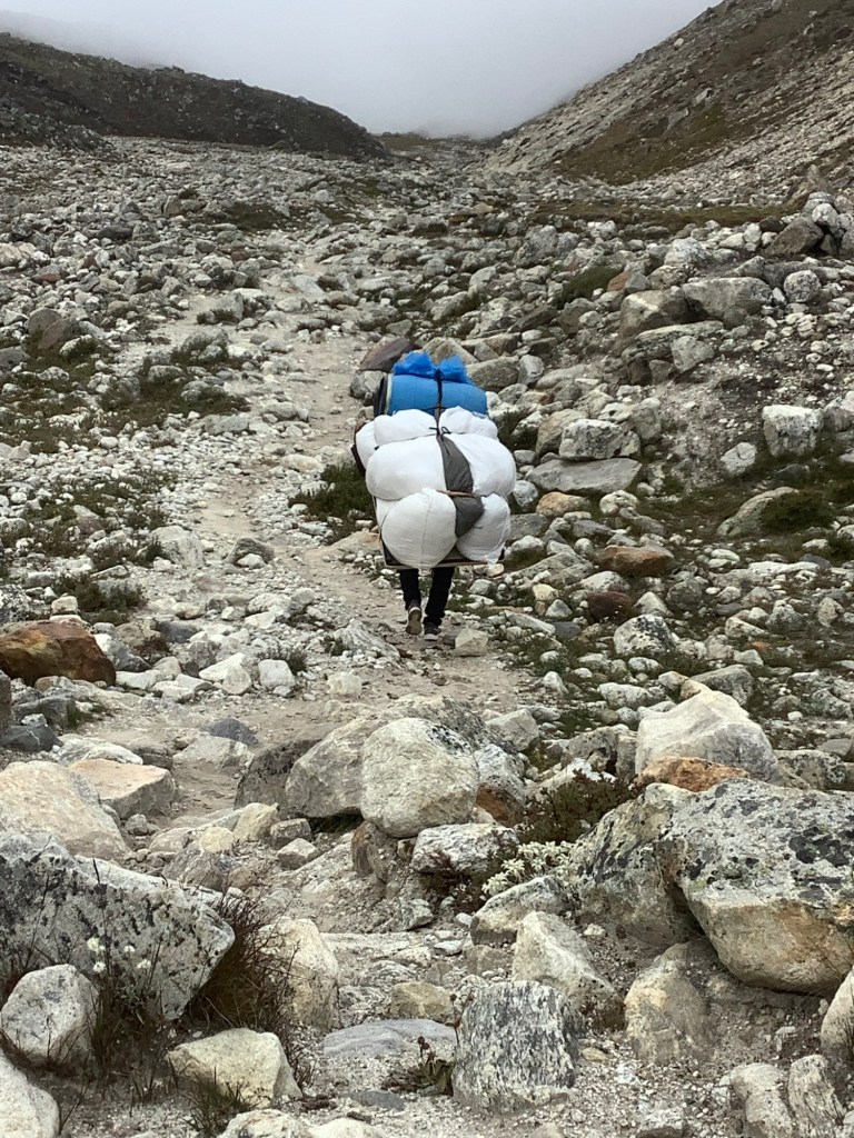
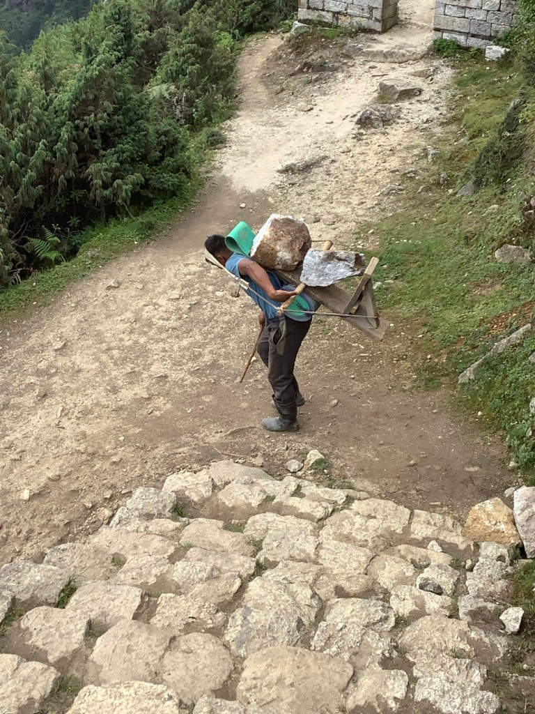
Lunch in Gorak Shep and then down to Lobuche. This isn’t a packhorse. It’s a packman.
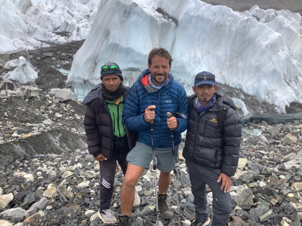
Tomorrow the party splits. Dan is keen to do some mountaineering and him and Bikram will walk up to Lobuche East High Camp with a mountaineering guide. At 1.00am the following morning the guide will wake Dan and take him to the summit of Lobuche East (20,800 feet) and back down to Lobuche, picking up Shane MacGowan on the way. Chapeau Daniel! I couldn’t do it. Well I could but we would need a High High Camp to spread the effort over three days or more!
I will be going down to Dingboche with Amit and Nir to have a rest day and to climb Nangkar Tshang. I think that without a mountaineering guide, and associated equipment, Nir and I will only be able to climb up to around 17,000 feet and not the more problematic summit.
I set out with the goal of:
Renjo La pass ✅
Cho La pass ✅
Kala Patthar ✅
Everest Base Camp again. ✅
Anything else is a bonus.
Night night.
Dzongla to Gorak Shep – A Trouble Halved
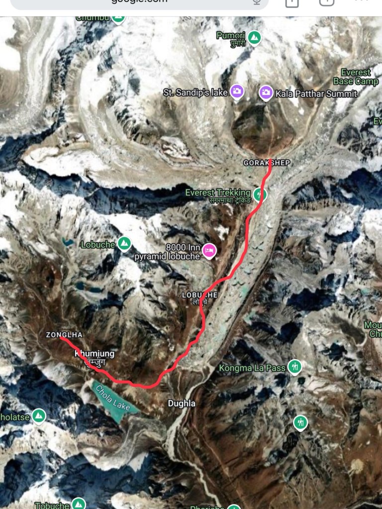
We’re getting quite good at this. Looking at our original schedule we had two days walking from Dzongla to Lobuche and Lobuche to Gorak Shep, up towards Everest Base Camp. We’ve decided to roll it into one.
Nepali spelling of place names is not always consistent. Dzongla or Zongla is where we ended up last night, tired but elated after a great Cho La crossing. Today’s walk is in red on the map below. We’re effectively walking around Lobuche peak to Lobuche village for lunch. The grey canal to the right of the red line is the Khumbu glacier. After lunch we’re walking beside and along the glacier up to Gorak Shep.
I hadn’t come across the 8000 Inn, Pyramid Lobuche before. Up in the hills. One review says ‘It is really clean and pleasant compared to the survivable but fairly grim regular lodges, and we were actually toasty at night with electric blankets’. Well bully for you, soft bedwetter. Why not stay in the other regular lodges like we do where previous occupants have already wet your bed for you!
We set off with the warm sun on our faces.
Feeling on top of the world Ma. Thanks Jimmy.
Even the lower glens, at a modest 16,000 feet, are beautifully remote.
We’re getting fitter and fitter, although the lack of oxygen really grabs and squeezes your heart and lungs. Your whole being becomes only burning legs and rapidly pumping heart and lungs, going uphill, and a relaxed, sauntering, coxcomb appreciating the views, going downhill.
Very soon we were high above the banks of Chola Lake and working hard. The altitude difference between breakfast and lunch was negligible, a bit like Minehead to Poole on the South West Coast Path, but the ups and downs to get you there are like the 21st Century history of Sheffield United.
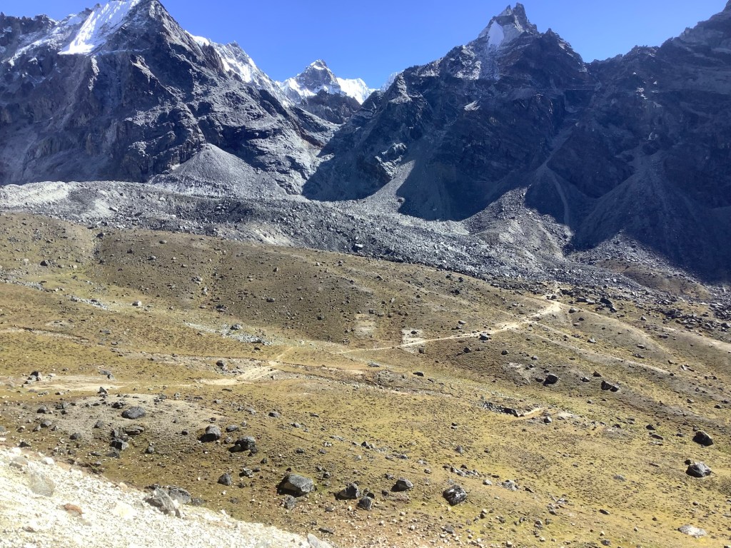
Looking at the map above, the vast majority of trekkers come up the valley from the south that leads up to Dughla and on to Lobuche. Our track came round from the west and joined the main trekking route just south of Lobuche. From here on was partly familiar territory, due to mine and Killer’s trek two years ago. This is the view looking down towards the main trekking route and around.
Before too long we had veered north and could see quite a few trekkers walking up the other side of the valley on the main track, and the bottom of the Khumbu Glacier, in a high wall of ice and terminal moraine.

Dan is intent on saving the cost of recharging his appliances, so he brought along a solar recharging unit to carry on the back of his rucksack. It’s only fully effective if at 90 degrees to the sun. See you later matey!

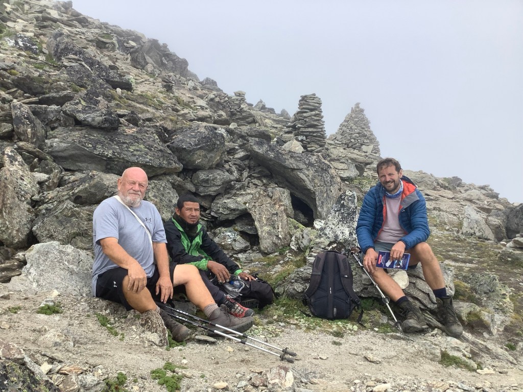
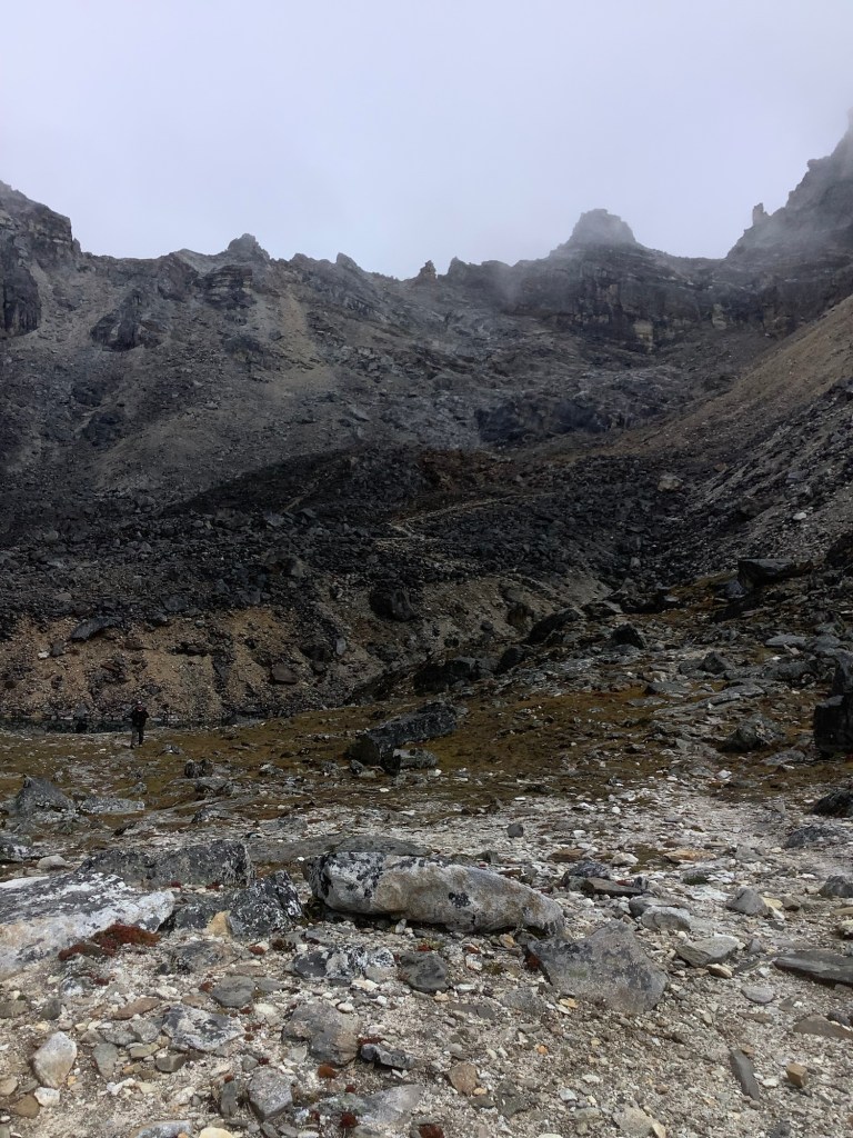
We arrived in Lobuche for lunch and it was a good place. We would be staying here tomorrow night. The staff were attentive and the food was good.
Then we set off for Gorak Shep. This was a walk along the moraine before moving over and walking along the glacier itself. It would take around three hours to reach there and the weather had dipped. If the views were going to be good then we intended to dump our stuff at the guest house and climb Kala Patthar to see the sunset over Everest.
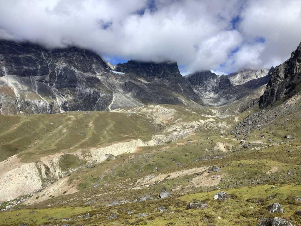
The view from the top of the moraine down the glacier was like a linear Baked Alaska. Strangely it reminded me of when I worked in the steel mills in Sheffield. The molten metal running down a channel from the furnace. Completely contained, in theory. Like the glacier.
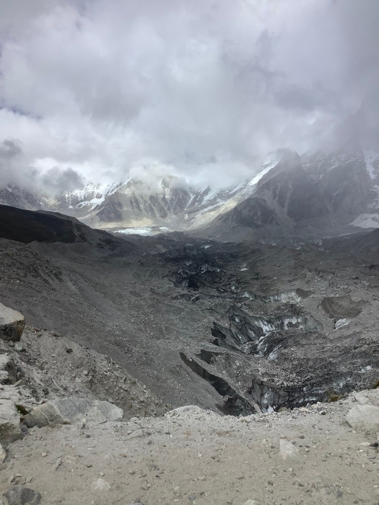
Looking up the glacier the white colouring below the mountains was chunks of ice fallen from the Khumbu Icefall. We intended to see them tomorrow.
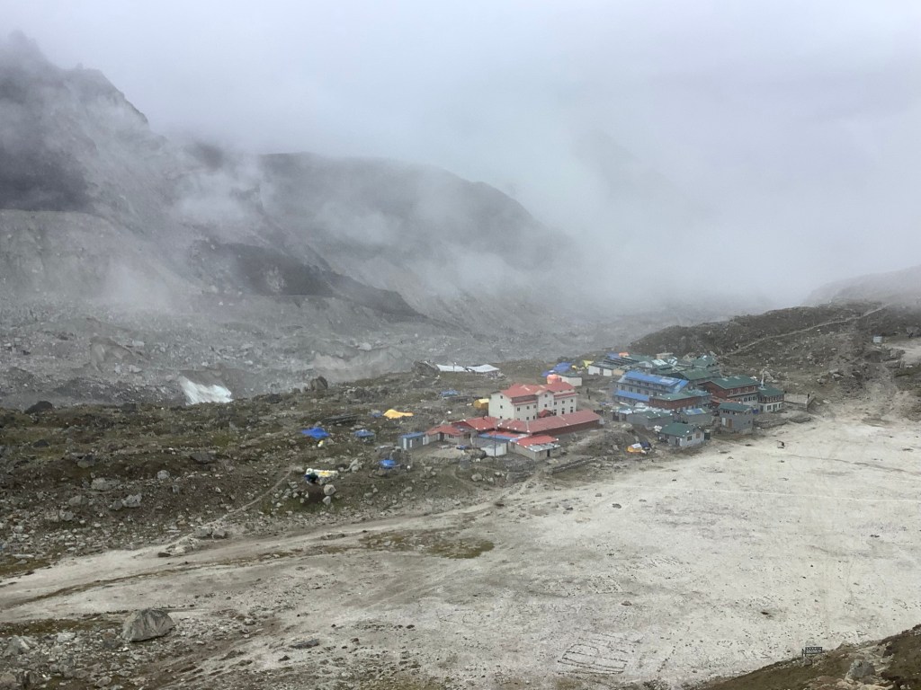
We arrived in Gorak Shep mid-afternoon. This is the highest trekkers’ accommodation on the Everest Base Camp route. In case photos of Dan and myself in shorts and T shirts confuses you meteorologically, the flat sand coloured area surrounding Gorak Shep is a frozen lake. It is covered by sand.
As we sat in our guest house the viewing conditions were not clear, so we decided to climb Kala Patthar early tomorrow morning. The summit is just visible behind and to the right of the peak in the middle. Its height seems to be the subject of some debate. Likely to be around 18,300 feet it will be the highest I’ve been if I get to the top.

To quote Wiki, The Kala Patthar hike is considered a challenging hike in the Everest region of Nepal. It requires a moderate to high level of fitness, endurance, and some prior hiking experience at high altitudes.
As one of the few septuagenarians to try it this year then I can assure you, my dear darling family and friends. It will be a piece of piss!! You’re not dealing with a soft southern bedwetter here matey boys and girls. I’m a northerner.
Hold on, I didn’t mean that I’m a soft, northern bedwetter I meant I’m a northerner and then by definition not a bedwetter. Well, maybe once or twice. Under exceptional circumstances. No I will not specify the circumstances. Well ok then. I was upset because United lost.
Night night.
The Cho La Pass – A Walk in the Park
Sagarmatha National Park actually.
I had a poor night’s sleep and there was nothing for breakfast other than rice pudding or porridge. I had rice pudding with honey. The lad made the mistake of passing us the honey jar, which we burgled, spooning lots into our dishes.
Setting off on a sunny autumn day was a delight. It rattled the cobwebs away.
We were lucky that our path took us up through the valley that looked like Grindsbrook, and it was in the shadow. No sweat. This was a route of false horizons, with quite a few skylines appearing, only to reveal another skyline which wasn’t Cho La.
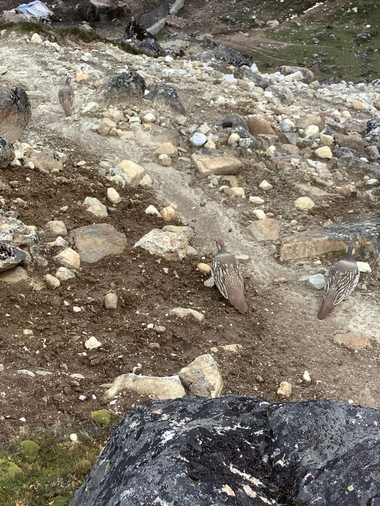
Lots of wild birds, mostly Snow Cocks, strutting around us and flying past.
By the first real incline Dan had charged ahead, and missed out on my disbursement of jelly babies. Nir loves them, but not as much as he loves Kendal Mint Cake.
We haven’t seen a shower or warm water for 4 days, but last night’s guest house had antibacterial gel dispensers on the table. So before breakfast this morning I went in to the common room, squirted a handful into my palm and went back to my room. I laced it over my stinky nether regions and it stung like hell but I felt a lot cleaner. I hope you aren’t eating.
Back to Cho La.
I was enjoying this section of the trek and I knew that, however difficult I found it, I would climb all 17,700 feet of Cho La.
We caught up with Dan and had a break in the sun which by this time shone further down the valley as we had walked up to meet it. Nir gave Dan a seminar on the local peaks.
We climbed and we climbed, Oh, how we climbed, My, how we climbed.
Thanks Eno.
We must be at the right altitude soon, I thought to myself in a curious way. We nearly were. But the next brow revealed a deep drop down into a valley, before our path rose up again to distant Cho La.
This vid puts it in perspective.
We dropped down to the valley floor and then started the long climb up. The usual stuff, huffing, puffing, counting steps and resting. Some people came past the other way and some asked me my age. I said it was an incredibly rude question to ask a 70 year old. I’m the oldest they’ve seen on this trek by a good margin but so what.
Let’s put this into perspective. We’re tourists. We stay in houses, not tents. We eat at least twice a day. We’ve got porters to carry our heavy stuff, otherwise we’d struggle to do this. We’ve got a guide who keeps us safe and who can bail us out of the shit, like he did on the last trip here.
But it didn’t stop the climb hurting for an old get. And it was rough.
As we got closer to the wall Dan and Amit went ahead and I made steady, slow shuffles and step ups. Nir and Bikram drop back to give me my space so I don’t feel like I’m holding them back.
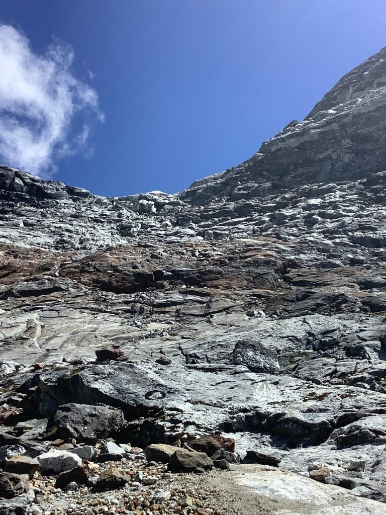
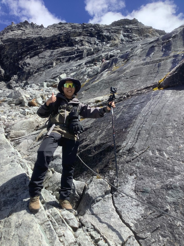
I realised that the route went past the base of the wall to the far side and that someone had fixed wires to the rock face. Whilst some had rusted and come away the bulk of them were sound. Even so it was a challenge and this is higher and steeper than it seems in the photo.
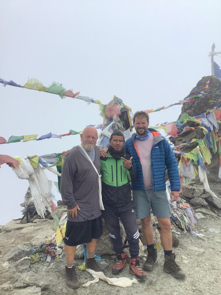
As I was about to pull myself up on a wire a group came down, so I let them pass. The last one was a young woman waltzing easily down with a GoPro camera on a stick. She was filming, and then I realised she was filming me. She said into the camera microphone,”this is Uncle Dave, he is seventy years old and he is very strong. I am coming down to give him a hug”.
We’ll blow me down! I asked her name and where she was from. She said she was Marilou from Singapore. She descended and said, “now I give you a hug”. I was taken aback really, but it would have been rude to refuse. I said that would take the pain of the climb away and she duly obliged. What a nice lass.
As she slipped away to her party I looked up to the next ledge, about 60 feet up, and there were Amit and Dan pissing themselves laughing. On the way down she said to Dan that he was big and strong. He said to her that was nothing, at the bottom of the climb was Uncle Dave, 70 years old and strong as an ox. He also added that I have a successful you tube channel so she should get down there and give me a hug. I felt like Harvey Weinstein. That’s verging on procurement. Nice lass though and nicely distanced but friendly hug. God bless, Marilou.
Nir and Bikram caught me up now we were proper climbing, although most of it was made safe by the wires. They made sure I didn’t do anything daft, particularly as there were patches of ice on the rock higher up and little pockets of snow. They were also happy to wait whilst I puffed and wheezed at frequent breather breaks. After nearly an hour the rock face became much less steep and I realised I could make the top in one go.
Looking to the side of the pass, over the back, was a steep ice and snow sheet.
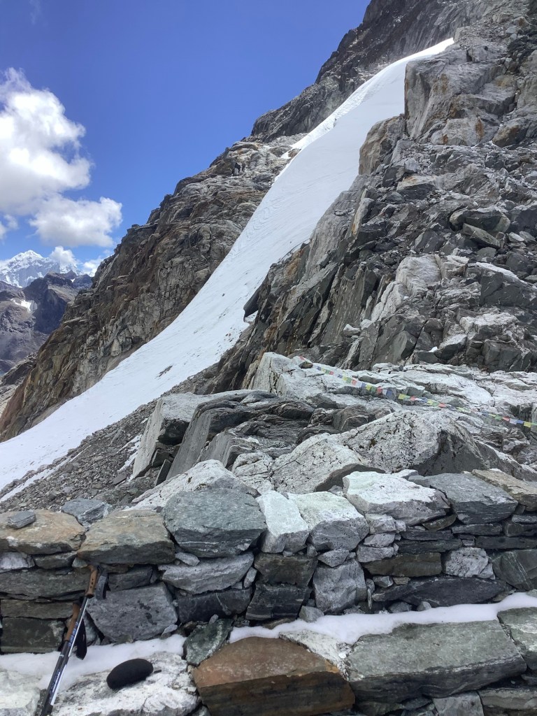
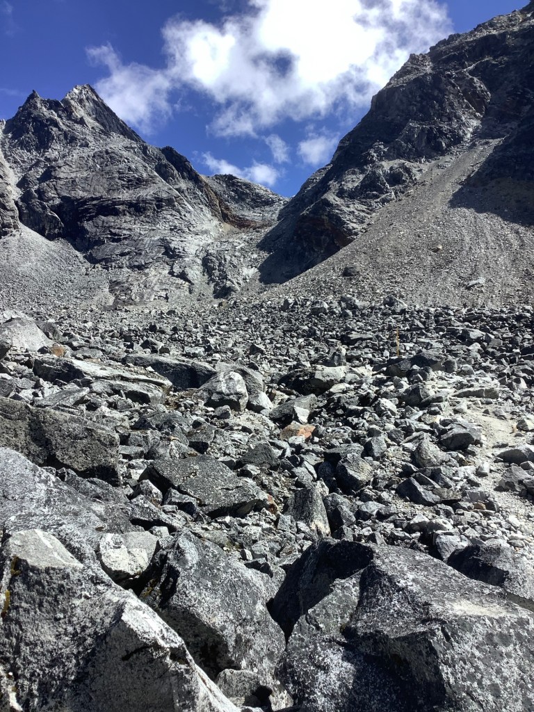
The route in front of us dropped down, again with wires, but there was considerable snow and ice for the foreseeable. What I didn’t realise was that this was another glacier of a very different kind.

We had two pairs of crampons (boot spikes) between the five of us. Nir fitted his to my boots and Dan opted to proceed without his crampons. I was so glad that I had them. I could clamber down the ice with confidence and made good time. On advice from Nawaraj I had left my brand new Grivel spikes in Kathmandu!
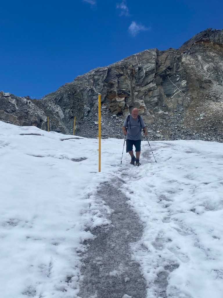
The ice turned to glacier, and it was very smooth with small streams running on the surface. We couldn’t assess how deep the ice was but, unlike the bigger, lower glaciers, this one didn’t have any rocks on top.
Then the streams started dipping into crevasses and disappearing. But you could still hear them and you knew they were somewhere underneath you. I hoped the tunnel roofs I was walking over didn’t collapse. Like this one had.
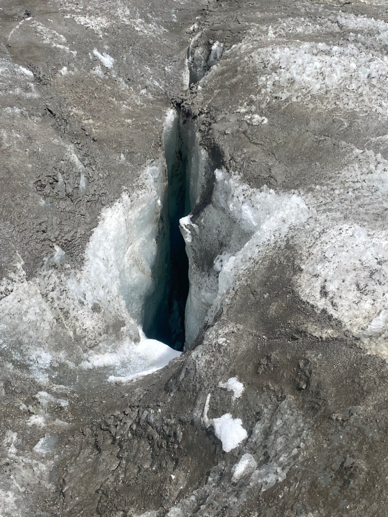
Where do you step? Where Nir went and keep your fingers crossed.
But the side views of the mountains still impressed me despite my predicament.
At last we scrambled off the glacier at its end.
And all felt relieved.
Now for a power drive down to Dzongla, our next destination. Scree scrambles and crossing streams that became rivers on stepping stones that we sometimes had to chuck in.
And away…….
We arrived in Djongla, ate in Djongla and we’ll sleep in Djongla.
Night night.
Gokyo to Dragnag
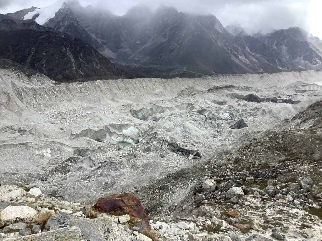
The Ngozumpo Glacier, which we’re crossing today, shoved billions of tons of earth and rocks to one side as it grew and slowly moved down the valley that it was shaping. This formed two high ridges either side of the glacier, which are being revealed more as the glacier shrinks. On the outside of these ridges, called lateral moraines, the tiny villages of Gokyo on the west, and Dragnag on the east were built.
They’re largely places for trekkers to stay, with the locals flitting to Namche or Kathmandu in winter.
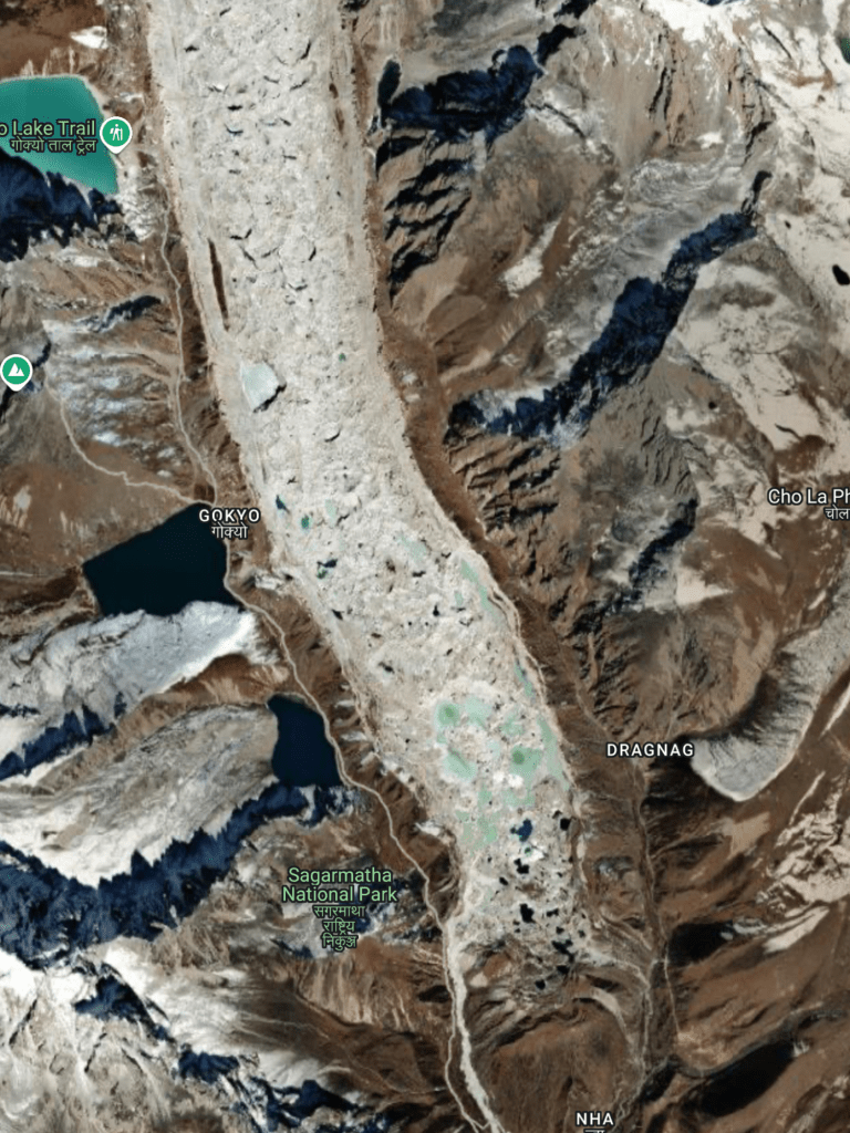
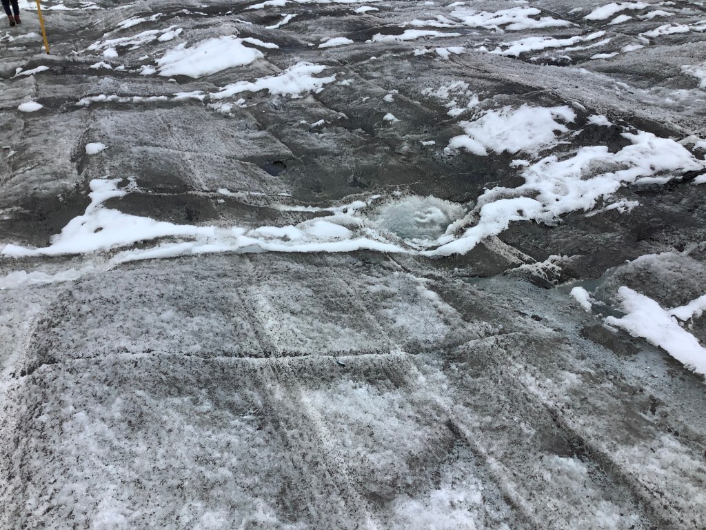
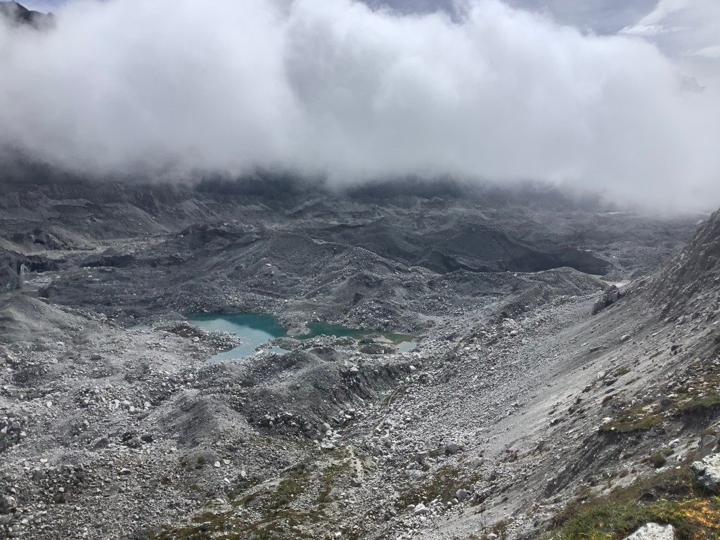
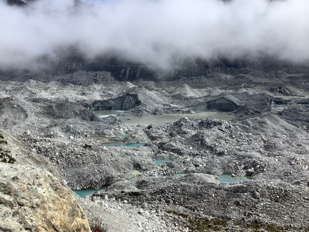
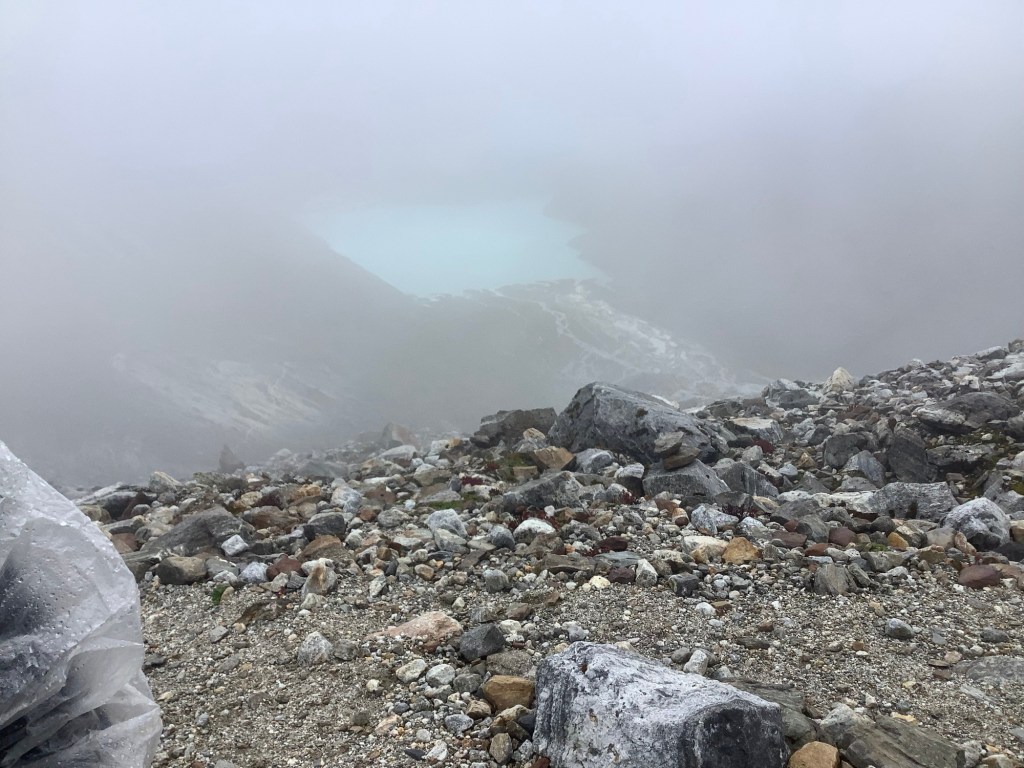
The glacier is retreating and is quite unstable. There is a recognised safe route across it from Gokyo to Dragnag, but this changes weekly. Looking at the picture of the glacier above the light blue areas are ponds and even lakes where melting ice accumulates. Some water filters down fissures in the ice and runs along and down until it reaches the bottom of the glacier and spills out. This causes caves filled with water that can collapse, forming a crater on the surface of the glacier that fills with water. If any path passed over this area then it needs to be rerouted.
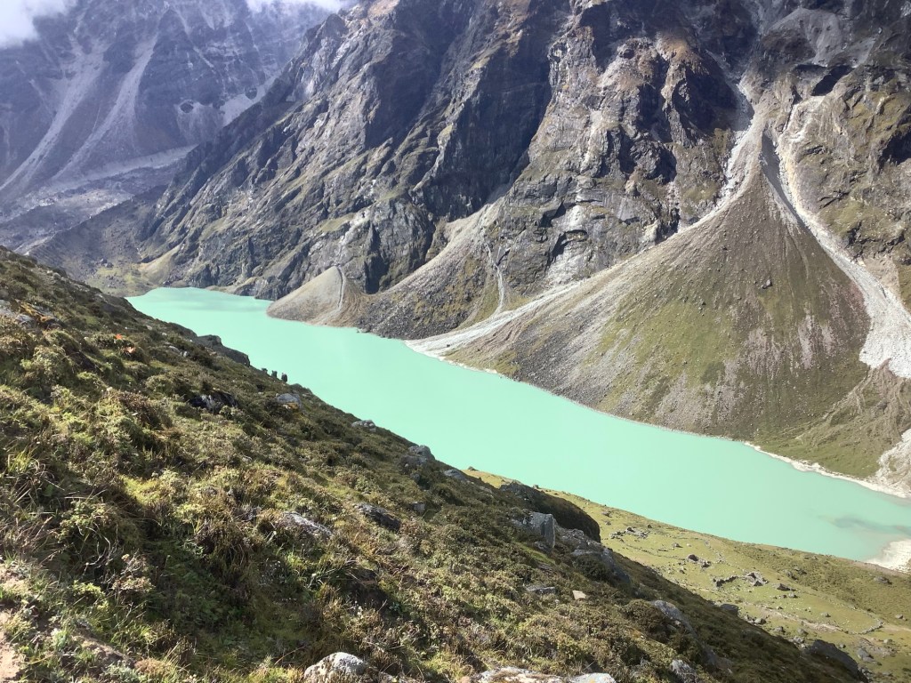
Leaving Gokyo at 9am the weather was good. The lake in front of Gokyo looked great.
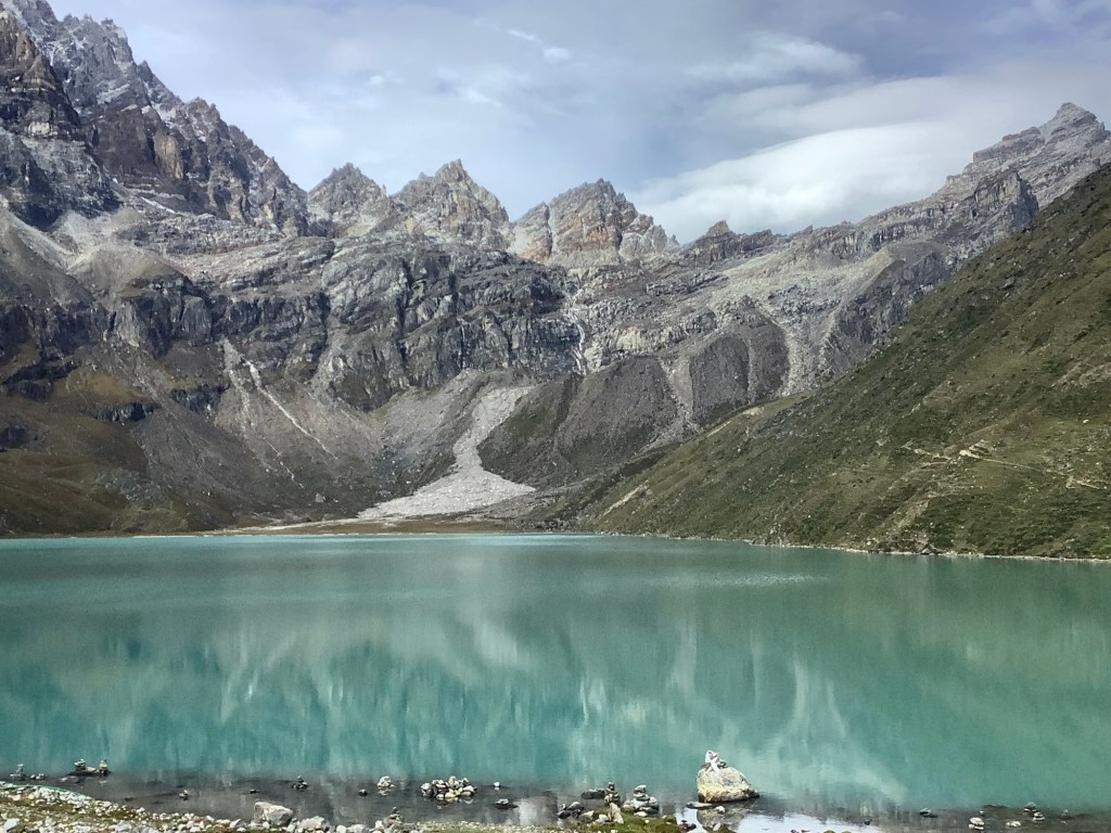
We climbed up the lateral moraine behind Gokyo and poked our noses over the edge. Southwards was where the most recent path had been, and our lads did a bit of a recce to see how we could get down to the glacier itself.
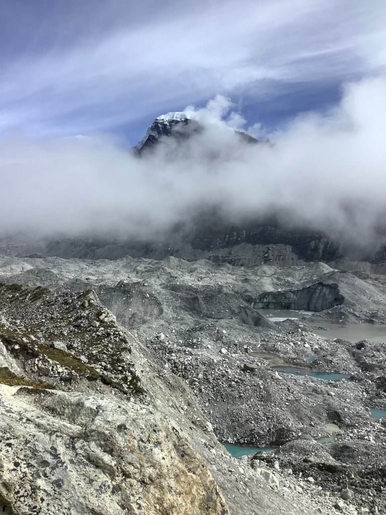
Looking northwards the mountains were peeping through cloud.
These larger glaciers have a lot of soil and rocks on their surface, to the extent that sometimes you would think you’re walking on a mountainside. Lurking sometimes many metres below is ice. At this point on the glacier the boulder and rock covering is quite thin. On those two mounds in the middle distance there is a dark covering like a roof, rocks and earth, and paler ice underneath.
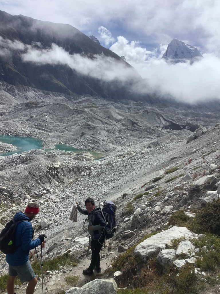
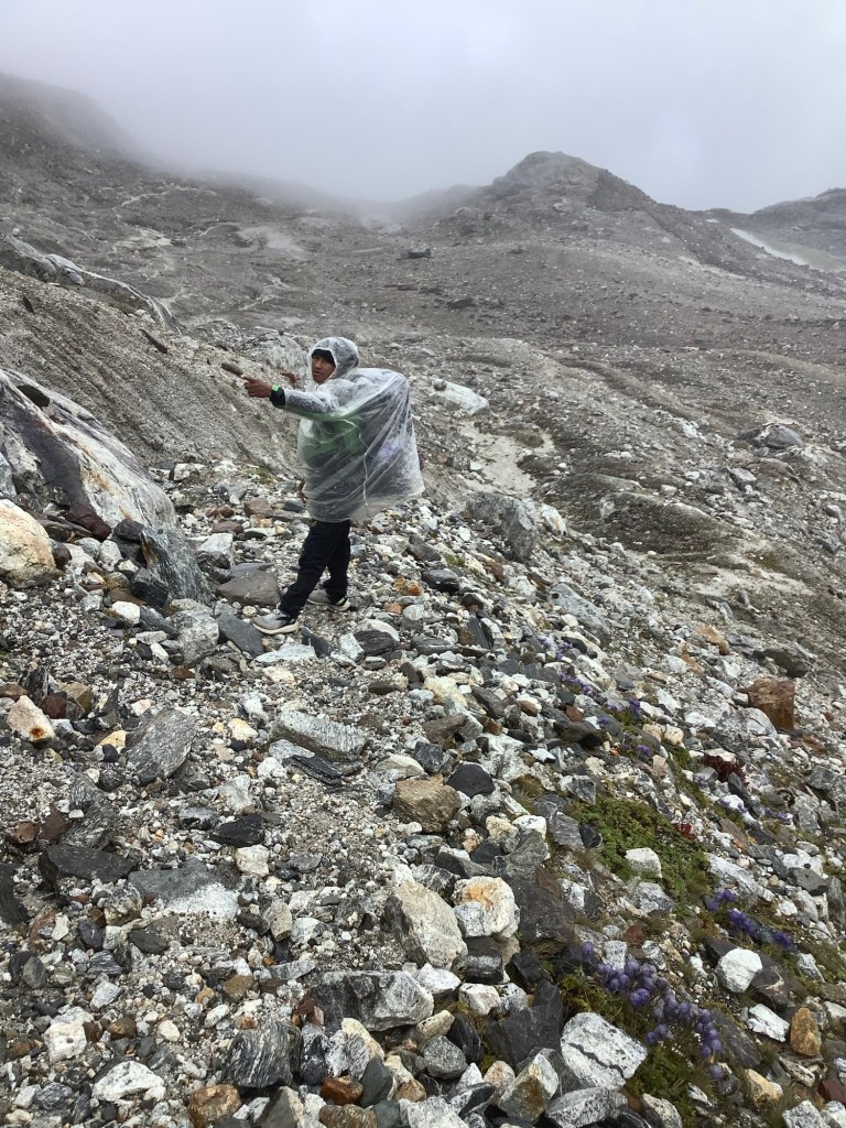
Amit found a route down. The problem with this section is that the lateral moraine, which we had to climb down, is falling onto the side of the shrinking glacier. And one area that we had to walk under was just waiting to tumble.
We climbed down , following our leader Nir. In Nir we trust.
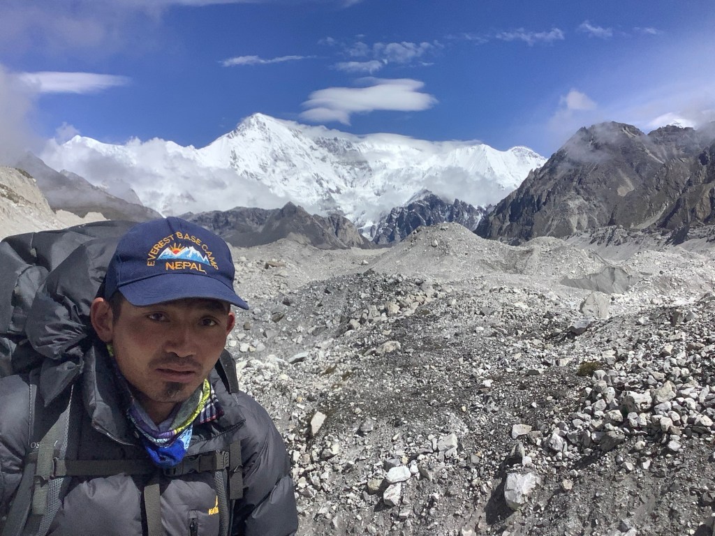
Shane MacGowan (aka Bikram) looked intent as we pressed ahead, with Cho Oyu, the sixth highest mountain in the world, just above his left shoulder. He’s a good lad. I like him.
Cutting across towards the east side the path was well trodden, but the crevasses and ice caves had swallowed it.
Nir instinctively found the most recent route, although Dan and Amit wanted to move ahead quickly. I shouted across to Dan that they were stood on an overhang of ice that was seriously cracked and waiting to sink down into the freezing water of the crater.
Dan shouted back that it made it more exciting. Crazy cookie!
All the time there is the sound of rocks, boulders and ice falling into water or chasms. I was glad to get to the eastern moraine and climb up its side. Looking back this is a primal wasteland. A potentially dangerous one too.
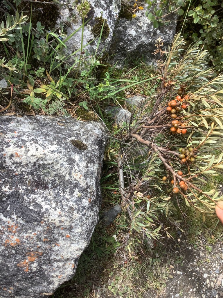
Nir and Bikram gave me a nature lesson on the track down to Dragnag. The Himalayan Pica in these parts isn’t a mouse, it‘s a small rabbit type creature, and we saw one on the rocks. There is a Yellow Bellied Weasel, and we spotted one in a dry stone wall. And this is a local berry, which the locals locally squeeze to get the juice out. Can’t remember its name but it’s great. It tastes sweet and sour at the same time. I had loads.
Just by Dragnag the valley leading up to Cho La pass struck off to the east. It so reminded me of Grindsbrook, just up from Edale, where Deborah, my sister and I carted our dad’s ashes and scattered them on the edge of Kinder Scout. Kinder is formed of gritstone and this is limestone, but the shape of the hill and valley felt very similar.
Here’s dad’s resting place.
Well they look a bit like each other.
Night night.
A Rest Day Climbing Gokyo Ri (Second blog today)
The kind of blog title that they call an oxymoron. But we are getting up later, breakfast at 7.30, and we will be climbing without rucksacks. A bit resty.
This satellite map shows this region.
The redline is the route from Renjo La pass yesterday down to Gokyo. The blue line is the route up to Gokyo Ri today, the most accessible of the local peaks and round about the same height as Renjo La. The grey mass in a broad sweep down the photo is the Ngozumba glacier. The green line is roughly the route we are taking tomorrow to Dragnag.

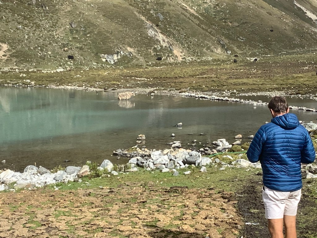
Today started brightly and yaks were wading in the lake.
We set off for Gokyo Ri, not a long route but a steep and high one. We were feeling so much better than yesterday and the going was easier.
Part way up the mountain our hardy Nepali lads decided to get a kip. How come the Gurkhas are one of the best fighting regiments in the world but two of its potential members can’t walk up a hill without a sleep?
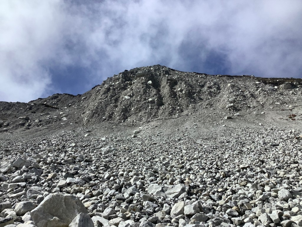
The grass and vegetation petered out and we were scrambling up dirt and rocks higher up, which got even steeper.
Me and Dan kept a discipline of 50 steps and a standing break, with a sitting break every 200 steps. Much, much stronger than yesterday and we were soon near the top.
One more push and we cleared it, although the cloud had come up from the valleys and the view was limited!

We felt more for the mountain because we couldn’t see anything else! And we had a bit of a celebration, feeling uplifted by our efforts and making it up in three and a half hours.
It’s amazing that the only two pieces of detritus indicated my age.
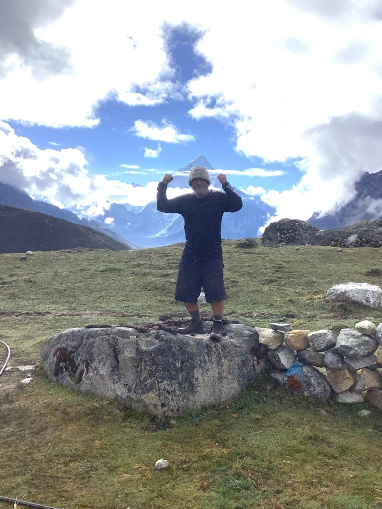
The three musketeers.
And we secured a very quick return to Gokyo, where the lads played cards and I blogged.

Another great day on this fantastic trek.
Night night.
Renjo La ou Pas
We got up early and met over breakfast. Chapati and eggs. Do we have a much needed rest day in this place? Or do we make a pitch for Renjo La, the first of our passes? In French, Renjo La ou pas? Aren’t I a clever little chap. Thank you Lord for sending me such a son, such a son, such a son, such a bum. Thanks Kevin.
We’ve seen some great wild life, eagles, beautiful little golden robins, Tibetan snow cock, wild goats, a high altitude mouse called a pica and a yeti. Yeti Dave? Yep, I’ve shared a room with Dan and seen him with his make up off.
We decided to go for Renjo La. Looking down the valley the morning was dry but cloudy as we set off at a steep incline.
The first half hour is very tough, gasping and aching, and then the rest is the same. It’s difficult to describe how we felt. I was lucky only to be carrying a day sack loaded with water.
To help avoid altitude sickness one needs to drink a lot of water and pee out something. Pee I suppose. But it’s something like carbon dioxide that causes the sickness and water drains it.
I didn’t think I could make it. At points the slope evened a bit and we could walk and breathe without too much pain. Count your steps. Try to do 20 without a stop. Short shuffles. Avoid steps and stick to slope. The pass is somewhere behind Dan.
It’s up there. Nir will find it. He’s crossed it dozens of times.
And eventually the final wall appeared in front of us. Dizzy and fatigued the sight of this brought quite a bit of demoralisation to two puffing Yorkshire Billies. The pass is just to the left of the notch in the middle.
It sure looks steep Danny Boy but if anybody can climb this maggot farmer then it’s me and you! May the Lord be with us on this day. Amen and pass me a semi automatic rifle in case we meet a group of people we don’t like.
It started to rain, and as we dragged ourselves upward the rain turned to snow. Not heavy snow but pellets of snow that didn’t settle but nevertheless made themselves felt.
Looking back down, the lake below which we’d passed an hour ago was still visible in the cloud.

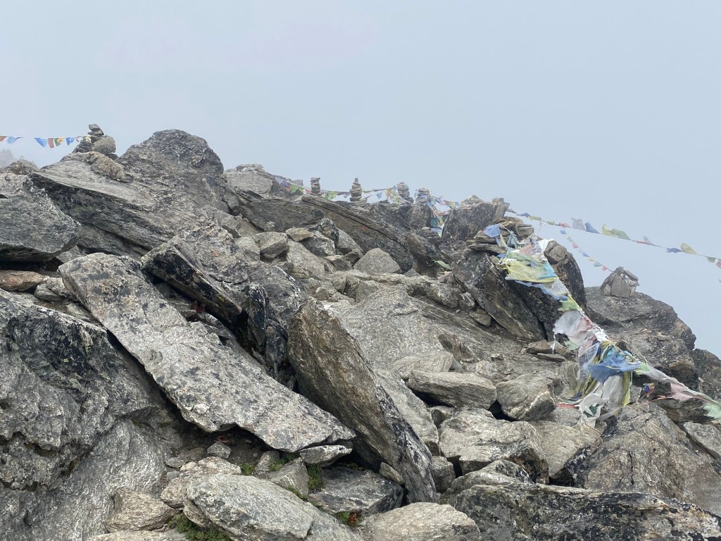
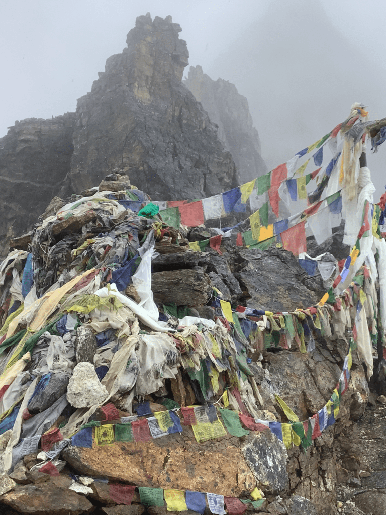
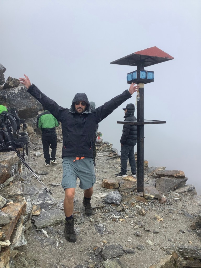
We shuffled and as we got higher the path became paved with rocks. This made it so much safer than we had thought. Only one place where a small landslide forced us out to the edge of the abyss, and that was passed safely. A few steps and a breather, repeated a hundred times, and we were there at the top. 17,537 feet.
Dan was elated. I was relieved.
And the view was amazing.
Now we had a long journey downhill to Gokyo, and this was not an easy track either. But we were fuelled by having achieved the top and made it in two days less than were scheduled. We dragged out the reserves of energy like men possessed. Yomping as I used to do in the special forces, which I am not allowed to write more about. (Special Forces my arse you bald, fat, elderly midget).
We sped down a boulder covered glacier with hanging glaciers either side.
But had time to stop to admire beautiful flowers. What sensitive souls we are.

Gokyo lake appeared through the clouds, like blue opal in Lightning Ridge. We might hit target, ay.
It wasn’t record time but we hammered it.
And we were hammered too. Without a drop of alcohol!
Night night.
Namche to Lungde – Trekking Hurts
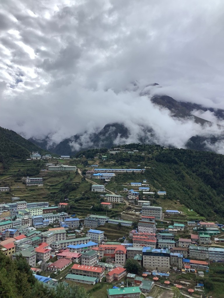
Breakfast was early, chapati and fried eggs, and a milk tea. This was the first day that I was not familiar with the surroundings we were about to ……. be surrounded by? We were turning left. Not a usual experience on scheduled airlines nowadays either. Upriver we were aiming for Thame and we set off at 7.30. The path took us high along the valley side, roller-coasting again, which adds substantially to the feet you have to climb. One day we climbed double the altitude we gained. Downhill is good, level is fine but in thin air trekking upwards trekking hurts.
Looking back across Namche the clouds were rolling in, but we escaped the rain.
There was a small quarry around the valley side, not visible from Namche, and young men, some of whom were barely out of school, were carrying huge chunks of rock on their backs down to a few construction projects in the village.
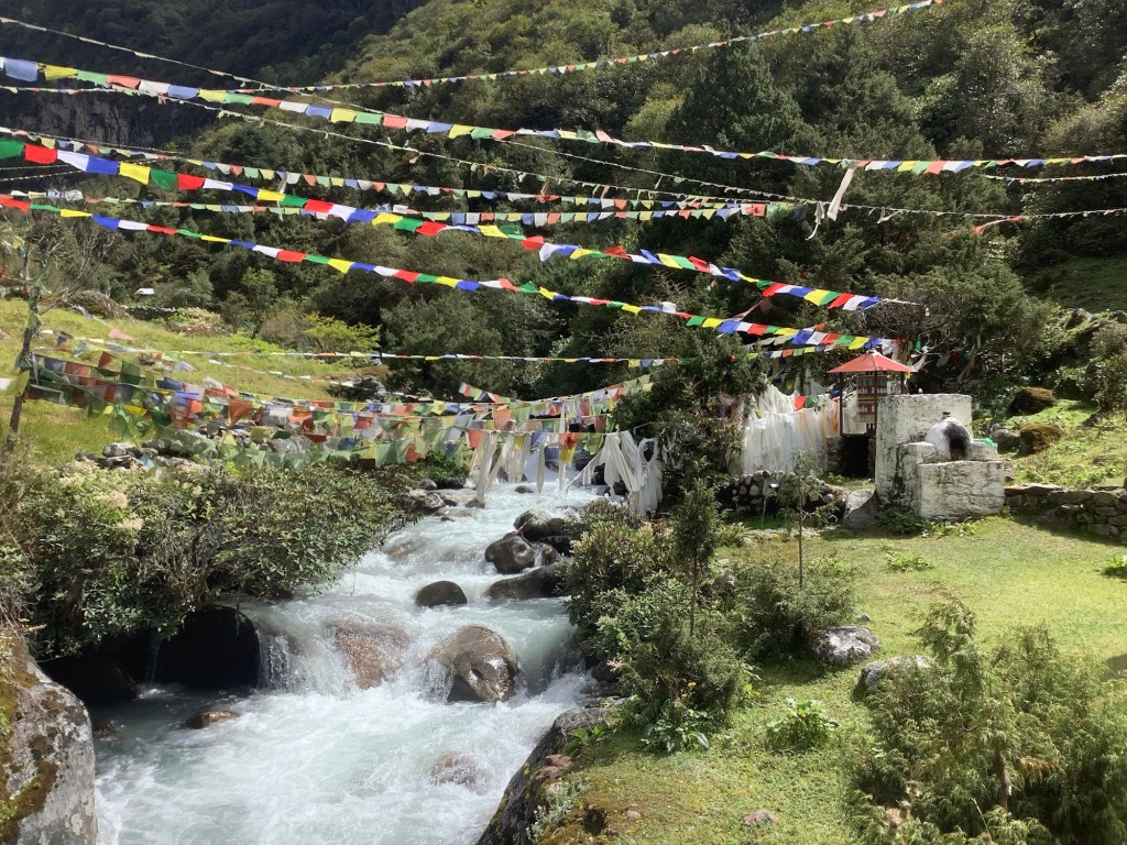
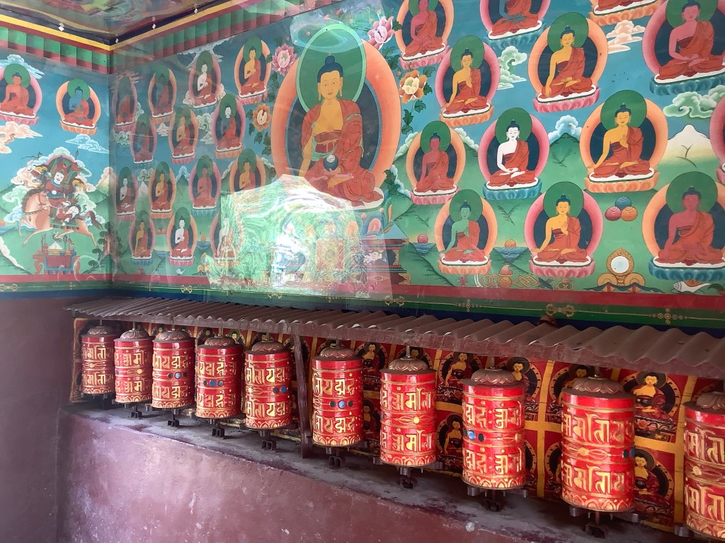
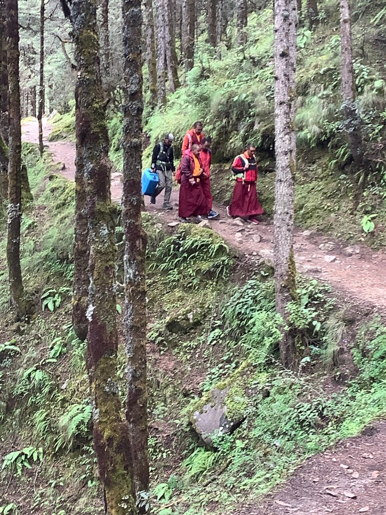
This is a Buddhist region in a Hindu country. A land of monasteries, Stupas with flags, gateway buildings with prayer wheels and be-robed Monks going shopping in town.
The valley opened out as we approached Thamo.
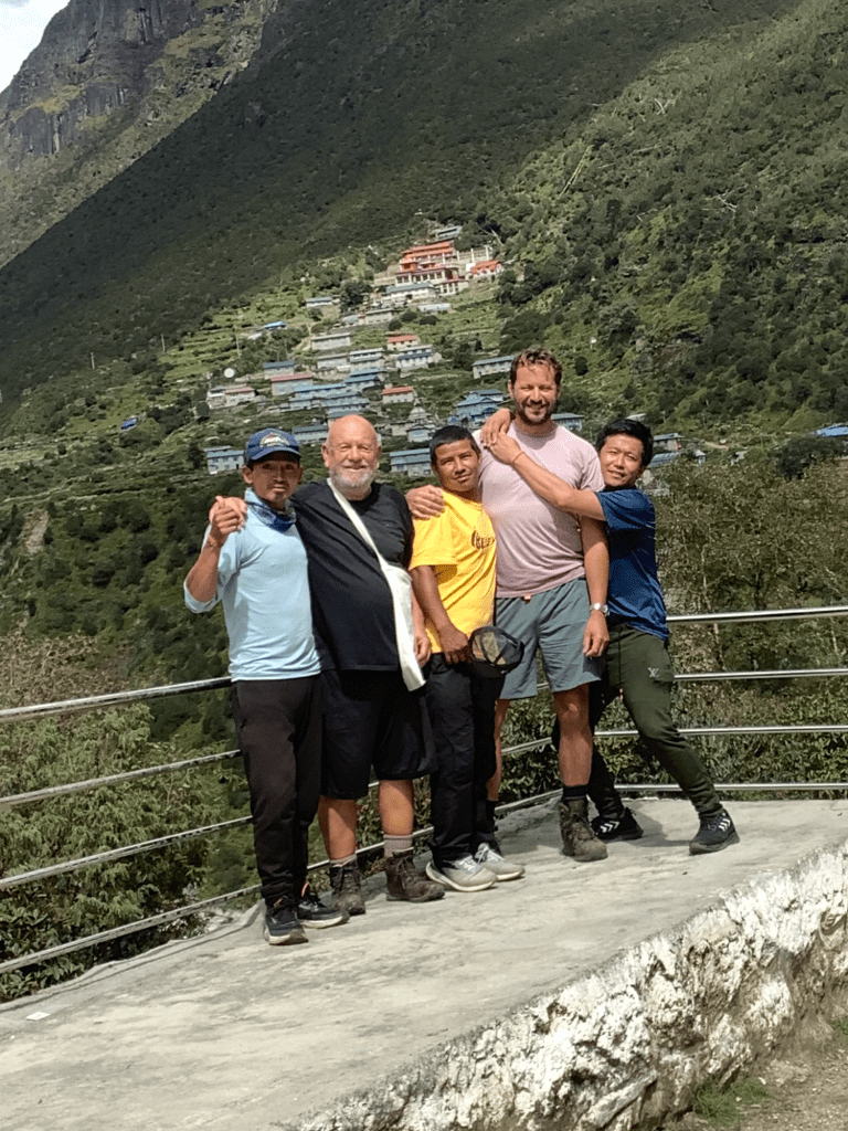
With a viewpoint presenting the gang an opportunity to grab a passing stranger and get a group photo.
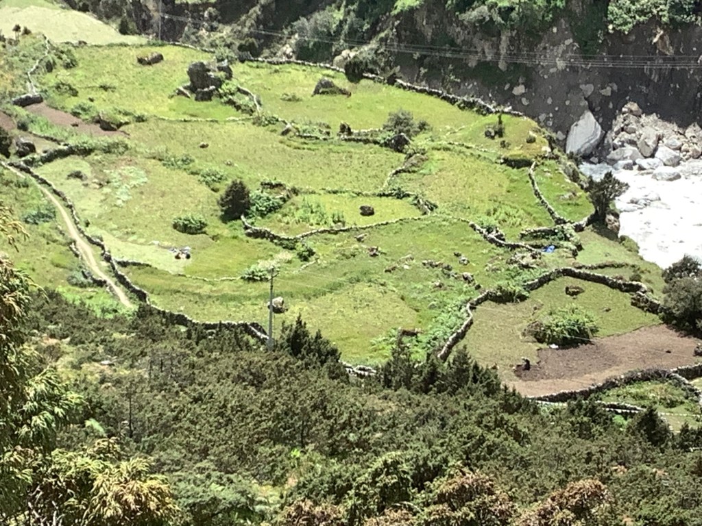
The enterprising Sherpas inhabiting this valley have built terraces and dry stone walled sections for grazing and growing. In the photo below a woman is turning over grass to plant potatoes, bottom right. Two others, middle left, are cutting hay for silage.
Looking upstream the devastating effect of the lake bursting its banks was clear.

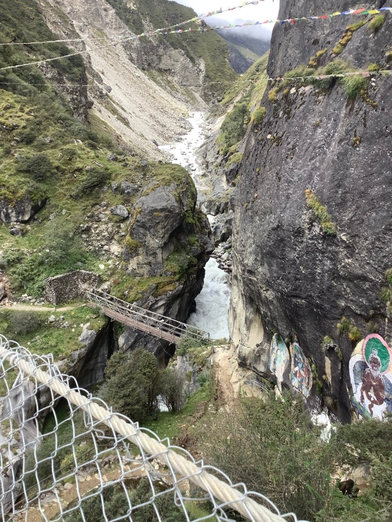
Fortunately the bridge built a year ago was unaffected. The old bridge looked a bit rickety, and was probably only used by the wild goats in the bottom right.
It was a difficult climb up to Thame and as we came into what was left of town the devastation was apparent. There were quite a few buildings left but some were under boulders and others had been partially washed away by the torrent.
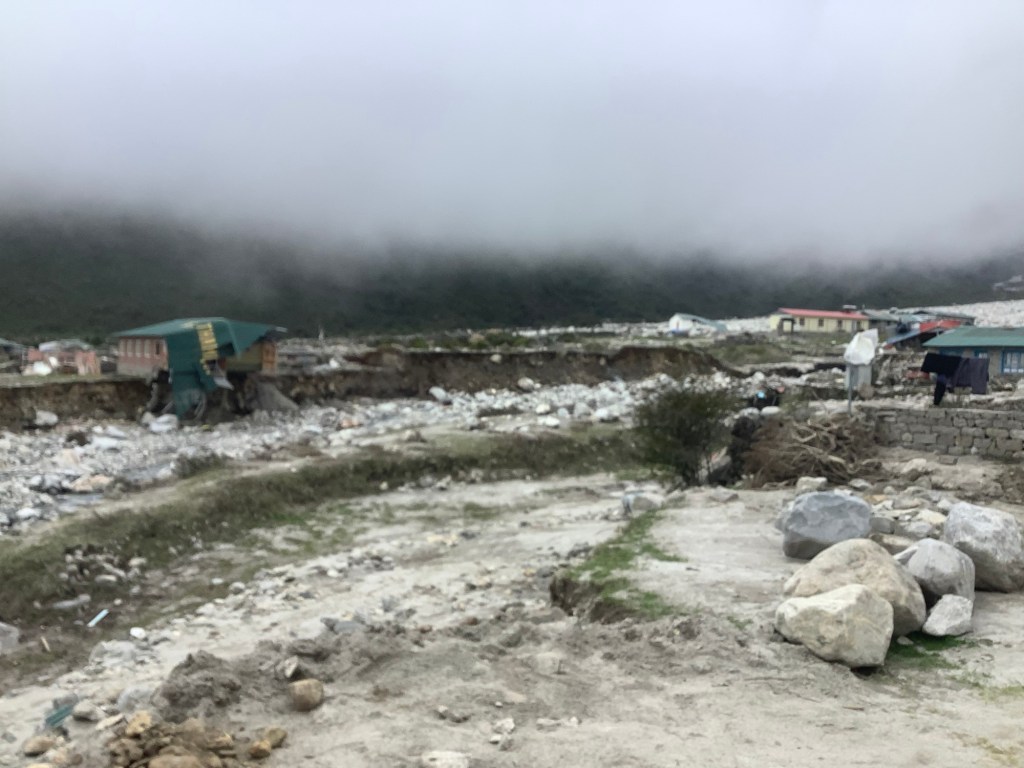

Reconstruction work was underway on some buildings, but 50% of the village was washed away and many of the remaining buildings are uninhabitable.
Nir found a guest house which was still standing and which offered to cook us lunch. It was being repaired and the wonderful people said they were unprepared for trekkers but could cook us rice and vegetables as long as we were ok eating in the kitchen. They were almost apologetic. They shall inherit the earth.
If you find yourself in this region please stay and eat at the Belle Vue Guest House. When it’s repaired.
We couldn’t stay here so we set off upstream again to find a place to stay. This turned into the longest and highest climb so far. And the countryside was becoming more barren as we went higher.

As the sky was darkening, rain started to fall and we finally made it to Lungde, where there were guest houses open. Two days ahead of schedule and 3,200 feet higher than we were this morning. I fell asleep in my clothes, hat and boots on my bed as soon as we arrived and Nir pulled the blanket over me. He brought me a cup of tea later. I made it down for dinner. We said we would meet over breakfast and decide what we were going to do.
Night night.
