Gokyo to Dragnag
The Ngozumpo Glacier, which we’re crossing today, shoved billions of tons of earth and rocks to one side as it grew and slowly moved down the valley that it was shaping. This formed two high ridges either side of the glacier, which are being revealed more as the glacier shrinks. On the outside of these ridges, called lateral moraines, the tiny villages of Gokyo on the west, and Dragnag on the east were built.
They’re largely places for trekkers to stay, with the locals flitting to Namche or Kathmandu in winter.
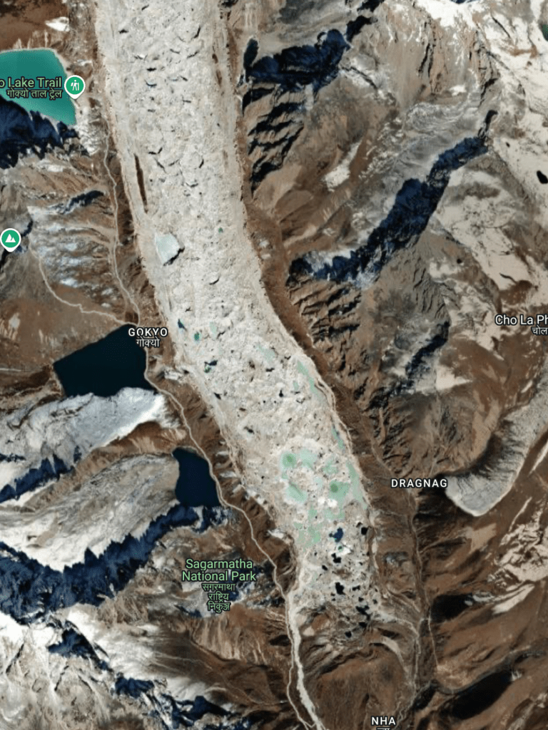
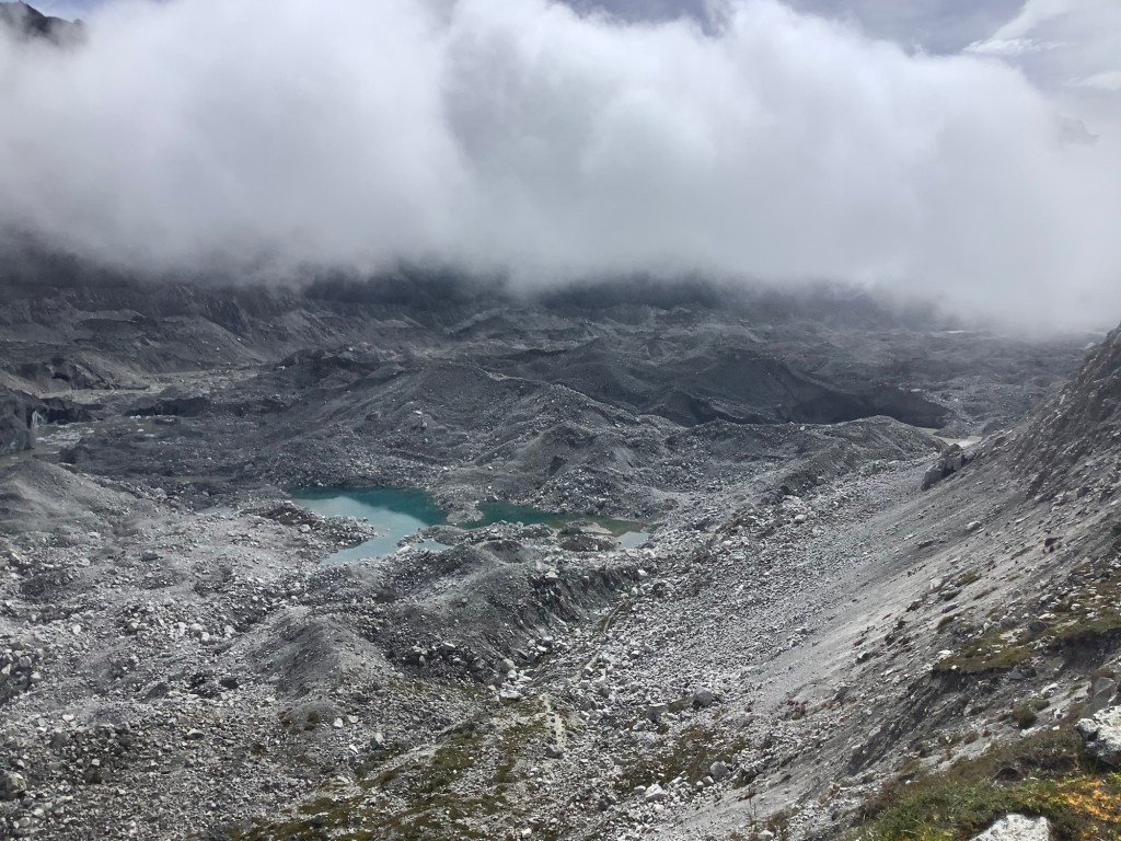
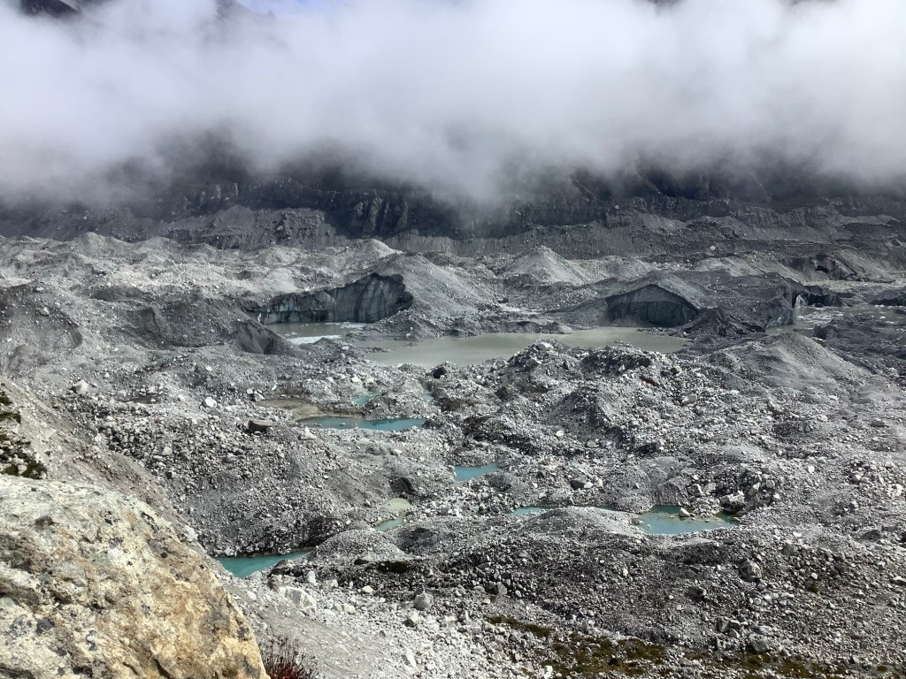
The glacier is retreating and is quite unstable. There is a recognised safe route across it from Gokyo to Dragnag, but this changes weekly. Looking at the picture of the glacier above the light blue areas are ponds and even lakes where melting ice accumulates. Some water filters down fissures in the ice and runs along and down until it reaches the bottom of the glacier and spills out. This causes caves filled with water that can collapse, forming a crater on the surface of the glacier that fills with water. If any path passed over this area then it needs to be rerouted.
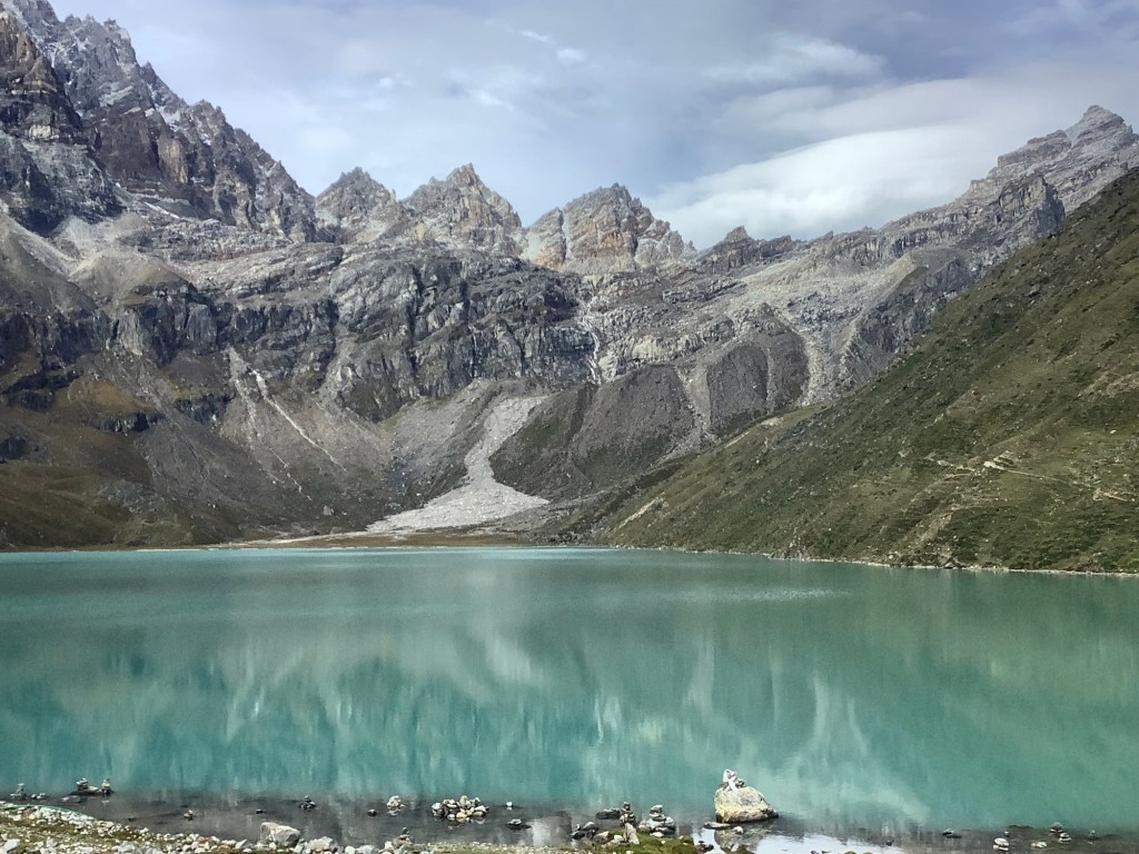
Leaving Gokyo at 9am the weather was good. The lake in front of Gokyo looked great.
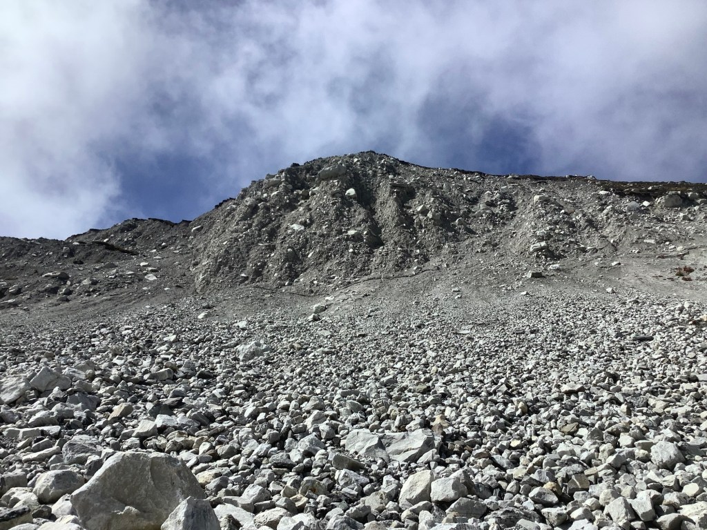
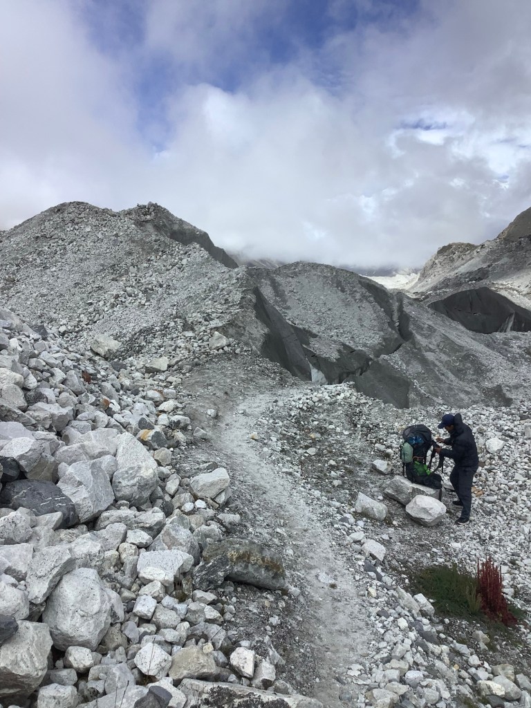
We climbed up the lateral moraine behind Gokyo and poked our noses over the edge. Southwards was where the most recent path had been, and our lads did a bit of a recce to see how we could get down to the glacier itself.
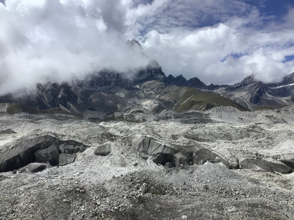
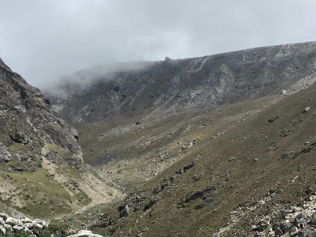
Looking northwards the mountains were peeping through cloud.
These larger glaciers have a lot of soil and rocks on their surface, to the extent that sometimes you would think you’re walking on a mountainside. Lurking sometimes many metres below is ice. At this point on the glacier the boulder and rock covering is quite thin. On those two mounds in the middle distance there is a dark covering like a roof, rocks and earth, and paler ice underneath.
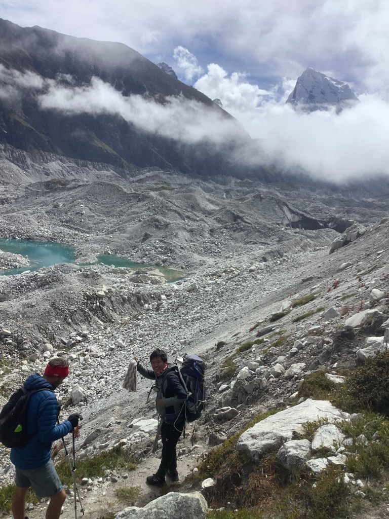
Amit found a route down. The problem with this section is that the lateral moraine, which we had to climb down, is falling onto the side of the shrinking glacier. And one area that we had to walk under was just waiting to tumble.
We climbed down , following our leader Nir. In Nir we trust.
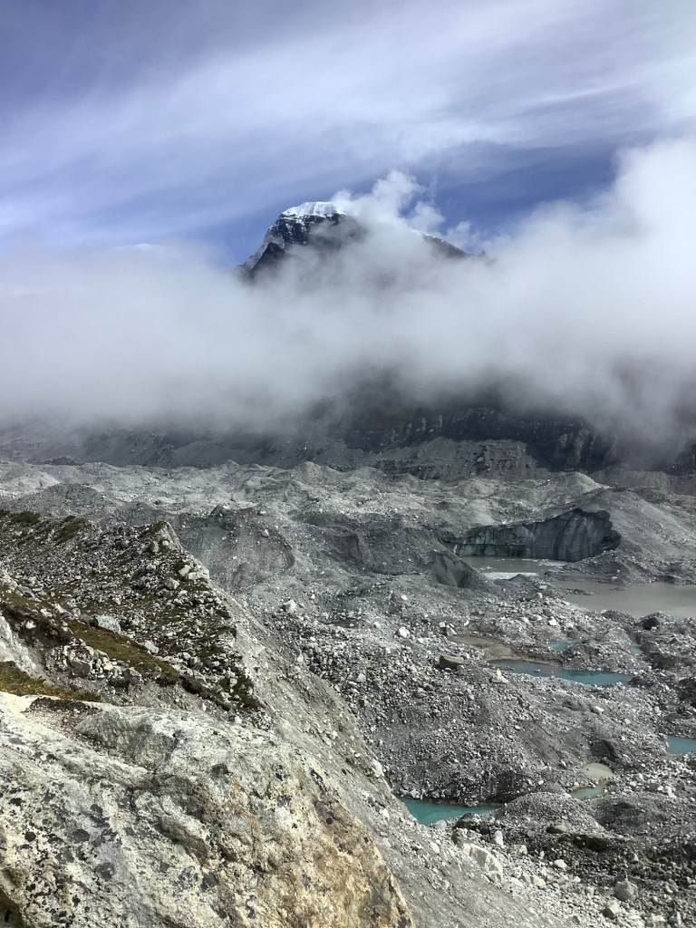
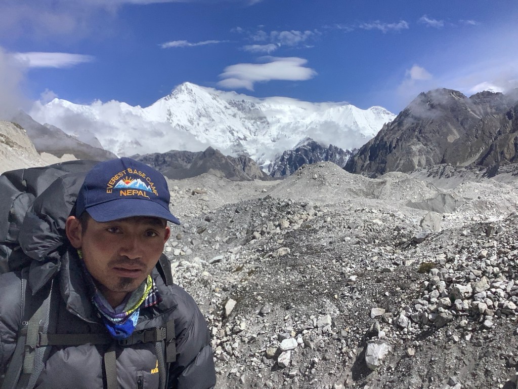
Shane MacGowan (aka Bikram) looked intent as we pressed ahead, with Cho Oyu, the sixth highest mountain in the world, just above his left shoulder. He’s a good lad. I like him.
Cutting across towards the east side the path was well trodden, but the crevasses and ice caves had swallowed it.
Nir instinctively found the most recent route, although Dan and Amit wanted to move ahead quickly. I shouted across to Dan that they were stood on an overhang of ice that was seriously cracked and waiting to sink down into the freezing water of the crater.
Dan shouted back that it made it more exciting. Crazy cookie!
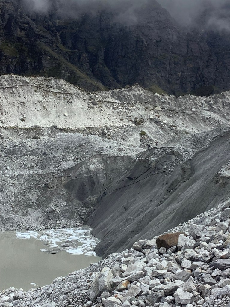
All the time there is the sound of rocks, boulders and ice falling into water or chasms. I was glad to get to the eastern moraine and climb up its side. Looking back this is a primal wasteland. A potentially dangerous one too.
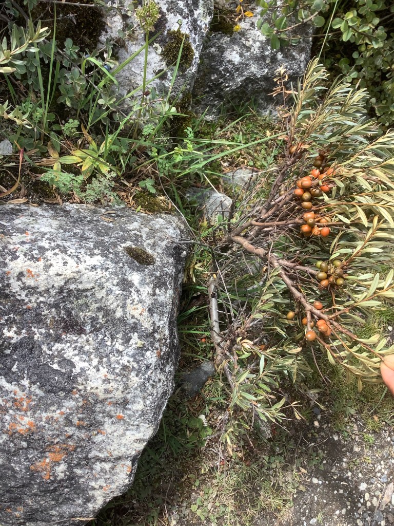
Nir and Bikram gave me a nature lesson on the track down to Dragnag. The Himalayan Pica in these parts isn’t a mouse, it‘s a small rabbit type creature, and we saw one on the rocks. There is a Yellow Bellied Weasel, and we spotted one in a dry stone wall. And this is a local berry, which the locals locally squeeze to get the juice out. Can’t remember its name but it’s great. It tastes sweet and sour at the same time. I had loads.
Just by Dragnag the valley leading up to Cho La pass struck off to the east. It so reminded me of Grindsbrook, just up from Edale, where Deborah, my sister and I carted our dad’s ashes and scattered them on the edge of Kinder Scout. Kinder is formed of gritstone and this is limestone, but the shape of the hill and valley felt very similar.
Here’s dad’s resting place.
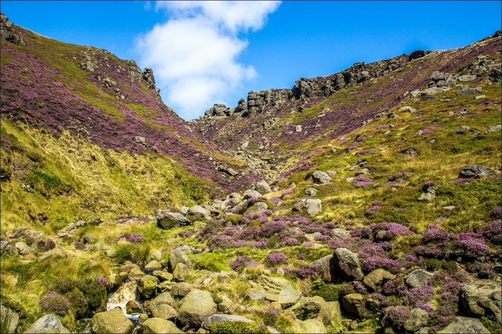
Well they look a bit like each other.
Night night.

You are so brave Smiffy, I am in awe! South West Coastal Path? Puh!!! Snogs for all xxx