Loch Laggan to Laggan – Spring In my Step
The coldest night camping I have known. My toothpaste froze in the tent. My tent froze in the Universe. The Universe froze above me. When I went for a pee in the neet the stars were in my face. No moon. Incredibly raw and real and wonderful. I couldn’t do more than a minute outside in the freezing cold, vainly looking for any sign of the Aurora Borealis. The tent was as solid as a shed with ice and frost coating it inside and out.
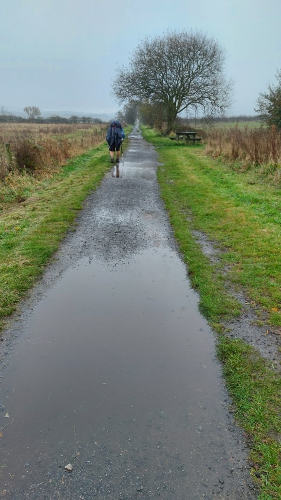
This morning I didn’t want to get out of my sleeping bag, although I was fully clothed, including my down jacket. Eventually I ate breakfast, a half tin of cold beans, a coco pops bar, two Dairylea sections and some water. I packed as much as I could inside the tent but rolling up sleeping mats and sleeping bags needs outside space. Luckily the sun gave an impression of warmth, even though it was still below freezing when I set off at 9am hundred o’clock. And Loch Laggan still had an almost imperceptibly thin icy mist.
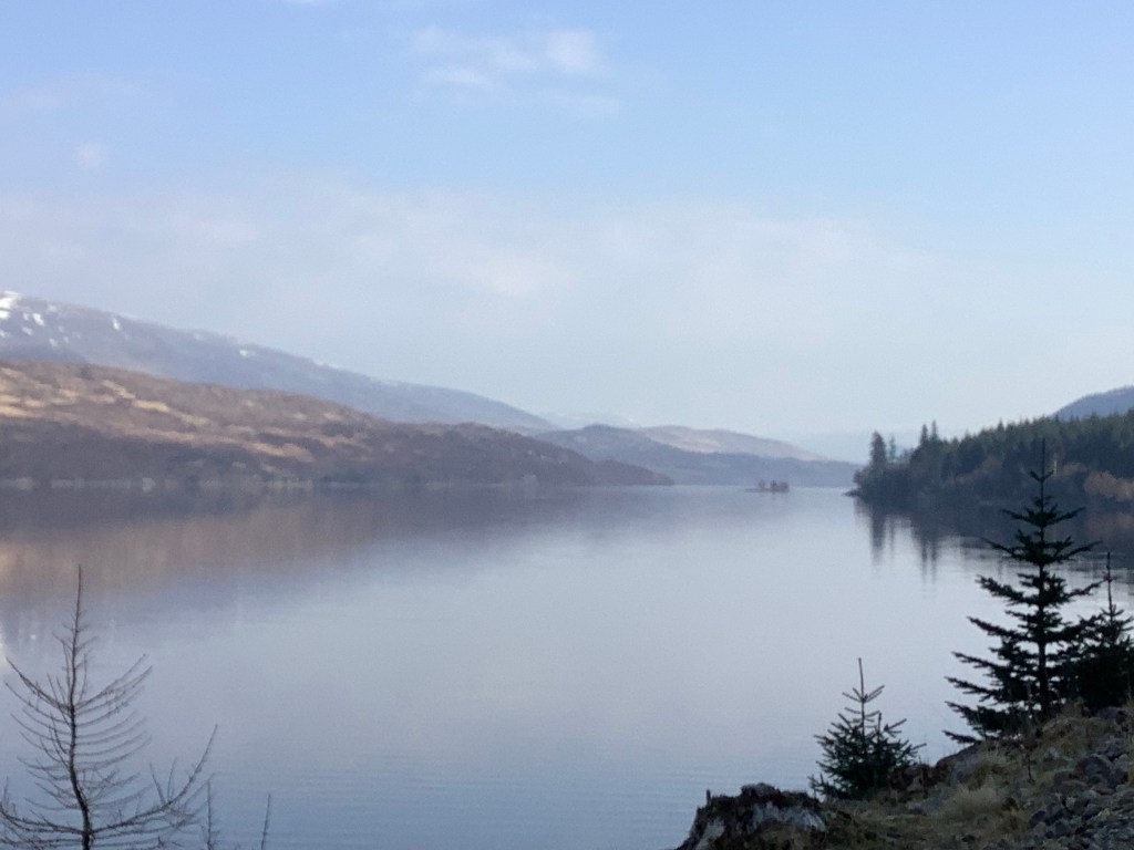
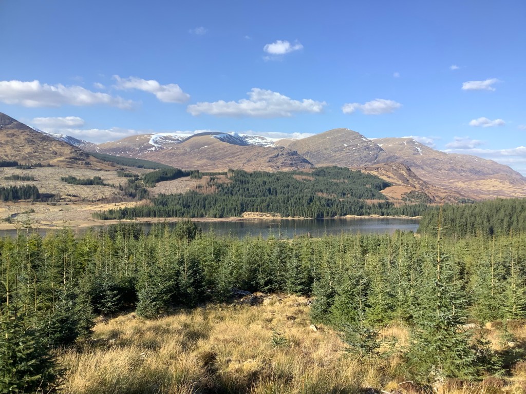
I was walking up the east side of the Loch which was shaded from the sun by a mountain to the east, so the cold persisted late into the morning. The view across the Loch, duplicated by the reflection, was great.
I needed to make good time this morning and I kicked off at a pace. By lunchtime I had walked the length of the lakeside stretch, round about 7 miles I’d guess, so I stopped for a picnic. Two Dairylea sections and five dates. Supplies were running low and I was trying to save some food for my evening meal in the tent.
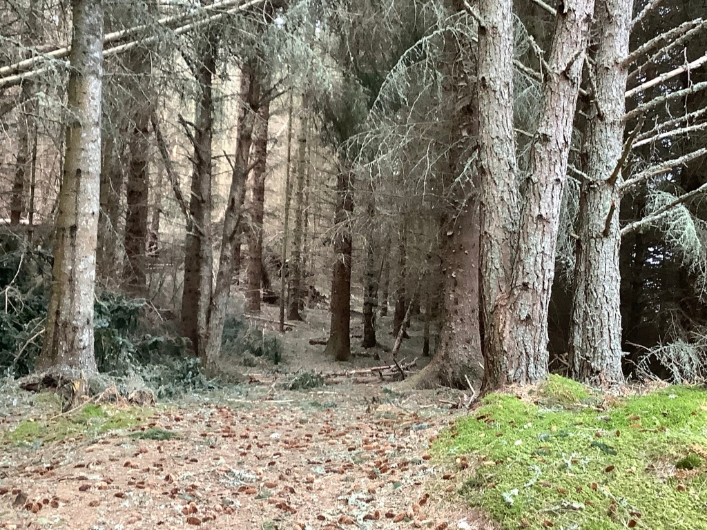
In the afternoon the path rose into a dark wood. These are so dense that even I find them sometimes creepy. When you’ve not seen anyone all day and you’re tired, and you’ve seen the movie Deliverance, then you’d prefer not to see anybody in this wood.
Diddle ing ding ding!
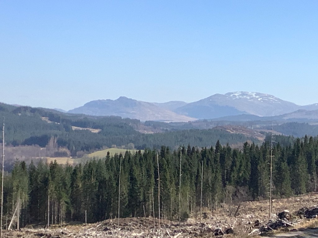
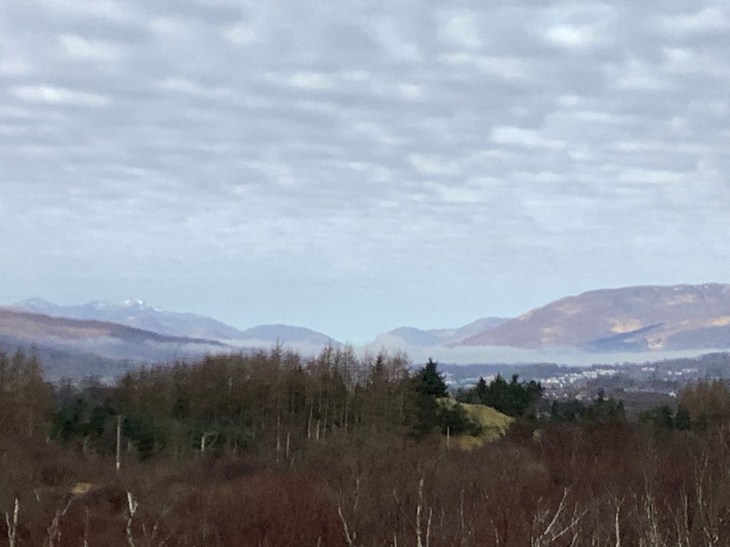
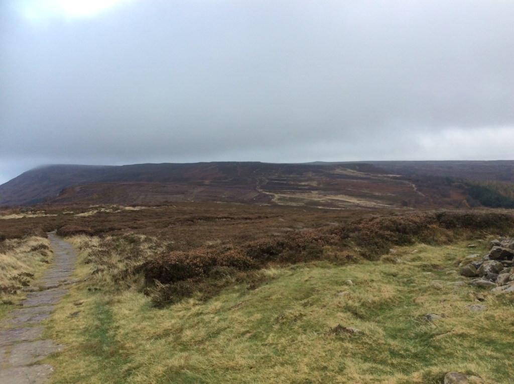
After a long uphill and down dale slog I made it to more open territory looking towards the distant mountains of the southern Cairngorms.
It’s easy to think how daft you are to be a bit twitchy about dark, dense and silent places when you are back in sunshine. But it was too silent, if you know what I mean. Dull, like Mirkwood.
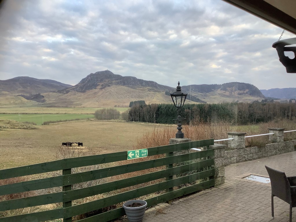
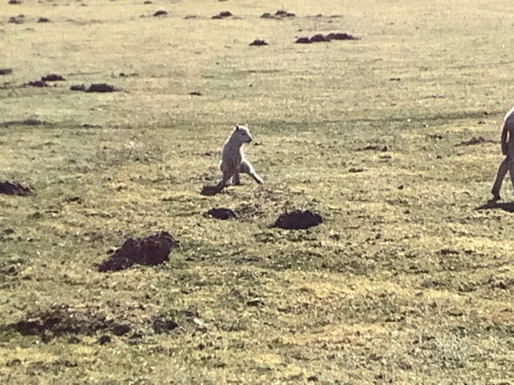
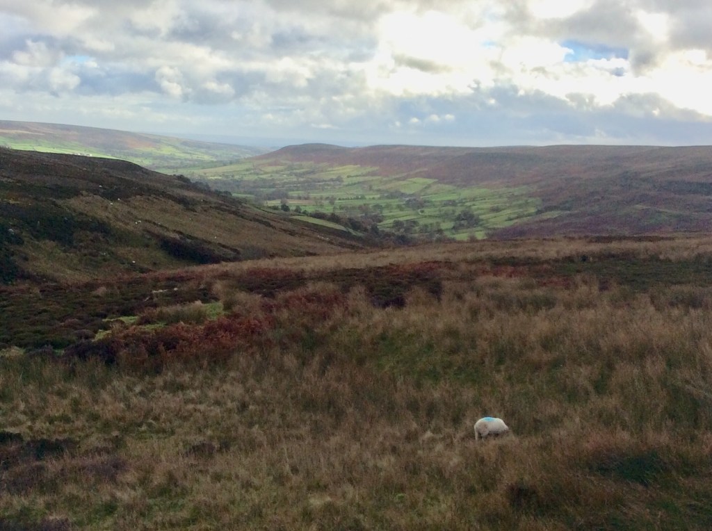
Crossing the pass between west and east, everything was now running into the North Sea rather than the Atlantic. In this Glen, down into the River Spey first. And I was by the Spey before you could say ‘Simple old idiot’. I was looking for a spot to pitch my tent and there were a few, but I was reluctant following last night’s very low temperatures. Eventually I walked past a bloke fishing for salmon and asked him if he knew anywhere to stay in the village of Laggan, which I was close to. He was a Glaswegian called Jimmy. You couldn’t make it up! He had been visiting this area since he was a kid and was well known. His advice was the Laggan Hotel just outside the village, which he rang from his mobile and got me a bargain because he knows the owners. Tonight sorted.
Seventeen miles today with that lairy rucksack. I’ll eat well and sleep well tonight.
Night night.
Roy Bridge upstream to Loch Laggan – Like a Salmon
Well not quite like a salmon. A bit like a dab or a bream. Or more like a crab. Or a crabby old bugger. Or just an old, crabby, smelly, tired, ridiculous old fart. One that dissipates slowly in a sealed room. In fact you could still smell me when the seal is broken in 100 years time. My great, great grandchildren might break the seal, inhale and say ‘Jesus Christ gggpa must have been in here before he went up to Loch Laggan’.
The day was stunning, but it had been a very frosty night.
A great breakfast and I’m off to the river again to cross at what was a ford yesterday. I hope it still is.
I covered about 14 miles yesterday, which was good going with a reyt heavy rucksack and a bit of a cold. The cold didn’t weigh much but it weighed me down, particularly going uphill. My legs are ok to say I’ve not really been training but my lungs are struggling a bit. They’ll be ok.
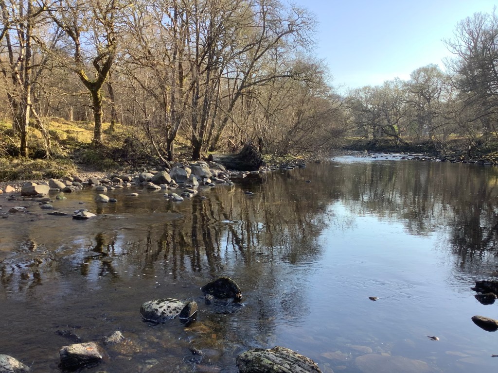
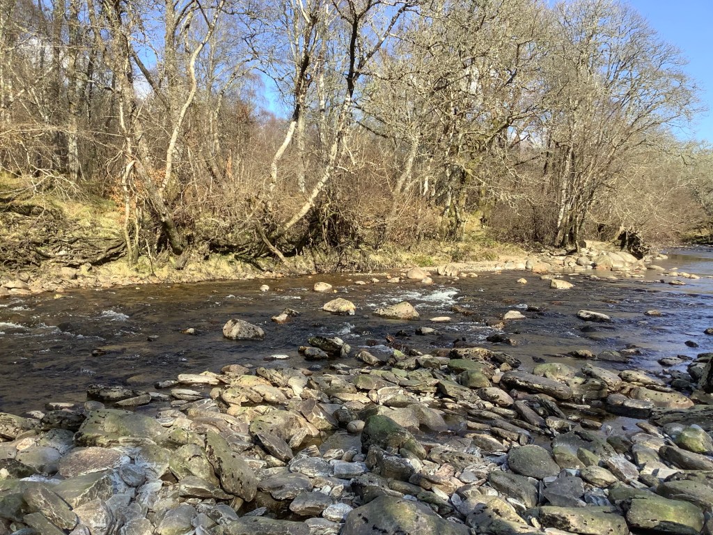
The river was a bit higher, the warm sun yesterday must have melted some of the snow.

But obviously as an experienced trekker I managed to cross the river in my bare feet with no more damage than the bottom of my shorts getting wet, but not my underpants or lower regions.
Look, before we get into any iffy areas in this blog that aren’t suitable for families could I just have a quiet word in your shell-like and warn you against outdated references like ‘lower regions’? Your mentality is antediluvian.
Ok.
Looking back the river looked quite lovely.
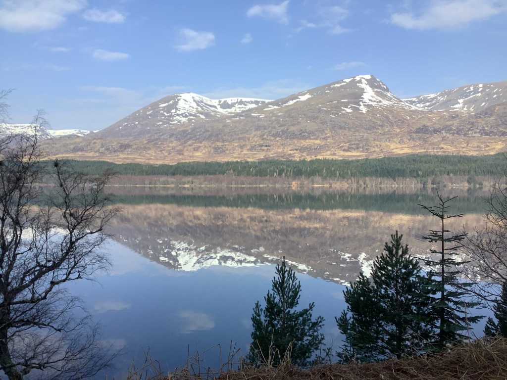
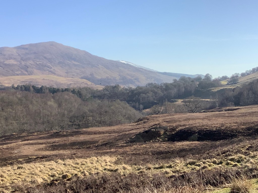
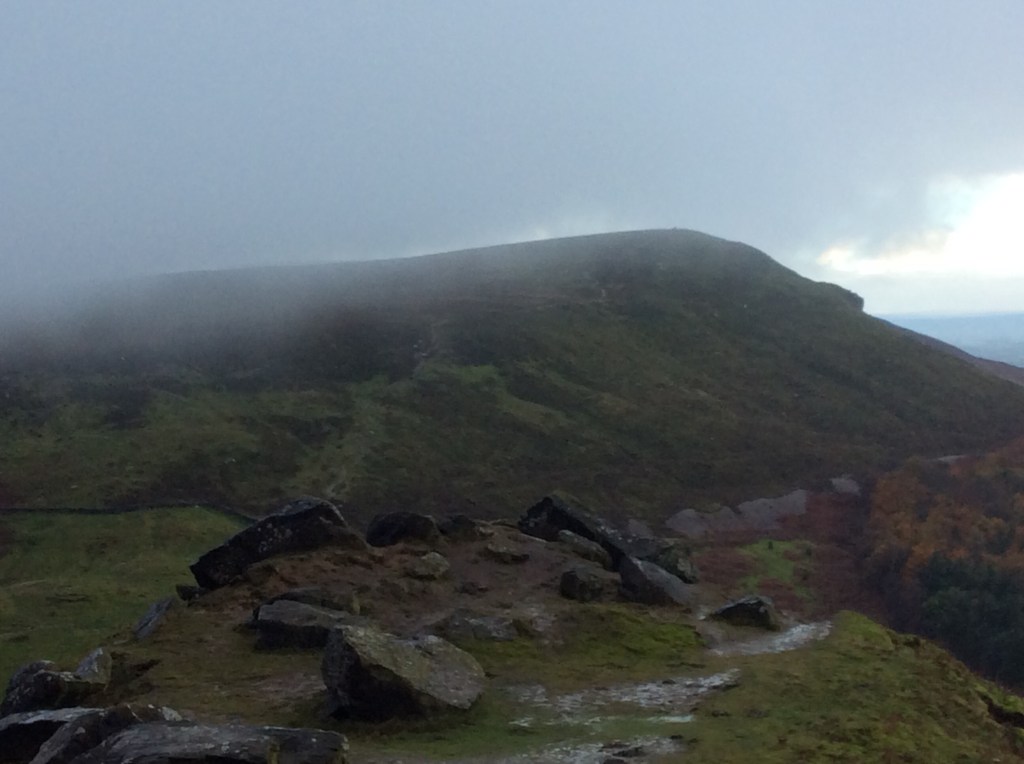
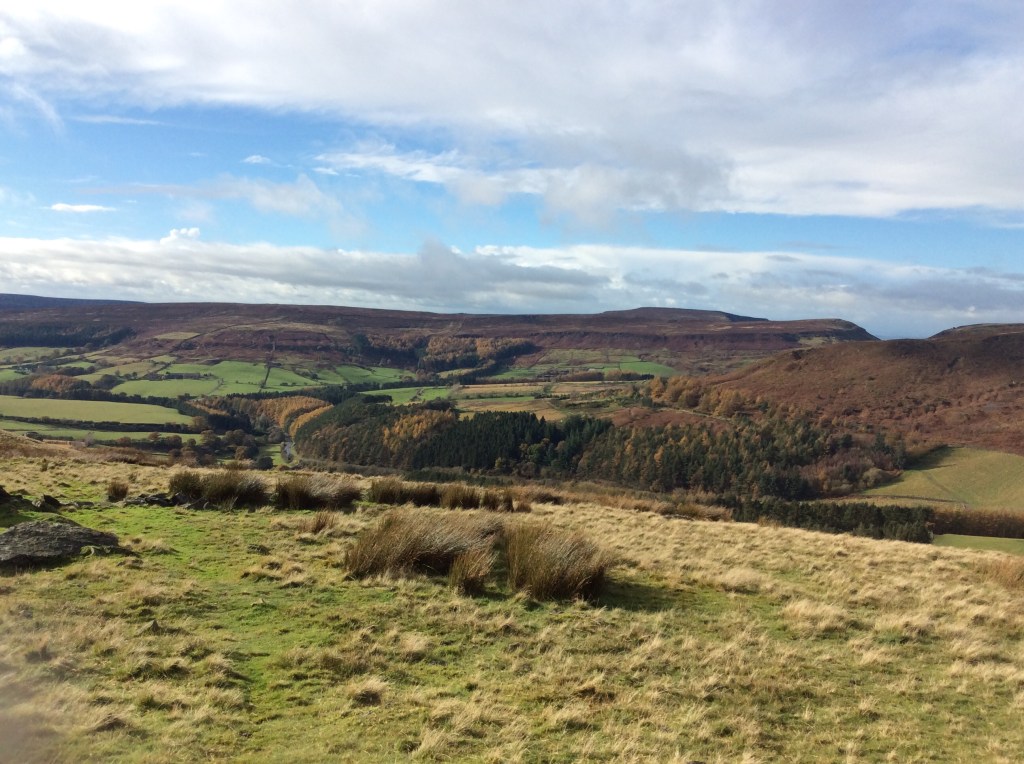
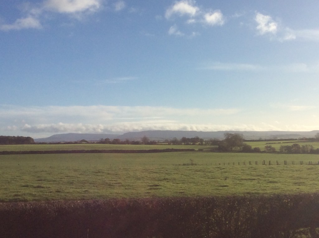
The day became cool, then mild and then warm. And the views were just outstanding.

The air was fresh, the sound of the river was therapeutic in the background as it made its inexorable way to Fort William and the Atlantic beyond. And after a cold winter the fauna came alive.
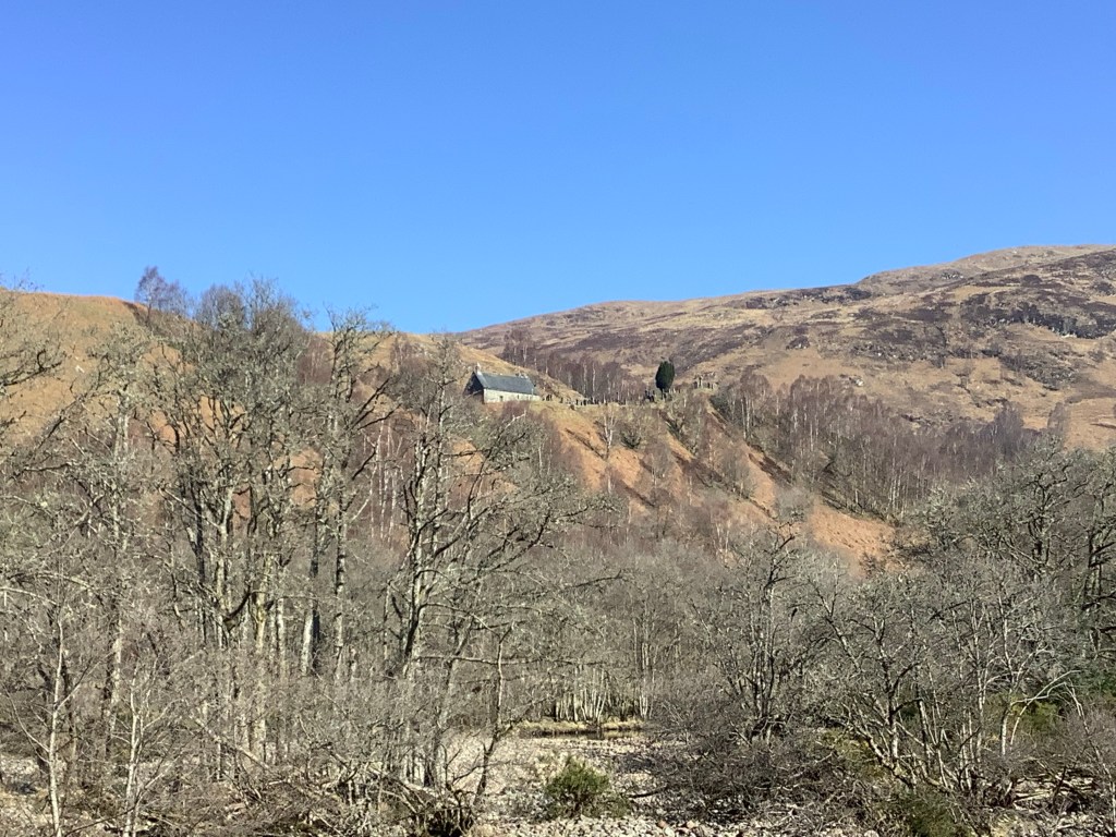
Miles from any village and stuck up on a hillside this church oversaw the valley, with its graveyard perched in the highlands. Not a bad place to spend eternity.
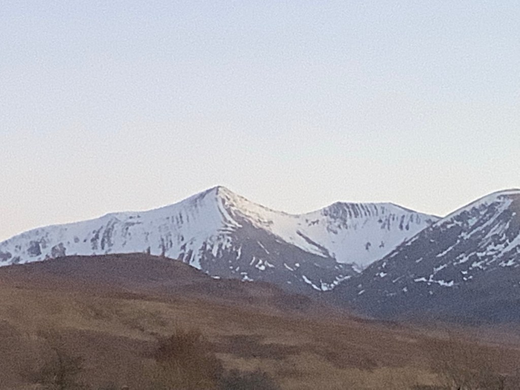
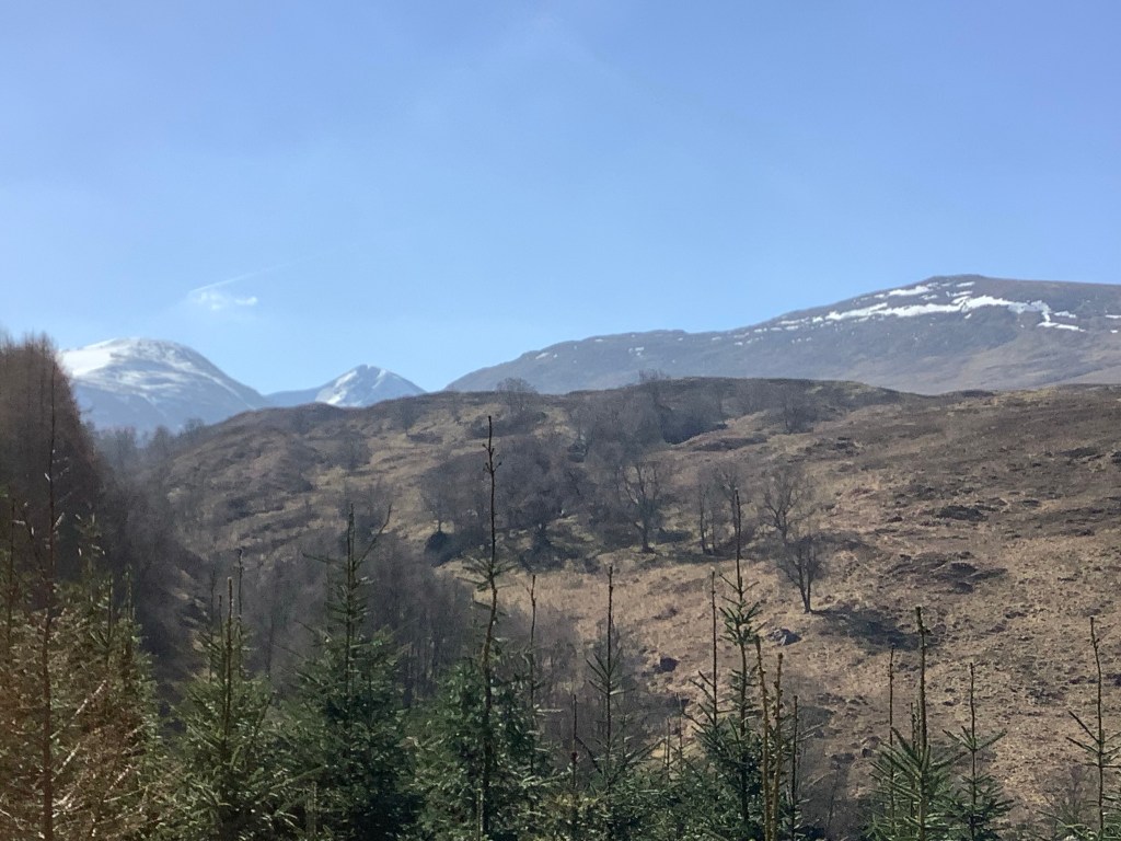
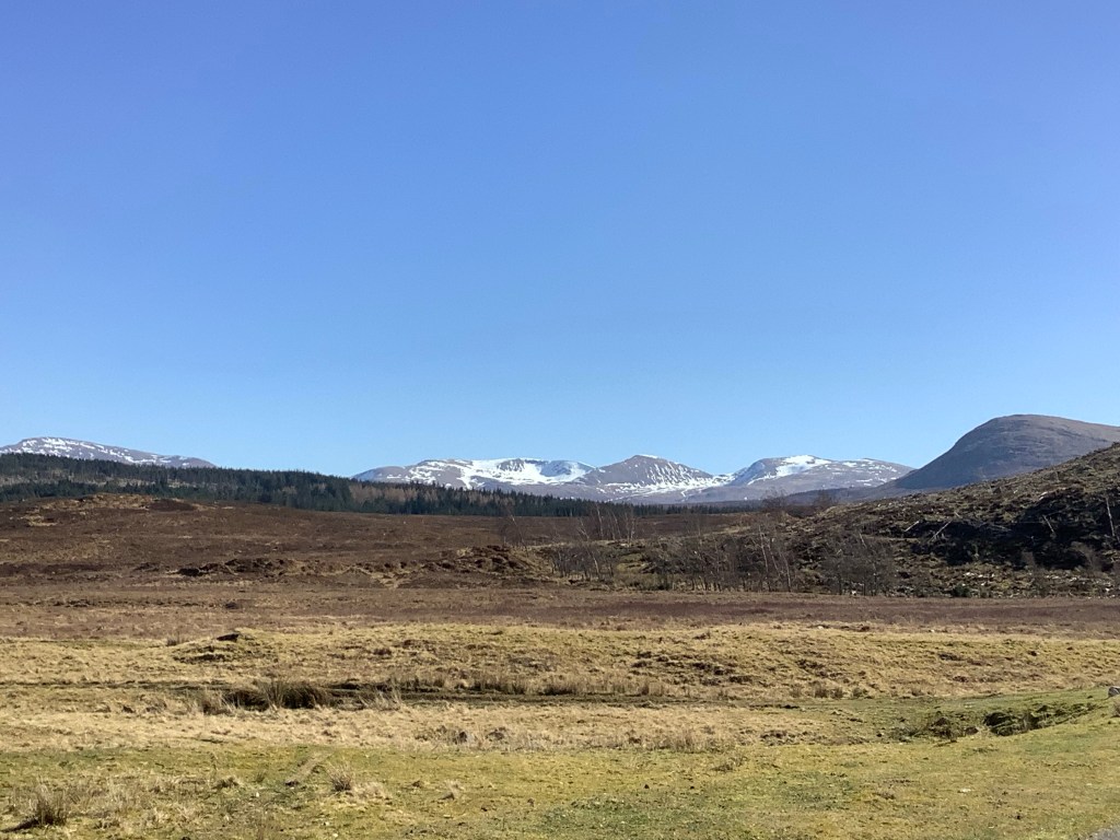
The track climbed and I got closer to touching snow, but not close enough. It would melt before I could climb there with this rucksack!
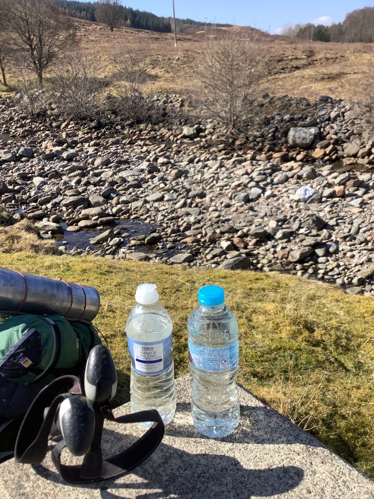
I was sweating a lot as the air got warmer and was running out of water faster than I had anticipated, so I saved my bottles to fill up at the next fast flowing stream. And it tasted beautiful. And it stoned me just like going home. Thanks Van.
One of the things I love is the big sky and the silence. Yes…I know that’s two things. One is the big sky, and another is the silence. It isn’t lonely, it’s comforting. The hills are alive, with the sound of nothing. They’re my pals when the weather is like this.
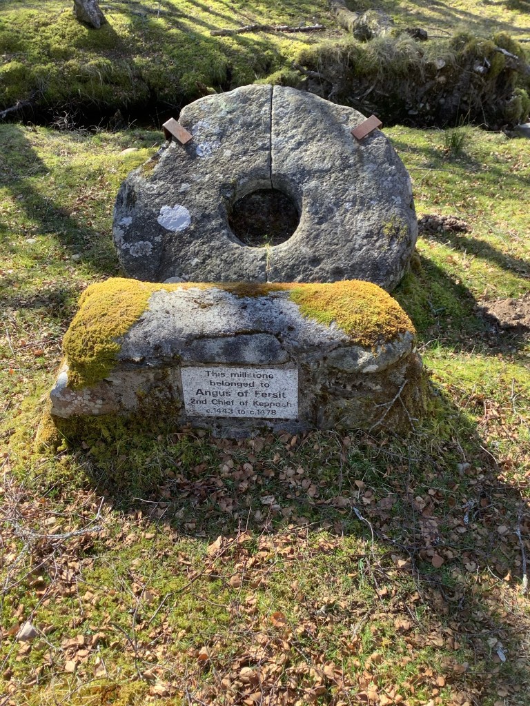
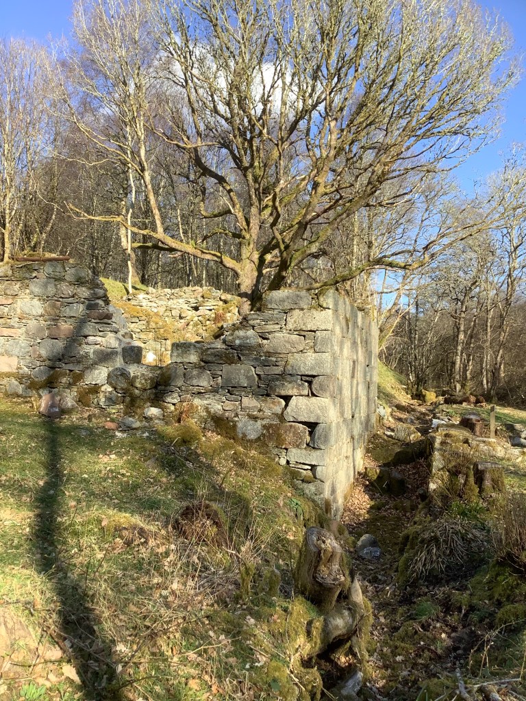
Nearly 600 years old. Reaffirming that the ruins I saw near Roy Bridge were probably those of an old mill. And maybe this came from it?
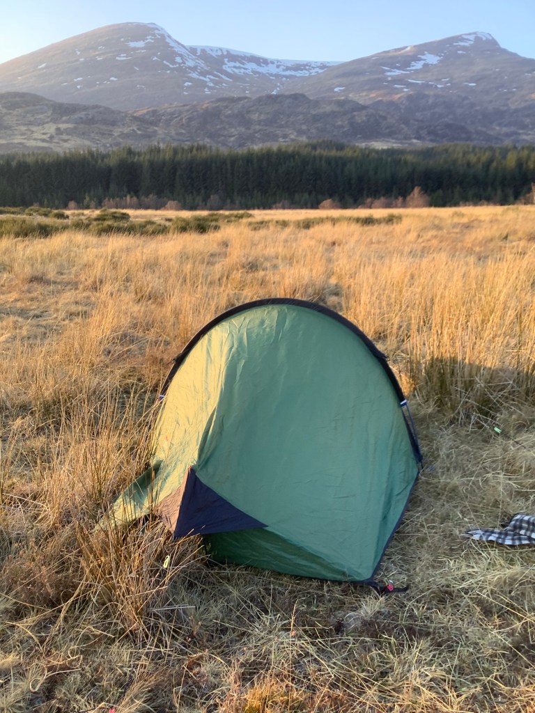
The sun was starting to sink and I knew that I had to find a pitch for my tent. My shoulders were struggling with the rucksack so the sooner the better. Looking northward I could see a lake that linked to the bottom end of Loch Laggan, which this track dropped down towards. It was likely to be flatter there and to lend itself to a more sheltered location.
The location I found was great, looking north and south.
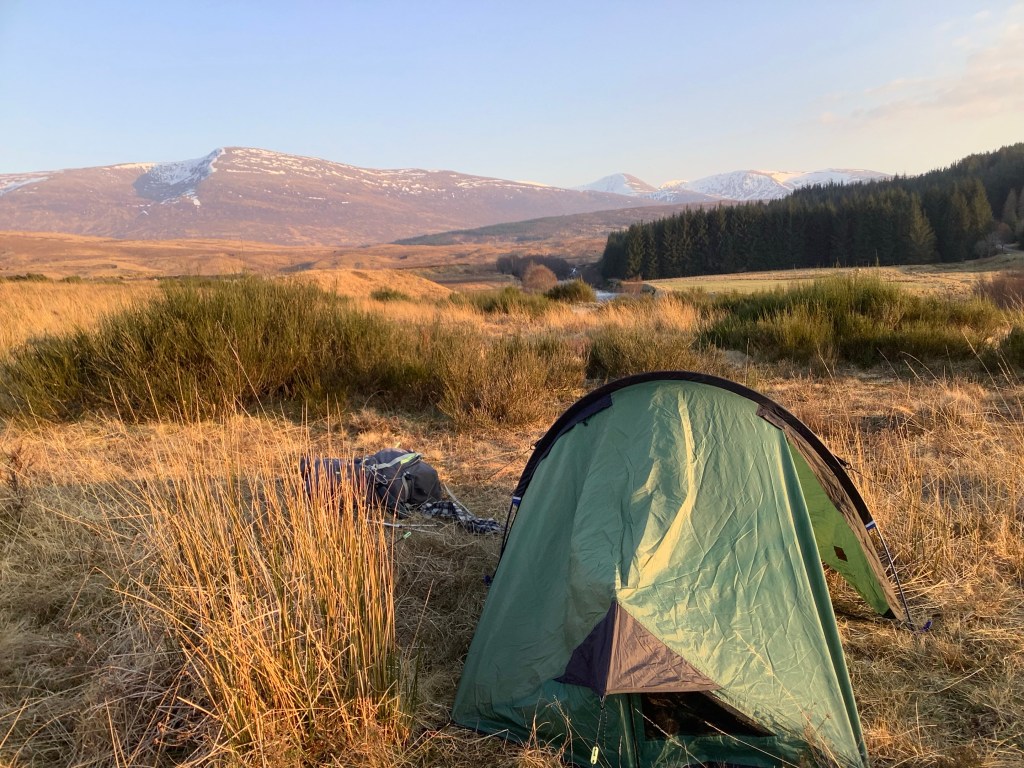
And looking west was a local farm and a stunning view.

A cold tin of beans, three portions of Dairylea cheese and four Medjool dates. A meal fit for a king.
Night night.
Fort William to Roybridge – Back and Forth
Hello; how are you? Good, good. How can I help you……oh God, I’m fed up with this stupid approach to a travel blog al(bloody)ready. Why can’t I just tell you what I’ve done and put in photos. After all, everyone who looks at this blog is only interested in the photos. So why tell you what I’ve bloody well done when it just gets in the way of you looking at the photos? Here are the bloody photos.


Night night.
Kingussie to Spean Bridge – Magic Bus
I caught two trains yesterday to travel most of the length of the British mainland from Leeds to Kingussie with a view to catching an early train this morning to Fort William, which was to be the starting point for my trek.
I arrived at Kingussie late into the twilight. It’s a village in the Cairngorm mountains national park. Outside the station was the local memorial for those who gave their lives in two world wars.
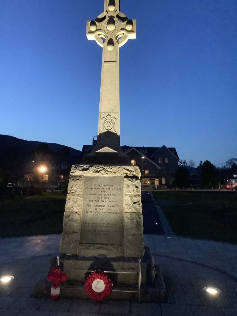
I always find these incredibly moving, but this one was off the scale. It’s a village that you can walk through end to end in 15 minutes and the number of lads who gave their lives was massive. This was one of three lists. Poor little buggers.

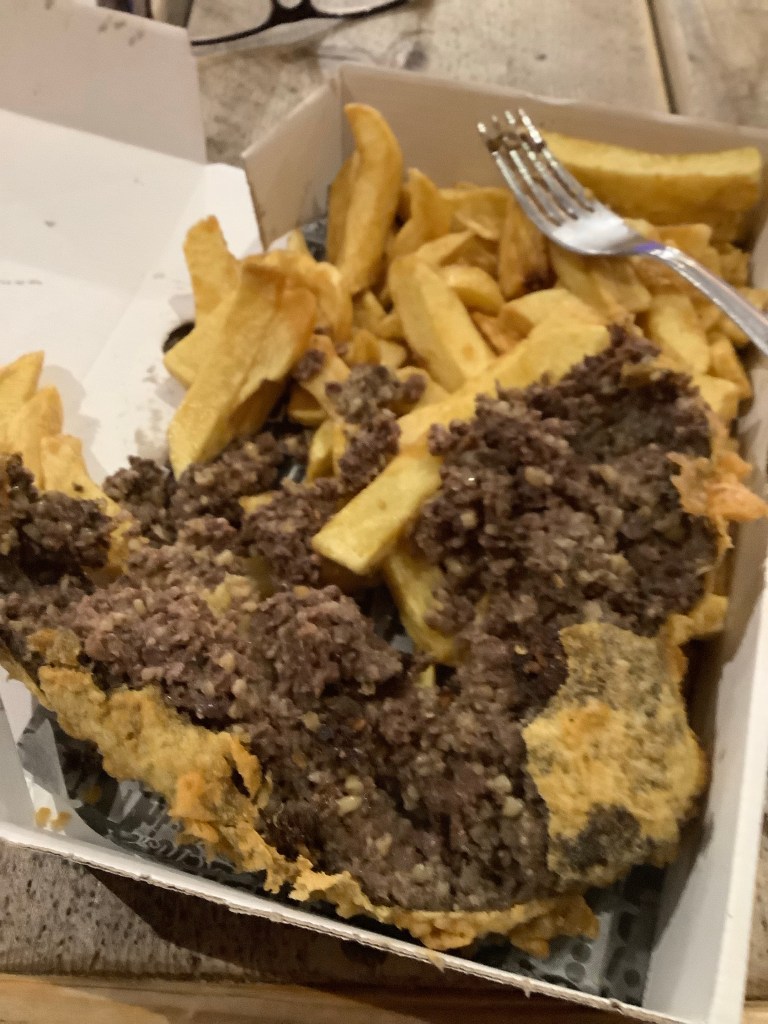
The first thing I did was stop at the chippy on my way to the hotel and get my usual haggis and chips.
I was the only one staying in the hotel. I had to put a code in a box to get the key out and never saw anyone. It was an old building. There were footsteps upstairs. I knew it must be another customer and nothing paranormal so I played it cool, gathered my thoughts and shit my pants!
You can’t write decently for more than 5 minutes can you? Answer me boy! Can you? You have to refer to bodily functions in a rude way don’t you boy?
Yes sir. Please don’t hit me again. I’ll be good.
This morning came and I had to get down to the station for a 7.30 train to Fort William. The only one of the day. A quick East to West dash. I arrived at 7.15 and the platform screens didn’t indicate that a train was coming, but a screen in the locked ticket office said it was a bus and it was on time.
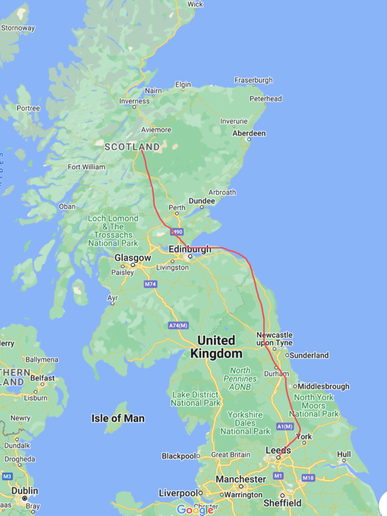
The long and short of this tedious story is that the bus never came and I had to get a train down to Stirling, another train to Glasgow , another train to Crianlarich (which was delayed as it had run over somebody on the track – sadly true) a bus to Fort William and a bus to Spean Bridge. I got here at 18.15. I feel so brassed off that I could ****.
BOY!!!!
The route in red is the one the Magic invisible bus would have taken. The blue route is the one I took.
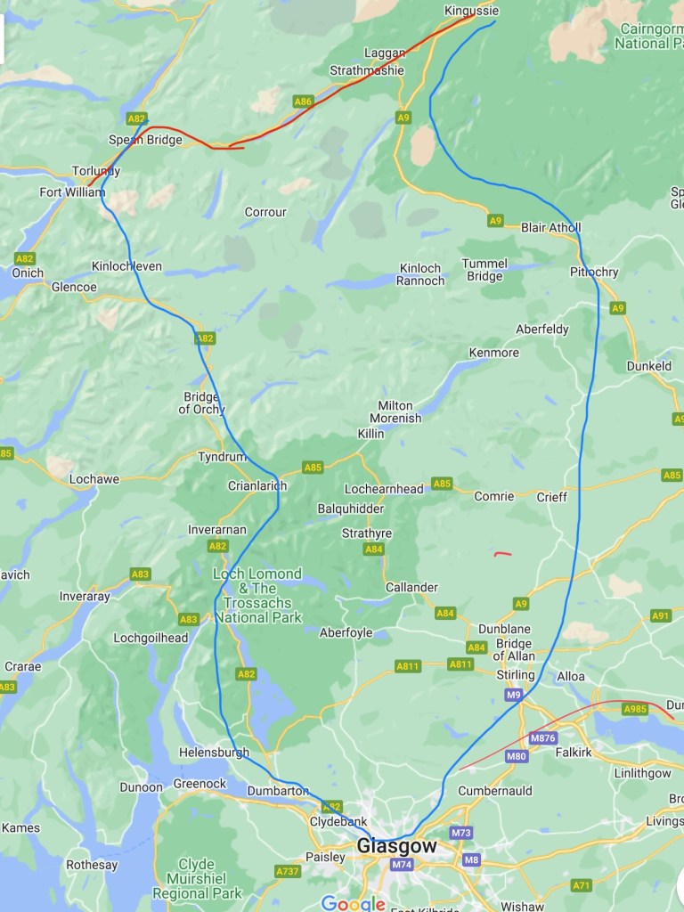
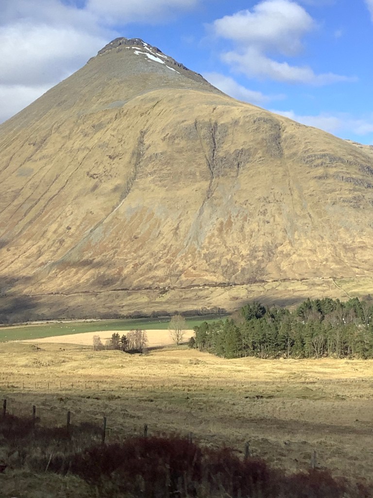
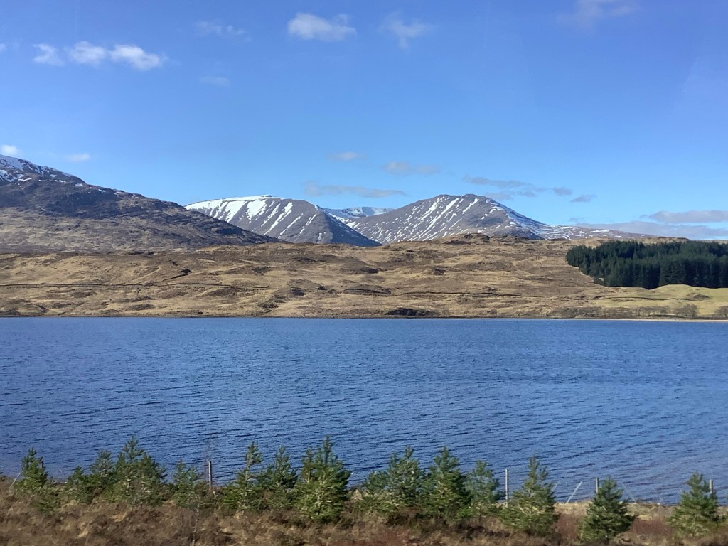
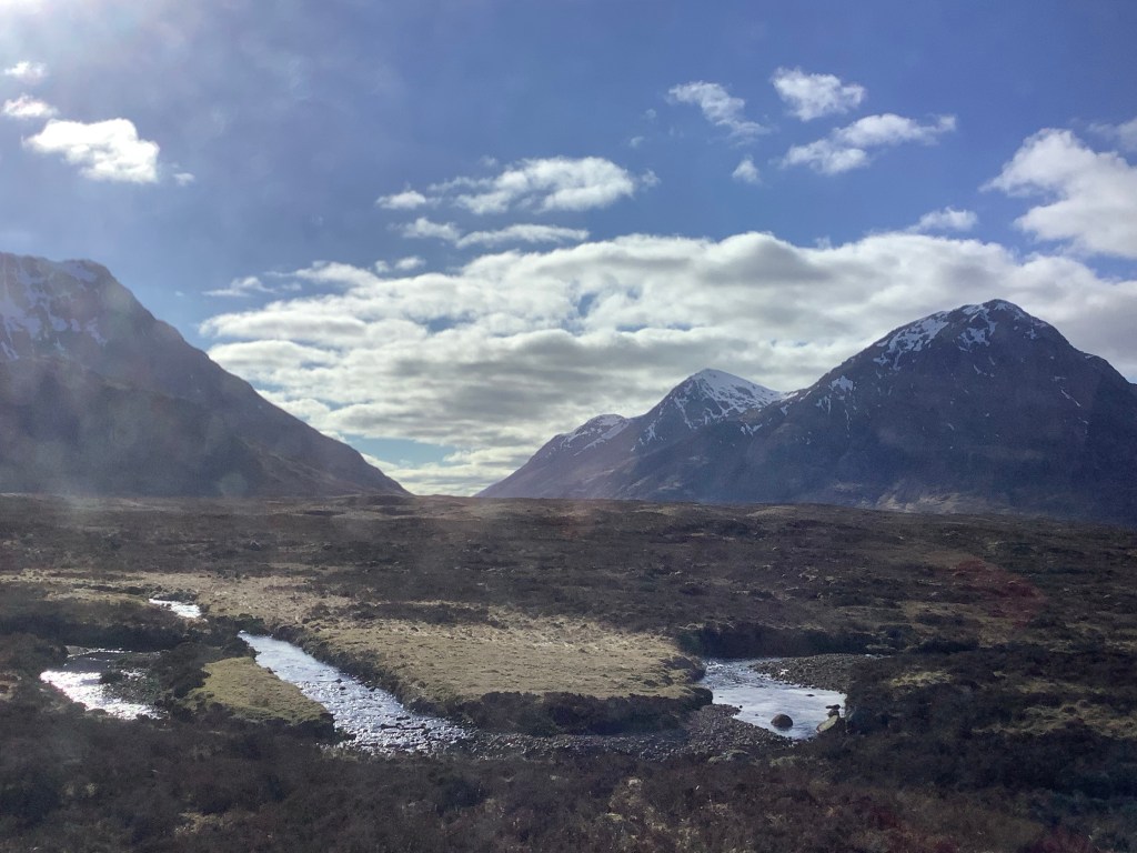
The big plus is that the route from Glasgow to Fort William was the most beautiful route I’ve ever taken on a train/bus.

Tomorrow I have to get a train from here at Spean Bridge back to Fort William to the start of the East Highland Way. I had to stay here because I’d already paid for the hotel. Well…..Maggie had. I have to go back because I’m walking the East Highland Way, not part of it – all of it. But; and this is the rub – it’s not a train tomorrow morning at 7.19 because the line got knackered last week. It’s a bus! And if it turns into a Magic bus and is completely invisible, like the useless non-arrival this morning, I’ll scream until I……. Until I……. Until…..oh ****!
BOYYYY!!!
Night night.
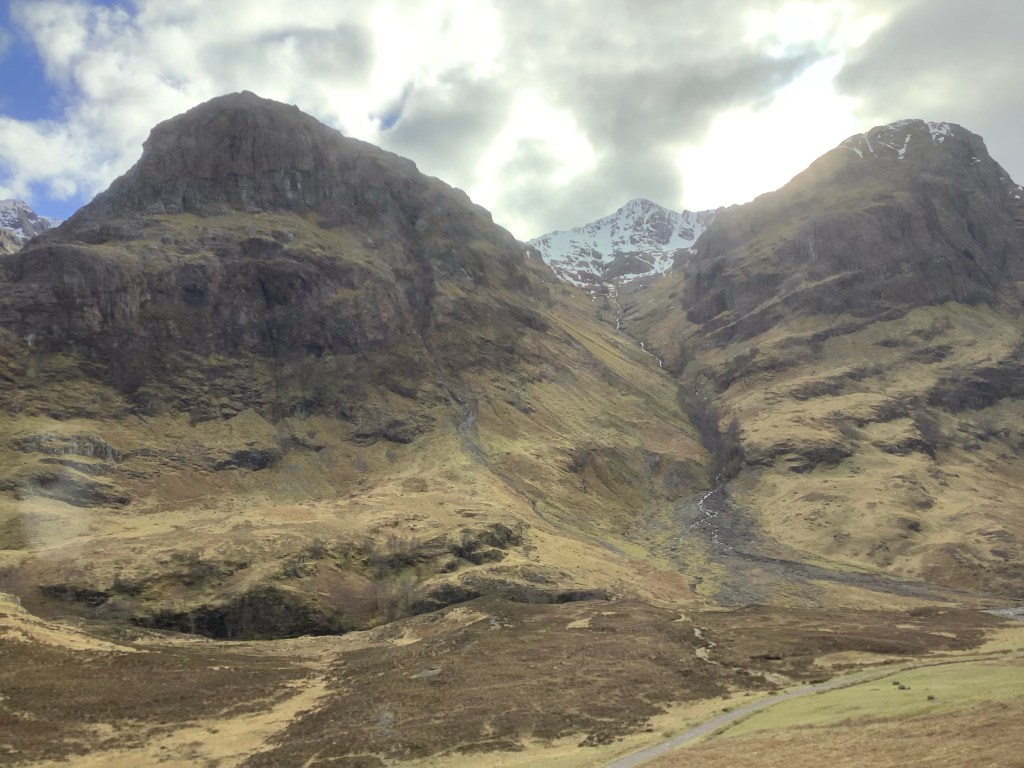
Scotland the Brave
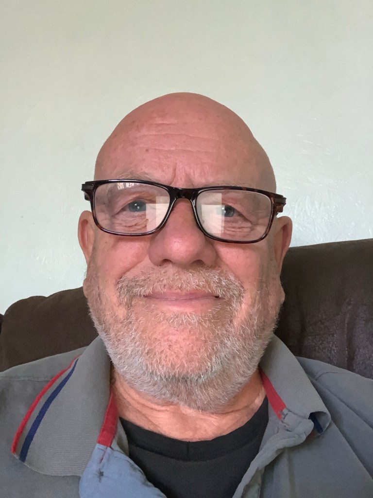
Well this old, fat bastard doesn’t evoke Scotland the Brave in my humble opinion. But he’s going trekking there in two days time, 140 miles from Fort William to Aviemore and down, through the Cairngorm mountains, to Pitlochry. Some remote country with more than my share of wild camping. And just to add a bit of spice to it the BBC is forecasting snow in Aviemore. But only light snow.
Keep an eye on this blog. I’ll start it on Thursday if all goes well but there will be several days between posts as there is no signal, no roads and no buildings (apart from the odd bothy) for many miles on one or two legs.
Night, night.
Robin Hood’s Bay to Scarborough – It‘s Alright Ma, I’m Only Walking.
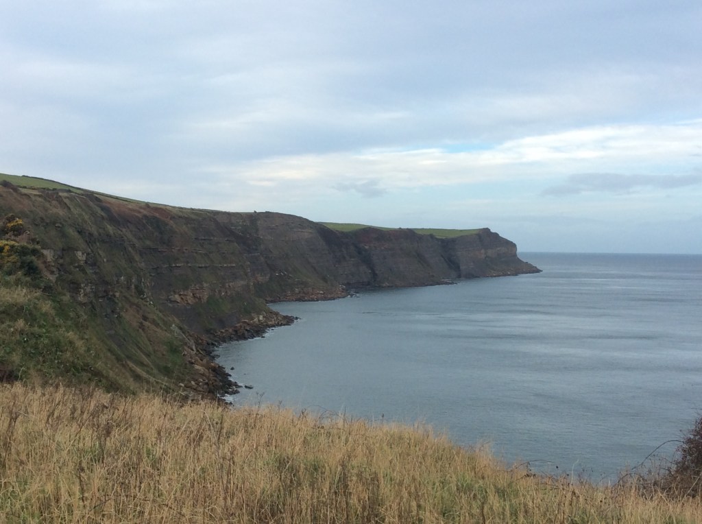
As Bob foresaw there was darkness at the break of noon. But by then we’d had an early breakfast and hit the muddily meandering Coast path to Ravenscar. With a view back towards RHB.
Getting a bit of a sweat on with climbs and falls due to streams cutting little valleys on their way to the sea. But we can handle it.

Then up to Ravenscar on the top of the cliffs.
We got a cup of tea to go in Ravenscar and switched from the undulating Coast path to the Cinder Trail, an old railway line. No steam trains here.
We got wetter and wetter. Richard’s phone lost it’s ability to take photos and mine just packed in for good, destroyed by damp in my pocket.

By mid-afternoon we’d made it to Scarborough, with a speedy sprint along the defunct railway. Well that was a decent trip.

The 5 highest peaks in England and 226 miles across the Northern uplands. I won’t do the Coast to Coast path again, it’s no doubt stunningly beautiful in summer but there are many, many walks to do. Enjoyed it and at least I got a trek in 2020. Suck that you dirty Covid bastaaad!
I’ll let you know what I’m up to before my next adventure.
Night night. Love Dave. X
Sleights to Robin Hood’s Bay – You’re not alone
You’re watching yourself but you’re too unfair. Thanks David.
I was shortly not to be alone, as Richard Taylor, father of Samwise, a close friend of my youngest, was walking up the coast to meet me.
But first a decent early morning with a decent breakfast and a decent hike over’t Moors. My bedroom window view of Eskdale was pleasant.
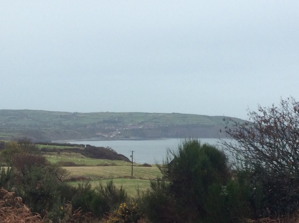
The Inn was near the bottom of a steep hill as the road drops off the Moors and down into Sleights. It was a good workout hauling my kit up this 1 in 4. Looking back was my first view of Whitby .
The route climbed further, turning eastwards to Littlebeck, then dropping steeply down to the village and the river running through it.
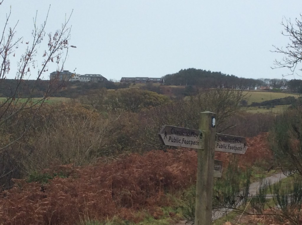
On the basis that whatever goes up must come down, and vice versa, the track climbed steeply again up onto the top, and I regained the Coast to Coast path which I had left at Grosmont. With a view from a different angle down to Whitby and a crock of gold.
Now I was making better time but the moor was very boggy and I had to make numerous detours around deeper mud holes. Then the rain came back. Richard rang and, as I was dropping down to the coast, he was walking up in the opposite direction.
Then he appeared, like King Lear on the desolate, storm blasted heath.

It was good to see him and we had a catch up on the way to Robin Hood’s Bay. We was slippin an we was slidin on that coastal path. A good indicator for the walk down to Scarborough tomorrow that we should switch to the disused railway line which Richard had found. Good lad! Then we were there. RHB.

We dropped our gear off at the B&B and hurried on down through the village to the sea.
Only another 16 miles to go and then I will have completed my route. But for tonight a few beers and a pleasant meal with Richard, whom I was finding to be an agreeable companion. As Jane Austen might say. Particularly as he doesn’t care for red cabbage, which meant that I could take all of it. Capital chap! Although I did effect a quid pro quo on the mange tout. TTFN.

Night night.
Blakey Ridge to Sleights – not on the buses – but maybe on the trains
I hate you Butler. A bit of an obscure reference for under 60s. Anyway, I’ll let it pass.
Today it rained. Not only rained but persistently. It just makes it hard to get decent photos when all you can see is the inside of a cloud. Great breakfast, latish start (9am) and I’m away, with my rucksack contained in a cheap, plastic poncho bound by garden twine. And my boots still holding together with superglue. New kit? No need. Up-cycling, hillwalking, freewheeling, Bob Dylan. How did you get here? You got a lot of nerve, sing Positively 4th Street for me.
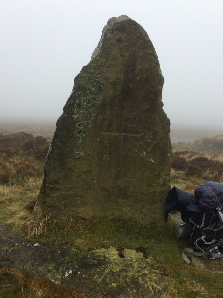
This standing stone appeared out of the mists (of time) and seemed mysterious. But the inscription below the cross of the Cross gave away its age. MM. A youngster.
This was a 15 mile walk today and the first 9 miles were over the Moors in the rain and cloud and wind. I was wet, and wanted to sit by a fire drinking hot chocolate. But when you’re Miles from Nowhere, thanks Cat, all you can do is walk. When the cloud lessened temporarily there wasn’t much to see anyway.

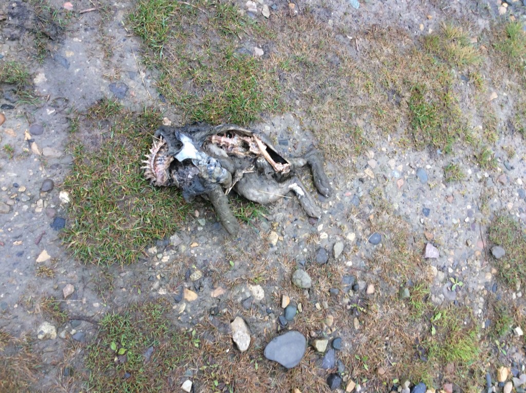
Oh look, a dead rabbit, said the old bloke desperate for photographic material. Or could it be an alien species?
Dropping down into the Esk valley I was so wet that I didn’t want to take my gloves off to take photos. When my hands are wet I can’t get them back on. Glaisdale was shut, but there was a covered entrance to the local pub and it gimme me shelter (thanks Mick/Keith) to get my kit in better shape, re-tie the twine and dry out for ten minutes or so. In the valleys it isn’t cold but it’s the rain that gets your clothes and kit.
It was a decent but damp walk down to Egmont, then on to Grosmont.
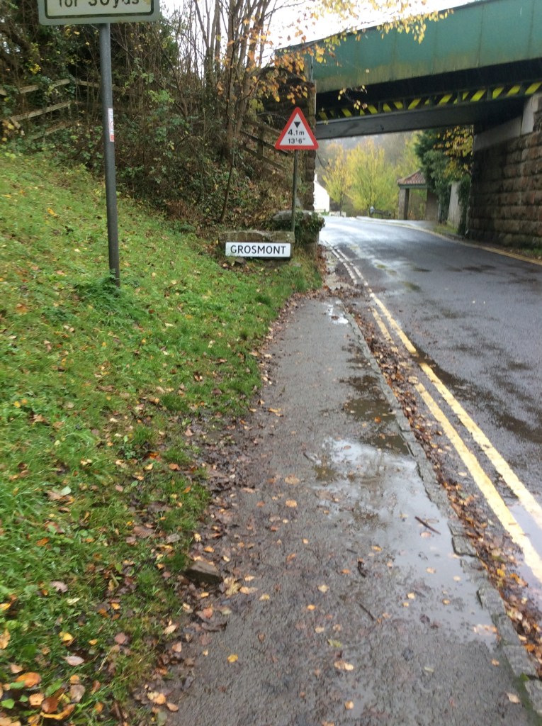
And what great timing had I? The steam train was in the village as I walked towards the station.
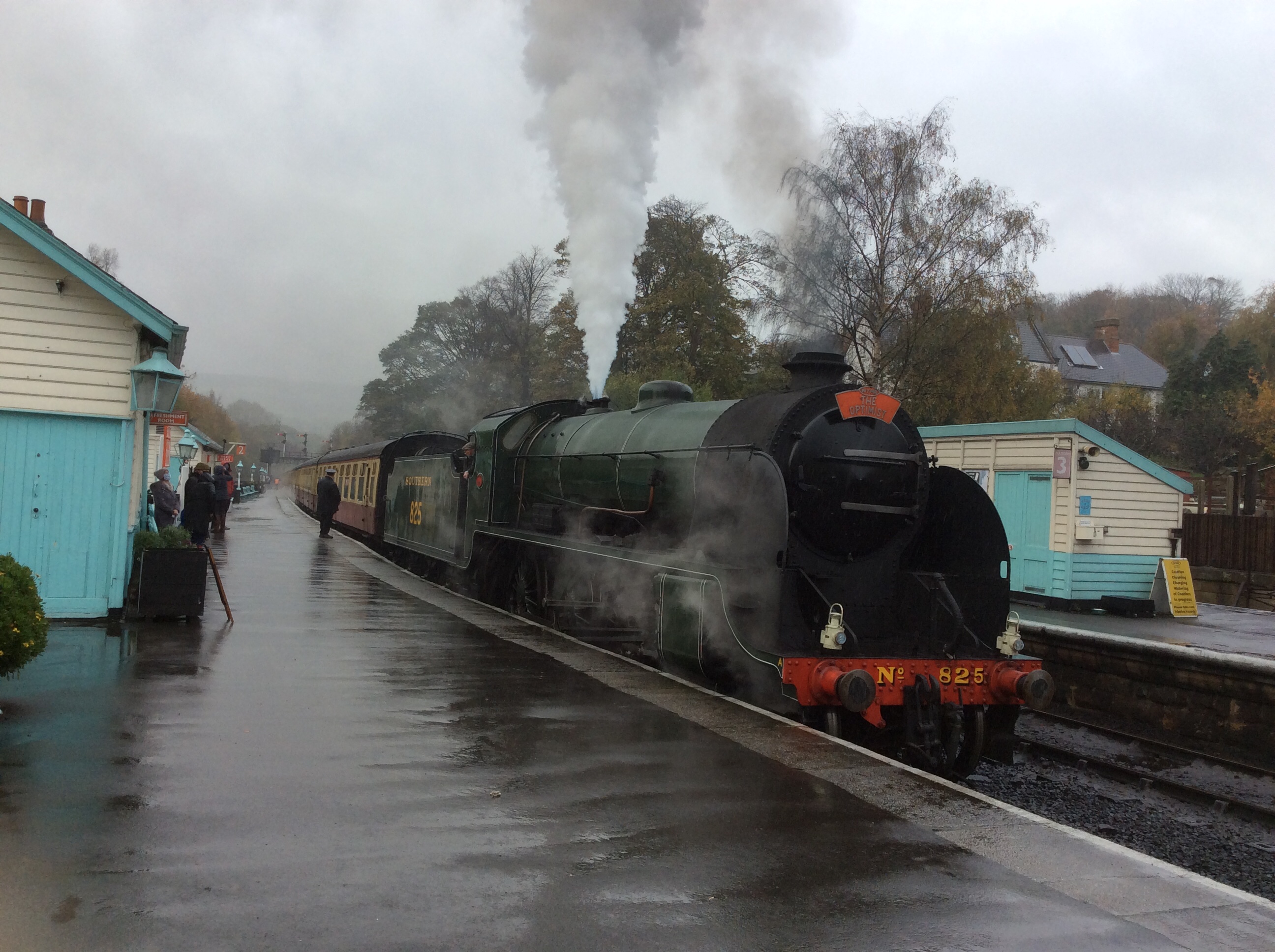
Even more magnificent, it set off.
Anyone who lived during the 50s and 60s would be hard hearted not to shed a tear and feel that lump in their throat at the passing by of this beautiful, evocative, historic yet present, representative of British greatness. Engineering greatness. Romantic greatness. I’m not jingoistic but I love a lot of what this great country has produced.
Including steak and ale pie and sticky toffee pudding, which I ate at the Inn that I was staying at tonight. To die for. But don’t believe the old lie: Dulce et decorum est pro patria mori. Just saying.
Night night.
Osmotherley to Blakey Ridge, the longest hike
The times I left the tent to pee were cold as midwinter and clear as a gateway to the Universe. Wow! All too soon the alarm went off at 5.45am. Jesus!
I packed the rucksack, bent double in my mini tent, and then dismantled the tent, after dragging it in the darkish early lightish to the campsite reception, where there was a dry surface to work on. When I was packed I had a cold tin of baked beans and half a litre of cold water for breakfast.
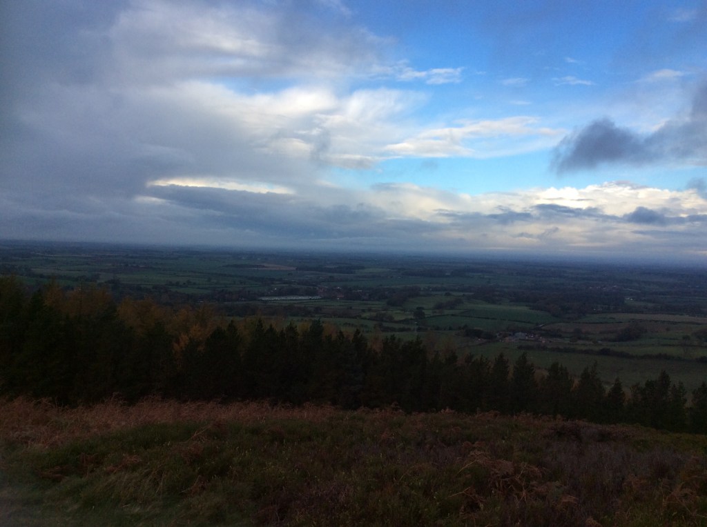
Setting off up the valley to join the Cleveland Way, which formed the bulk of the route today, the view over the back of the ridge, towards the north, was subdued in the early light.
As I walked round the rollercoaster the light grew.
But so did the wind and, shortly followed by, the showers. The views were obliterated. Shame.
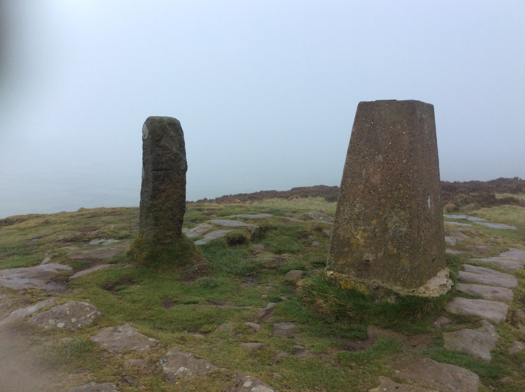
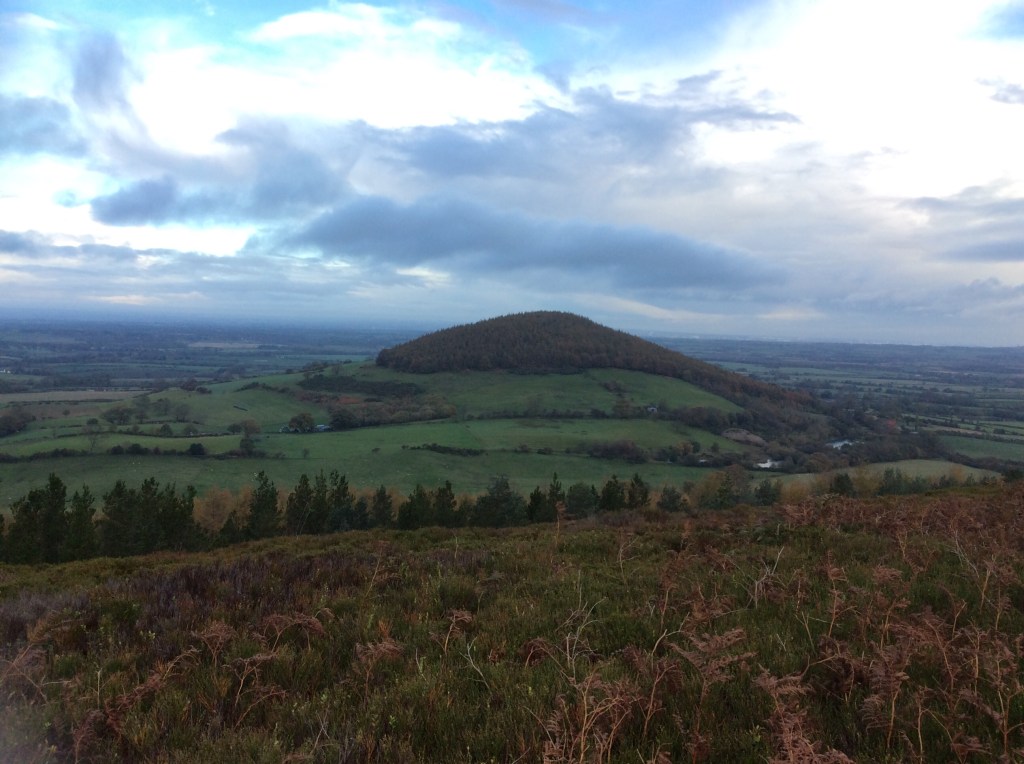
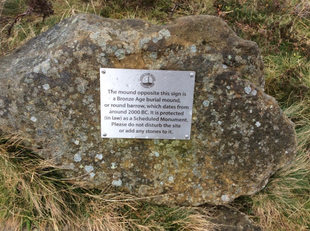
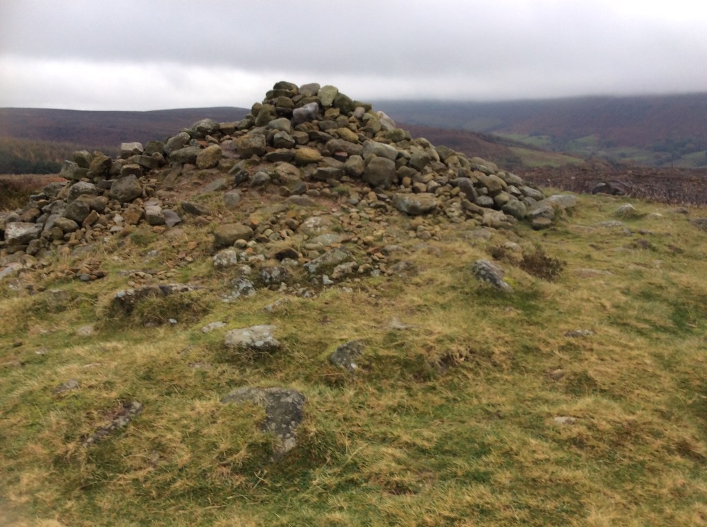
Historic country though, like most of the UK, peppered with ancient sites. We take them for granted but these are enormously significant. If one of our forefathers is buried under here we could add over 200 ‘greats’ to the grandad. Awe inspiring? You bet!
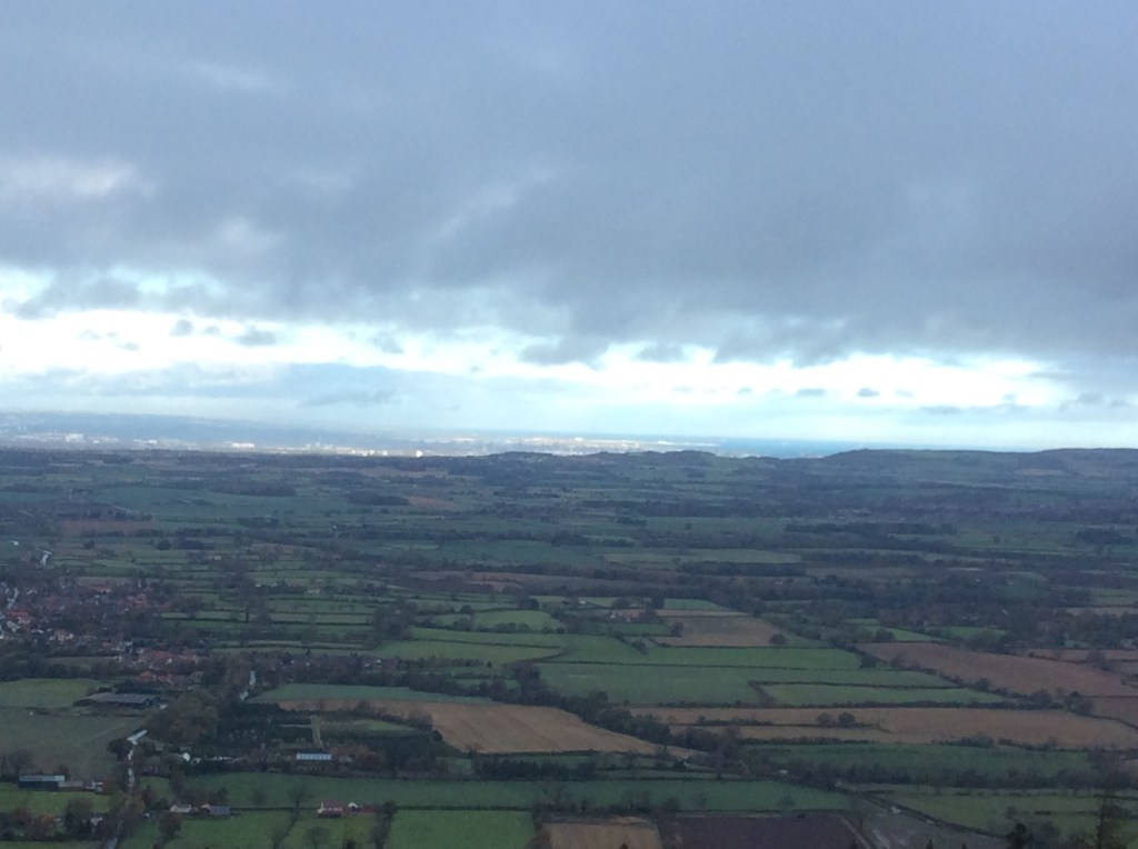
Over to the left, out towards the North Sea, the sun had been shining on Middlesbrough continuously for nearly an hour. What for? It’s still a craphole, rain or shine. Shine on me instead of this wind and rain, and the backstreets and the backstreets. Thanks Van.
The sections of flat walking on top had become paved, like the Lakes and popular Dales hikes.
And just when it looked like the future was flat, a drop and a climb intervened! This is it, looking back to where I was half an hour ago.
Finally the climb that culminated in rock faces for a number of real climbers, not scramblers like me, ended with an ongoing even walk into the Moors.
Looking back the hilltops to the right, which I’d stepped gingerly down and vigorously up, where bathed in sunlight.
And up into the Moors the sun brought a bright and optimistic perspective. My pace quickened, but around 14.00pm hundred hours I was starting to flag.
And then, after another half hour of gritted teeth I saw the Lion Inn up on a hill. But I was so concentrating on getting there that I couldn’t loosen my grip on my walking poles to take a picture. Twenty miles from start to finish, 14 of them rising and falling. Persistently. (Word of the week).
And then at 15.15 I arrived. Had a bath for an hour, slept for a while then got an early dinner and went to bed. £30 bed and breakfast. Private bathroom. Result.
Night night.
Lovesome Hill to (Os)Motherley – a natural progression
Tomorrow is a long, long walk with not a lot of daylight, so I took my time today to complete the short 10 miles to save my legs, lungs and energy. Breakfast at the farm was nice and the first 8 miles of the walk were along the rest of the Vale of York. The last 2 miles were up the Yorkshire Moors and over to the campsite at Osmotherley. A brief taste of tomorrow.
For the moment it was a goodbye to Lovesome Hill. Bye.
And the Sun was out, shining on the Moors that I would walk to today.
It looks like dry land but it int. It’s sodden, muddy and sodden muddy. Oh, I’m so clever with werds. This was flat farmland but it wasn’t a bad walk at all, if you like wading. And the sun stayed out for me, just mee, how lucky am I?
Some folk say ‘What do you think of when you’re walking Dave?’Well they don’t because nobody talks to me apart from my missus. Well, if any folk did ask that I’d answer, ‘I hope I get across before the next frickin train.’
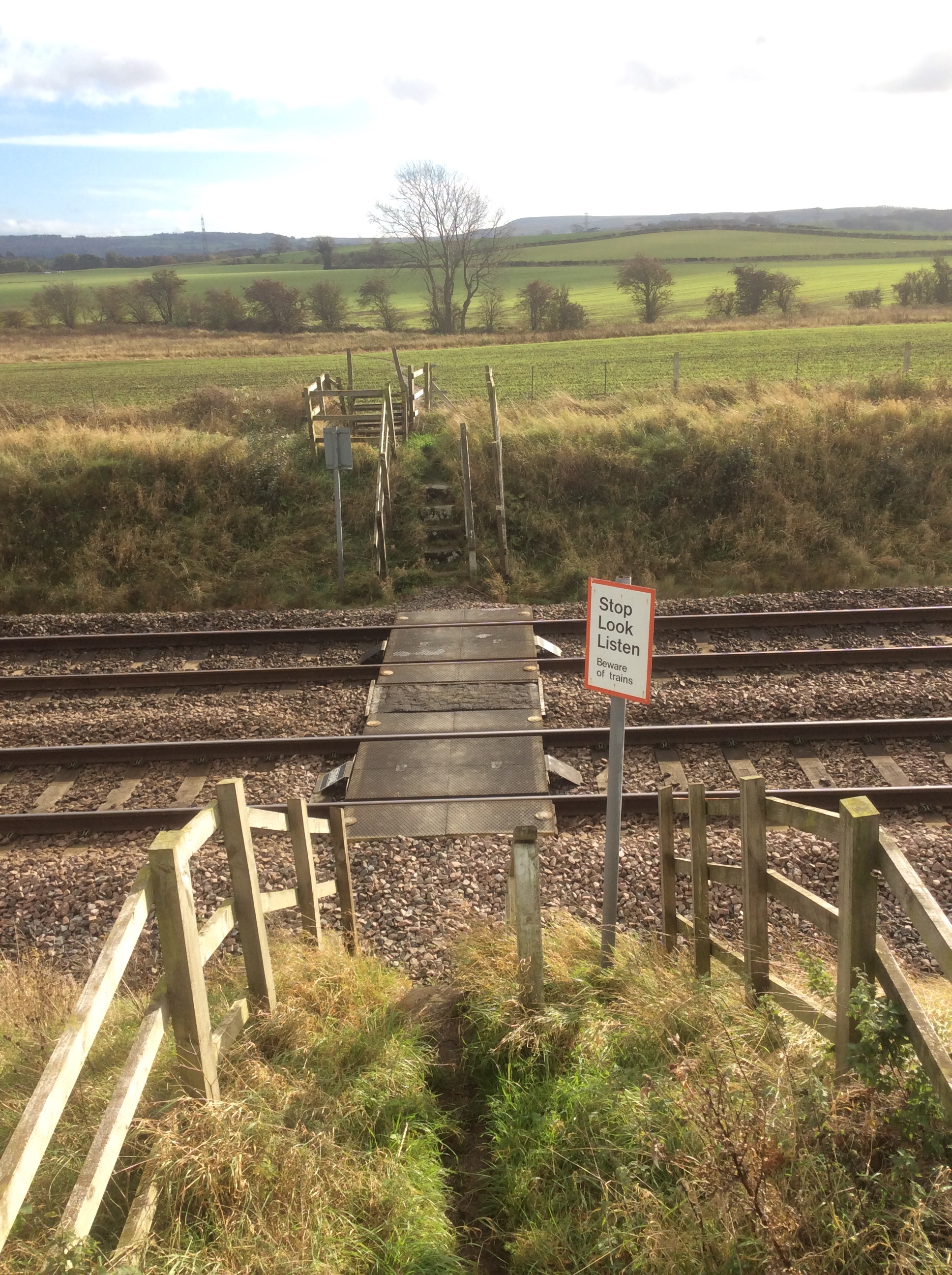
I did. That’s why I’m writing this. I looked back from the mini hill in the midi stance (there I go again 🤗 mit dem werds) . And with maximum telephoto I got a grainy shot of the hills in the Dales which I left two days ago.

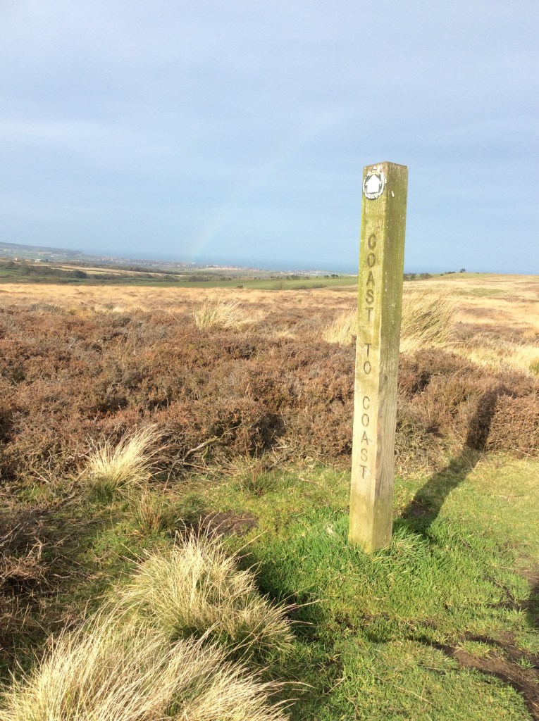
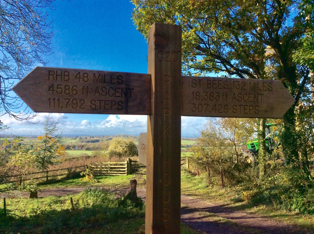
Starting to climb into theMoors was the first Coast to Coast way-sign that I’d seen with details of what was achieved and what needed to be achieved. My own details were a bit top heavier with distance and altitude as I’d climbed dem mountains in the Lakes and was walking on to Scarborough. Interesting though.
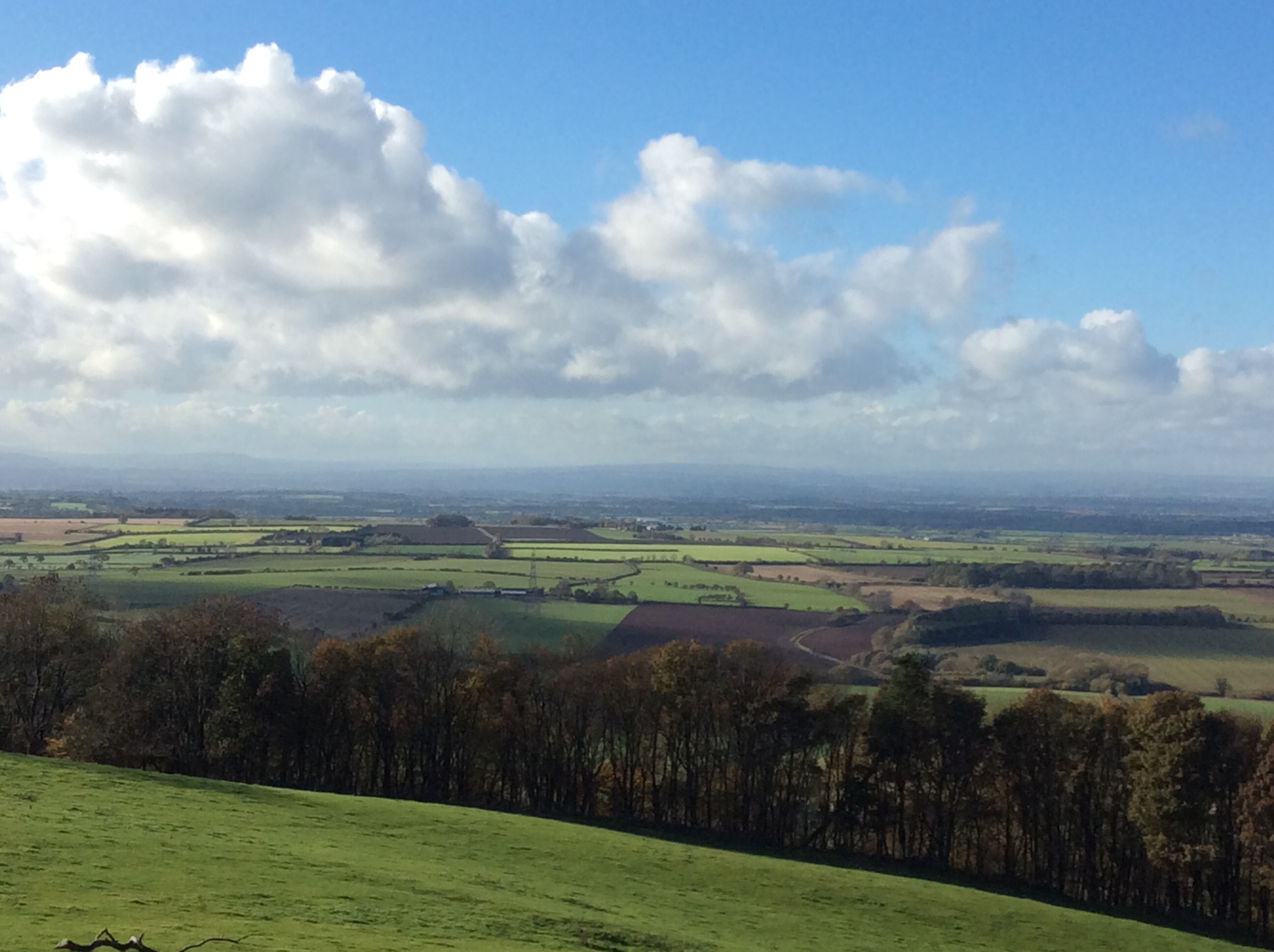
From the top of this low section of Moors the view was clearer back across to the distant Dales.
In Osmotherley I pitched my tent, in sodden grass, walked down to the village and had a jolly good beef roast. Returning to el tento I was in my sleeping bag by 6pm. The alarm was set for 5.45am. My sleep was broken by cold conditions, the need to pee, pain in my right knee and discomfort. Apart from that I slept well.
Night night.
